

$1,900
/ Month
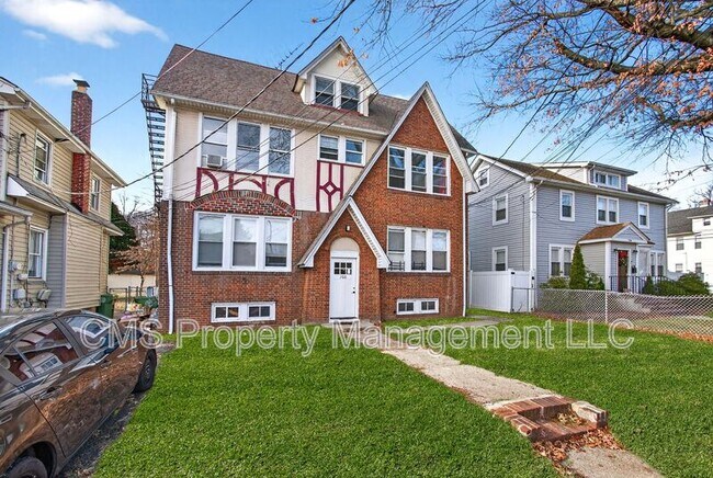
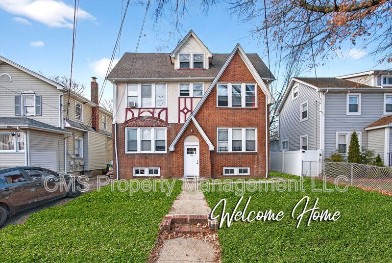
706 Chestnut St Unit 2L
Roselle, NJ 07203
Today
|
Edit
Favorites
-
Bedrooms
2
-
Bathrooms
1
-
Square Feet
--
706 Chestnut St Unit 2L

Favorites
About This Home
$2,850 deposit
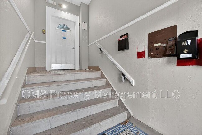
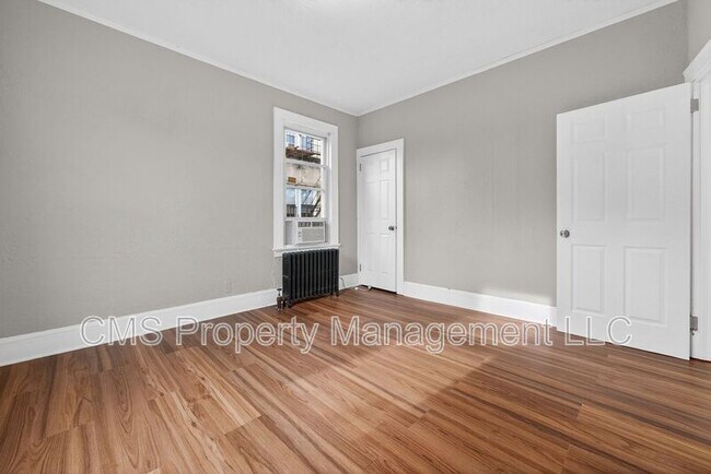
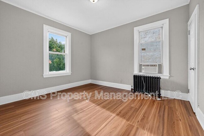
Welcome to 706 Chestnut St. Unit 2L, located in the vibrant city of Roselle, NJ. This renovated apartment offers a comfortable and stylish living space with two bedrooms and one bathroom. As you step inside, you'll be greeted by the charm of the second floor unit, featuring beautiful hardwood floors throughout. The updated kitchen is a chef's dream. With attention to detail, this apartment offers a fresh and contemporary feel. Conveniently located, this apartment is just minutes away from local shops, restaurants, and entertainment options. Don't miss the opportunity to make 706 Chestnut St. your new home! Tenants are responsible for electric, gas and cable. Tenants are responsible for 1.5 month security deposit and 1st month's rent due at lease signing.
706 Chestnut St is a condo located in Union County and the 07203 ZIP Code.
* Price shown is base rent. Excludes user-selected optional fees and variable or usage-based fees and required charges due at or prior to move-in or at move-out. Price, availability, fees, and any applicable rent special are subject to change without notice.
* Square footage definitions vary. Displayed square footage is approximate.
Fees and Policies
The fees below are based on community-supplied data and may exclude additional fees and utilities.
-
One-Time Basics
-
Due at Move-In
-
Security Deposit - RefundableCharged per unit.$2,850
-
-
Due at Move-In
Property Fee Disclaimer: Based on community-supplied data and independent market research. Subject to change without notice. May exclude fees for mandatory or optional services and usage-based utilities.
Contact
Location
Get Directions
Ideally located about 10 miles southwest of Newark and 18 miles from New York City, Roselle is a cozy borough for those looking for a quieter place to call home. First settled around 1664, Roselle was settled by farmers looking for better farmland. It was part of the first New Jersey settlement called Elizabethtown. The borough was officially incorporated in 1894 as Roselle.
Today, this terrific community features beautiful parks and great shopping. Warinanco Park, the borough's largest park, offers ball fields, a running track, a playground, pedal boats, an ice skating rink, a fitness trail, a bicycle path, fishing, a spray pool, tennis courts, picnic areas, and shuffleboard. Roselle's tree-lined streets are mainly residential, with a shopping district located between Westfield Avenue and West 1st Avenue.
Learn more about living in Roselle
Education
| Colleges & Universities | Distance | ||
|---|---|---|---|
| Colleges & Universities | Distance | ||
| Drive: | 7 min | 2.9 mi | |
| Drive: | 9 min | 3.5 mi | |
| Drive: | 12 min | 4.2 mi | |
| Drive: | 19 min | 10.4 mi |
706 Chestnut St Unit 2L is within 7 minutes or 2.9 miles from Union County Coll., Elizabeth. It is also near Kean University and Union County College, Cranford.
Transportation options available in Roselle include Military Park, located 9.3 miles from 706 Chestnut St Unit 2L. 706 Chestnut St Unit 2L is near Newark Liberty International, located 12.4 miles or 18 minutes away, and LaGuardia, located 27.6 miles or 52 minutes away.
| Transit / Subway | Distance | ||
|---|---|---|---|
| Transit / Subway | Distance | ||
|
|
Drive: | 17 min | 9.3 mi |
|
|
Drive: | 17 min | 9.8 mi |
|
|
Drive: | 18 min | 10.7 mi |
| Drive: | 19 min | 11.1 mi | |
|
|
Drive: | 18 min | 11.2 mi |
| Commuter Rail | Distance | ||
|---|---|---|---|
| Commuter Rail | Distance | ||
|
|
Drive: | 4 min | 1.5 mi |
|
|
Drive: | 4 min | 2.0 mi |
|
|
Drive: | 7 min | 2.9 mi |
|
|
Drive: | 7 min | 3.1 mi |
|
|
Drive: | 8 min | 3.8 mi |
| Airports | Distance | ||
|---|---|---|---|
| Airports | Distance | ||
|
Newark Liberty International
|
Drive: | 18 min | 12.4 mi |
|
LaGuardia
|
Drive: | 52 min | 27.6 mi |
Time and distance from 706 Chestnut St Unit 2L.
| Shopping Centers | Distance | ||
|---|---|---|---|
| Shopping Centers | Distance | ||
| Walk: | 18 min | 1.0 mi | |
| Drive: | 3 min | 1.3 mi | |
| Drive: | 3 min | 1.5 mi |
706 Chestnut St Unit 2L has 3 shopping centers within 1.5 miles, which is about a 3-minute drive. The miles and minutes will be for the farthest away property.
| Parks and Recreation | Distance | ||
|---|---|---|---|
| Parks and Recreation | Distance | ||
|
William Miller Sperry Observatory
|
Drive: | 10 min | 4.1 mi |
|
Hawk Rise Sanctuary
|
Drive: | 11 min | 4.4 mi |
|
Merrill Park
|
Drive: | 14 min | 6.1 mi |
|
Liberty State Park
|
Drive: | 15 min | 7.2 mi |
|
Staten Island Industrial Park
|
Drive: | 15 min | 8.6 mi |
706 Chestnut St Unit 2L has 5 parks within 8.6 miles, including William Miller Sperry Observatory, Hawk Rise Sanctuary, and Merrill Park.
| Hospitals | Distance | ||
|---|---|---|---|
| Hospitals | Distance | ||
| Drive: | 8 min | 3.3 mi | |
| Drive: | 8 min | 3.6 mi | |
| Drive: | 13 min | 7.8 mi |
706 Chestnut St Unit 2L has 3 hospitals within 7.8 miles, the nearest is Trinitas Regional Medical Center which is 3.3 miles away and a 8 minute drive.
| Military Bases | Distance | ||
|---|---|---|---|
| Military Bases | Distance | ||
| Drive: | 17 min | 5.8 mi | |
| Drive: | 15 min | 6.1 mi | |
| Drive: | 23 min | 16.3 mi |
706 Chestnut St Unit 2L has 3 military bases within 16.3 miles, the nearest is Tamdques Reservation which is 5.8 miles away and a 17 minute drive.
You May Also Like
How do I access Social Services in New Jersey?
Statewide service is free, confidential, multilingual and always open. Three easy ways to reach Social Services in NJ: Dial 2-1-1; text your zip code to 898-211; or chat at https://www.nj211.org
Similar Rentals Nearby


What Are Walk Score®, Transit Score®, and Bike Score® Ratings?
Walk Score® measures the walkability of any address. Transit Score® measures access to public transit. Bike Score® measures the bikeability of any address.
What is a Sound Score Rating?
A Sound Score Rating aggregates noise caused by vehicle traffic, airplane traffic and local sources
706 Chestnut St
Roselle, NJ 07203