
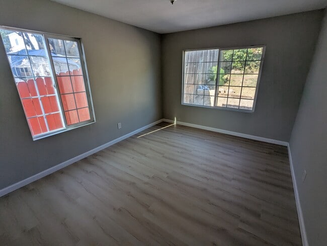
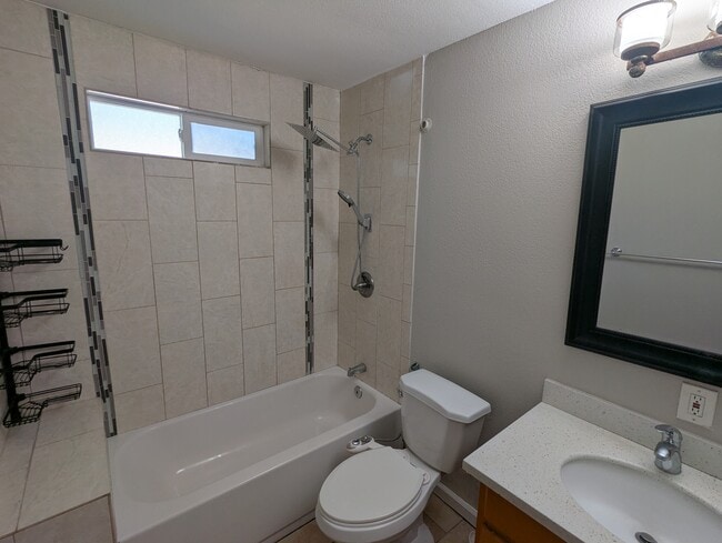
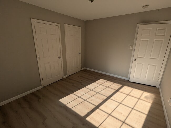
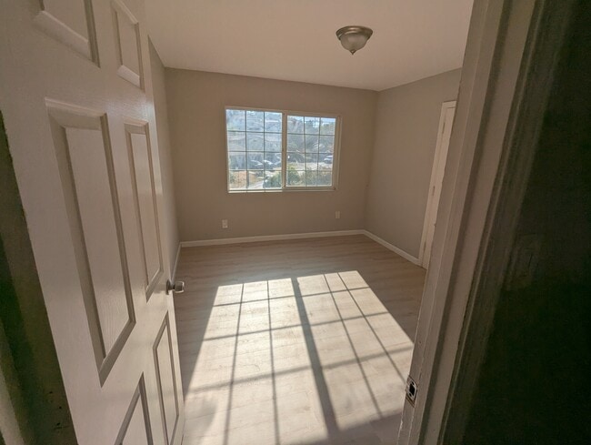
706 Appian Way
El Sobrante, CA 94803
-
Bedrooms
4
-
Bathrooms
2
-
Square Feet
1,558 sq ft

Contact
Tucked into the rolling hills of Contra Costa County, El Sobrante sits about 20 miles northwest of San Francisco, offering a quieter pace without losing touch with the Bay Area's energy. The name itself comes from the Spanish word for "surplus," a nod to the original Rancho El Sobrante land grant that once covered this corner of California. Spanning just three square miles, the area carries a close-knit, residential feel while staying well-connected to nearby cities like Richmond and San Pablo via I-80. Kennedy Grove Regional Recreation Area, Wildcat Canyon Regional Park, and the San Pablo Reservoir are all within easy reach, making the outdoors a natural part of everyday life here. The housing mix leans toward single-family homes on tree-lined streets, though renters will also find apartment communities ranging from garden-style units to more spacious multi-bedroom layouts suited to a range of lifestyles.
Learn more about living in El SobranteYou May Also Like
| Colleges & Universities | Distance | ||
|---|---|---|---|
| Colleges & Universities | Distance | ||
| Drive: | 7 min | 2.9 mi | |
| Drive: | 20 min | 12.9 mi | |
| Drive: | 24 min | 14.0 mi | |
| Drive: | 24 min | 14.6 mi |


View GreatSchools Rating Methodology
Data provided by GreatSchools.org © 2026. All rights reserved.
Transportation options available in El Sobrante include El Cerrito Del Norte, located 7.0 miles from 706 Appian Way. 706 Appian Way is near Metro Oakland International, located 26.0 miles or 35 minutes away, and San Francisco International, located 33.6 miles or 47 minutes away.
| Transit / Subway | Distance | ||
|---|---|---|---|
| Transit / Subway | Distance | ||
|
|
Drive: | 10 min | 7.0 mi |
|
|
Drive: | 11 min | 7.2 mi |
|
|
Drive: | 13 min | 8.8 mi |
|
|
Drive: | 18 min | 12.3 mi |
|
|
Drive: | 20 min | 13.0 mi |
| Commuter Rail | Distance | ||
|---|---|---|---|
| Commuter Rail | Distance | ||
| Drive: | 12 min | 7.4 mi | |
|
|
Drive: | 14 min | 11.1 mi |
| Drive: | 18 min | 13.4 mi | |
|
|
Drive: | 20 min | 14.2 mi |
| Drive: | 26 min | 16.4 mi |
| Airports | Distance | ||
|---|---|---|---|
| Airports | Distance | ||
|
Metro Oakland International
|
Drive: | 35 min | 26.0 mi |
|
San Francisco International
|
Drive: | 47 min | 33.6 mi |
Scores provided by
Traffic
BusyAirport
CalmBusinesses
ActiveScores provided by
HowLoud What is a Sound Score Rating? A Sound Score Rating aggregates noise caused by vehicle traffic, airplane traffic and local sources. How It WorksTime and distance from 706 Appian Way.
| Shopping Centers | Distance | ||
|---|---|---|---|
| Shopping Centers | Distance | ||
| Walk: | 5 min | 0.3 mi | |
| Walk: | 7 min | 0.4 mi | |
| Walk: | 9 min | 0.5 mi |
| Parks and Recreation | Distance | ||
|---|---|---|---|
| Parks and Recreation | Distance | ||
|
Sobrante Ridge Regional Preserve
|
Drive: | 6 min | 2.4 mi |
|
Kennedy Grove Regional Recreation Area
|
Drive: | 8 min | 3.4 mi |
|
Ohlone Wilderness
|
Drive: | 7 min | 4.2 mi |
|
Point Pinole Regional Shoreline
|
Drive: | 8 min | 4.2 mi |
|
Wildcat Canyon Regional Park
|
Drive: | 17 min | 9.4 mi |
| Hospitals | Distance | ||
|---|---|---|---|
| Hospitals | Distance | ||
| Drive: | 17 min | 12.6 mi | |
| Drive: | 17 min | 13.1 mi | |
| Drive: | 23 min | 14.5 mi |
| Military Bases | Distance | ||
|---|---|---|---|
| Military Bases | Distance | ||
| Drive: | 8 min | 4.5 mi | |
| Drive: | 16 min | 9.5 mi | |
| Drive: | 23 min | 14.0 mi |
706 Appian Way Photos
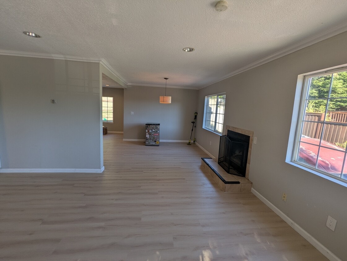
706 Appian Way
El Sobrante, CA 94803