$1,650 / Month
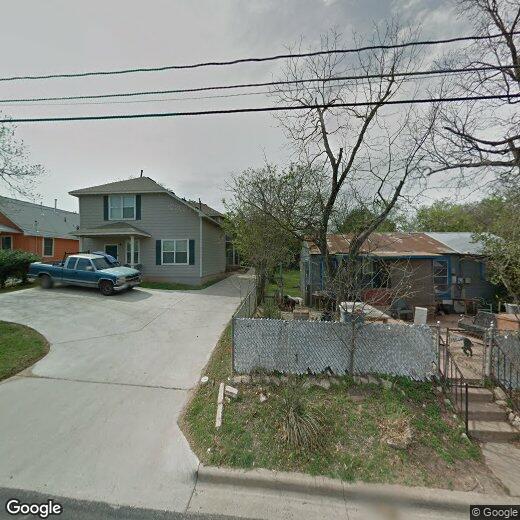
7002 Bennett Ave Unit A
Austin, TX 78752
Today
Favorites
512-981-6949
-
Bedrooms
3
-
Bathrooms
2
-
Square Feet
2,376 sq ft
-
Available
Available Now
7002 Bennett Ave Unit A

Favorites
7002 Bennett Ave is an apartment community located in Travis County and the 78752 ZIP Code.
* Price shown is base rent and may not include non-optional fees and utilities.
Price, availability, fees, and any applicable rent special are subject to change without notice.
* Square footage definitions vary. Displayed square footage is approximate.
Features
- Dishwasher
Contact
- Listed by Bay | Bay Property Management Group Austin
- Phone Number
- Contact
Location
Get Directions
Amenities
- Dishwasher
St. Johns is a popular area that has many families settling in the area. A quiet community in the northeast area of the city, residents appreciate the relaxed pace of this locale and neighboring Coronado Hills. With many multigenerational families settling here, St. Johns hosts plenty of options for families and professionals alike.
Located just 20 minutes outside of Downtown Austin, St. Johns is surrounded by Highway 290, Highway 183, and I-35, making it perfect for commuters. There are plenty of chain restaurants that serve the area, but for a greater variety of offerings just cross the I-35 to Highland and indulge in the options along North Lamar Blvd.
Learn more about living in St Johns
Education
| Colleges & Universities | Distance | ||
|---|---|---|---|
| Colleges & Universities | Distance | ||
| Drive: | 7 min | 4.4 mi | |
| Drive: | 9 min | 5.8 mi | |
| Drive: | 11 min | 5.9 mi | |
| Drive: | 12 min | 6.3 mi |
7002 Bennett Ave Unit A is within 7 minutes or 4.4 miles from University of Texas at Austin. It is also near Austin C.C., Eastview Campus and Austin C.C., Rio Grande Campus.
Transportation options available in Austin include Highland Station, located 1.3 miles from 7002 Bennett Ave Unit A. 7002 Bennett Ave Unit A is near Austin-Bergstrom International, located 16.7 miles or 27 minutes away.
| Transit / Subway | Distance | ||
|---|---|---|---|
| Transit / Subway | Distance | ||
| Drive: | 3 min | 1.3 mi | |
| Drive: | 3 min | 1.4 mi | |
| Drive: | 9 min | 4.8 mi | |
| Drive: | 10 min | 5.1 mi | |
| Drive: | 10 min | 5.5 mi |
| Commuter Rail | Distance | ||
|---|---|---|---|
| Commuter Rail | Distance | ||
|
|
Drive: | 12 min | 7.1 mi |
|
|
Drive: | 39 min | 31.7 mi |
|
|
Drive: | 44 min | 36.2 mi |
| Airports | Distance | ||
|---|---|---|---|
| Airports | Distance | ||
|
Austin-Bergstrom International
|
Drive: | 27 min | 16.7 mi |
Time and distance from 7002 Bennett Ave Unit A.
| Shopping Centers | Distance | ||
|---|---|---|---|
| Shopping Centers | Distance | ||
| Walk: | 13 min | 0.7 mi | |
| Walk: | 14 min | 0.7 mi | |
| Walk: | 14 min | 0.8 mi |
7002 Bennett Ave Unit A has 3 shopping centers within 0.8 mile, which is about a 14-minute walk. The miles and minutes will be for the farthest away property.
| Parks and Recreation | Distance | ||
|---|---|---|---|
| Parks and Recreation | Distance | ||
|
Beverly S. Sheffield Northwest District Park
|
Drive: | 9 min | 3.4 mi |
|
Thinkery
|
Drive: | 7 min | 3.5 mi |
|
Elisabet Ney Museum
|
Drive: | 7 min | 3.6 mi |
|
Texas Memorial Museum
|
Drive: | 8 min | 4.3 mi |
|
Jourdan-Bachman Pioneer Farms
|
Drive: | 10 min | 5.7 mi |
7002 Bennett Ave Unit A has 5 parks within 5.7 miles, including Elisabet Ney Museum, Thinkery, and Beverly S. Sheffield Northwest District Park.
| Hospitals | Distance | ||
|---|---|---|---|
| Hospitals | Distance | ||
| Drive: | 5 min | 2.3 mi | |
| Drive: | 6 min | 2.9 mi | |
| Drive: | 7 min | 3.7 mi |
7002 Bennett Ave Unit A has 3 hospitals within 3.7 miles, the nearest is Cross Creek Hospital which is 2.3 miles away and a 5 minute drive.
| Military Bases | Distance | ||
|---|---|---|---|
| Military Bases | Distance | ||
| Drive: | 84 min | 68.9 mi | |
| Drive: | 86 min | 71.1 mi |
7002 Bennett Ave Unit A is 68.9 miles from Fort Hood, and is convenient to other military bases, including Randolph Air Force Base.
You May Also Like
Similar Rentals Nearby


What Are Walk Score®, Transit Score®, and Bike Score® Ratings?
Walk Score® measures the walkability of any address. Transit Score® measures access to public transit. Bike Score® measures the bikeability of any address.
What is a Sound Score Rating?
A Sound Score Rating aggregates noise caused by vehicle traffic, airplane traffic and local sources

7002 Bennett Ave
Austin, TX 78752