3 Beds, 1 Bath, 1,900 sq ft
6A Maynard St
Boston, MA 02131
-
Bedrooms
3
-
Bathrooms
1.5
-
Square Feet
1,192 sq ft
-
Available
Available Now
Highlights
- No Cooling
- Heating System Uses Natural Gas

About This Home
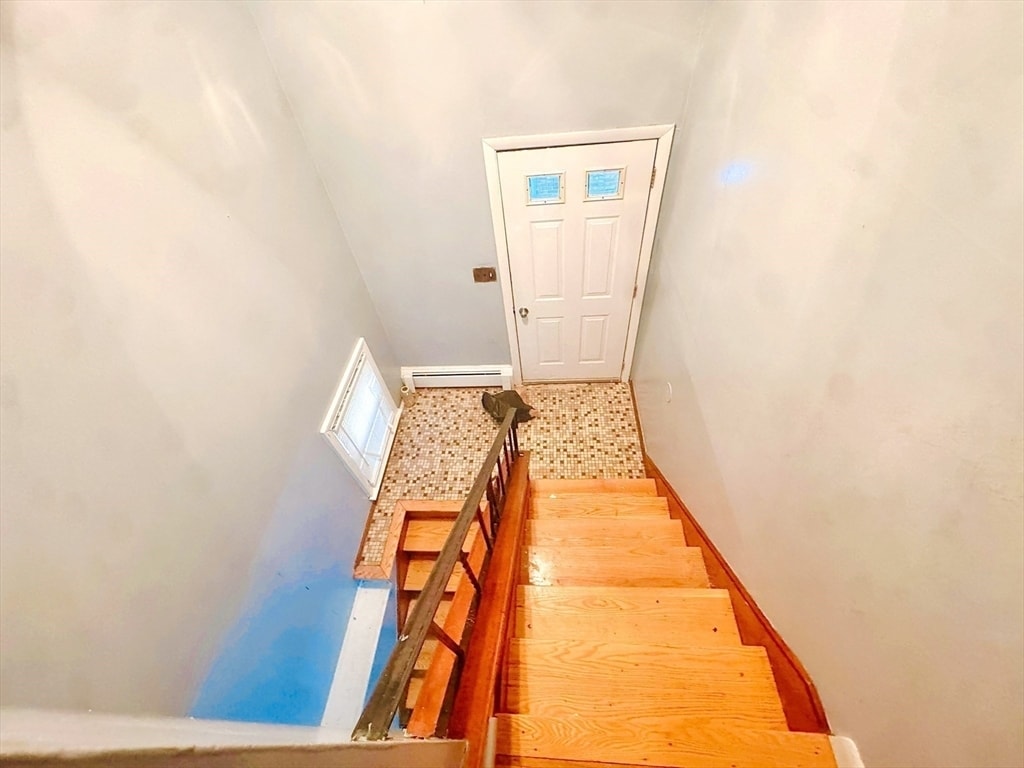
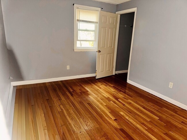
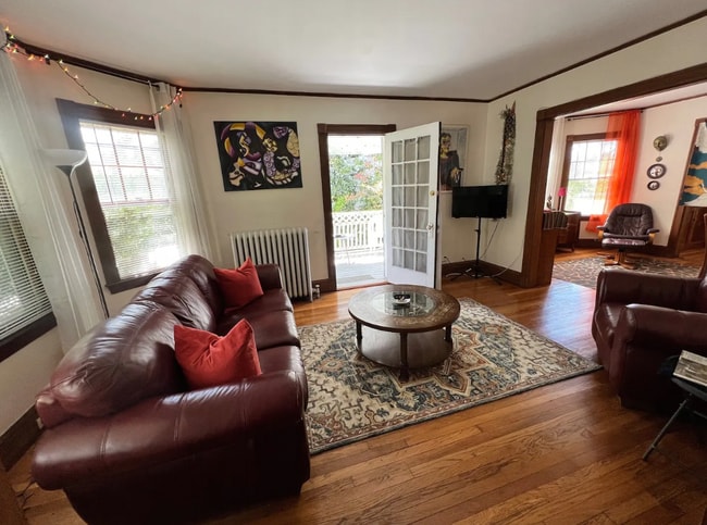
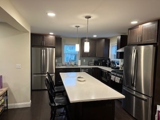
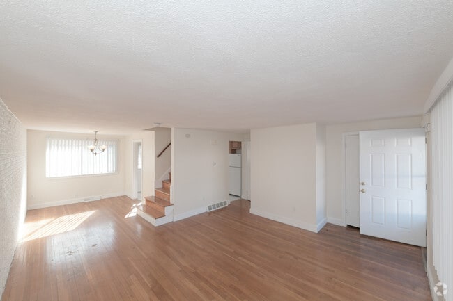
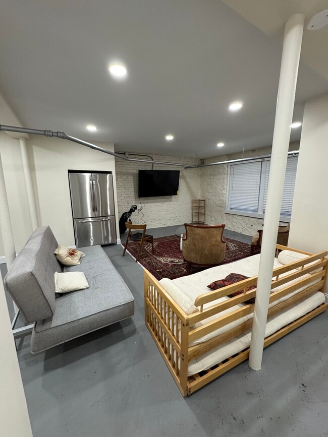
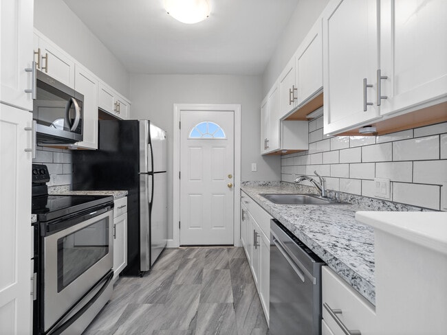
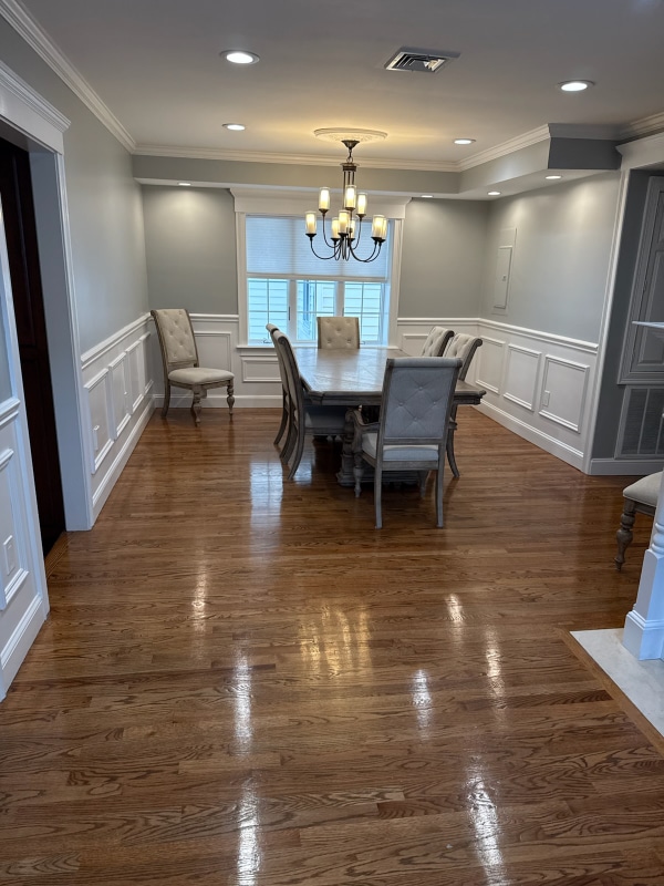
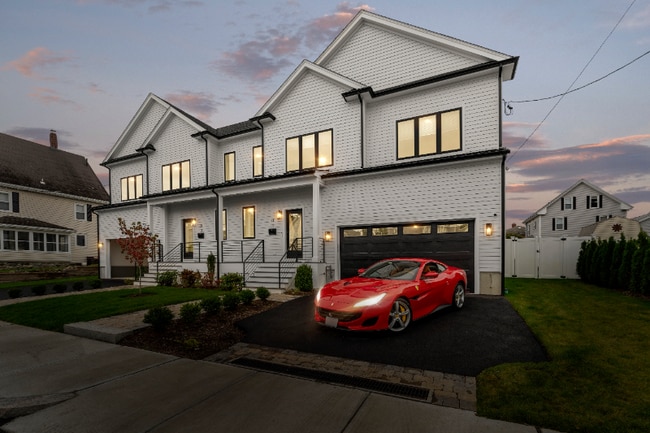
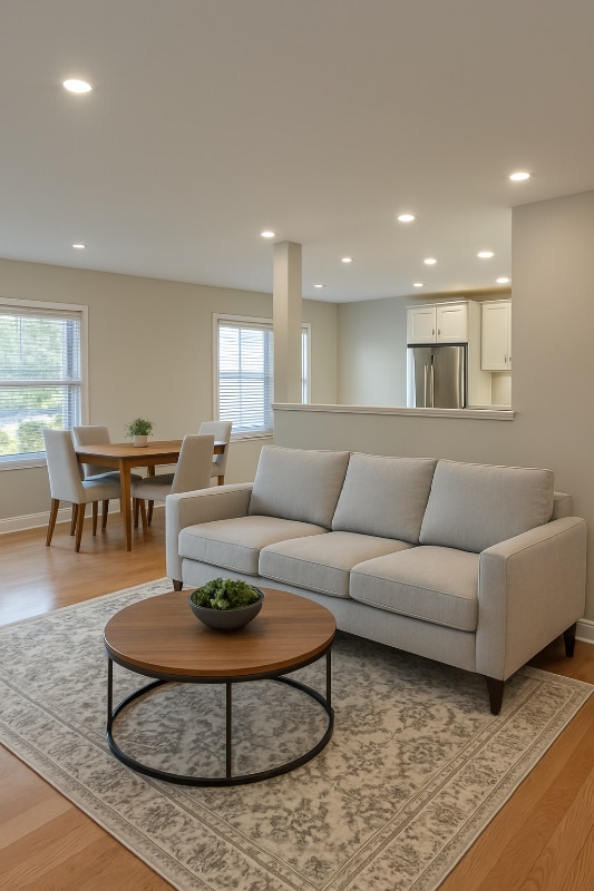
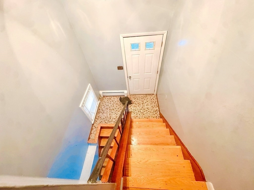
Sunny,spacious split-level townhouse in Roslindale! This home features hardwood floors,3 bedrooms,1.5 baths,an open-concept lower level,and 1 off-street parking space. Conveniently located near shopping,transportation,and Roslindale Square MLS# 73455623
6A Maynard St is a townhome located in Suffolk County and the 02131 ZIP Code. This area is served by the Boston Public Schools attendance zone.
Home Details
Year Built
Bedrooms and Bathrooms
Home Design
Interior Spaces
Kitchen
Listing and Financial Details
Lot Details
Parking
Utilities
Community Details
Overview
Pet Policy
Fees and Policies
The fees below are based on community-supplied data and may exclude additional fees and utilities.
- One-Time Basics
- Due at Move-In
- Security Deposit - RefundableCharged per unit.$1,750
- Due at Move-In
Property Fee Disclaimer: Based on community-supplied data and independent market research. Subject to change without notice. May exclude fees for mandatory or optional services and usage-based utilities.
Contact
- Listed by Mervine Offre | Coldwell Banker Realty - Canton
- Phone Number
-
Source
 MLS Property Information Network
- Range
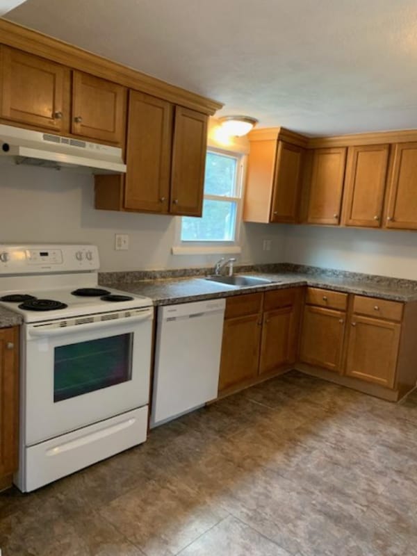
- Refrigerator
Metropolitan Hill-Beech Street is a predominantly residential portion of Roslindale, brimming with colorful historic buildings strewn along quiet tree-lined streets. Metropolitan Hill-Beech Street also contains a slew of locally owned shops and diverse eateries on Washington Street in addition to the vibrant Roslindale Village Main Street, which is commonly referred to as Rozzie Square.
Area residents enjoy a small-town feel, and quick access to lush green spaces like Bellevue Hill Park, West Roxbury Parkway, Sherrin Woods, and the George Wright Golf Course. The expansive Franklin Park and its many attractions are just a few minutes north of the area as well. Convenience to the MBTA Needham Line makes commuting and traveling into Boston a breeze.
Learn more about living in Metropolitan Hill-Beech St| Colleges & Universities | Distance | ||
|---|---|---|---|
| Colleges & Universities | Distance | ||
| Drive: | 9 min | 3.6 mi | |
| Drive: | 10 min | 4.9 mi | |
| Drive: | 10 min | 5.4 mi | |
| Drive: | 10 min | 5.5 mi |
 The GreatSchools Rating helps parents compare schools within a state based on a variety of school quality indicators and provides a helpful picture of how effectively each school serves all of its students. Ratings are on a scale of 1 (below average) to 10 (above average) and can include test scores, college readiness, academic progress, advanced courses, equity, discipline and attendance data. We also advise parents to visit schools, consider other information on school performance and programs, and consider family needs as part of the school selection process.
View GreatSchools Rating Methodology
Data provided by GreatSchools.org © 2025. All rights reserved.
Transportation options available in Boston include Forest Hills Station, located 2.0 miles from 6A Maynard St. 6A Maynard St is near General Edward Lawrence Logan International, located 10.2 miles or 20 minutes away.
| Transit / Subway | Distance | ||
|---|---|---|---|
| Transit / Subway | Distance | ||
|
|
Drive: | 4 min | 2.0 mi |
|
|
Drive: | 5 min | 2.3 mi |
|
|
Drive: | 6 min | 2.9 mi |
|
|
Drive: | 6 min | 2.9 mi |
|
|
Drive: | 6 min | 3.0 mi |
| Commuter Rail | Distance | ||
|---|---|---|---|
| Commuter Rail | Distance | ||
|
|
Drive: | 4 min | 1.3 mi |
|
|
Drive: | 5 min | 1.9 mi |
| Drive: | 4 min | 1.9 mi | |
|
|
Drive: | 4 min | 2.1 mi |
|
|
Drive: | 5 min | 2.3 mi |
| Airports | Distance | ||
|---|---|---|---|
| Airports | Distance | ||
|
General Edward Lawrence Logan International
|
Drive: | 20 min | 10.2 mi |
Time and distance from 6A Maynard St.
| Shopping Centers | Distance | ||
|---|---|---|---|
| Shopping Centers | Distance | ||
| Walk: | 16 min | 0.9 mi | |
| Walk: | 20 min | 1.1 mi | |
| Drive: | 3 min | 1.2 mi |
| Parks and Recreation | Distance | ||
|---|---|---|---|
| Parks and Recreation | Distance | ||
|
Mass Audubon's Boston Nature Center and Wildlife Sanctuary
|
Drive: | 5 min | 1.8 mi |
|
Stony Brook Reservation
|
Drive: | 5 min | 2.2 mi |
|
Arnold Arboretum of Harvard University
|
Drive: | 6 min | 2.3 mi |
|
Brook Farm Historic Site
|
Drive: | 8 min | 3.4 mi |
|
Franklin Park Zoo
|
Drive: | 8 min | 4.3 mi |
| Hospitals | Distance | ||
|---|---|---|---|
| Hospitals | Distance | ||
| Drive: | 7 min | 2.8 mi | |
| Drive: | 8 min | 3.3 mi | |
| Drive: | 6 min | 3.6 mi |
| Military Bases | Distance | ||
|---|---|---|---|
| Military Bases | Distance | ||
| Drive: | 29 min | 14.3 mi |
You May Also Like
Similar Rentals Nearby
-
$3,600Total Monthly PriceTotal Monthly Price NewPrices include all required monthly fees.Townhome for Rent
-
$7,500Total Monthly PriceTotal Monthly Price NewPrices include all required monthly fees.12 Month LeaseTownhome for Rent
5 Beds, 5.5 Baths, 2,103 sq ft
-
-
-
-
Total Monthly Price New3 Beds$3,230+Total Monthly PricePrices include base rent and required monthly fees. Variable costs based on usage may apply.
-
-
-
-
What Are Walk Score®, Transit Score®, and Bike Score® Ratings?
Walk Score® measures the walkability of any address. Transit Score® measures access to public transit. Bike Score® measures the bikeability of any address.
What is a Sound Score Rating?
A Sound Score Rating aggregates noise caused by vehicle traffic, airplane traffic and local sources
