
$5,000
/ Month
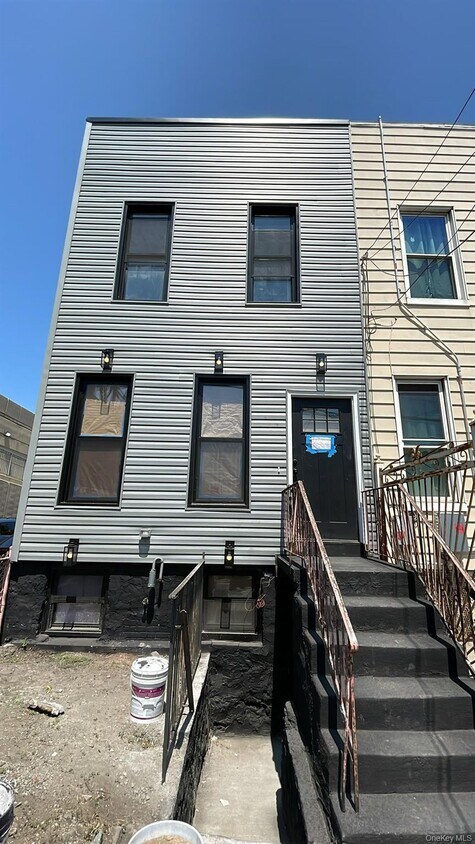
685 E 132nd St
The Bronx, NY 10454
Today
Favorites
917-727-3037
-
Bedrooms
3
-
Bathrooms
2.5
-
Square Feet
1,400 sq ft
-
Available
Available Now
Highlight
- Stainless Steel Appliances
685 E 132nd St

Favorites
About This Home
Available Now
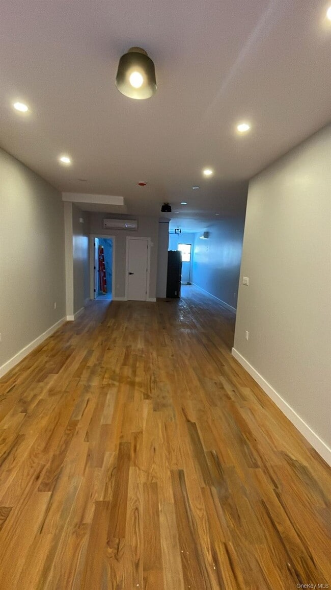
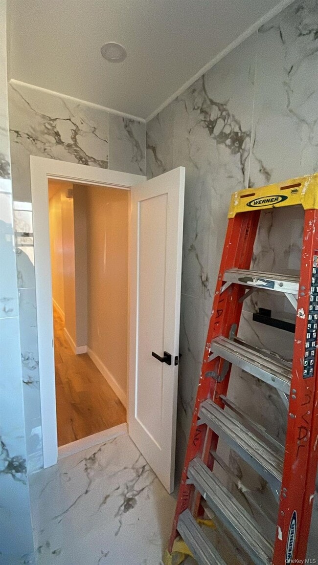
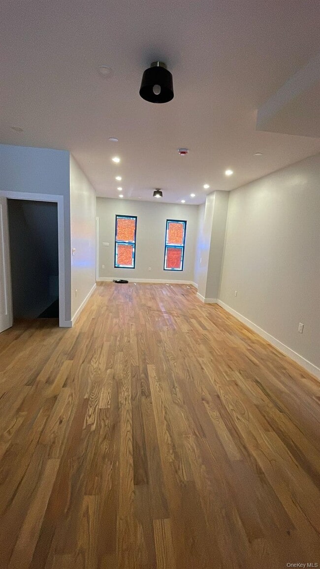
Gorgeous Finished 3-Bedroom House + Basement Move right into this beautifully finished 3-bedroom home,complete with a spacious and fully finished basement. Features include: Bright,open living and dining area Modern kitchen with quality finishes 3 large bedrooms with plenty of closet space Fully finished basement,perfect for recreation or extra storage Updated bathrooms Move-in ready condition Located in a vibrant neighborhood with easy access to shopping,dining,schools,and transportation. Based on information submitted to the MLS GRID as of [see last changed date above]. All data is obtained from various sources and may not have been verified by broker or MLS GRID. Supplied Open House Information is subject to change without notice. All information should be independently reviewed and verified for accuracy. Properties may or may not be listed by the office/agent presenting the information. Some IDX listings have been excluded from this website. Prices displayed on all Sold listings are the Last Known Listing Price and may not be the actual selling price.
685 E 132nd St is a house located in Bronx County and the 10454 ZIP Code. This area is served by the New York City Geographic District # 7 attendance zone.
* Price shown is base rent. Excludes user-selected optional fees and variable or usage-based fees and required charges due at or prior to move-in or at move-out. Price, availability, fees, and any applicable rent special are subject to change without notice.
* Square footage definitions vary. Displayed square footage is approximate.
Home Details
Home Type
Single Family Detached Home
Year Built
Built in 1920
Bedrooms and Bathrooms
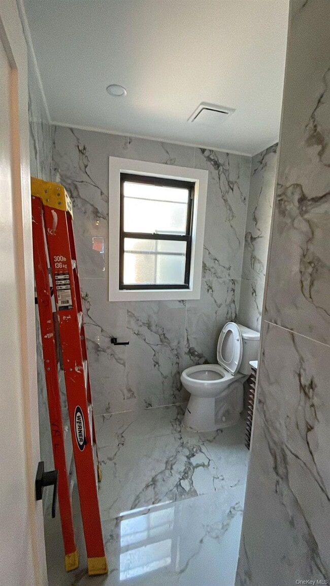
2.5 Bathrooms
3 Bedrooms
Interior Spaces
1,400 Sq Ft Home
Kitchen
Stainless Steel Appliances
Oven
Dishwasher
Listing and Financial Details
12-Month Minimum Lease Term
Assessor Parcel Number 02561-0084
Lot Details
1,650 Sq Ft Lot
1 Common Wall
Two or More Common Walls
Schools
Contact Agent Elementary School
Contact Agent High School
Utilities
No Cooling
Sewer Not Available
Community Details
Pet Policy
No Dogs Allowed
Contact
- Listed by Yoel Peyamipour | Pomp Realty Advisors Inc
- Phone Number
- Contact
-
Source
 OneKey® MLS
Information Copyright 2025, OneKey® MLS. All Rights Reserved.
The source of the displayed data is either the property owner or public record provided by non-governmental third parties. It is believed to be reliable but not guaranteed. This information is provided exclusively for consumers’ personal, non-commercial use.
The data relating to real estate for sale on this website comes in part from the IDX Program of OneKey® MLS.
Location
Get Directions
The East and Harlem Rivers encircle Port Morris, an industrial-based waterfront neighborhood on the southwestern tip of the Bronx, New York. As the community's renaissance continues, residential construction adds to the supply of houses and condos for rent. Pulaski Park, a neighborhood recreational space and gathering place, offers exercise areas and basketball courts. Nearby highways give access to other city locations, including historic Harlem in Manhattan, just across the Harlem River.
Port Morris locals encourage their 90,000 neighbors to partake in community activities such as using the Randall's Island Connector to walk or bike to the island adjacent to the neighborhood. The Bronx Kill, a narrow stretch of water that connects the East and Harlem Rivers and separates Port Morris from Randall's Island, accommodates locals who canoe at high tide and walk across at low tide to get to the island.
Learn more about living in Port Morris
Education
| Colleges & Universities | Distance | ||
|---|---|---|---|
| Colleges & Universities | Distance | ||
| Drive: | 6 min | 2.3 mi | |
| Drive: | 9 min | 3.9 mi | |
| Drive: | 9 min | 4.0 mi | |
| Drive: | 10 min | 4.1 mi |
685 E 132nd St is within 6 minutes or 2.3 miles from Hostos Community College. It is also near The City College of New York and Manhattan School Of Music.
Schools


Public Elementary School
Grades PK-5
343 Students
Nearby
Charter Elementary, Middle & High School
Grades K-12
458 Students
Nearby
Charter Middle & High School
Grades 6-12
602 Students
Nearby
Public Middle School
Grades 6-8
198 Students
Attendance Zone
Public Middle School
Grades 6-8
303 Students
Attendance Zone
Public High School
Grades 9-12
330 Students
Nearby
Private Elementary & Middle School
Grades PK-9
31 Students
Nearby
Private Elementary & Middle School
Grades PK-8
295 Students
Nearby
Private High School
Grades 9-12
857 Students
Nearby
School data provided by
 The GreatSchools Rating helps parents compare schools within a state based on a variety of school quality indicators and provides a helpful picture of how effectively each school serves all of its students. Ratings are on a scale of 1 (below average) to 10 (above average) and can include test scores, college readiness, academic progress, advanced courses, equity, discipline and attendance data. We also advise parents to visit schools, consider other information on school performance and programs, and consider family needs as part of the school selection process.
View GreatSchools Rating Methodology
Data provided by GreatSchools.org © 2025. All rights reserved.
View GreatSchools Rating Methodology
Data provided by GreatSchools.org © 2025. All rights reserved.
Transportation options available in The Bronx include Cypress Avenue, located 0.5 mile from 685 E 132nd St. 685 E 132nd St is near LaGuardia, located 6.2 miles or 14 minutes away, and John F Kennedy International, located 17.4 miles or 27 minutes away.
| Transit / Subway | Distance | ||
|---|---|---|---|
| Transit / Subway | Distance | ||
|
|
Walk: | 9 min | 0.5 mi |
|
|
Walk: | 13 min | 0.7 mi |
|
|
Drive: | 2 min | 1.1 mi |
|
|
Drive: | 3 min | 1.1 mi |
|
|
Drive: | 4 min | 1.4 mi |
| Commuter Rail | Distance | ||
|---|---|---|---|
| Commuter Rail | Distance | ||
|
|
Drive: | 6 min | 2.4 mi |
|
|
Drive: | 5 min | 2.6 mi |
|
|
Drive: | 9 min | 3.0 mi |
| Drive: | 10 min | 4.1 mi | |
|
|
Drive: | 9 min | 5.0 mi |
| Airports | Distance | ||
|---|---|---|---|
| Airports | Distance | ||
|
LaGuardia
|
Drive: | 14 min | 6.2 mi |
|
John F Kennedy International
|
Drive: | 27 min | 17.4 mi |
Time and distance from 685 E 132nd St.
| Shopping Centers | Distance | ||
|---|---|---|---|
| Shopping Centers | Distance | ||
| Drive: | 5 min | 1.8 mi | |
| Drive: | 6 min | 2.2 mi | |
| Drive: | 7 min | 2.8 mi |
685 E 132nd St has 3 shopping centers within 2.8 miles, which is about a 7-minute drive. The miles and minutes will be for the farthest away property.
| Parks and Recreation | Distance | ||
|---|---|---|---|
| Parks and Recreation | Distance | ||
|
St. Mary's Park
|
Drive: | 4 min | 1.3 mi |
|
Randall's Island Park
|
Drive: | 3 min | 1.4 mi |
|
Captain Rivera Playground
|
Drive: | 5 min | 1.7 mi |
|
Marcus Garvey Park
|
Drive: | 8 min | 2.3 mi |
|
Thomas Jefferson Park
|
Drive: | 7 min | 2.7 mi |
685 E 132nd St has 5 parks within 2.7 miles, including Randall's Island Park, St. Mary's Park, and Captain Rivera Playground.
| Hospitals | Distance | ||
|---|---|---|---|
| Hospitals | Distance | ||
| Drive: | 6 min | 2.3 mi | |
| Drive: | 7 min | 2.4 mi | |
| Drive: | 8 min | 3.6 mi |
685 E 132nd St has 3 hospitals within 3.6 miles, the nearest is Lincoln Medical & Mental Health Center which is 2.3 miles away and a 6 minute drive.
| Military Bases | Distance | ||
|---|---|---|---|
| Military Bases | Distance | ||
| Drive: | 19 min | 10.3 mi | |
| Drive: | 27 min | 12.9 mi |
685 E 132nd St is 10.3 miles from Fort Totten US Govt Reservation, and is convenient to other military bases, including Governors Island Support Center.
You May Also Like
Similar Rentals Nearby


What Are Walk Score®, Transit Score®, and Bike Score® Ratings?
Walk Score® measures the walkability of any address. Transit Score® measures access to public transit. Bike Score® measures the bikeability of any address.
What is a Sound Score Rating?
A Sound Score Rating aggregates noise caused by vehicle traffic, airplane traffic and local sources

685 E 132nd St
The Bronx, NY 10454