

$1,500 / Month
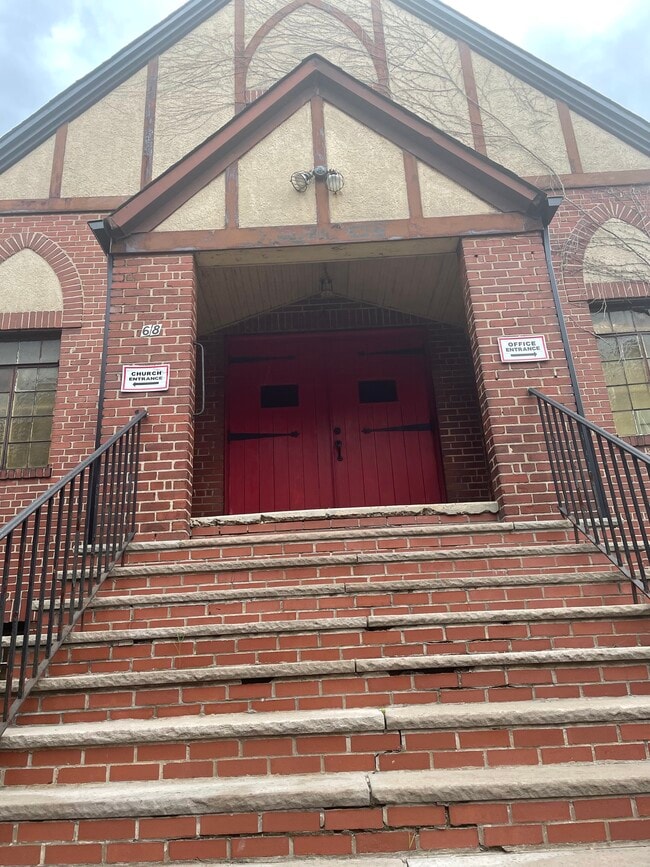
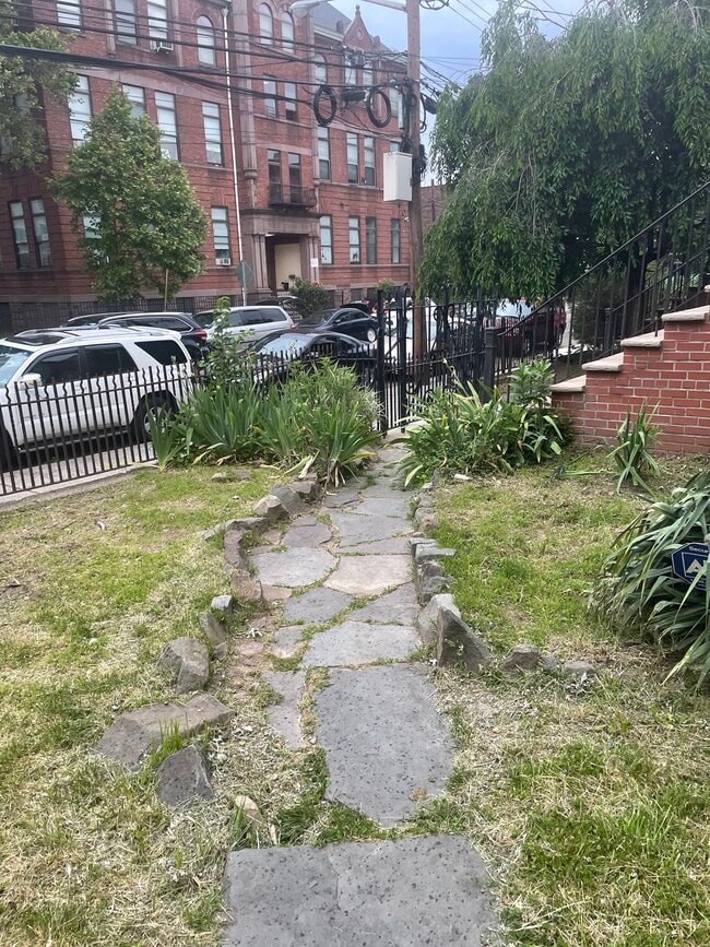
68 Storms Ave
Jersey City, NJ 07306
2 Weeks Ago
Favorites
68 Storms Ave

Favorites
Check Back Soon for Upcoming Availability
| Beds | Baths | Average SF |
|---|---|---|
| Studio Studio 0 Br | 1 Bath 1 Bath 1 Ba | 3,000 SF |
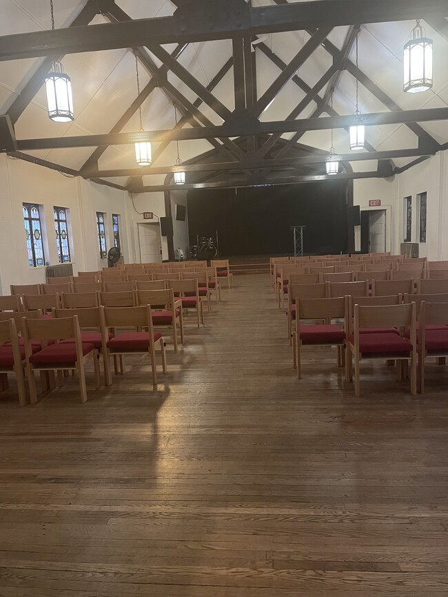
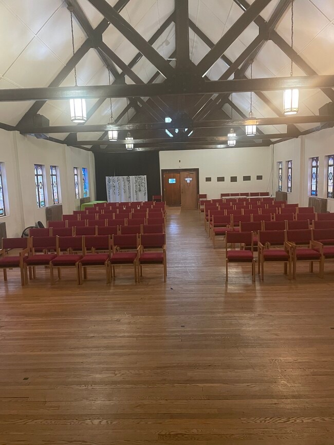
About This Property
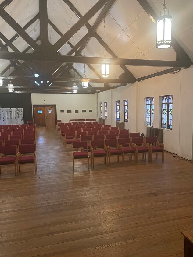
The Hub Church publicación ¿Es un 501 (c) (3) iglesia buscando un lugar para organizar los servicios de iglesia y periódica o eventos? Ha llegado al lugar correcto en 68 Storms Avenue. Este será el lugar perfecto para tu iglesia y de ministerios para crecer. No deseo que nuestras instalaciones se puedes utilizar para el compañerismo del cuerpo de Cristo y de traer esplendor a Dios. Estamos ubicados en la ciudad de Jersey, específicamente el área de McGinley Square. Disponibilidad: Los domingos: 15:00 - final de la noche Días de semana y de algunos de los sábados (pendiente de la iglesia calendario) Ponte en contacto con para analizar/negociar el uso que desea. Documentación obligatoria: Ten listo para proporcionar documentación de 501 (c) (3) nivel y seguro. Aspectos destacados del edificio Iglesia histórica con techos estilo catedral Capacidad: Aproximadamente. 100 sillas ya disponibles Journal Square/área de McGinley Square Todos los servicios públicos incluidos Acceso a Internet (por una cargo adicional) Mucho espacio de estacionamiento en el lugar Acceso a la hermandad salón para encuentros íntimos o eventos de comedor Para programar una visita o para obtener más información, ponte en contacto con el administrador de Church a través de correo electrónico en. Estamos encantados de ayudarlo y ver tu crecimiento de ministerios.
68 Storms Ave is a house located in Hudson County and the 07306 ZIP Code. This area is served by the Jersey City Public attendance zone.
Location
Get Directions
Signs reading "The Heart of Jersey City: McGinley Square" line the streets of this bustling neighborhood. The up-and-coming area of Jersey City houses small businesses, diverse eateries, and large franchises alike. The streets buzz with commuters on their way to work, students heading to class, and locals running daily errands.
Saint Peter's College allots for much of historic McGinley Square. An active redevelopment plan and local organizations aim to make the neighborhood a highly desirable place to live by upgrading older buildings and bringing in new businesses, condos, and entertainment centers.
Locals can enjoy proximity to New York City and Downtown Jersey City while enjoying a more affordable cost of living. Unique shops, diverse cuisine, and a host of dynamic recreational parks await you in this thriving community.
Learn more about living in McGinley SquareBelow are rent ranges for similar nearby apartments
| Beds | Average Size | Lowest | Typical | Premium |
|---|---|---|---|---|
| Studio Studio Studio | 476-477 Sq Ft | $1,100 | $1,984 | $2,600 |
| 1 Bed 1 Bed 1 Bed | 671-676 Sq Ft | $1,400 | $2,321 | $3,700 |
| 2 Beds 2 Beds 2 Beds | 956-964 Sq Ft | $1,575 | $2,895 | $4,950 |
| 3 Beds 3 Beds 3 Beds | 1286-1292 Sq Ft | $1,850 | $3,279 | $5,975 |
| 4 Beds 4 Beds 4 Beds | 1466 Sq Ft | $2,950 | $3,729 | $4,500 |
Education
| Colleges & Universities | Distance | ||
|---|---|---|---|
| Colleges & Universities | Distance | ||
| Walk: | 9 min | 0.5 mi | |
| Walk: | 14 min | 0.8 mi | |
| Drive: | 4 min | 2.1 mi | |
| Drive: | 12 min | 4.1 mi |
68 Storms Ave is within 9 minutes or 0.5 mile from Saint Peter's College. It is also near Hudson Co. Comm. College and New Jersey City University.
Schools


Public Elementary & Middle School
Grades PK-8
1,092 Students
Attendance Zone
Public High School
Grades 9-12
194 Students
Attendance Zone
Public High School
Grades 9-12
942 Students
Attendance Zone
Private Elementary School
Grades PK-6
Nearby
Private Elementary & Middle School
Grades PK-9
391 Students
Nearby
Private High School
Grades 9-12
497 Students
Nearby
School data provided by
 The GreatSchools Rating helps parents compare schools within a state based on a variety of school quality indicators and provides a helpful picture of how effectively each school serves all of its students. Ratings are on a scale of 1 (below average) to 10 (above average) and can include test scores, college readiness, academic progress, advanced courses, equity, discipline and attendance data. We also advise parents to visit schools, consider other information on school performance and programs, and consider family needs as part of the school selection process.
View GreatSchools Rating Methodology
Data provided by GreatSchools.org © 2025. All rights reserved.
View GreatSchools Rating Methodology
Data provided by GreatSchools.org © 2025. All rights reserved.
Transportation options available in Jersey City include Martin Luther King Drive, located 1.3 miles from 68 Storms Ave. 68 Storms Ave is near Newark Liberty International, located 9.1 miles or 13 minutes away, and LaGuardia, located 14.4 miles or 32 minutes away.
| Transit / Subway | Distance | ||
|---|---|---|---|
| Transit / Subway | Distance | ||
|
|
Drive: | 3 min | 1.3 mi |
|
|
Drive: | 3 min | 1.4 mi |
|
|
Drive: | 3 min | 1.4 mi |
|
|
Drive: | 4 min | 1.6 mi |
|
|
Drive: | 4 min | 2.0 mi |
| Commuter Rail | Distance | ||
|---|---|---|---|
| Commuter Rail | Distance | ||
|
|
Walk: | 15 min | 0.8 mi |
|
|
Drive: | 4 min | 1.7 mi |
|
|
Drive: | 6 min | 2.3 mi |
|
|
Drive: | 7 min | 2.8 mi |
|
|
Drive: | 7 min | 3.0 mi |
| Airports | Distance | ||
|---|---|---|---|
| Airports | Distance | ||
|
Newark Liberty International
|
Drive: | 13 min | 9.1 mi |
|
LaGuardia
|
Drive: | 32 min | 14.4 mi |
Time and distance from 68 Storms Ave.
| Shopping Centers | Distance | ||
|---|---|---|---|
| Shopping Centers | Distance | ||
| Walk: | 21 min | 1.1 mi | |
| Drive: | 3 min | 1.3 mi | |
| Drive: | 5 min | 2.2 mi |
68 Storms Ave has 3 shopping centers within 2.2 miles, which is about a 5-minute walk. The miles and minutes will be for the farthest away property.
| Parks and Recreation | Distance | ||
|---|---|---|---|
| Parks and Recreation | Distance | ||
|
Liberty Science Center
|
Drive: | 5 min | 1.7 mi |
|
Liberty Landing Marina
|
Drive: | 6 min | 2.2 mi |
|
Ellis Island National Monument
|
Drive: | 11 min | 3.1 mi |
|
Statue of Liberty
|
Drive: | 11 min | 3.1 mi |
|
Laurel Hill Park
|
Drive: | 11 min | 4.4 mi |
68 Storms Ave has 5 parks within 4.4 miles, including Liberty Science Center, Liberty Landing Marina, and Ellis Island National Monument.
| Hospitals | Distance | ||
|---|---|---|---|
| Hospitals | Distance | ||
| Drive: | 3 min | 1.3 mi | |
| Drive: | 3 min | 1.6 mi | |
| Drive: | 8 min | 3.3 mi |
68 Storms Ave has 3 hospitals within 3.3 miles, the nearest is Jersey City Medical Center which is 1.3 miles away and a 3 minute drive.
| Military Bases | Distance | ||
|---|---|---|---|
| Military Bases | Distance | ||
| Drive: | 11 min | 6.5 mi | |
| Drive: | 15 min | 6.5 mi |
68 Storms Ave is 6.5 miles from Military Ocean Terminal, and is convenient to other military bases, including Governors Island Support Center.
You May Also Like
Similar Rentals Nearby


What Are Walk Score®, Transit Score®, and Bike Score® Ratings?
Walk Score® measures the walkability of any address. Transit Score® measures access to public transit. Bike Score® measures the bikeability of any address.
What is a Sound Score Rating?
A Sound Score Rating aggregates noise caused by vehicle traffic, airplane traffic and local sources
68 Storms Ave
Jersey City, NJ 07306