
Venue Residences
3688 Overland Ave,
Los Angeles, CA 90034
$3,250 - $7,150
1-2 Beds
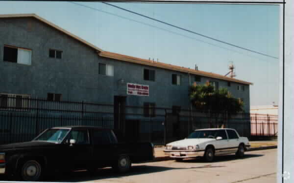

At 6709 10th Ave in Los Angeles, you've discovered your new home. The location of this community is in Los Angeles on 10th Ave. The leasing team is ready to help match you with the perfect floorplan. Come for a visit to see the current floorplan options. Get a head start on moving now. Contact or stop by 6709 10th Ave to schedule a tour today!
6709 10th Ave is an apartment community located in Los Angeles County and the 90043 ZIP Code. This area is served by the Los Angeles Unified attendance zone.
Found in the Inglewood area of Los Angeles County, Park Mesa spans nearly three square miles between Downtown Los Angeles, which is 11 miles east, and Los Angeles International Airport, six miles west.
Park Mesa Heights hosts a variety of events and festivals. Inglewood's annual Dr. Martin Luther King Jr. Day Celebration brings residents out to commemorate, while the Slauson Indoor Swap Meet draws bargain hunters. With L.A. beaches lining the Pacific Ocean just eight miles away, Park Mesa Heights provides coastal breezes and easy access to sand and surf.
Learn more about living in Park Mesa Heights| Colleges & Universities | Distance | ||
|---|---|---|---|
| Colleges & Universities | Distance | ||
| Drive: | 10 min | 4.8 mi | |
| Drive: | 10 min | 5.9 mi | |
| Drive: | 12 min | 5.9 mi | |
| Drive: | 11 min | 7.3 mi |


Transportation options available in Los Angeles include Fairview Heights Station, located 0.7 mile from 6709 10th Ave. 6709 10th Ave is near Los Angeles International, located 6.1 miles or 12 minutes away, and Long Beach (Daugherty Field), located 19.8 miles or 28 minutes away.
| Transit / Subway | Distance | ||
|---|---|---|---|
| Transit / Subway | Distance | ||
| Walk: | 13 min | 0.7 mi | |
| Walk: | 16 min | 0.8 mi | |
| Drive: | 3 min | 1.7 mi | |
| Drive: | 3 min | 1.9 mi | |
| Drive: | 5 min | 2.5 mi |
| Commuter Rail | Distance | ||
|---|---|---|---|
| Commuter Rail | Distance | ||
|
|
Drive: | 16 min | 10.6 mi |
|
|
Drive: | 18 min | 10.8 mi |
|
|
Drive: | 23 min | 12.7 mi |
| Drive: | 20 min | 14.6 mi | |
|
|
Drive: | 23 min | 15.2 mi |
| Airports | Distance | ||
|---|---|---|---|
| Airports | Distance | ||
|
Los Angeles International
|
Drive: | 12 min | 6.1 mi |
|
Long Beach (Daugherty Field)
|
Drive: | 28 min | 19.8 mi |
Time and distance from 6709 10th Ave.
| Shopping Centers | Distance | ||
|---|---|---|---|
| Shopping Centers | Distance | ||
| Walk: | 16 min | 0.9 mi | |
| Drive: | 3 min | 1.6 mi | |
| Drive: | 3 min | 1.7 mi |
| Parks and Recreation | Distance | ||
|---|---|---|---|
| Parks and Recreation | Distance | ||
|
Natural History Museum of LA County
|
Drive: | 9 min | 5.1 mi |
|
Kenneth Hahn State Recreation Area
|
Drive: | 12 min | 5.1 mi |
|
Exposition Park Rose Garden
|
Drive: | 9 min | 5.2 mi |
|
California Science Center
|
Drive: | 10 min | 5.3 mi |
|
Augustus Hawkins Natural Park
|
Drive: | 10 min | 5.8 mi |
| Hospitals | Distance | ||
|---|---|---|---|
| Hospitals | Distance | ||
| Drive: | 6 min | 3.1 mi | |
| Drive: | 11 min | 6.7 mi | |
| Drive: | 12 min | 7.8 mi |
| Military Bases | Distance | ||
|---|---|---|---|
| Military Bases | Distance | ||
| Drive: | 12 min | 7.0 mi |
What Are Walk Score®, Transit Score®, and Bike Score® Ratings?
Walk Score® measures the walkability of any address. Transit Score® measures access to public transit. Bike Score® measures the bikeability of any address.
What is a Sound Score Rating?
A Sound Score Rating aggregates noise caused by vehicle traffic, airplane traffic and local sources

6709 10th Ave
Los Angeles, CA 90043


