
$1,900
Total Monthly Price
12 Month Lease
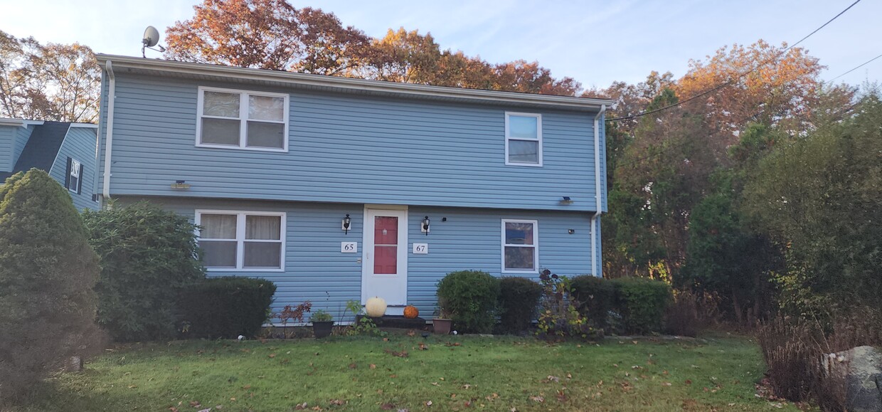
67 R Dr Unit 67
Westport, MA 02790
Favorites
67 R Dr Unit 67

Favorites
Check Back Soon for Upcoming Availability
| Beds | Baths | Average SF |
|---|---|---|
| 2 Bedrooms 2 Bedrooms 2 Br | 1 Bath 1 Bath 1 Ba | 850 SF |
Fees and Policies
The fees listed below are community-provided and may exclude utilities or add-ons. All payments are made directly to the property and are non-refundable unless otherwise specified.
- Parking
-
Other--
Details
Utilities Included
-
Trash Removal
Property Information
-
2 units
About This Property
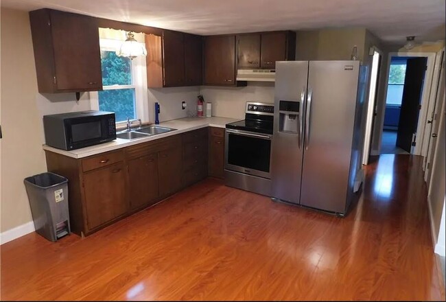
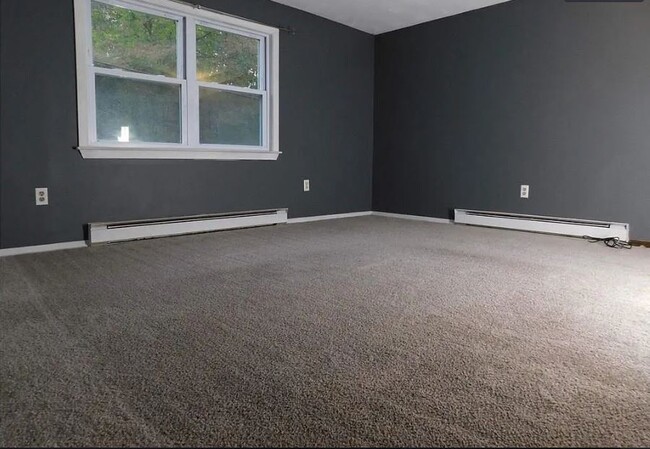
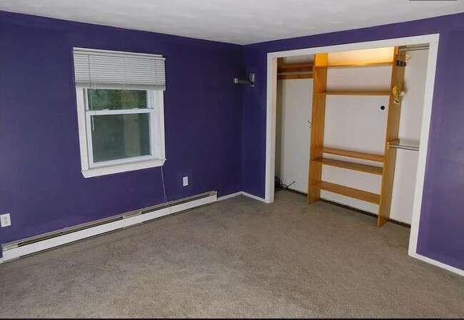
This 2 bedroom rental in Westport offers plenty of space to spread out and enjoy the comfort of country living while living close to everything. Horseneck Beach is 15 minutes away, Rte. 6 shopping and dining is 2 milutes away. Close proximity to the highway and UMass Dartmouth make this second floor apartment even more convenient. This rental is available dec 1. This property provides a peaceful country atmosphere. Located walking distance to hiking trails. Please be advised that this property does not have laundry hookups on site, allows no smoking, and is not certified lead safe.
67 R Dr is an apartment community located in Bristol County and the 02790 ZIP Code. This area is served by the Westport School District attendance zone.
Apartment Features
- Smoke Free
- Walking/Biking Trails
67 R Dr,
Westport,
MA
02790
Westport is a quaint suburban community just to the west of New Bedford. It shares a western border with Rhode Island, adding to its charming New England feel. Westport is a largely residential area with pockets of entertainment and culture. Head to central village for some top-notch pizza and a number of ice cream shops, or North Westport for a great collection of shops and grocery stores.
Hit the beach at Horseneck State Park, or enjoy the riverfront views at Westport Rivers Vineyard or Buzzards Bay Brewing. There’s amazing rental variety in Westport, including newly renovated lofts and historic apartment buildings. MA-88 connects to I-195 in the north, putting the rest of New England just a short drive away.
Learn more about living in Westport
Amenities
- Smoke Free
- Walking/Biking Trails
Expenses
Utilities Included
Trash Removal
Included
Education
| Colleges & Universities | Distance | ||
|---|---|---|---|
| Colleges & Universities | Distance | ||
| Drive: | 15 min | 6.6 mi | |
| Drive: | 16 min | 7.3 mi | |
| Drive: | 21 min | 12.9 mi | |
| Drive: | 37 min | 20.1 mi |
67 R Dr Unit 67 is within 15 minutes or 6.6 miles from Bristol Community College. It is also near UMass Dartmouth and Roger Williams University.
Schools


Public Elementary, Middle & High School
Grades K-12
876 Students
Attendance Zone
Public Elementary School
Grades K-5
465 Students
Attendance Zone
Public Elementary School
Grades PK-5
170 Students
Attendance Zone
Private Elementary & Middle School
Grades PK-8
244 Students
Nearby
Private Middle & High School
Grades 6-12
24 Students
Nearby
School data provided by
 The GreatSchools Rating helps parents compare schools within a state based on a variety of school quality indicators and provides a helpful picture of how effectively each school serves all of its students. Ratings are on a scale of 1 (below average) to 10 (above average) and can include test scores, college readiness, academic progress, advanced courses, equity, discipline and attendance data. We also advise parents to visit schools, consider other information on school performance and programs, and consider family needs as part of the school selection process.
View GreatSchools Rating Methodology
Data provided by GreatSchools.org © 2026. All rights reserved.
View GreatSchools Rating Methodology
Data provided by GreatSchools.org © 2026. All rights reserved.
Walkability Near 67 R Dr Westport, MA 02790
Getting Around
 What do Walkability, Transit, Drivability, and Bikeability mean?
Walkability measures the walking distance to day-to-day needs.
Transit measures access to public transportation.
Drivability measures congestion, parking availability, and access to major roads.
Bikeability measures the suitability for cycling.
How It Works
What do Walkability, Transit, Drivability, and Bikeability mean?
Walkability measures the walking distance to day-to-day needs.
Transit measures access to public transportation.
Drivability measures congestion, parking availability, and access to major roads.
Bikeability measures the suitability for cycling.
How It Works
Somewhat Walkable
Walkability
20
/ 100
Minimal Public Transit
Transit
0
/ 100
Exceptionally Drivable
Drivability
100
/ 100
Somewhat Bikeable
Bikeability
30
/ 100
Scores provided by
-
Soundscore™
-
/ 100
Traffic
-Airport
-Businesses
-Scores provided by
HowLoud What is a Sound Score Rating? A Sound Score Rating aggregates noise caused by vehicle traffic, airplane traffic and local sources. How It WorksYou May Also Like
Similar Rentals Nearby
-
-
-
-
-
-
2 Beds$2,751+3 Beds$3,617Total Monthly PriceTotal Monthly Price NewPrices include required monthly fees of $155.Base Rent:2 Beds$2,596+3 Beds$3,4622 Months Free
Fitness Center Pool Refrigerator Kitchen In Unit Washer & Dryer Clubhouse
-
-
-
-


What Are Walk Score®, Transit Score®, and Bike Score® Ratings?
Walk Score® measures the walkability of any address. Transit Score® measures access to public transit. Bike Score® measures the bikeability of any address.
What is a Sound Score Rating?
A Sound Score Rating aggregates noise caused by vehicle traffic, airplane traffic and local sources.

67 R Dr
Westport, MA 02790