$3,200
Total Monthly Price
12 Month Lease
67 Dudley St
Boston, MA 02119
Favorites
-
Bedrooms
2
-
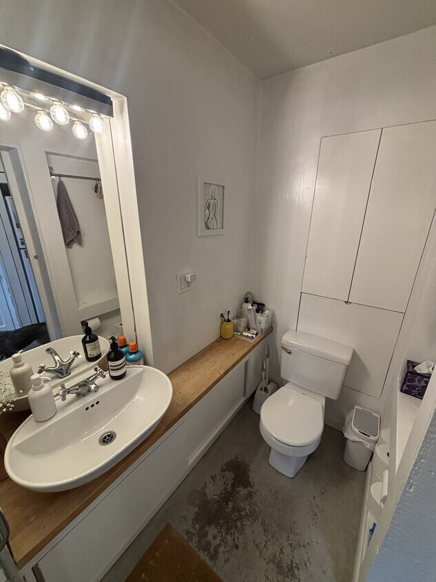
Bathrooms
1
-
Square Feet
1,974 sq ft
-
Available
Available Sep 1
Highlights
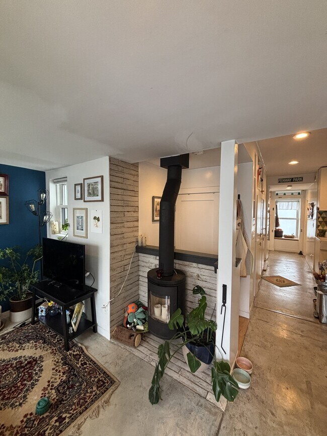
- Basement
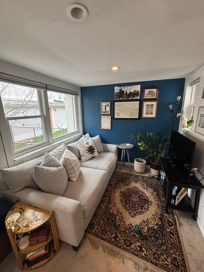
- Deck
67 Dudley St

Favorites
About This Home
12 Month Lease,
$3,200 deposit,
Available Sep 1
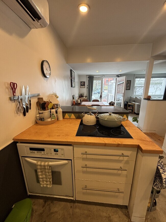
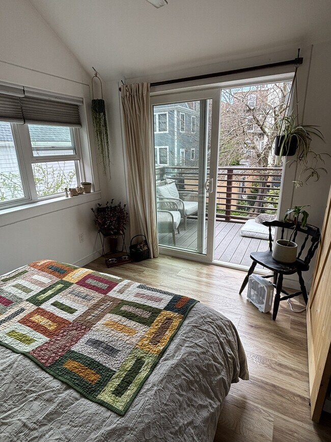
Rare free-standing single-family in vibrant Boston built from the foundation up in 2008 & loaded w/thoughtful design. Over 1,000 SF of bright, open living space w/2-bedrooms on a loft-style 2nd floor & in-unit washer/dryer. The layout lives smart: custom multi-functional cabinetry maximizes every corner, while generous windows flood the home w/natural light all day long. Access a large back deck from the dining area perfect for entertaining or escape to the private roof deck off the upstairs bedroom for your own urban retreat. Large basement offers excellent storage. Plenty of on-street parking. Minutes from Roxbury Crossing (Orange Line), Longwood Medical (Green Line) & Nubian Square (Silver Line) commuting couldn't be easier. A cozy, well-crafted home in one of Boston's most exciting & rapidly transforming neighborhoods. Available 9/1. Small dogs. This one won't last.
67 Dudley St is a house located in Suffolk County and the 02119 ZIP Code.
* Price shown is total price based on community-supplied monthly required fees. Excludes user-selected optional fees and variable or usage-based fees and required charges due at or prior to move-in or at move-out. Price, availability, fees, and any applicable rent special are subject to change without notice.
* Square footage definitions vary. Displayed square footage is approximate.
House Features
- Dining Room
- Basement
- Deck
Contact
- Contact
Location
Get Directions
Situated between the South End and Dudley Square, Lower Roxbury is a predominantly residential neighborhood brimming with apartments and town houses available for rent. Residents enjoy a walkable urban environment filled with diverse historical architecture.
Warren Street and Washington Street are the neighborhood’s main commercial thoroughfares, touting rows of specialty shops, markets, and eateries in historic buildings. Northeastern University, Wentworth Institute of Technology, and Massachusetts College of Art and Design are all just northwest of Lower Roxbury, offering the community a bevy of cultural and educational amenities. Getting around from Lower Roxbury is easy with access to multiple T stops on the Orange Line.
Learn more about living in Lower Roxbury
Education
| Colleges & Universities | Distance | ||
|---|---|---|---|
| Colleges & Universities | Distance | ||
| Walk: | 18 min | 1.0 mi | |
| Drive: | 3 min | 1.3 mi | |
| Drive: | 3 min | 1.5 mi | |
| Drive: | 5 min | 1.7 mi |
67 Dudley St is within 18 minutes or 1.0 mile from Wentworth Inst. of Technology. It is also near Northeastern University and MCPHS University, Boston.
Transportation options available in Boston include Roxbury Crossing Station, located 0.6 mile from 67 Dudley St. 67 Dudley St is near General Edward Lawrence Logan International, located 5.9 miles or 12 minutes away.
| Transit / Subway | Distance | ||
|---|---|---|---|
| Transit / Subway | Distance | ||
|
|
Walk: | 11 min | 0.6 mi |
|
|
Drive: | 2 min | 1.1 mi |
|
|
Drive: | 3 min | 1.3 mi |
|
|
Drive: | 3 min | 1.3 mi |
|
|
Drive: | 4 min | 1.8 mi |
| Commuter Rail | Distance | ||
|---|---|---|---|
| Commuter Rail | Distance | ||
| Drive: | 3 min | 1.3 mi | |
|
|
Drive: | 3 min | 1.4 mi |
|
|
Drive: | 4 min | 1.6 mi |
|
|
Drive: | 8 min | 2.3 mi |
|
|
Drive: | 10 min | 5.1 mi |
| Airports | Distance | ||
|---|---|---|---|
| Airports | Distance | ||
|
General Edward Lawrence Logan International
|
Drive: | 12 min | 5.9 mi |
Getting Around
 What do Walkability, Transit, Drivability, and Bikeability mean?
Walkability measures the walking distance to day-to-day needs.
Transit measures access to public transportation.
Drivability measures congestion, parking availability, and access to major roads.
Bikeability measures the suitability for cycling.
How It Works
What do Walkability, Transit, Drivability, and Bikeability mean?
Walkability measures the walking distance to day-to-day needs.
Transit measures access to public transportation.
Drivability measures congestion, parking availability, and access to major roads.
Bikeability measures the suitability for cycling.
How It Works
Exceptionally Walkable
Walkability
100
/ 100
Exceptional Public Transit
Transit
100
/ 100
Fairly Drivable
Drivability
40
/ 100
Very Bikeable
Bikeability
80
/ 100
Scores provided by
-
Soundscore™
-
/ 100
Traffic
-Airport
-Businesses
-Scores provided by
HowLoud What is a Sound Score Rating? A Sound Score Rating aggregates noise caused by vehicle traffic, airplane traffic and local sources. How It WorksTime and distance from 67 Dudley St.
| Shopping Centers | Distance | ||
|---|---|---|---|
| Shopping Centers | Distance | ||
| Walk: | 17 min | 0.9 mi | |
| Drive: | 4 min | 1.6 mi | |
| Drive: | 4 min | 1.7 mi |
67 Dudley St has 3 shopping centers within 1.7 miles, which is about a 4-minute drive. The miles and minutes will be for the farthest away property.
| Parks and Recreation | Distance | ||
|---|---|---|---|
| Parks and Recreation | Distance | ||
|
Roxbury Heritage State Park
|
Walk: | 5 min | 0.3 mi |
|
Lower Neponset River Trail
|
Drive: | 4 min | 1.9 mi |
|
Franklin Park Zoo
|
Drive: | 4 min | 2.1 mi |
|
Charles River Reservation
|
Drive: | 6 min | 2.7 mi |
|
Coit Observatory
|
Drive: | 7 min | 3.1 mi |
67 Dudley St has 5 parks within 3.1 miles, including Roxbury Heritage State Park, Lower Neponset River Trail, and Franklin Park Zoo.
| Hospitals | Distance | ||
|---|---|---|---|
| Hospitals | Distance | ||
| Walk: | 16 min | 0.9 mi | |
| Drive: | 3 min | 1.2 mi | |
| Drive: | 3 min | 1.3 mi |
67 Dudley St has 3 hospitals within 1.3 miles, the nearest is Boston Medical Center which is 0.9 mile away and a 16 minute walk.
| Military Bases | Distance | ||
|---|---|---|---|
| Military Bases | Distance | ||
| Drive: | 29 min | 15.8 mi | |
| Drive: | 32 min | 16.3 mi | |
| Drive: | 37 min | 22.2 mi |
67 Dudley St has 3 military bases within 22.2 miles, the nearest is US Military Reservation which is 15.8 miles away and a 29 minute drive.
Amenities
- Dining Room
- Basement
- Deck
67 Dudley St Photos
What Are Walk Score®, Transit Score®, and Bike Score® Ratings?
Walk Score® measures the walkability of any address. Transit Score® measures access to public transit. Bike Score® measures the bikeability of any address.
What is a Sound Score Rating?
A Sound Score Rating aggregates noise caused by vehicle traffic, airplane traffic and local sources.

67 Dudley St
Boston, MA 02119