

$1,775 / Month
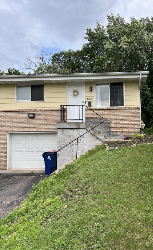
666-662 47 1/2 Ave NE
Columbia Heights, MN 55421
Today
Favorites
763-360-4125
-
Bedrooms
2
-
Bathrooms
1
-
Square Feet
1,200 sq ft
-
Available
Available Aug 1
666-662 47 1/2 Ave NE

Favorites
About This Home
$1,775 deposit,
Available Aug 1
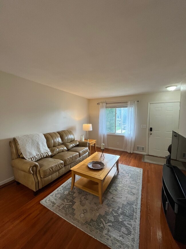
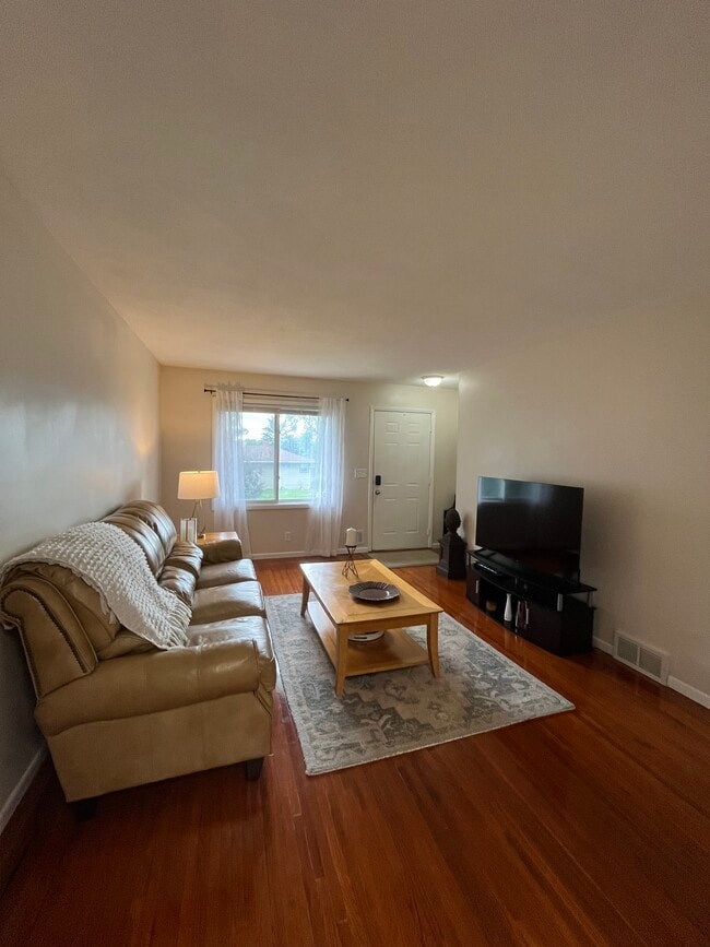
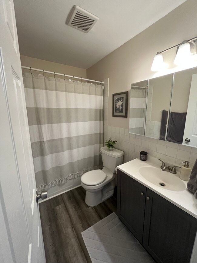
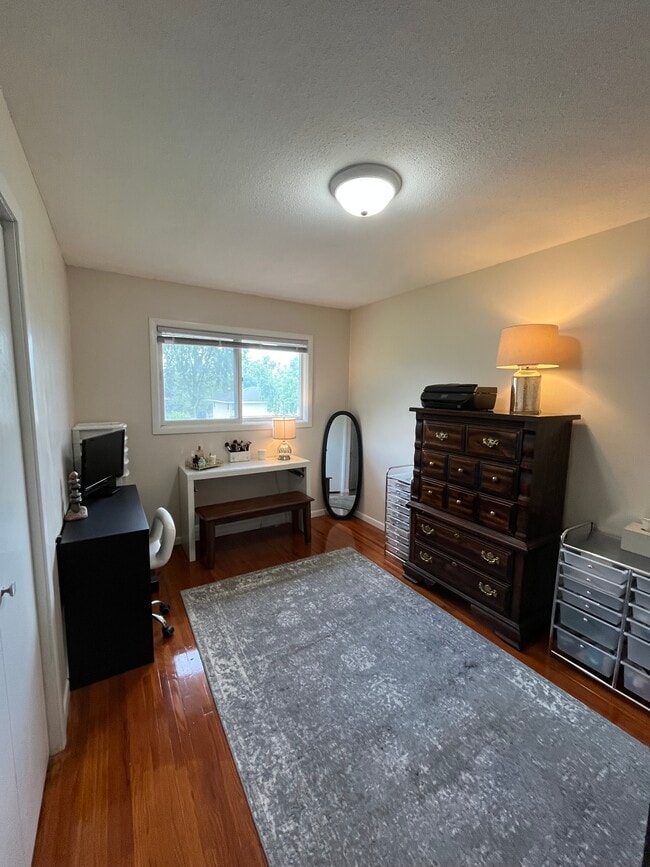
Welcome to your new conveniently located home in the heart of Columbia Heights. Located on a quiet half street between Mckenna Park and Valley View Elementary School. Convenient proximity to many major roadways including I-694, I-94, University Ave, and Central Ave. Only 6 miles from downtown Minneapolis. Also close to many great restaurants, shops, and more. 2 Bed, 1 Bath, Kitchen and Living room upstairs, a Large Family room and private Laundry room in the basement. 1,200 sf total. Amenities included: central air, central heat, hardwood floors, stainless steel appliances, updated kitchen, updated bathroom, storage, washer dryer, and backyard patio. Updated flooring and paint throughout. 1 Car tuck under garage stall with additional driveway parking spots. Utilities included: Sewer, water, trash and recycling Date Available: Friday August 1st 2025. $1,775/month rent.
666-662 47 1/2 Ave NE is a house located in Anoka County and the 55421 ZIP Code. This area is served by the Columbia Heights Public School Dist attendance zone.
* Price shown is base rent and may not include non-optional fees and utilities.
Price, availability, fees, and any applicable rent special are subject to change without notice.
* Square footage definitions vary. Displayed square footage is approximate.
House Features
- Washer/Dryer
- Washer/Dryer Hookup
Fees and Policies
The fees below are based on community-supplied data and may exclude additional fees and utilities.
- Dogs Allowed
-
Fees not specified
- Cats Allowed
-
Fees not specified
Contact
- Listed by Nick Weitz
- Phone Number
- Contact
Location
Get Directions
Amenities
- Washer/Dryer
- Washer/Dryer Hookup
Just five miles north of Downtown Minneapolis, Columbia Heights is a historic community that combines the amenities of the big city with the more relaxed pace of the suburbs. Most of the landscape is occupied by residential neighborhoods, with a rental market spanning from affordable small houses and apartments to more upscale condos and homes.
The majority of the city’s commercial activity runs along Central Avenue, with everything from international grocers to popular local eateries to the historic Heights Theatre located on this corridor. In addition to the urban resources of the Twin Cities, you’ll also be just minutes away from countless parks, golf courses, and other outdoor recreation facilities in the area.
Learn more about living in Columbia Heights
Education
| Colleges & Universities | Distance | ||
|---|---|---|---|
| Colleges & Universities | Distance | ||
| Drive: | 10 min | 6.4 mi | |
| Drive: | 16 min | 6.7 mi | |
| Drive: | 12 min | 8.1 mi | |
| Drive: | 18 min | 11.7 mi |
666-662 47 1/2 Ave NE is within 10 minutes or 6.4 miles from Bethel University, Saint Paul. It is also near Northwestern College and University of St. Thomas.
Schools


Public Elementary School
Grades PK-5
540 Students
Attendance Zone
Public Middle School
Grades 6-8
664 Students
Attendance Zone
Public High School
Grades 9-12
1,092 Students
Attendance Zone
Private Elementary & Middle School
Grades PK-8
148 Students
Nearby
Private Elementary, Middle & High School
Grades PK-12
393 Students
Nearby
School data provided by
 The GreatSchools Rating helps parents compare schools within a state based on a variety of school quality indicators and provides a helpful picture of how effectively each school serves all of its students. Ratings are on a scale of 1 (below average) to 10 (above average) and can include test scores, college readiness, academic progress, advanced courses, equity, discipline and attendance data. We also advise parents to visit schools, consider other information on school performance and programs, and consider family needs as part of the school selection process.
View GreatSchools Rating Methodology
Data provided by GreatSchools.org © 2025. All rights reserved.
View GreatSchools Rating Methodology
Data provided by GreatSchools.org © 2025. All rights reserved.
Transportation options available in Columbia Heights include Warehouse District/Hennepin Avenue Station, located 6.1 miles from 666-662 47 1/2 Ave NE. 666-662 47 1/2 Ave NE is near Minneapolis-St Paul International/Wold-Chamberlain, located 16.4 miles or 33 minutes away.
| Transit / Subway | Distance | ||
|---|---|---|---|
| Transit / Subway | Distance | ||
|
|
Drive: | 14 min | 6.1 mi |
|
|
Drive: | 14 min | 6.2 mi |
| Drive: | 15 min | 6.3 mi | |
|
|
Drive: | 15 min | 6.4 mi |
|
|
Drive: | 15 min | 6.4 mi |
| Commuter Rail | Distance | ||
|---|---|---|---|
| Commuter Rail | Distance | ||
|
|
Drive: | 6 min | 2.9 mi |
|
|
Drive: | 15 min | 6.2 mi |
|
|
Drive: | 18 min | 12.9 mi |
|
|
Drive: | 20 min | 14.5 mi |
|
|
Drive: | 21 min | 15.6 mi |
| Airports | Distance | ||
|---|---|---|---|
| Airports | Distance | ||
|
Minneapolis-St Paul International/Wold-Chamberlain
|
Drive: | 33 min | 16.4 mi |
Time and distance from 666-662 47 1/2 Ave NE.
| Shopping Centers | Distance | ||
|---|---|---|---|
| Shopping Centers | Distance | ||
| Walk: | 11 min | 0.6 mi | |
| Walk: | 11 min | 0.6 mi | |
| Walk: | 14 min | 0.8 mi |
666-662 47 1/2 Ave NE has 3 shopping centers within 0.8 mile, which is about a 14-minute walk. The miles and minutes will be for the farthest away property.
| Parks and Recreation | Distance | ||
|---|---|---|---|
| Parks and Recreation | Distance | ||
|
Columbia Park
|
Drive: | 5 min | 2.0 mi |
|
Hi-View Park
|
Drive: | 5 min | 2.2 mi |
|
Silverwood Park
|
Drive: | 7 min | 2.6 mi |
|
North Mississippi Regional Park
|
Drive: | 9 min | 4.8 mi |
|
Carl Kroening Interpretive Center
|
Drive: | 9 min | 4.8 mi |
666-662 47 1/2 Ave NE has 5 parks within 4.8 miles, including Columbia Park, Hi-View Park, and Silverwood Park.
| Hospitals | Distance | ||
|---|---|---|---|
| Hospitals | Distance | ||
| Drive: | 17 min | 7.0 mi | |
| Drive: | 17 min | 7.5 mi | |
| Drive: | 13 min | 8.5 mi |
666-662 47 1/2 Ave NE has 3 hospitals within 8.5 miles, the nearest is Hennepin County Medical Center which is 7.0 miles away and a 17 minute drive.
| Military Bases | Distance | ||
|---|---|---|---|
| Military Bases | Distance | ||
| Drive: | 27 min | 13.4 mi |
666-662 47 1/2 Ave NE is 13.4 miles and a 27 minute drive from Fort Snelling Military Reservation.
You May Also Like
Similar Rentals Nearby


What Are Walk Score®, Transit Score®, and Bike Score® Ratings?
Walk Score® measures the walkability of any address. Transit Score® measures access to public transit. Bike Score® measures the bikeability of any address.
What is a Sound Score Rating?
A Sound Score Rating aggregates noise caused by vehicle traffic, airplane traffic and local sources
666-662 47 1/2 Ave NE
Columbia Heights, MN 55421