
$2,200
/ Month
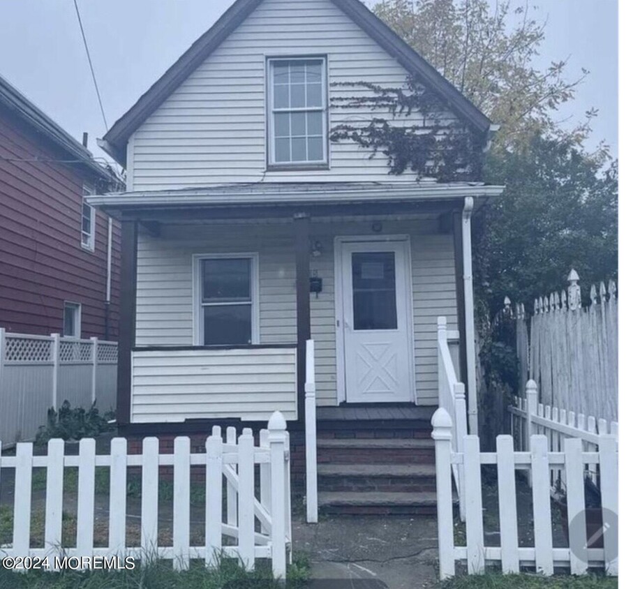
665 State St
Perth Amboy, NJ 08861
2 Weeks Ago
|
Edit
Favorites
665 State St

Favorites
Check Back Soon for Upcoming Availability
| Beds | Baths | Average SF |
|---|---|---|
| 2 Bedrooms 2 Bedrooms 2 Br | 2 Baths 2 Baths 2 Ba | 1,080 SF |
About This Property
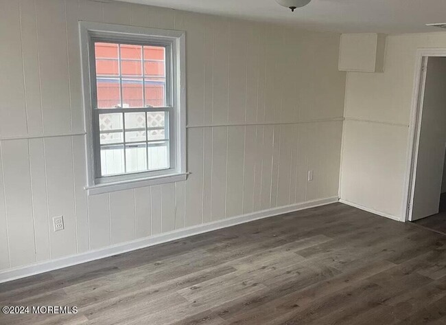
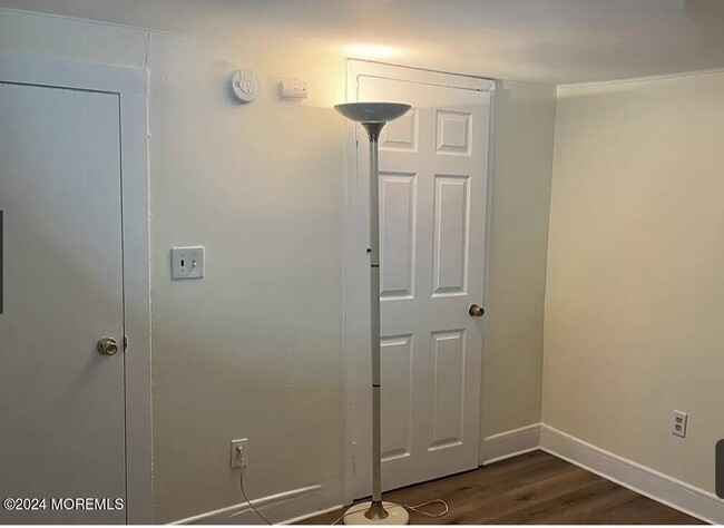
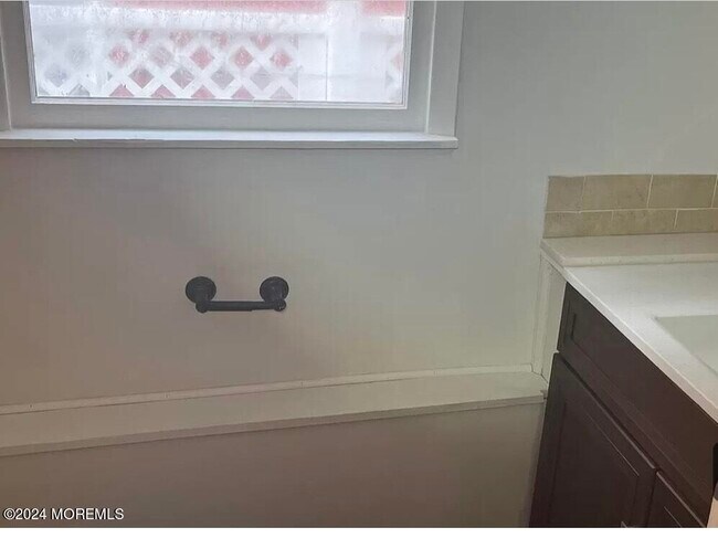
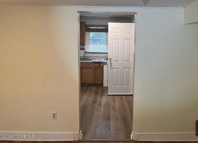
THis is a newly renovated single family house with 2 bedrooms and 1.5 bathrooms. Wood floor,in kitchen,multiple storage rooms,fenced backyard,newly installed air conditioner. Two floors over 1000 SF. It located in downtown district,closing to laundromat,grocery shopping,hospital,gym,school,and all kinds of restaurants,easy access to major highways of route 440,route 9,route 287,New Jersey,tim Pike,and the Garden City Parkway.
665 State St is a house located in Middlesex County and the 08861 ZIP Code. This area is served by the Perth Amboy Public attendance zone.
Location
Get Directions
Education
| Colleges & Universities | Distance | ||
|---|---|---|---|
| Colleges & Universities | Distance | ||
| Drive: | 16 min | 8.4 mi | |
| Drive: | 23 min | 12.8 mi | |
| Drive: | 22 min | 13.0 mi | |
| Drive: | 22 min | 14.2 mi |
665 State St is within 16 minutes or 8.4 miles from Middlesex Co. Coll., Edison. It is also near Rutgers University, Livingston and Coll. of Staten Island, CUNY.
Schools


Public Elementary School
Grades PK-5
431 Students
Nearby
Public Elementary & Middle School
Grades 5-8
1,310 Students
Attendance Zone
Public Elementary School
Grades K-4
618 Students
Attendance Zone
Public High School
Grades 9-12
2,658 Students
Attendance Zone
Private Elementary & Middle School
Grades K-8
126 Students
Nearby
Private Elementary School
Grades 3-5
Nearby
Private High School
Grades 9-12
55 Students
Nearby
Private High School
Grades 9-11
Nearby
School data provided by
 The GreatSchools Rating helps parents compare schools within a state based on a variety of school quality indicators and provides a helpful picture of how effectively each school serves all of its students. Ratings are on a scale of 1 (below average) to 10 (above average) and can include test scores, college readiness, academic progress, advanced courses, equity, discipline and attendance data. We also advise parents to visit schools, consider other information on school performance and programs, and consider family needs as part of the school selection process.
View GreatSchools Rating Methodology
Data provided by GreatSchools.org © 2025. All rights reserved.
View GreatSchools Rating Methodology
Data provided by GreatSchools.org © 2025. All rights reserved.
You May Also Like
Similar Rentals Nearby


What Are Walk Score®, Transit Score®, and Bike Score® Ratings?
Walk Score® measures the walkability of any address. Transit Score® measures access to public transit. Bike Score® measures the bikeability of any address.
What is a Sound Score Rating?
A Sound Score Rating aggregates noise caused by vehicle traffic, airplane traffic and local sources
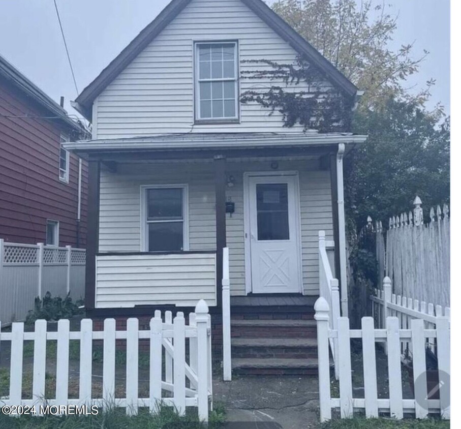
665 State St
Perth Amboy, NJ 08861