
Venue Residences
3688 Overland Ave,
Los Angeles, CA 90034
$2,625 - $5,650
Studio - 2 Beds
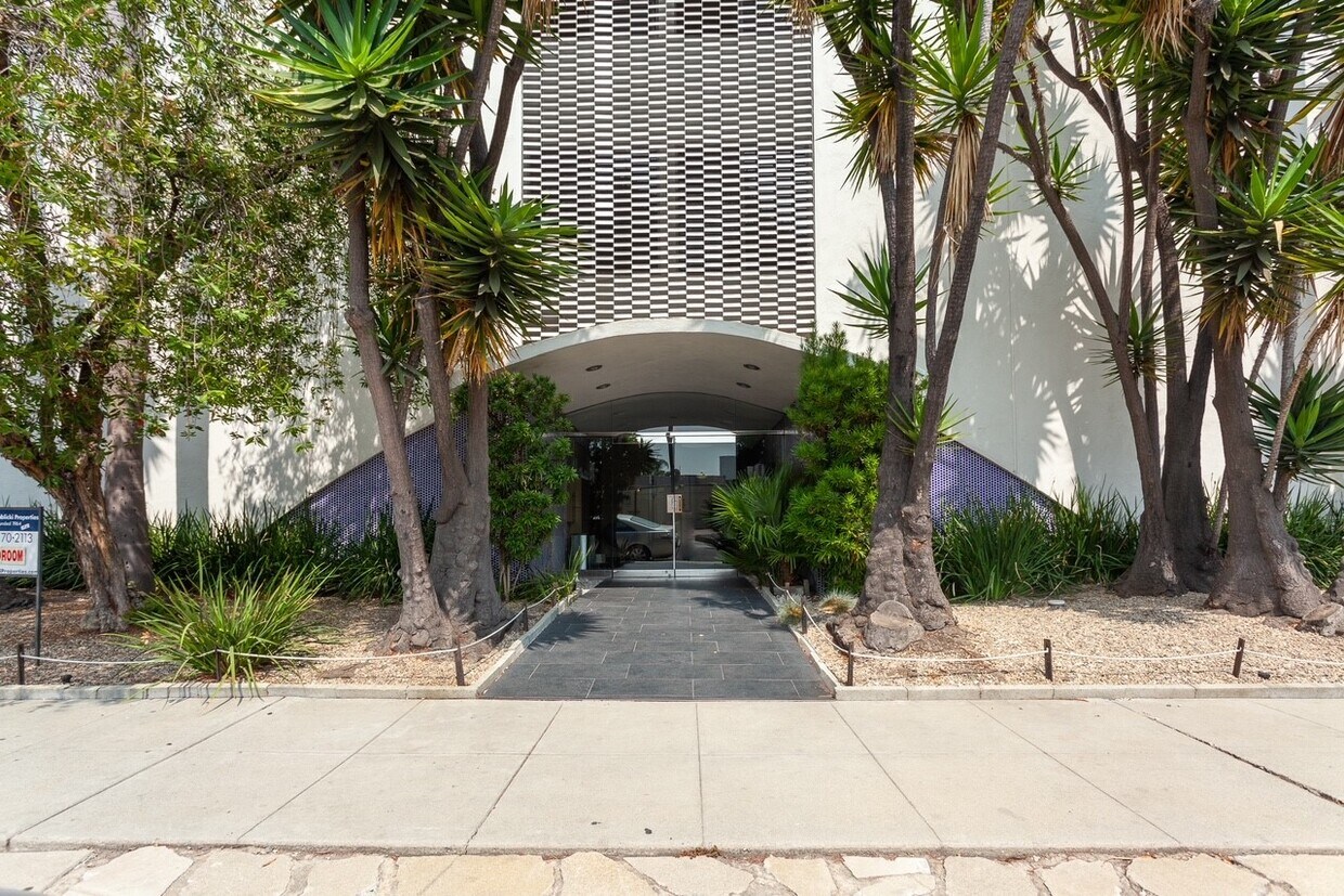

Updated units. Well maintained building. Intercom access.Elevator. Manager on site. Great location!
6617 Orange St is an apartment community located in Los Angeles County and the 90048 ZIP Code. This area is served by the Los Angeles Unified Rocp School District attendance zone.
Laundry Facilities
Elevator
Controlled Access
Recycling
Air Conditioning
Dishwasher
High Speed Internet Access
Hardwood Floors
Granite Countertops
Refrigerator
Tub/Shower
Disposal
Mid-Wilshire is a vibrant neighborhood located in the heart of Los Angeles, California. Known for its rich cultural diversity and historic architecture, this area is a popular choice for those seeking a cosmopolitan lifestyle with easy access to the city's top attractions. For potential renters looking for a place to call home in Mid-Wilshire, there are a variety of rental options available. From charming historic buildings to modern high-rise apartments, this neighborhood offers a diverse range of housing options to fit every lifestyle.
One of the most attractive features of Mid-Wilshire is its central location. Situated just a few miles west of Downtown LA, Mid-Wilshire is easily accessible by public transportation, making it an ideal location for commuters. In addition, the neighborhood is home to a number of major institutions, including the Los Angeles County Museum of Art and the Petersen Automotive Museum, offering plenty of cultural attractions for residents.
Learn more about living in Mid-WilshireCompare neighborhood and city base rent averages by bedroom.
| Mid-Wilshire | Los Angeles, CA | |
|---|---|---|
| Studio | $1,962 | $1,710 |
| 1 Bedroom | $2,444 | $2,180 |
| 2 Bedrooms | $3,254 | $3,015 |
| 3 Bedrooms | $4,351 | $4,300 |
| Colleges & Universities | Distance | ||
|---|---|---|---|
| Colleges & Universities | Distance | ||
| Drive: | 9 min | 4.8 mi | |
| Drive: | 10 min | 5.2 mi | |
| Drive: | 12 min | 5.3 mi | |
| Drive: | 13 min | 5.6 mi |


Transportation options available in Los Angeles include La Cienega/Jefferson, located 3.2 miles from 6617 Orange St. 6617 Orange St is near Los Angeles International, located 10.3 miles or 20 minutes away, and Bob Hope, located 13.1 miles or 25 minutes away.
| Transit / Subway | Distance | ||
|---|---|---|---|
| Transit / Subway | Distance | ||
|
|
Drive: | 6 min | 3.2 mi |
|
|
Drive: | 8 min | 3.6 mi |
|
|
Drive: | 8 min | 4.0 mi |
|
|
Drive: | 8 min | 4.5 mi |
|
|
Drive: | 9 min | 4.7 mi |
| Commuter Rail | Distance | ||
|---|---|---|---|
| Commuter Rail | Distance | ||
|
|
Drive: | 17 min | 9.1 mi |
|
|
Drive: | 19 min | 9.2 mi |
|
|
Drive: | 19 min | 10.3 mi |
|
|
Drive: | 22 min | 11.1 mi |
|
|
Drive: | 23 min | 12.0 mi |
| Airports | Distance | ||
|---|---|---|---|
| Airports | Distance | ||
|
Los Angeles International
|
Drive: | 20 min | 10.3 mi |
|
Bob Hope
|
Drive: | 25 min | 13.1 mi |
Scores provided by
Traffic
-Airport
-Businesses
-Scores provided by
HowLoud What is a Sound Score Rating? A Sound Score Rating aggregates noise caused by vehicle traffic, airplane traffic and local sources. How It WorksTime and distance from 6617 Orange St.
| Shopping Centers | Distance | ||
|---|---|---|---|
| Shopping Centers | Distance | ||
| Walk: | 3 min | 0.2 mi | |
| Walk: | 12 min | 0.6 mi |
| Parks and Recreation | Distance | ||
|---|---|---|---|
| Parks and Recreation | Distance | ||
|
Zimmer Children's Museum
|
Walk: | 3 min | 0.2 mi |
|
La Brea Tar Pits
|
Drive: | 2 min | 1.2 mi |
|
Virginia Robinson Gardens
|
Drive: | 8 min | 3.6 mi |
|
Runyon Canyon
|
Drive: | 10 min | 4.3 mi |
|
Kenneth Hahn State Recreation Area
|
Drive: | 13 min | 5.3 mi |
| Hospitals | Distance | ||
|---|---|---|---|
| Hospitals | Distance | ||
| Walk: | 16 min | 0.9 mi | |
| Walk: | 17 min | 0.9 mi | |
| Drive: | 2 min | 1.1 mi |
| Military Bases | Distance | ||
|---|---|---|---|
| Military Bases | Distance | ||
| Drive: | 20 min | 11.9 mi | |
| Drive: | 41 min | 29.8 mi | |
| Drive: | 44 min | 32.0 mi |
Pets Allowed Fitness Center Pool Maintenance on site High-Speed Internet Controlled Access EV Charging
Pets Allowed In Unit Washer & Dryer Maintenance on site Heat Controlled Access Elevator
What Are Walk Score®, Transit Score®, and Bike Score® Ratings?
Walk Score® measures the walkability of any address. Transit Score® measures access to public transit. Bike Score® measures the bikeability of any address.
What is a Sound Score Rating?
A Sound Score Rating aggregates noise caused by vehicle traffic, airplane traffic and local sources.

6617 Orange St
Los Angeles, CA 90048


