$1,895
/ Month
660 W 2nd St
Benicia, CA 94510
Favorites
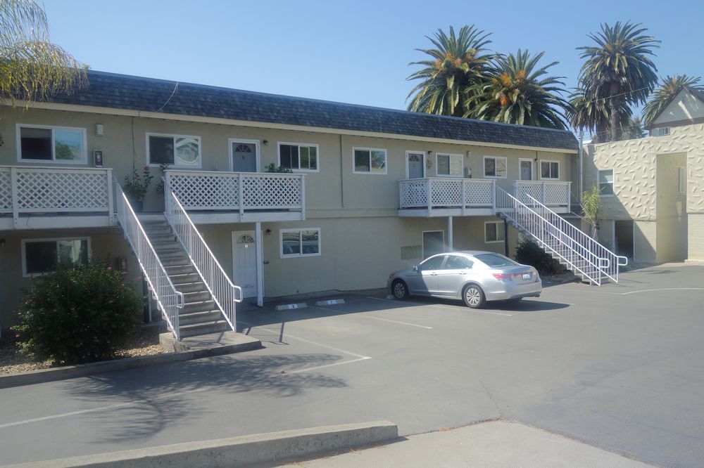
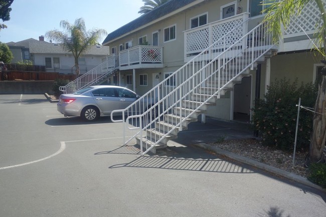
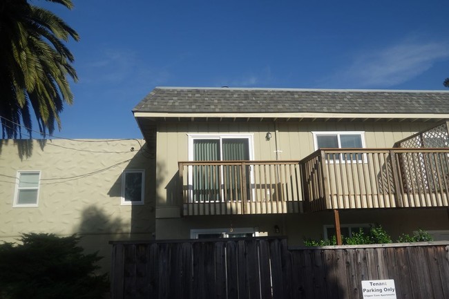
660 W 2nd St

Favorites
Check Back Soon for Upcoming Availability
| Beds | Baths | Average SF |
|---|---|---|
| 2 Bedrooms 2 Bedrooms 2 Br | 1 Bath 1 Bath 1 Ba | 850 SF |
About This Property
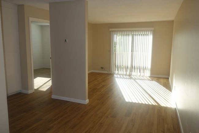
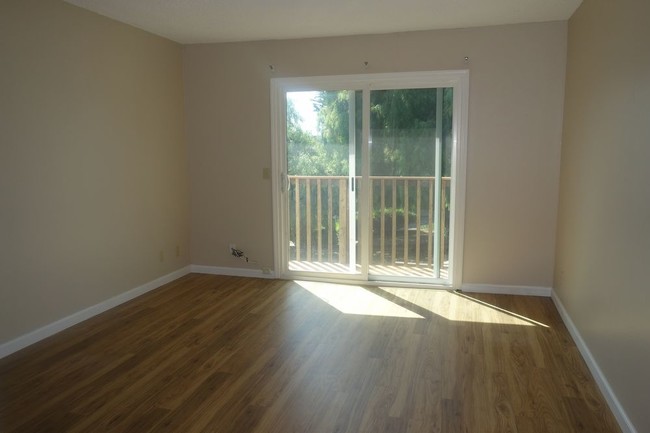
Deluxe 2 bedroom - Clipper Cove Apt. - Quiet complex - A walk to Downtown Benicia Enjoy this updated unit with granite counters and new cabinets in kitchen and bathroom. We have 2 additional units available. Call to qualify today. OPEN SUNDAY 11/13 1pm-2:30pm.OPEN SUNDAY 11/13 1pm-2:30pm.
660 W 2nd St is an apartment community located in Solano County and the 94510 ZIP Code.
660 W 2nd St,
Benicia,
CA
94510
Benicia sits on the north bank of the Carquinez Strait, quietly holding onto a history that most California cities can only read about — it served as the state capital for thirteen months between 1853 and 1854, and the original Capitol building still stands downtown. That sense of history gives the city a grounded, unhurried character that sets it apart from busier Bay Area neighbors. Situated in Solano County, Benicia connects easily to Vallejo to the west and Martinez across the strait, while Interstate 680 and 780 put Sacramento, Oakland, and San Francisco within reasonable driving distance.
Daily life here moves at a pace that encourages actually noticing your surroundings. The downtown area anchors the city with waterfront views, local shops, and a working arts district that grew out of the converted Benicia Arsenal — once the largest weapons storehouse on the West Coast.
Learn more about living in Benicia
Education
| Colleges & Universities | Distance | ||
|---|---|---|---|
| Colleges & Universities | Distance | ||
| Drive: | 16 min | 10.0 mi | |
| Drive: | 21 min | 10.9 mi | |
| Drive: | 24 min | 16.8 mi | |
| Drive: | 25 min | 17.2 mi |
660 W 2nd St is within 21 minutes or 10.9 miles from Touro University California. It is also near Diablo Valley, Pleasant Hill and Solano Community College.
Transportation options available in Benicia include North Concord / Martinez, located 11.1 miles from 660 W 2nd St. 660 W 2nd St is near Metro Oakland International, located 37.5 miles or 50 minutes away, and San Francisco International, located 46.9 miles or 65 minutes away.
| Transit / Subway | Distance | ||
|---|---|---|---|
| Transit / Subway | Distance | ||
|
|
Drive: | 17 min | 11.1 mi |
|
|
Drive: | 18 min | 11.6 mi |
| Commuter Rail | Distance | ||
|---|---|---|---|
| Commuter Rail | Distance | ||
|
|
Drive: | 10 min | 6.1 mi |
|
|
Drive: | 27 min | 20.8 mi |
| Drive: | 29 min | 20.8 mi | |
|
|
Drive: | 32 min | 24.4 mi |
| Drive: | 35 min | 26.7 mi |
| Airports | Distance | ||
|---|---|---|---|
| Airports | Distance | ||
|
Metro Oakland International
|
Drive: | 50 min | 37.5 mi |
|
San Francisco International
|
Drive: | 65 min | 46.9 mi |
Walkability Near 660 W 2nd St Benicia, CA 94510
Getting Around
 What do Walkability, Transit, Drivability, and Bikeability mean?
Walkability measures the walking distance to day-to-day needs.
Transit measures access to public transportation.
Drivability measures congestion, parking availability, and access to major roads.
Bikeability measures the suitability for cycling.
How It Works
What do Walkability, Transit, Drivability, and Bikeability mean?
Walkability measures the walking distance to day-to-day needs.
Transit measures access to public transportation.
Drivability measures congestion, parking availability, and access to major roads.
Bikeability measures the suitability for cycling.
How It Works
Fairly Walkable
Walkability
50
/ 100
Limited Public Transit
Transit
20
/ 100
Exceptionally Drivable
Drivability
90
/ 100
Fairly Bikeable
Bikeability
50
/ 100
Scores provided by
-
Soundscore™
-
/ 100
Traffic
-Airport
-Businesses
-Scores provided by
HowLoud What is a Sound Score Rating? A Sound Score Rating aggregates noise caused by vehicle traffic, airplane traffic and local sources. How It WorksTime and distance from 660 W 2nd St.
| Shopping Centers | Distance | ||
|---|---|---|---|
| Shopping Centers | Distance | ||
| Walk: | 9 min | 0.5 mi | |
| Walk: | 12 min | 0.6 mi | |
| Walk: | 17 min | 0.9 mi |
660 W 2nd St has 3 shopping centers within 0.9 mile, which is about a 17-minute walk. The miles and minutes will be for the farthest away property.
| Parks and Recreation | Distance | ||
|---|---|---|---|
| Parks and Recreation | Distance | ||
|
Benicia Capitol State Historic Park
|
Walk: | 3 min | 0.2 mi |
|
Benicia State Recreation Area
|
Drive: | 10 min | 4.2 mi |
|
Martinez Regional Shoreline
|
Drive: | 12 min | 5.5 mi |
|
Alhambra Creek Watershed
|
Drive: | 9 min | 6.1 mi |
|
Carquinez Strait Regional Shoreline
|
Drive: | 19 min | 11.2 mi |
660 W 2nd St has 5 parks within 11.2 miles, including Benicia Capitol State Historic Park, Benicia State Recreation Area, and Martinez Regional Shoreline.
| Hospitals | Distance | ||
|---|---|---|---|
| Hospitals | Distance | ||
| Drive: | 11 min | 6.7 mi | |
| Drive: | 13 min | 7.9 mi | |
| Drive: | 14 min | 8.9 mi |
660 W 2nd St has 3 hospitals within 8.9 miles, the nearest is Contra Costa Regional Medical Center which is 6.7 miles away and a 11 minute drive.
| Military Bases | Distance | ||
|---|---|---|---|
| Military Bases | Distance | ||
| Drive: | 5 min | 2.4 mi | |
| Drive: | 19 min | 10.3 mi | |
| Drive: | 31 min | 13.8 mi |
660 W 2nd St has 3 military bases within 13.8 miles, the nearest is Armory Vallejo which is 2.4 miles away and a 5 minute drive.
You May Also Like
Similar Rentals Nearby
-
-
-
-
-
-
-
2 Beds$5,1303 Beds$6,880Total Monthly Price12 Month LeaseTotal Monthly Price NewPrices include base rent and required monthly fees. Variable costs based on usage may apply.Specials
Pets Allowed Fitness Center In Unit Washer & Dryer Stainless Steel Appliances Business Center Package Service Elevator
-
-
-


What Are Walk Score®, Transit Score®, and Bike Score® Ratings?
Walk Score® measures the walkability of any address. Transit Score® measures access to public transit. Bike Score® measures the bikeability of any address.
What is a Sound Score Rating?
A Sound Score Rating aggregates noise caused by vehicle traffic, airplane traffic and local sources.

660 W 2nd St
Benicia, CA 94510