$1,395
/ Month
660 Maple St Unit B
West Sacramento, CA 95691
Favorites
916-460-9787
-
Bedrooms
1
-
Bathrooms
1
-
Square Feet
--
-
Available
Available Now
660 Maple St Unit B

Favorites
About This Home
$1,000 deposit,
Available Now
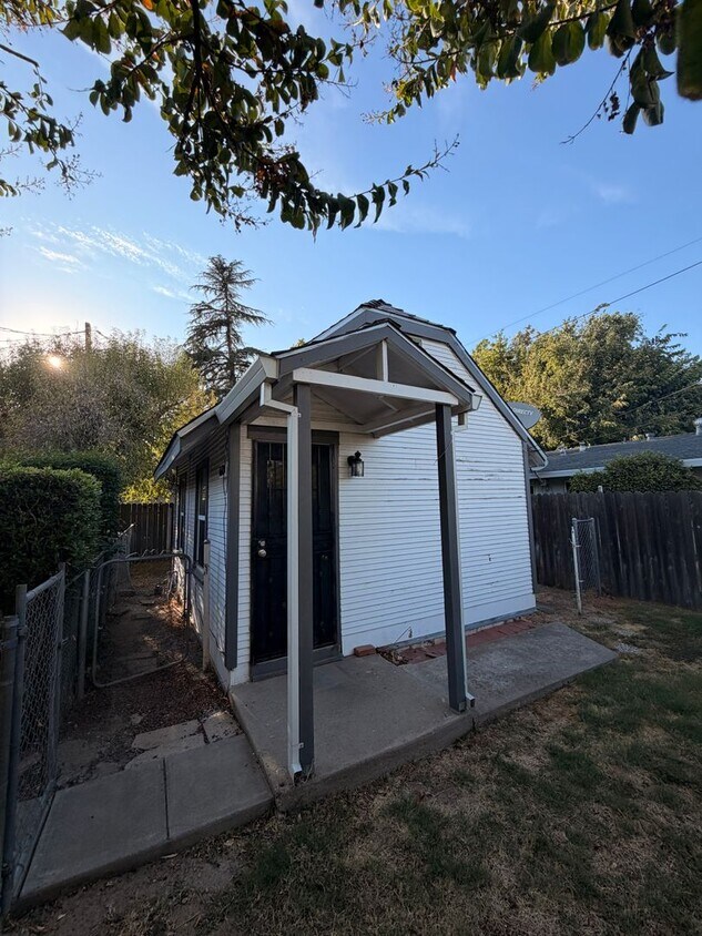
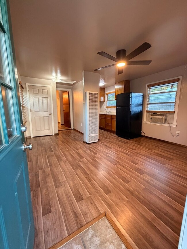
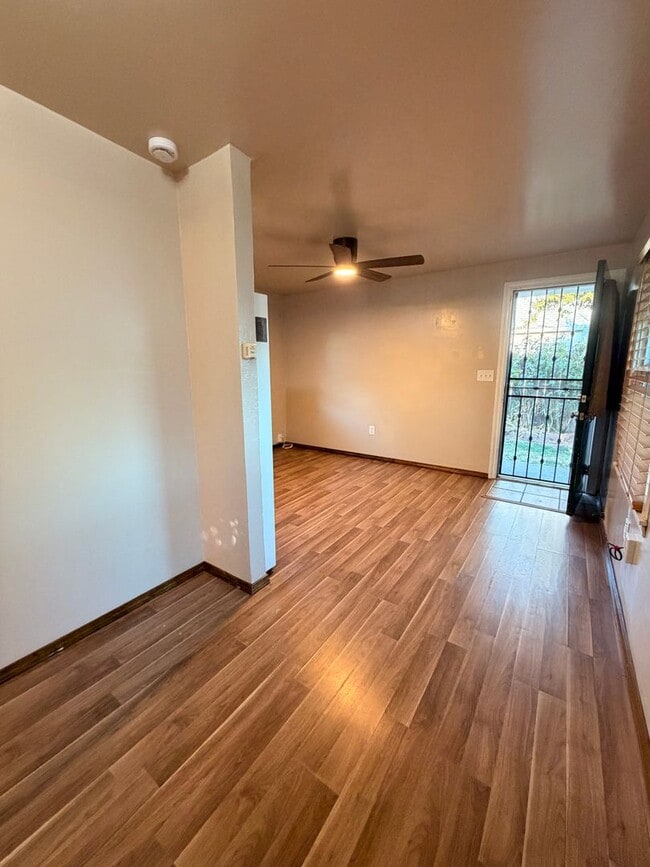
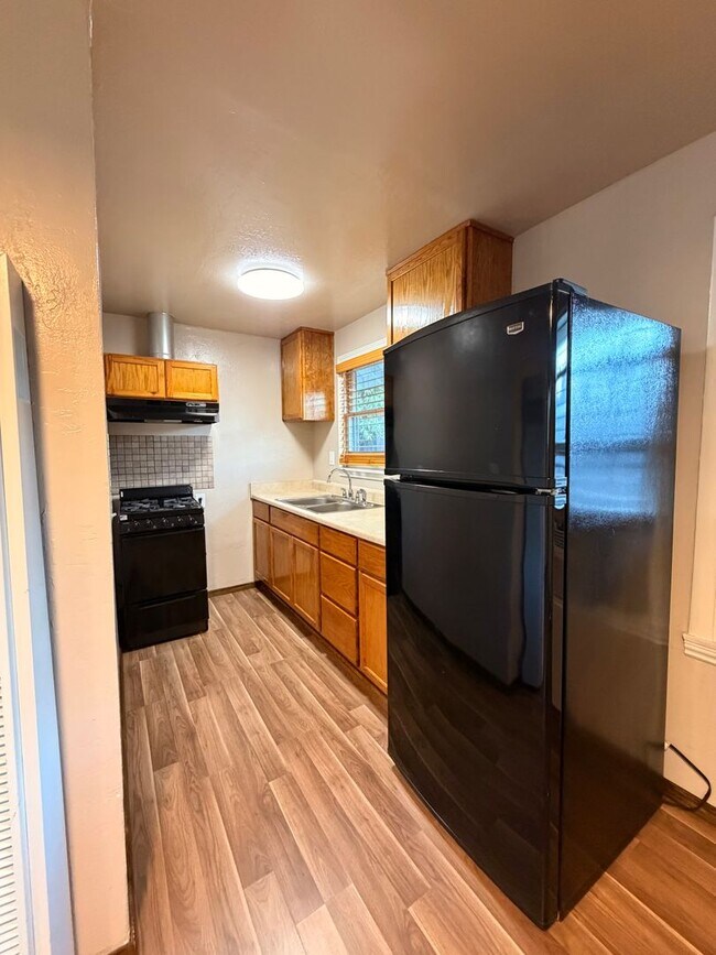
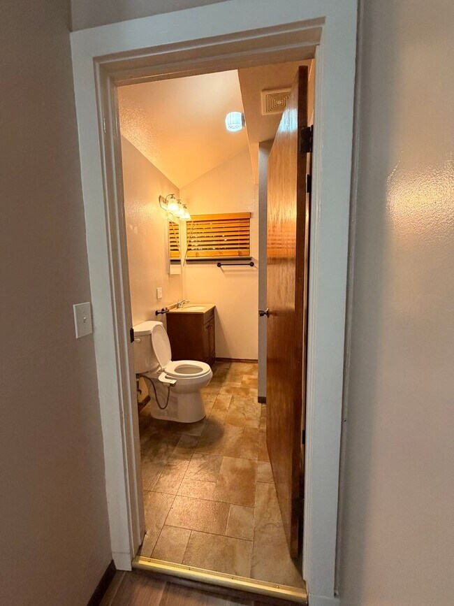
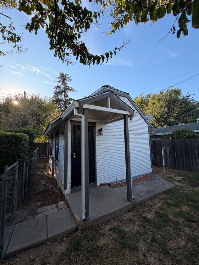
Welcome to Unit B at 660 Maple St, West Sacramento! This cozy studio offers a practical and comfortable living space in a convenient West Sacramento location. The studio features an efficient layout that makes the most of the available space, providing a comfortable place to call home. Located near local shops, restaurants, parks, and major roadways, this property offers easy access to everything West Sacramento and the surrounding area have to offer. -$1,450 rent per month -$1,000 Security Deposit -$49 Application Fee - 12-Month Lease - 2.5x Rent Income Requirement -Pets Welcome ($500 Pet Deposit + $25/Month Pet Rent) Qualified applicants with verified rental history and credit are encouraged to apply. Applications are processed in the order received and screened in accordance with Fair Housing laws. **Please contact Laura for showing availability at or . This unit will not last long!** *Photos may not represent the exact unit available and are provided as a fair representation of the property.*
660 Maple St is an apartment community located in Yolo County and the 95691 ZIP Code.
* Price shown is base rent. Excludes user-selected optional fees and variable or usage-based fees and required charges due at or prior to move-in or at move-out. Price, availability, fees, and any applicable rent special are subject to change without notice.
* Square footage definitions vary. Displayed square footage is approximate.
Contact
- Listed by Bright Property Management Inc. | Bright Property Management Inc.
- Phone Number
- Contact
Location
Get Directions
Few cities in the Sacramento region have grown as quickly -- or as thoughtfully -- as West Sacramento. The city has expanded steadily while holding onto its easy-going riverfront character. Sitting directly across the Sacramento River from the state capital, it offers a commute of about 15 minutes by car into Downtown Sacramento via the iconic Tower Bridge. Popular neighborhoods include Southport, known for newer construction near parks, and the Bridge District, positioned close to the river for fast crossings into the city. Daily errands are easy to run, and the area rewards those who enjoy outdoor routines, with trails and parks woven through its residential streets.
The rental landscape covers a broad range of options, from garden-style apartment communities in Southport to loft-style units in the Bridge District, along with townhomes and mid-rise buildings spread across the city's 23 square miles.
Learn more about living in West Sacramento
Education
| Colleges & Universities | Distance | ||
|---|---|---|---|
| Colleges & Universities | Distance | ||
| Drive: | 9 min | 5.1 mi | |
| Drive: | 14 min | 8.5 mi | |
| Drive: | 20 min | 12.9 mi | |
| Drive: | 22 min | 15.0 mi |
660 Maple St Unit B is within 9 minutes or 5.1 miles from Sacramento City College. It is also near Sacramento State and Cosumnes River College.
Transportation options available in West Sacramento include 8Th & Capitol, located 2.6 miles from 660 Maple St Unit B. 660 Maple St Unit B is near Sacramento International, located 12.9 miles or 21 minutes away.
| Transit / Subway | Distance | ||
|---|---|---|---|
| Transit / Subway | Distance | ||
|
|
Drive: | 6 min | 2.6 mi |
|
|
Drive: | 6 min | 2.6 mi |
|
|
Drive: | 6 min | 2.7 mi |
|
|
Drive: | 6 min | 2.7 mi |
|
|
Drive: | 6 min | 2.8 mi |
| Commuter Rail | Distance | ||
|---|---|---|---|
| Commuter Rail | Distance | ||
|
|
Drive: | 6 min | 2.7 mi |
|
|
Drive: | 16 min | 11.9 mi |
|
|
Drive: | 31 min | 23.6 mi |
|
|
Drive: | 32 min | 25.8 mi |
|
|
Drive: | 46 min | 35.4 mi |
| Airports | Distance | ||
|---|---|---|---|
| Airports | Distance | ||
|
Sacramento International
|
Drive: | 21 min | 12.9 mi |
Getting Around
 What do Walkability, Transit, Drivability, and Bikeability mean?
Walkability measures the walking distance to day-to-day needs.
Transit measures access to public transportation.
Drivability measures congestion, parking availability, and access to major roads.
Bikeability measures the suitability for cycling.
How It Works
What do Walkability, Transit, Drivability, and Bikeability mean?
Walkability measures the walking distance to day-to-day needs.
Transit measures access to public transportation.
Drivability measures congestion, parking availability, and access to major roads.
Bikeability measures the suitability for cycling.
How It Works
Fairly Walkable
Walkability
50
/ 100
Limited Public Transit
Transit
30
/ 100
Exceptionally Drivable
Drivability
90
/ 100
Moderately Bikeable
Bikeability
60
/ 100
Scores provided by
What do Walkability, Transit, Drivability, and Bikeability mean?
Walkability measures the walking distance to day-to-day needs.
Transit measures access to public transportation.
Drivability measures congestion, parking availability, and access to major roads.
Bikeability measures the suitability for cycling.
How It Works
-
Soundscore™
-
/ 100
Traffic
-Airport
-Businesses
-Scores provided by
HowLoud What is a Sound Score Rating? A Sound Score Rating aggregates noise caused by vehicle traffic, airplane traffic and local sources. How It WorksTime and distance from 660 Maple St Unit B.
| Shopping Centers | Distance | ||
|---|---|---|---|
| Shopping Centers | Distance | ||
| Walk: | 12 min | 0.6 mi | |
| Walk: | 13 min | 0.7 mi | |
| Walk: | 15 min | 0.8 mi |
660 Maple St Unit B has 3 shopping centers within 0.8 mile, which is about a 15-minute walk. The miles and minutes will be for the farthest away property.
| Parks and Recreation | Distance | ||
|---|---|---|---|
| Parks and Recreation | Distance | ||
|
Old Sacramento Historic District
|
Drive: | 5 min | 2.2 mi |
|
California State Railroad Museum
|
Drive: | 6 min | 2.4 mi |
|
California Native Plant Demonstration Garden
|
Drive: | 7 min | 2.9 mi |
|
California State Capitol Museum
|
Drive: | 6 min | 3.0 mi |
|
Natomas Oaks Park
|
Drive: | 10 min | 5.8 mi |
660 Maple St Unit B has 5 parks within 5.8 miles, including Old Sacramento Historic District, California State Railroad Museum, and California Native Plant Demonstration Garden.
| Hospitals | Distance | ||
|---|---|---|---|
| Hospitals | Distance | ||
| Drive: | 8 min | 5.3 mi | |
| Drive: | 9 min | 5.3 mi | |
| Drive: | 9 min | 6.2 mi |
660 Maple St Unit B has 3 hospitals within 6.2 miles, the nearest is Sutter Medical Center, Sacramento which is 5.3 miles away and a 8 minute drive.
| Military Bases | Distance | ||
|---|---|---|---|
| Military Bases | Distance | ||
| Drive: | 26 min | 14.2 mi | |
| Drive: | 50 min | 37.8 mi | |
| Drive: | 70 min | 49.6 mi |
660 Maple St Unit B has 3 military bases within 49.6 miles, the nearest is McClellan Air Force Base which is 14.2 miles away and a 26 minute drive.
You May Also Like
Similar Rentals Nearby
660 Maple St
West Sacramento, CA 95691