
The Equestrian At Pelham Parkway
1680 Pelham Pkwy S,
Bronx, NY 10461
Studio - 2 Beds $1,700 - $2,650


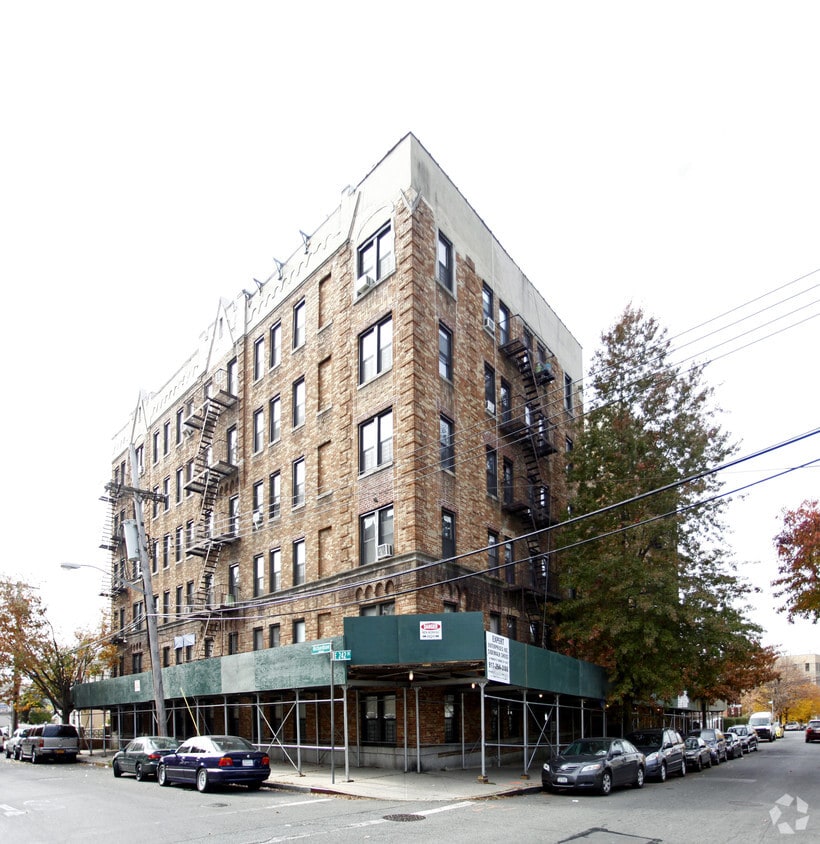

Discover your next place at 660 E 242nd St in Bronx. The location of this community is in the 10470 area of Bronx. The leasing team is ready to help you find the perfect floorplan. Schedule a time to see the available floorplan options. Drop by the leasing office to schedule a tour.
660 E 242nd St is an apartment community located in Bronx County and the 10470 ZIP Code. This area is served by the New York City Geographic District #11 attendance zone.
Refrigerator
Heating
Range
Kitchen
Wakefield is an urban neighborhood in the eastern section of the Bronx accessible to Manhattan through Interstate 87 or by hopping on one of the many public transit stations in the neighborhood. Wakefield is bounded by the Bronx River to the west, so many parks and trails that lead into the New York Botanical Garden are available to residents. The neighborhood itself consists of residential areas with apartments and condos in long-standing brick buildings as well as quaint rowhomes that make up the rental scene. Along with residences, this compact area is filled with a variety of restaurants serving everything from international cuisine to New York classics, and a range of shops and businesses provide Wakefield residents with the essentials. Other great features in the neighborhood include a community garden, green spaces, and a few schools.
Learn more about living in Wakefield| Colleges & Universities | Distance | ||
|---|---|---|---|
| Colleges & Universities | Distance | ||
| Drive: | 7 min | 2.8 mi | |
| Drive: | 8 min | 4.4 mi | |
| Drive: | 9 min | 4.4 mi | |
| Drive: | 10 min | 4.6 mi |


Transportation options available in Bronx include Wakefield-241 Street, located 0.2 mile from 660 E 242nd St. 660 E 242nd St is near LaGuardia, located 13.7 miles or 24 minutes away, and Westchester County, located 17.9 miles or 27 minutes away.
| Transit / Subway | Distance | ||
|---|---|---|---|
| Transit / Subway | Distance | ||
|
|
Walk: | 3 min | 0.2 mi |
|
|
Walk: | 11 min | 0.6 mi |
|
|
Walk: | 18 min | 1.0 mi |
|
|
Drive: | 2 min | 1.4 mi |
|
|
Drive: | 5 min | 2.1 mi |
| Commuter Rail | Distance | ||
|---|---|---|---|
| Commuter Rail | Distance | ||
|
|
Drive: | 2 min | 1.2 mi |
|
|
Drive: | 3 min | 1.5 mi |
|
|
Drive: | 4 min | 2.0 mi |
|
|
Drive: | 4 min | 2.4 mi |
|
|
Drive: | 5 min | 2.9 mi |
| Airports | Distance | ||
|---|---|---|---|
| Airports | Distance | ||
|
LaGuardia
|
Drive: | 24 min | 13.7 mi |
|
Westchester County
|
Drive: | 27 min | 17.9 mi |
Time and distance from 660 E 242nd St.
| Shopping Centers | Distance | ||
|---|---|---|---|
| Shopping Centers | Distance | ||
| Drive: | 2 min | 1.1 mi | |
| Drive: | 5 min | 2.1 mi | |
| Drive: | 4 min | 2.2 mi |
| Parks and Recreation | Distance | ||
|---|---|---|---|
| Parks and Recreation | Distance | ||
|
Seton Falls Park
|
Drive: | 3 min | 1.6 mi |
|
Williamsbridge Oval
|
Drive: | 7 min | 3.1 mi |
|
Van Cortlandt Park
|
Drive: | 7 min | 4.5 mi |
|
Wave Hill
|
Drive: | 11 min | 5.2 mi |
|
Bartow-Pell Woods
|
Drive: | 10 min | 5.7 mi |
| Hospitals | Distance | ||
|---|---|---|---|
| Hospitals | Distance | ||
| Walk: | 16 min | 0.8 mi | |
| Drive: | 6 min | 3.2 mi | |
| Drive: | 9 min | 4.7 mi |
| Military Bases | Distance | ||
|---|---|---|---|
| Military Bases | Distance | ||
| Drive: | 21 min | 11.7 mi |
What Are Walk Score®, Transit Score®, and Bike Score® Ratings?
Walk Score® measures the walkability of any address. Transit Score® measures access to public transit. Bike Score® measures the bikeability of any address.
What is a Sound Score Rating?
A Sound Score Rating aggregates noise caused by vehicle traffic, airplane traffic and local sources


