
$2,075 - $2,150
Total Monthly Price
12 Month Lease
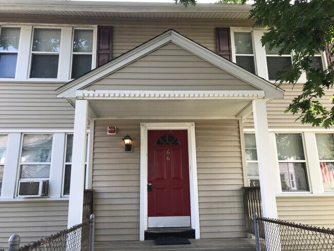
66 Safford St
Quincy, MA 02170
Favorites
66 Safford St

Favorites
Check Back Soon for Upcoming Availability
| Beds | Baths | Average SF |
|---|---|---|
| 2 Bedrooms 2 Bedrooms 2 Br | 1 Bath 1 Bath 1 Ba | 675 SF |
Fees and Policies
The fees listed below are community-provided and may exclude utilities or add-ons. All payments are made directly to the property and are non-refundable unless otherwise specified.
- Dogs Allowed
-
Fees not specified
- Cats Allowed
-
Fees not specified
- Parking
-
Other--
Details
Property Information
-
8 units
About 66 Safford St Quincy, MA 02170
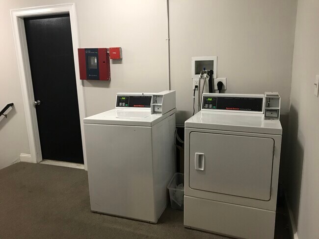
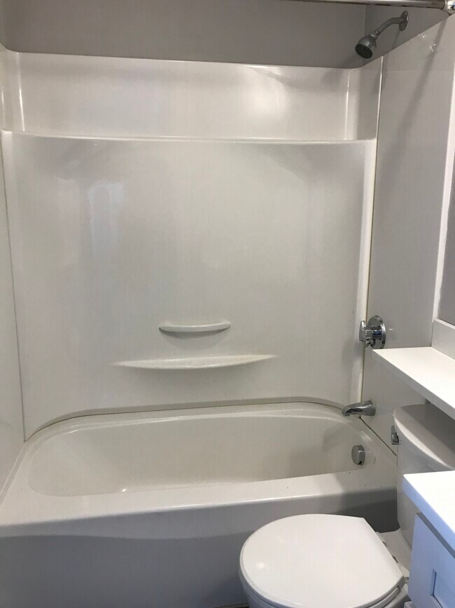
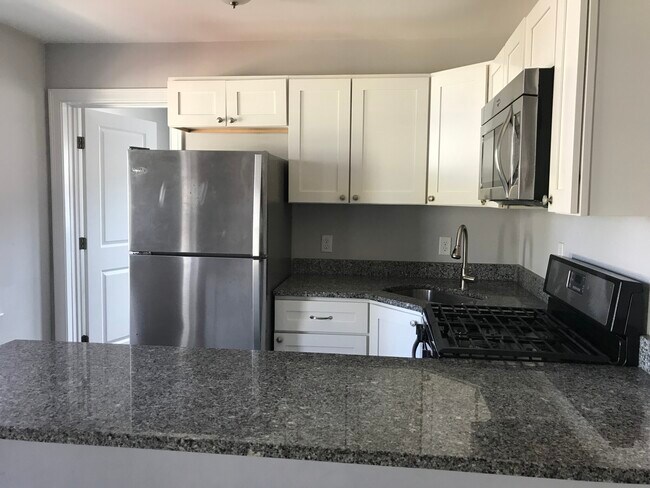
Tastefully renovated, spacious apartment. Prime location! Located in Montclair North Quincy/Wollaston -- 8 min walk to T (Red-line Subway Stations); 10 minutes to UMass Boston, 15 min to South Station/Downtown. Close to supermarket, restaurants, schools and parks. Featuring newly finished hardwood floors, freshly painted. Newer kitchen with granite counter tops and stainless steel appliances, laundry in common area. Pictures are of similar unit, actual unit may differ slightly.
66 Safford St is an apartment community located in Norfolk County and the 02170 ZIP Code.
Apartment Features
Washer/Dryer
Hardwood Floors
Granite Countertops
Microwave
- Washer/Dryer
- Granite Countertops
- Stainless Steel Appliances
- Kitchen
- Microwave
- Hardwood Floors
- Laundry Facilities
66 Safford St,
Quincy,
MA
02170
Across the Neponset River from Downtown Boston lies the Quincy neighborhood of Montclair. Commuters drive eight miles north on Interstate 93 to reach downtown, while residents without a car enjoy easy access using several bus lines or the Red Line's North Quincy subway station. This quiet residential community of apartments and bungalow-style houses provides a small-town atmosphere within a larger urban environment.
There’s a diverse mix of cuisine that belies Montclair’s relatively small size. Most of Montclair's businesses are found along Hancock Street near North Quincy station. Residents gather at Assembly Bar on Sundays for comfort food while watching the New England Patriots.
Learn more about living in MontclairBelow are rent ranges for similar nearby apartments
Amenities
- Washer/Dryer
- Granite Countertops
- Stainless Steel Appliances
- Kitchen
- Microwave
- Hardwood Floors
- Laundry Facilities
Education
| Colleges & Universities | Distance | ||
|---|---|---|---|
| Colleges & Universities | Distance | ||
| Drive: | 10 min | 4.4 mi | |
| Drive: | 15 min | 6.0 mi | |
| Drive: | 13 min | 6.9 mi | |
| Drive: | 13 min | 7.1 mi |
66 Safford St is within 10 minutes or 4.4 miles from UMass Boston. It is also near Curry College and Northeastern University.
Transportation options available in Quincy include North Quincy Station, located 0.4 mile from 66 Safford St. 66 Safford St is near General Edward Lawrence Logan International, located 9.8 miles or 18 minutes away.
| Transit / Subway | Distance | ||
|---|---|---|---|
| Transit / Subway | Distance | ||
|
|
Walk: | 8 min | 0.4 mi |
|
|
Walk: | 16 min | 0.8 mi |
|
|
Drive: | 6 min | 3.0 mi |
|
|
Drive: | 6 min | 3.0 mi |
|
|
Drive: | 7 min | 3.4 mi |
| Commuter Rail | Distance | ||
|---|---|---|---|
| Commuter Rail | Distance | ||
|
|
Drive: | 5 min | 2.0 mi |
|
|
Drive: | 8 min | 4.2 mi |
| Drive: | 11 min | 4.3 mi | |
| Drive: | 9 min | 4.5 mi | |
| Drive: | 10 min | 4.8 mi |
| Airports | Distance | ||
|---|---|---|---|
| Airports | Distance | ||
|
General Edward Lawrence Logan International
|
Drive: | 18 min | 9.8 mi |
Walkability Near 66 Safford St Quincy, MA 02170
Getting Around
 What do Walkability, Transit, Drivability, and Bikeability mean?
Walkability measures the walking distance to day-to-day needs.
Transit measures access to public transportation.
Drivability measures congestion, parking availability, and access to major roads.
Bikeability measures the suitability for cycling.
How It Works
What do Walkability, Transit, Drivability, and Bikeability mean?
Walkability measures the walking distance to day-to-day needs.
Transit measures access to public transportation.
Drivability measures congestion, parking availability, and access to major roads.
Bikeability measures the suitability for cycling.
How It Works
Moderately Walkable
Walkability
70
/ 100
Some Public Transit
Transit
50
/ 100
Moderately Drivable
Drivability
60
/ 100
Moderately Bikeable
Bikeability
60
/ 100
Scores provided by
Active
Soundscore™
74
/ 100
Traffic
ActiveAirport
CalmBusinesses
BusyScores provided by
HowLoud What is a Sound Score Rating? A Sound Score Rating aggregates noise caused by vehicle traffic, airplane traffic and local sources. How It WorksTime and distance from 66 Safford St.
| Shopping Centers | Distance | ||
|---|---|---|---|
| Shopping Centers | Distance | ||
| Walk: | 5 min | 0.3 mi | |
| Drive: | 4 min | 1.2 mi | |
| Drive: | 5 min | 2.3 mi |
66 Safford St has 3 shopping centers within 2.3 miles, which is about a 5-minute drive. The miles and minutes will be for the farthest away property.
| Parks and Recreation | Distance | ||
|---|---|---|---|
| Parks and Recreation | Distance | ||
|
Adams National Historical Park
|
Drive: | 4 min | 1.8 mi |
|
Squantum Point Park
|
Drive: | 8 min | 2.7 mi |
|
Dorchester Shores Reservation
|
Drive: | 9 min | 4.3 mi |
|
Franklin Park Zoo
|
Drive: | 11 min | 6.1 mi |
|
Lower Neponset River Trail
|
Drive: | 11 min | 6.2 mi |
66 Safford St has 5 parks within 6.2 miles, including Adams National Historical Park, Squantum Point Park, and Lower Neponset River Trail.
| Hospitals | Distance | ||
|---|---|---|---|
| Hospitals | Distance | ||
| Drive: | 6 min | 3.3 mi | |
| Drive: | 8 min | 3.4 mi | |
| Drive: | 10 min | 5.9 mi |
66 Safford St has 3 hospitals within 5.9 miles, the nearest is Carney Hospital which is 3.3 miles away and a 6 minute drive.
| Military Bases | Distance | ||
|---|---|---|---|
| Military Bases | Distance | ||
| Drive: | 41 min | 22.1 mi | |
| Drive: | 39 min | 22.3 mi | |
| Drive: | 43 min | 24.5 mi |
66 Safford St has 3 military bases within 24.5 miles, the nearest is Hanscom Air Force Base which is 22.1 miles away and a 41 minute drive.
You May Also Like
Similar Rentals Nearby
-
-
-
-
2 Beds$2,649+3 Beds$4,035+Total Monthly PriceTotal Monthly Price NewPrices include base rent and required monthly fees. Variable costs based on usage may apply.
Pets Allowed Fitness Center Pool Dishwasher Kitchen In Unit Washer & Dryer
-
2 Beds$5,659+3 Beds$8,949Total Monthly PriceTotal Monthly Price NewPrices include required monthly fees of $12.Base Rent:2 Beds$5,647+3 Beds$8,937
Fitness Center Pool Dishwasher Refrigerator In Unit Washer & Dryer Walk-In Closets
-
2 Beds$5,581+Total Monthly PriceTotal Monthly Price NewPrices include required monthly fees of $10 - $15.Base Rent:2 Beds$5,571+
Fitness Center High-Speed Internet Stainless Steel Appliances Package Service Granite Countertops Elevator
-
-
Plus Fees2 Beds$4,095+3 Beds$9,350+1 Month Free
Pets Allowed Fitness Center Pool Dishwasher Refrigerator Kitchen
-
2 Beds$2,915+Total Monthly PriceTotal Monthly Price NewPrices include base rent and required monthly fees. Variable costs based on usage may apply.Specials
Pets Allowed Fitness Center Dishwasher Refrigerator Kitchen In Unit Washer & Dryer
-
2 Beds$2,748+Total Monthly PriceTotal Monthly Price NewPrices include base rent and required monthly fees of $8. Variable costs based on usage may apply.Base Rent:2 Beds$2,739+2 Months Free
Fitness Center Clubhouse Balcony Granite Countertops Smoke Free Basketball Court


What Are Walk Score®, Transit Score®, and Bike Score® Ratings?
Walk Score® measures the walkability of any address. Transit Score® measures access to public transit. Bike Score® measures the bikeability of any address.
What is a Sound Score Rating?
A Sound Score Rating aggregates noise caused by vehicle traffic, airplane traffic and local sources.

66 Safford St
Quincy, MA 02170