
The Equestrian At Pelham Parkway
1680 Pelham Pkwy S,
Bronx, NY 10461
$1,850 - $2,900
Studio - 2 Beds


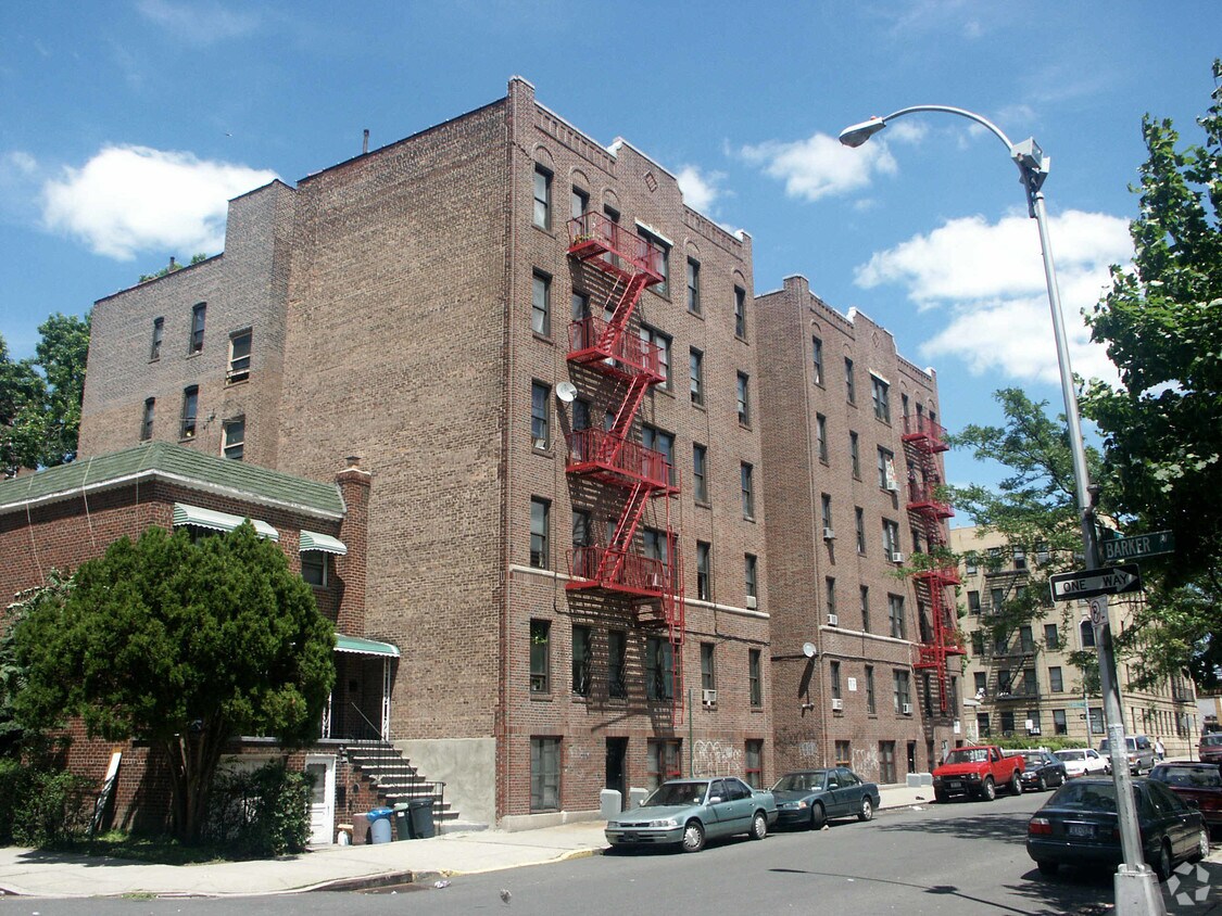
Experience a new place to live at 653 Britton St in Bronx. This community is located in the 10467 area of Bronx. Come for a visit to check out the current floorplan options. Here at this community, the professional leasing team will assist you in finding your perfect new home. Experience a new standard at 653 Britton St.
653 Britton St is an apartment community located in Bronx County and the 10467 ZIP Code. This area is served by the New York City Geographic District #11 attendance zone.
Nestled at the heart of the Bronx, Allerton borders the expansive Bronx Park, home to the Bronx Zoo and New York Botanical Garden. This area is rich in green spaces such as Waring Playground and Reiss Field, making it ideal for outdoor enthusiasts. The neighborhood's streets are lined with mid-rise brick apartment buildings, small co-ops, and condos, with rental prices generally lower than the Manhattan average.
Residents enjoy a diverse array of eateries like Roma Pizza and Halal Chandni Chowk, alongside convenient grocery options including Key Food and Foodtown. A highlight is the replica of the French Our Lady of Lourdes Grotto at St. Lucy Roman Catholic Church, believed to be a place of healing.
Allerton is a haven for commuters, with the 2 and 5 subway lines providing easy access to Midtown Manhattan in about an hour. Additionally, several bus lines and major roadways like U.S. 1 and Bronx River Parkway make traveling around the city straightforward.
Learn more about living in AllertonCompare neighborhood and city base rent averages by bedroom.
| Allerton | Bronx, NY | |
|---|---|---|
| Studio | $1,317 | $1,613 |
| 1 Bedroom | $1,383 | $1,636 |
| 2 Bedrooms | $1,534 | $2,098 |
| 3 Bedrooms | $1,545 | $2,358 |
| Colleges & Universities | Distance | ||
|---|---|---|---|
| Colleges & Universities | Distance | ||
| Drive: | 6 min | 2.0 mi | |
| Drive: | 7 min | 2.2 mi | |
| Drive: | 5 min | 2.2 mi | |
| Drive: | 6 min | 2.4 mi |


Transportation options available in Bronx include Allerton Avenue, located 0.2 mile from 653 Britton St. 653 Britton St is near LaGuardia, located 11.5 miles or 22 minutes away, and Westchester County, located 21.0 miles or 33 minutes away.
| Transit / Subway | Distance | ||
|---|---|---|---|
| Transit / Subway | Distance | ||
|
|
Walk: | 3 min | 0.2 mi |
|
|
Walk: | 7 min | 0.4 mi |
|
|
Walk: | 13 min | 0.7 mi |
|
|
Drive: | 2 min | 1.2 mi |
|
|
Drive: | 4 min | 1.4 mi |
| Commuter Rail | Distance | ||
|---|---|---|---|
| Commuter Rail | Distance | ||
|
|
Walk: | 19 min | 1.0 mi |
|
|
Drive: | 2 min | 1.2 mi |
|
|
Drive: | 5 min | 1.7 mi |
|
|
Drive: | 5 min | 2.6 mi |
|
|
Drive: | 7 min | 2.8 mi |
| Airports | Distance | ||
|---|---|---|---|
| Airports | Distance | ||
|
LaGuardia
|
Drive: | 22 min | 11.5 mi |
|
Westchester County
|
Drive: | 33 min | 21.0 mi |
Scores provided by
Traffic
-Airport
-Businesses
-Scores provided by
HowLoud What is a Sound Score Rating? A Sound Score Rating aggregates noise caused by vehicle traffic, airplane traffic and local sources. How It WorksTime and distance from 653 Britton St.
| Shopping Centers | Distance | ||
|---|---|---|---|
| Shopping Centers | Distance | ||
| Drive: | 5 min | 1.7 mi | |
| Drive: | 6 min | 2.1 mi |
| Parks and Recreation | Distance | ||
|---|---|---|---|
| Parks and Recreation | Distance | ||
|
Bronx Zoo
|
Drive: | 6 min | 1.6 mi |
|
Williamsbridge Oval
|
Drive: | 5 min | 1.8 mi |
|
Bronx Park
|
Drive: | 7 min | 2.0 mi |
|
Poe Park
|
Drive: | 6 min | 2.0 mi |
|
New York Botanical Garden
|
Drive: | 8 min | 2.3 mi |
| Hospitals | Distance | ||
|---|---|---|---|
| Hospitals | Distance | ||
| Drive: | 4 min | 1.7 mi | |
| Drive: | 4 min | 1.8 mi | |
| Drive: | 7 min | 2.5 mi |
| Military Bases | Distance | ||
|---|---|---|---|
| Military Bases | Distance | ||
| Drive: | 18 min | 9.3 mi | |
| Drive: | 35 min | 18.2 mi | |
| Drive: | 41 min | 26.7 mi |
What Are Walk Score®, Transit Score®, and Bike Score® Ratings?
Walk Score® measures the walkability of any address. Transit Score® measures access to public transit. Bike Score® measures the bikeability of any address.
What is a Sound Score Rating?
A Sound Score Rating aggregates noise caused by vehicle traffic, airplane traffic and local sources.
653 Britton St
Bronx, NY 10467


