
The Vitagraph
1277 E 14th St,
Brooklyn, NY 11230
$3,295 - $4,304
2-3 Beds


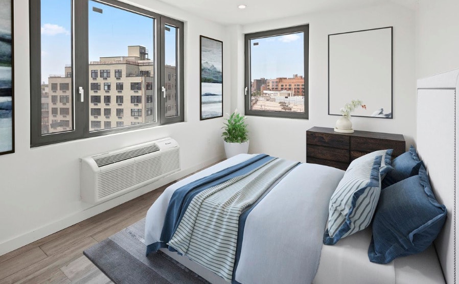
Brand New Luxury Building!! Model pictures, actual layout is different (Pictures are virtually staged) Brand new 1 bedroom featuring top of the line renovations, Stainless steel appliances, open kitchen layout, granite counter tops, Marble Italian baths, lots of windows flooding the apartment with natural sunlight in prime location.. All units have massive private balconies, top quality custom windows, and beautifully gray Italian wood flooring's throughout. 651 Bushwick Ave is a 4 minute walk walk from the M, J & Z train. Enjoy tons of nearby cafes, restaurants, bars and parks the neighborhood has to offer such as Freedom triangle & Beattie square as well as much more. NO BROKERS FEE PRICE IS WITH ONE MONTH RENT CREDIT Call or email us today to set up a tour of this luxury master piece. Guarantors Accepted
651 Bushwick Ave is an apartment community located in Kings County and the 11221 ZIP Code. This area is served by the New York City Geographic District #32 attendance zone.
Laundry Facilities
Roof Terrace
Recycling
Disposal Chutes
Hardwood Floors
Granite Countertops
Refrigerator
Tile Floors
Neighboring Williamsburg to the east, Bushwick is a vibrant Brooklyn neighborhood known for its incredible street art, local shops, and diverse cuisine. Bushwick has historically served as a haven for immigrants, and now attracts scores of creative types to its many galleries and converted loft spaces.
In addition to a host of new local businesses, Bushwick offers residents exciting nightlife options and easy subway access. Colorful apartment buildings line quiet residential streets in Bushwick as well, providing plenty of rental opportunities to the community. Numerous neighborhood parks offer a tranquil reprieve from the big-city bustle.
Learn more about living in BushwickCompare neighborhood and city base rent averages by bedroom.
| Bushwick | Brooklyn, NY | |
|---|---|---|
| Studio | $2,044 | $2,680 |
| 1 Bedroom | $1,715 | $3,031 |
| 2 Bedrooms | $2,011 | $3,947 |
| 3 Bedrooms | $2,583 | $4,907 |
| Colleges & Universities | Distance | ||
|---|---|---|---|
| Colleges & Universities | Distance | ||
| Drive: | 6 min | 1.8 mi | |
| Drive: | 7 min | 2.1 mi | |
| Drive: | 9 min | 2.9 mi | |
| Drive: | 11 min | 3.4 mi |


Transportation options available in Brooklyn include Myrtle Avenue, located 0.2 mile from 651 Bushwick Ave. 651 Bushwick Ave is near LaGuardia, located 8.1 miles or 16 minutes away, and John F Kennedy International, located 11.8 miles or 20 minutes away.
| Transit / Subway | Distance | ||
|---|---|---|---|
| Transit / Subway | Distance | ||
|
|
Walk: | 3 min | 0.2 mi |
|
|
Walk: | 6 min | 0.3 mi |
|
|
Walk: | 8 min | 0.5 mi |
|
|
Walk: | 10 min | 0.5 mi |
|
|
Drive: | 3 min | 1.2 mi |
| Commuter Rail | Distance | ||
|---|---|---|---|
| Commuter Rail | Distance | ||
|
|
Drive: | 7 min | 2.3 mi |
|
|
Drive: | 5 min | 2.5 mi |
|
|
Drive: | 10 min | 3.3 mi |
|
|
Drive: | 11 min | 3.8 mi |
|
|
Drive: | 12 min | 4.0 mi |
| Airports | Distance | ||
|---|---|---|---|
| Airports | Distance | ||
|
LaGuardia
|
Drive: | 16 min | 8.1 mi |
|
John F Kennedy International
|
Drive: | 20 min | 11.8 mi |
Scores provided by
Traffic
-Airport
-Businesses
-Scores provided by
HowLoud What is a Sound Score Rating? A Sound Score Rating aggregates noise caused by vehicle traffic, airplane traffic and local sources. How It WorksTime and distance from 651 Bushwick Ave.
| Shopping Centers | Distance | ||
|---|---|---|---|
| Shopping Centers | Distance | ||
| Drive: | 3 min | 1.5 mi |
| Parks and Recreation | Distance | ||
|---|---|---|---|
| Parks and Recreation | Distance | ||
|
Maria Hernandez Park
|
Walk: | 13 min | 0.7 mi |
|
Martinez Playground
|
Drive: | 3 min | 1.2 mi |
|
Sternberg Park
|
Drive: | 4 min | 1.3 mi |
|
Hattie Carthan Garden
|
Drive: | 5 min | 1.6 mi |
|
St. John's Park
|
Drive: | 6 min | 1.8 mi |
| Hospitals | Distance | ||
|---|---|---|---|
| Hospitals | Distance | ||
| Walk: | 11 min | 0.6 mi | |
| Walk: | 19 min | 1.0 mi | |
| Drive: | 6 min | 1.8 mi |
| Military Bases | Distance | ||
|---|---|---|---|
| Military Bases | Distance | ||
| Drive: | 18 min | 6.9 mi | |
| Drive: | 22 min | 11.3 mi | |
| Drive: | 29 min | 11.5 mi |
What Are Walk Score®, Transit Score®, and Bike Score® Ratings?
Walk Score® measures the walkability of any address. Transit Score® measures access to public transit. Bike Score® measures the bikeability of any address.
What is a Sound Score Rating?
A Sound Score Rating aggregates noise caused by vehicle traffic, airplane traffic and local sources.
651 Bushwick Ave
Brooklyn, NY 11221


