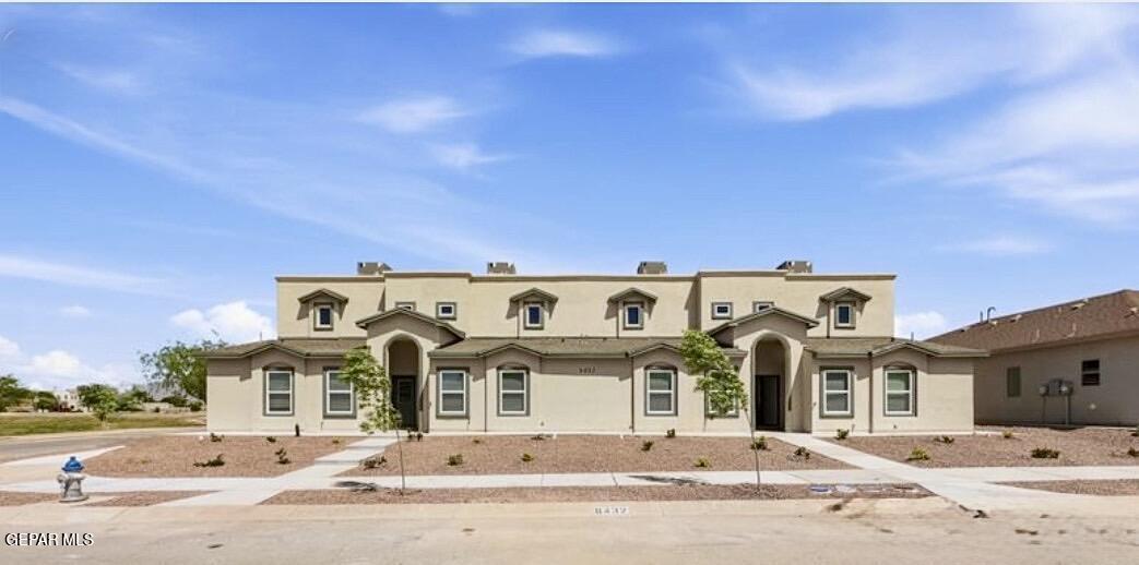
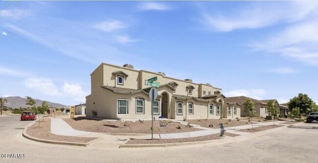
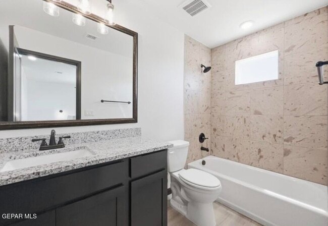
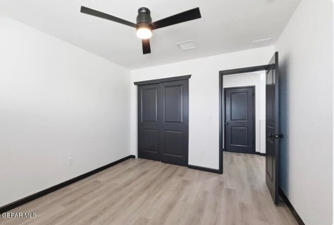
$2,350 / Month

6432 Pagasa Pl

,

El Paso, TX 79932

Share Listing
Favorites
915-204-1922
  • Bedrooms

    3

  • Bathrooms

    2

  • Square Feet

    5,400 sq ft

  • Available

    Available Now

Highlights

  • Corner Lot
  • Attached Garage
  • Refrigerated Cooling System
  • Tankless Water Heater
  • Ceramic Tile Flooring
  • Ceiling Fan
6432 Pagasa Pl
Share Listing
Favorites

6432 Pagasa Pl is a townhome located in El Paso County and the 79932 ZIP Code. This area is served by the Canutillo Independent School District attendance zone.

* Price shown is base rent. Excludes user-selected optional fees and variable or usage-based fees and required charges due at or prior to move-in or at move-out. Price, availability, fees, and any applicable rent special are subject to change without notice.
* Square footage definitions vary. Displayed square footage is approximate.

Home Details

Home Type

Quadruplex

Year Built

Built in 2026

Bedrooms and Bathrooms

2 Full Bathrooms 3 Bedrooms

Flooring

Ceramic Tile Vinyl

Interior Spaces

Ceiling Fan Utility Room 5,400 Sq Ft Home 2-Story Property Blinds

Kitchen

Dishwasher Disposal

Laundry

Washer and Dryer

Listing and Financial Details

Property Available on 5/18/26 6 Month Lease Term 12 Month Lease Term 24 Month Lease Term Assessor Parcel Number 643932 Tenant pays for all utilities

Lot Details

Corner Lot

Parking

Attached Garage

Schools

Canutillo Elementary And Middle School Canutillo High School

Utilities

Refrigerated Cooling System Tankless Water Heater Heating System Uses Natural Gas

Community Details

Overview

Property has a Home Owners Association Rio Valley Subdivision

Pet Policy

Pets allowed on a case-by-case basis

Contact

  • Listed by Cristian Arturo Guerra | Guerra Real Estate Group LLC
  • Phone Number
  • Contact
  • Source
    Greater El Paso Association of Realtors
Copyright © 2026 Greater El Paso Association of Realtors. All rights reserved. All information provided by the listing agent/broker is deemed reliable but is not guaranteed and should be independently verified.
| Edit

Under 30 minutes

Commute Time is calculated at rush hour.
City - El Paso

El Paso sits where West Texas, New Mexico, and the Mexican state of Chihuahua converge, giving the city a cross-border identity that shapes everything from its architecture to its daily rhythm. With the Franklin Mountains rising inside city limits and the Rio Grande forming its southern edge, the geography alone sets it apart from anywhere else in Texas. Fort Bliss, one of the largest U.S. Army installations in the country, and the University of Texas at El Paso are two of the city's most significant economic and institutional anchors. The Chamizal National Memorial marks the site of a peacefully resolved international border dispute, a piece of history few American cities can claim.

Neighborhoods range widely in character. Manhattan Heights offers historic homes close to downtown, while Northeast El Paso spreads out with newer residential development near Fort Bliss. Kern Place, adjacent to UTEP's campus, has an established, walkable feel.

Learn more about living in El Paso 
Amenities
  • Ceiling Fans
  • Dishwasher
  • Disposal
  • Refrigerator
  • Vinyl Flooring
Education
Colleges & Universities Distance
Drive: 8 min 3.4 mi
Drive: 20 min 13.3 mi
Drive: 20 min 14.1 mi
Drive: 27 min 16.0 mi
6432 Pagasa Pl is within 8 minutes or 3.4 miles from El Paso C.C., Northwest Campus. It is also near UT El Paso and El Paso C.C., Rio Grande.
Schools
Grades PK-5
466 Students
Attendance Zone
Public Middle School
Grades 6-8
700 Students
Attendance Zone
Public High School
Grades 9-12
1,642 Students
Attendance Zone
Private Elementary, Middle & High School
Grades K-12
47 Students
Nearby
Private Elementary School
Grades PK-5
Nearby
Transportation

6432 Pagasa Pl is near El Paso International, located 28.7 miles or 44 minutes away.

Airports Distance
Airports Distance
El Paso International
Drive: 44 min 28.7 mi
Getting Around
Not Walkable
Walkability
10 / 100
Limited Public Transit
Transit
30 / 100
Exceptionally Drivable
Drivability
90 / 100
Fairly Bikeable
Bikeability
50 / 100

Scores provided by

What do Walkability, Transit, Drivability, and Bikeability mean? Walkability measures the walking distance to day-to-day needs. Transit measures access to public transportation. Drivability measures congestion, parking availability, and access to major roads. Bikeability measures the suitability for cycling. How It Works
-
Soundscore
- / 100

Traffic

-

Airport

-

Businesses

-

Scores provided by

HowLoud What is a Sound Score Rating? A Sound Score Rating aggregates noise caused by vehicle traffic, airplane traffic and local sources. How It Works
Points of Interest

Time and distance from 6432 Pagasa Pl.

Shopping Centers Distance
Drive: 4 min 1.4 mi
Drive: 5 min 2.0 mi
Drive: 6 min 3.0 mi
6432 Pagasa Pl has 3 shopping centers within 3.0 miles, which is about a 6-minute drive. The miles and minutes will be for the farthest away property.
Parks and Recreation Distance
El Paso Desert Botanical Garden
Drive: 12 min 7.1 mi
6432 Pagasa Pl has a nearby park, El Paso Desert Botanical Garden , located 7.1 miles or 12 minutes away.
Hospitals Distance
Hospitals Distance
Drive: 9 min 5.2 mi
6432 Pagasa Pl is 5.2 miles and a 9 minute drive from Peak Behavioral Health Services.
Military Bases Distance
Drive: 32 min 22.2 mi
6432 Pagasa Pl is 22.2 miles and a 32 minute drive from Fort Bliss.

You May Also Like

Similar Rentals Nearby