
$1,650 / Month
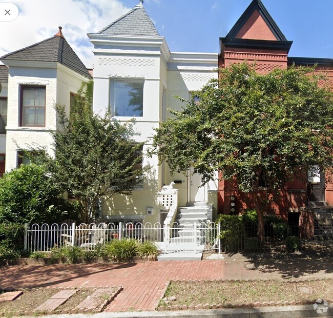
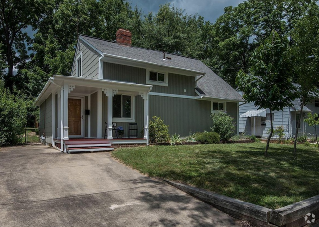
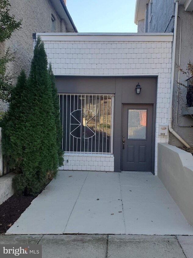
640 Columbia Rd NW
Washington, DC 20001
2 Weeks Ago
Favorites
640 Columbia Rd NW

Favorites
Check Back Soon for Upcoming Availability
| Beds | Baths | Average SF |
|---|---|---|
| Studio Studio 0 Br | 1 Bath 1 Bath 1 Ba | 725 SF |
About This Property
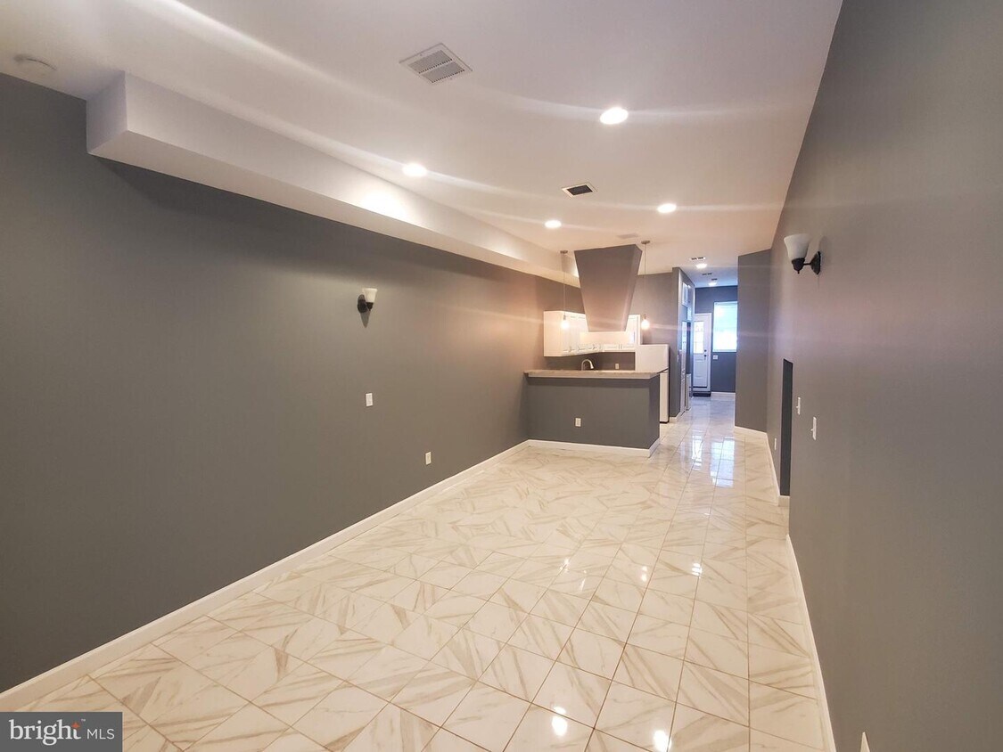
Luxury living at a great price. Rarely available 1 level open floor plan large 724 square foot studio carriage house that is airy, contemporary, and tranquil. Home boast 14 foot ceiling height. Big picture window brings amazing sunshine through front of property. Property has front and back entry. Close to everything in the heart of Columbia Heights. Walk to NuVegan Cafe restaurant, beer garden., Georgia Avenue/Petworth metro walking distance or bus lines access at corner of Georgia Avenue and Columbia Roadrrunning from Downtown DC to Silver Spring Station. Wont last!
640 Columbia Rd NW is a house located in District of Columbia County and the 20001 ZIP Code. This area is served by the District Of Columbia Public Schools attendance zone.
Location
Get Directions
With places like Union Drinkery and the NuVegan Café, Park View has everything you could want in a hip, trendy neighborhood. Georgia Avenue runs through the neighborhood and serves as a lively commercial district, lined with delis, cafes, restaurants, yoga studios, and curious businesses like Kraken Axes -- an ax-throwing venue. Park View is a small neighborhood often thought to be part of its nearby neighbors: Columbia Heights is on the west side, Petworth is to the north, and Soldiers Home is on the east side.
Howard University is located on the south end of the neighborhood, making Park View a popular choice for college students. While there are a few parks in Park View, the neighborhood is actually named for its view of the nearby Armed Forces Retirement Home-Washington, a US Historic District that contains Lincoln's Cottage. Residents of Park View enjoy fast access to the nearby Petworth Metro Station, just north of the neighborhood.
Learn more about living in Park ViewBelow are rent ranges for similar nearby apartments
| Beds | Average Size | Lowest | Typical | Premium |
|---|---|---|---|---|
| Studio Studio Studio | 597 Sq Ft | $1,294 | $2,211 | $4,710 |
| 1 Bed 1 Bed 1 Bed | 666-667 Sq Ft | $1,125 | $2,118 | $3,809 |
| 2 Beds 2 Beds 2 Beds | 1058 Sq Ft | $1,999 | $3,285 | $11,714 |
| 3 Beds 3 Beds 3 Beds | 1657 Sq Ft | $2,500 | $4,010 | $5,300 |
| 4 Beds 4 Beds 4 Beds | 1342 Sq Ft | $1,100 | $4,155 | $7,402 |
Education
| Colleges & Universities | Distance | ||
|---|---|---|---|
| Colleges & Universities | Distance | ||
| Walk: | 10 min | 0.6 mi | |
| Drive: | 3 min | 1.3 mi | |
| Drive: | 5 min | 2.0 mi | |
| Drive: | 5 min | 2.2 mi |
640 Columbia Rd NW is within 10 minutes or 0.6 mile from Howard University. It is also near Trinity Washington University and Catholic University.
Schools


Public Elementary School
Grades PK-5
433 Students
Attendance Zone
Charter Middle School
Grades 6-9
235 Students
Nearby
Public Middle School
Grades 6-8
528 Students
Attendance Zone
Public High School
Grades 9-12
913 Students
Attendance Zone
Private Elementary & Middle School
Grades PK-8
215 Students
Nearby
Private Elementary & Middle School
Grades PK-8
24 Students
Nearby
Private High School
Grades 9-12
38 Students
Nearby
School data provided by
 The GreatSchools Rating helps parents compare schools within a state based on a variety of school quality indicators and provides a helpful picture of how effectively each school serves all of its students. Ratings are on a scale of 1 (below average) to 10 (above average) and can include test scores, college readiness, academic progress, advanced courses, equity, discipline and attendance data. We also advise parents to visit schools, consider other information on school performance and programs, and consider family needs as part of the school selection process.
View GreatSchools Rating Methodology
View GreatSchools Rating Methodology
Transportation options available in Washington include Columbia Heights, located 0.6 mile from 640 Columbia Rd NW. 640 Columbia Rd NW is near Ronald Reagan Washington Ntl, located 7.2 miles or 14 minutes away, and Washington Dulles International, located 28.5 miles or 47 minutes away.
| Transit / Subway | Distance | ||
|---|---|---|---|
| Transit / Subway | Distance | ||
|
|
Walk: | 12 min | 0.6 mi |
|
|
Walk: | 14 min | 0.8 mi |
|
|
Walk: | 20 min | 1.0 mi |
|
|
Walk: | 23 min | 1.2 mi |
|
|
Drive: | 5 min | 2.6 mi |
| Commuter Rail | Distance | ||
|---|---|---|---|
| Commuter Rail | Distance | ||
|
|
Drive: | 7 min | 3.1 mi |
|
|
Drive: | 7 min | 3.2 mi |
|
|
Drive: | 9 min | 4.7 mi |
|
|
Drive: | 11 min | 5.8 mi |
|
|
Drive: | 12 min | 6.0 mi |
| Airports | Distance | ||
|---|---|---|---|
| Airports | Distance | ||
|
Ronald Reagan Washington Ntl
|
Drive: | 14 min | 7.2 mi |
|
Washington Dulles International
|
Drive: | 47 min | 28.5 mi |
Time and distance from 640 Columbia Rd NW.
| Shopping Centers | Distance | ||
|---|---|---|---|
| Shopping Centers | Distance | ||
| Walk: | 13 min | 0.7 mi | |
| Drive: | 2 min | 1.1 mi | |
| Drive: | 5 min | 1.8 mi |
640 Columbia Rd NW has 3 shopping centers within 1.8 miles, which is about a 5-minute walk. The miles and minutes will be for the farthest away property.
| Parks and Recreation | Distance | ||
|---|---|---|---|
| Parks and Recreation | Distance | ||
|
Meridian Hill Park
|
Drive: | 2 min | 1.1 mi |
|
Carter G. Woodson Home National Historic Site
|
Drive: | 4 min | 1.3 mi |
|
National Zoo
|
Drive: | 4 min | 1.6 mi |
|
Mary McLeod Bethune Council House NHS
|
Drive: | 5 min | 1.8 mi |
|
National Geographic Museum
|
Drive: | 5 min | 2.3 mi |
640 Columbia Rd NW has 5 parks within 2.3 miles, including Meridian Hill Park, Carter G. Woodson Home National Historic Site, and National Zoo.
| Hospitals | Distance | ||
|---|---|---|---|
| Hospitals | Distance | ||
| Walk: | 9 min | 0.5 mi | |
| Walk: | 16 min | 0.8 mi | |
| Walk: | 17 min | 0.9 mi |
640 Columbia Rd NW has 3 hospitals within 0.9 mile, the nearest is Children's Hospital National Medical Center which is 0.5 mile away and a 9 minute walk.
| Military Bases | Distance | ||
|---|---|---|---|
| Military Bases | Distance | ||
| Drive: | 4 min | 1.8 mi | |
| Drive: | 10 min | 3.8 mi |
640 Columbia Rd NW is 1.8 miles from US Soldiers & Airmens Home, and is convenient to other military bases, including Naval Observatory.
You May Also Like
Similar Rentals Nearby
What Are Walk Score®, Transit Score®, and Bike Score® Ratings?
Walk Score® measures the walkability of any address. Transit Score® measures access to public transit. Bike Score® measures the bikeability of any address.
What is a Sound Score Rating?
A Sound Score Rating aggregates noise caused by vehicle traffic, airplane traffic and local sources
640 Columbia Rd NW
Washington, DC 20001