
$1,995
/ Month
636 Mt Lubentia Ct E
Upper Marlboro, MD 20774
Favorites
636 Mt Lubentia Ct E

Favorites
Check Back Soon for Upcoming Availability
| Beds | Baths | Average SF |
|---|---|---|
| 3 Bedrooms 3 Bedrooms 3 Br | 3 Baths 3 Baths 3 Ba | — |
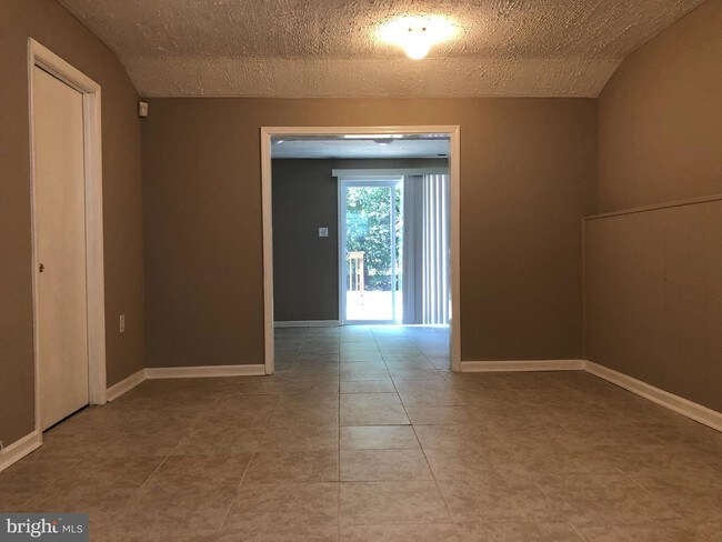
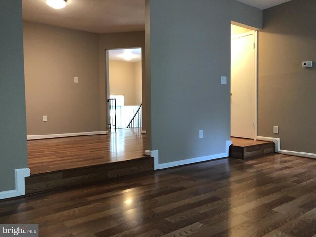
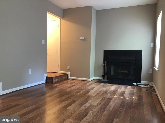
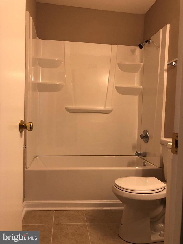
About This Property
Very Spacious, renovated townhouse in great community. Excellent location. Close to beltway, PG Community College, shopping, restaurants and three Metro stations. Very short drive to Largo Metro Station. Good credit, excellent rental history and job stability. Min. credit 620; Income>$68,000.
636 Mt Lubentia Ct E is a townhome located in Prince George's County and the 20774 ZIP Code. This area is served by the Prince George's County Public Schools attendance zone.
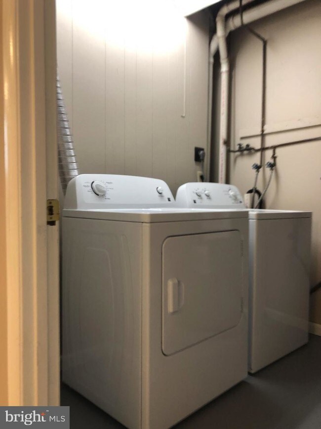
Townhome Features
- Basement
636 Mt Lubentia Ct E,
Upper Marlboro,
MD
20774
Moving to Upper Marlboro? You’ll be grateful for the close distance to nearby attractions and the sense of pride throughout the community. Located in Prince George’s County, the city is fused with urban and suburban amenities.
There’s much to enjoy about Upper Marlboro, and because it’s more intimate than other surrounding cities, it takes pride in putting on a series of events from homecoming games at local schools to show-stopping performances at the Show Place Arena. Darnall’s Chance House Museum is another city highlight that dates back to 1742.
Shopping in Upper Marlboro reflects the small, quaint ideology of the community. Fresh-baked goods and handmade crafts are purchased at the neighborhood Dutch Village Farmers Market. The distance to Washington D.C. gives residents a choice of either commuting into town by car or Metro rail.
Learn more about living in Upper Marlboro
Amenities
- Basement
Education
| Colleges & Universities | Distance | ||
|---|---|---|---|
| Colleges & Universities | Distance | ||
| Drive: | 5 min | 1.8 mi | |
| Drive: | 9 min | 3.2 mi | |
| Drive: | 26 min | 12.7 mi | |
| Drive: | 23 min | 13.5 mi |
636 Mt Lubentia Ct E is within 5 minutes or 1.8 miles from Prince George's Comm. Coll.. It is also near Univ. of Md. Univ. Coll. and Gallaudet University.
Schools


Public Elementary School
Grades PK-5
407 Students
Attendance Zone
Public Middle School
Grades 6-8
915 Students
Attendance Zone
Public High School
Grades 9-12
939 Students
Attendance Zone
Private Elementary, Middle & High School
Grades PK-12
78 Students
Nearby
School data provided by
 The GreatSchools Rating helps parents compare schools within a state based on a variety of school quality indicators and provides a helpful picture of how effectively each school serves all of its students. Ratings are on a scale of 1 (below average) to 10 (above average) and can include test scores, college readiness, academic progress, advanced courses, equity, discipline and attendance data. We also advise parents to visit schools, consider other information on school performance and programs, and consider family needs as part of the school selection process.
View GreatSchools Rating Methodology
Data provided by GreatSchools.org © 2026. All rights reserved.
View GreatSchools Rating Methodology
Data provided by GreatSchools.org © 2026. All rights reserved.
Transportation options available in Upper Marlboro include Largo Town Center, located 2.4 miles from 636 Mt Lubentia Ct E. 636 Mt Lubentia Ct E is near Ronald Reagan Washington Ntl, located 20.2 miles or 33 minutes away, and Baltimore/Washington International Thurgood Marshall, located 29.1 miles or 45 minutes away.
| Transit / Subway | Distance | ||
|---|---|---|---|
| Transit / Subway | Distance | ||
|
|
Drive: | 6 min | 2.4 mi |
|
|
Drive: | 11 min | 4.9 mi |
|
|
Drive: | 11 min | 6.1 mi |
|
Capitol Heights, Blue/Silver Line Center Platform
|
Drive: | 13 min | 6.8 mi |
|
|
Drive: | 14 min | 7.4 mi |
| Commuter Rail | Distance | ||
|---|---|---|---|
| Commuter Rail | Distance | ||
| Drive: | 16 min | 7.9 mi | |
|
|
Drive: | 16 min | 7.9 mi |
| Drive: | 17 min | 8.5 mi | |
| Drive: | 21 min | 11.4 mi | |
| Drive: | 25 min | 12.8 mi |
| Airports | Distance | ||
|---|---|---|---|
| Airports | Distance | ||
|
Ronald Reagan Washington Ntl
|
Drive: | 33 min | 20.2 mi |
|
Baltimore/Washington International Thurgood Marshall
|
Drive: | 45 min | 29.1 mi |
Walkability Near 636 Mt Lubentia Ct E Upper Marlboro, MD 20774
Getting Around
 What do Walkability, Transit, Drivability, and Bikeability mean?
Walkability measures the walking distance to day-to-day needs.
Transit measures access to public transportation.
Drivability measures congestion, parking availability, and access to major roads.
Bikeability measures the suitability for cycling.
How It Works
What do Walkability, Transit, Drivability, and Bikeability mean?
Walkability measures the walking distance to day-to-day needs.
Transit measures access to public transportation.
Drivability measures congestion, parking availability, and access to major roads.
Bikeability measures the suitability for cycling.
How It Works
Somewhat Walkable
Walkability
30
/ 100
Limited Public Transit
Transit
30
/ 100
Exceptionally Drivable
Drivability
90
/ 100
Fairly Bikeable
Bikeability
50
/ 100
Scores provided by
-
Soundscore™
-
/ 100
Traffic
-Airport
-Businesses
-Scores provided by
HowLoud What is a Sound Score Rating? A Sound Score Rating aggregates noise caused by vehicle traffic, airplane traffic and local sources. How It WorksTime and distance from 636 Mt Lubentia Ct E.
| Shopping Centers | Distance | ||
|---|---|---|---|
| Shopping Centers | Distance | ||
| Drive: | 5 min | 1.8 mi | |
| Drive: | 6 min | 2.3 mi | |
| Drive: | 6 min | 2.5 mi |
636 Mt Lubentia Ct E has 3 shopping centers within 2.5 miles, which is about a 6-minute drive. The miles and minutes will be for the farthest away property.
| Parks and Recreation | Distance | ||
|---|---|---|---|
| Parks and Recreation | Distance | ||
|
Watkins Nature Center
|
Drive: | 7 min | 3.5 mi |
|
Old Maryland Farm
|
Drive: | 7 min | 3.6 mi |
|
Walker Mill Regional Park
|
Drive: | 8 min | 3.6 mi |
|
Watkins Regional Park
|
Drive: | 11 min | 4.5 mi |
|
Suitland Bog
|
Drive: | 14 min | 7.4 mi |
636 Mt Lubentia Ct E has 5 parks within 7.4 miles, including Watkins Nature Center, Watkins Regional Park, and Old Maryland Farm.
| Hospitals | Distance | ||
|---|---|---|---|
| Hospitals | Distance | ||
| Drive: | 17 min | 8.7 mi | |
| Drive: | 16 min | 8.7 mi | |
| Drive: | 22 min | 13.4 mi |
636 Mt Lubentia Ct E has 3 hospitals within 13.4 miles, the nearest is Doctors Community Hospital which is 8.7 miles away and a 17 minute drive.
| Military Bases | Distance | ||
|---|---|---|---|
| Military Bases | Distance | ||
| Drive: | 15 min | 7.6 mi | |
| Drive: | 24 min | 13.0 mi | |
| Drive: | 26 min | 13.9 mi |
636 Mt Lubentia Ct E has 3 military bases within 13.9 miles, the nearest is Andrews Airforce Base which is 7.6 miles away and a 15 minute drive.
You May Also Like
Similar Rentals Nearby
-
-
-
-
3 Beds$6,851+Total Monthly PriceTotal Monthly Price NewPrices include required monthly fees of $142.Base Rent:3 Beds$6,598+2 Months Free
Pets Allowed Fitness Center Pool Dishwasher Refrigerator Kitchen
-
-
3 Beds$3,247+Total Monthly PriceTotal Monthly Price NewPrices include required monthly fees of $92.Base Rent:3 Beds$3,155+
Pets Allowed Fitness Center Pool Dishwasher Refrigerator Kitchen
-
3 Beds$6,018+Total Monthly PriceTotal Monthly Price NewPrices include base rent and required monthly fees of $92. Variable costs based on usage may apply.Base Rent:3 Beds$5,925+2 Months Free
Pets Allowed Fitness Center Pool Dishwasher Refrigerator In Unit Washer & Dryer
-
3 Beds$3,249Total Monthly PriceTotal Monthly Price NewPrices include base rent and required monthly fees of $14. Variable costs based on usage may apply.Base Rent:3 Beds$3,234+Specials
Pets Allowed Fitness Center Pool Dishwasher Refrigerator Kitchen
-
-


What Are Walk Score®, Transit Score®, and Bike Score® Ratings?
Walk Score® measures the walkability of any address. Transit Score® measures access to public transit. Bike Score® measures the bikeability of any address.
What is a Sound Score Rating?
A Sound Score Rating aggregates noise caused by vehicle traffic, airplane traffic and local sources.
636 Mt Lubentia Ct E
Upper Marlboro, MD 20774