
Morrowfield
2715 Murray Ave,
Pittsburgh, PA 15217
$890 - $1,535
Studio - 2 Beds


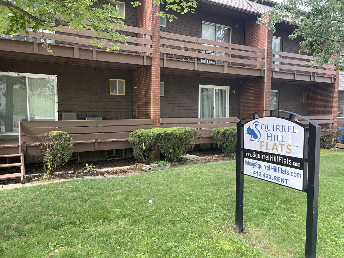
All apartments at 6350 Forward Ave should have the following: - Off Street parking - Dishwasher - Hardwood Flrs - Dining Room - Living Room - Kitchen - Bathroom - Fridge - Stove - Freezer - large closets - AC - Heat - Smoke Free There's also a shared laundry room for all tenants in the building.
6350 Forward Ave is an apartment community located in Allegheny County and the 15217 ZIP Code. This area is served by the Pittsburgh Public Schools attendance zone.
Unique Features
Air Conditioning
Dishwasher
High Speed Internet Access
Hardwood Floors
Nestled between Schenley Park and Frick Park in the city's East End, Squirrel Hill is considered one of Pittsburgh's most popular neighborhoods. Although the city divides the neighborhood into Squirrel Hill North and Squirrel Hill South, locals tend to treat the area as one sprawling entity.
Squirrel Hill South's stability remains part of its appeal, as do its rolling hills, walkable business district on Murray Avenue, excellent schools, and tranquil streets. With homes ranging from mid-rise apartments to ornate mansions, rental options are available for a wide variety of different tastes and budgets.
Squirrel Hill South's historic charm combined with an easy-going attitude makes it a great place to live. Proximity to multiple universities makes the community an ideal location for students, faculty, and staff. Carnegie Mellon University and Chatham University sit in Squirrel Hill North, and to the west lies the University of Pittsburgh in Oakland.
Learn more about living in Squirrel Hill SouthCompare neighborhood and city base rent averages by bedroom.
| Squirrel Hill South | Squirrel Hill, PA | |
|---|---|---|
| Studio | $879 | $1,154 |
| 1 Bedroom | $1,189 | $1,584 |
| 2 Bedrooms | $1,664 | $2,019 |
| 3 Bedrooms | $2,527 | $3,096 |
| Colleges & Universities | Distance | ||
|---|---|---|---|
| Colleges & Universities | Distance | ||
| Drive: | 5 min | 1.6 mi | |
| Drive: | 5 min | 2.2 mi | |
| Drive: | 7 min | 2.9 mi | |
| Drive: | 6 min | 3.2 mi |


Transportation options available in Squirrel Hill include First Avenue, located 4.4 miles from 6350 Forward Ave. 6350 Forward Ave is near Pittsburgh International, located 21.6 miles or 32 minutes away, and Arnold Palmer Regional, located 40.1 miles or 62 minutes away.
| Transit / Subway | Distance | ||
|---|---|---|---|
| Transit / Subway | Distance | ||
|
|
Drive: | 7 min | 4.4 mi |
|
|
Drive: | 8 min | 4.8 mi |
|
|
Drive: | 9 min | 5.0 mi |
|
|
Drive: | 8 min | 5.1 mi |
|
|
Drive: | 8 min | 5.2 mi |
| Commuter Rail | Distance | ||
|---|---|---|---|
| Commuter Rail | Distance | ||
|
|
Drive: | 9 min | 5.1 mi |
|
|
Drive: | 46 min | 30.6 mi |
|
|
Drive: | 58 min | 37.0 mi |
|
|
Drive: | 60 min | 46.8 mi |
| Airports | Distance | ||
|---|---|---|---|
| Airports | Distance | ||
|
Pittsburgh International
|
Drive: | 32 min | 21.6 mi |
|
Arnold Palmer Regional
|
Drive: | 62 min | 40.1 mi |
Time and distance from 6350 Forward Ave.
| Shopping Centers | Distance | ||
|---|---|---|---|
| Shopping Centers | Distance | ||
| Walk: | 5 min | 0.3 mi | |
| Drive: | 3 min | 1.1 mi | |
| Drive: | 3 min | 1.1 mi |
| Parks and Recreation | Distance | ||
|---|---|---|---|
| Parks and Recreation | Distance | ||
|
Frick Park
|
Walk: | 18 min | 0.9 mi |
|
Frick Environmental Center
|
Walk: | 18 min | 1.0 mi |
|
Chatham Arboretum
|
Drive: | 5 min | 1.5 mi |
|
Schenley Park
|
Drive: | 6 min | 2.4 mi |
|
Rivers Of Steel National Heritage Area
|
Drive: | 8 min | 2.7 mi |
| Hospitals | Distance | ||
|---|---|---|---|
| Hospitals | Distance | ||
| Drive: | 7 min | 2.6 mi | |
| Drive: | 5 min | 2.8 mi | |
| Drive: | 6 min | 3.2 mi |
| Military Bases | Distance | ||
|---|---|---|---|
| Military Bases | Distance | ||
| Drive: | 28 min | 20.0 mi |
What Are Walk Score®, Transit Score®, and Bike Score® Ratings?
Walk Score® measures the walkability of any address. Transit Score® measures access to public transit. Bike Score® measures the bikeability of any address.
What is a Sound Score Rating?
A Sound Score Rating aggregates noise caused by vehicle traffic, airplane traffic and local sources
6350 Forward Ave
Squirrel Hill, PA 15217


