$1,750
Total Monthly Price
6348 Eagles Crest Ln
Chesterfield, VA 23832
Favorites
6348 Eagles Crest Ln

Favorites
Check Back Soon for Upcoming Availability
| Beds | Baths | Average SF |
|---|---|---|
| 3 Bedrooms 3 Bedrooms 3 Br | 2.5 Baths 2.5 Baths 2.5 Ba | 1,798 SF |
Fees and Policies
The fees listed below are community-provided and may exclude utilities or add-ons. All payments are made directly to the property and are non-refundable unless otherwise specified.
- Dogs Allowed
-
Fees not specified
- Cats Allowed
-
Fees not specified
- Parking
-
Garage--
About This Property
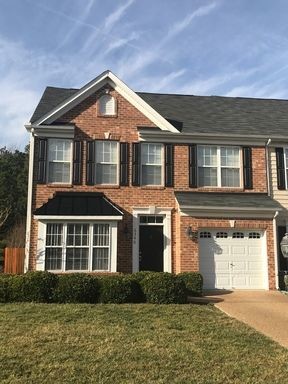
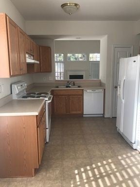
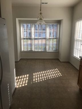
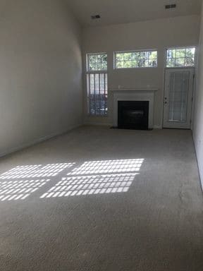
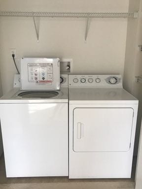
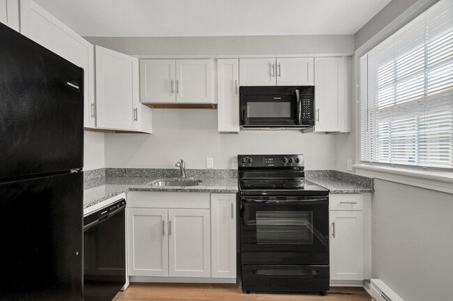
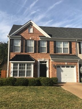
Spacious Townhome off of Rt.10 and minutes from Fort Lee / Chesterfield /Richmond. This home features 2 fully finished levels which provides plenty of living and storage space with beautiful patio and garage. - 3 Bedroom - 2.5 Bathrooms - Eat in Kitchen - Fireplace - First Floor Master Suite - Washer and Dryer Included - Garage / Driveway Parking - Minutes from Pocahontas State Park Schools: OB Gates Elementary Salem Church Middle and LC Bird High Pets Situational with Owner approval PetScreening Rating - 60 Non-Refundable Application Fee per applicant - all occupants 18 - 150 Non-Refundable Leasing Administrative Fee - due at lease signing - 10 Filter Easy Monthly Fee...Filters delivered to your door quarterly - All properties must be shown to applicant or licensed Realtor prior to application consideration/ processing. - All information is deemed correct and subject to change without notice. EHO
6348 Eagles Crest Ln is a townhome located in Chesterfield County and the 23832 ZIP Code. This area is served by the Chesterfield County Public Schools attendance zone.
Townhome Features
Air Conditioning
Dishwasher
Microwave
Refrigerator
- Air Conditioning
- Cable Ready
- Fireplace
- Dishwasher
- Disposal
- Microwave
- Refrigerator
6348 Eagles Crest Ln,
Chesterfield,
VA
23832
Situated about 15 miles southwest of Richmond, Chesterfield offers residents a peaceful enclave from the bustle of city living. Engulfed in lush natural beauty, Chesterfield is convenient to an array of outdoor activities at Pocahontas State Park, Harry G. Daniel Park at Ironbridge, and a host of nearby lakes and reservoirs.
Chesterfield is known as a historic treasure, with roots dating back to the 17th century. Residents and visitors alike can learn more about Chesterfield’s storied past at the Chesterfield County Museum, Magnolia Grange House Museum, and Henricus Historical Park.
While Chesterfield feels worlds away from big-city congestion, it’s only about a 20-minute drive from the capital city of Richmond. Commuting and traveling from Chesterfield is easy with access to Route 288 and Chesterfield County Airport.
Learn more about living in Chesterfield
Amenities
- Air Conditioning
- Cable Ready
- Fireplace
- Dishwasher
- Disposal
- Microwave
- Refrigerator
Education
| Colleges & Universities | Distance | ||
|---|---|---|---|
| Colleges & Universities | Distance | ||
| Drive: | 13 min | 7.1 mi | |
| Drive: | 25 min | 13.8 mi | |
| Drive: | 24 min | 16.1 mi | |
| Drive: | 27 min | 16.8 mi |
6348 Eagles Crest Ln is within 13 minutes or 7.1 miles from John Tyler C.C., Chester. It is also near Virginia State University and VCU.
Schools


Public Elementary School
Grades PK-5
563 Students
Attendance Zone
Public Middle School
Grades 6-8
910 Students
Attendance Zone
Public High School
Grades 9-12
2,031 Students
Attendance Zone
Private Elementary, Middle & High School
Grades K-12
46 Students
Nearby
Private Elementary & Middle School
Grades PK-8
Nearby
School data provided by
 The GreatSchools Rating helps parents compare schools within a state based on a variety of school quality indicators and provides a helpful picture of how effectively each school serves all of its students. Ratings are on a scale of 1 (below average) to 10 (above average) and can include test scores, college readiness, academic progress, advanced courses, equity, discipline and attendance data. We also advise parents to visit schools, consider other information on school performance and programs, and consider family needs as part of the school selection process.
View GreatSchools Rating Methodology
Data provided by GreatSchools.org © 2026. All rights reserved.
The GreatSchools Rating helps parents compare schools within a state based on a variety of school quality indicators and provides a helpful picture of how effectively each school serves all of its students. Ratings are on a scale of 1 (below average) to 10 (above average) and can include test scores, college readiness, academic progress, advanced courses, equity, discipline and attendance data. We also advise parents to visit schools, consider other information on school performance and programs, and consider family needs as part of the school selection process.
View GreatSchools Rating Methodology
Data provided by GreatSchools.org © 2026. All rights reserved.
Walkability Near 6348 Eagles Crest Ln Chesterfield, VA 23832
Getting Around
 What do Walkability, Transit, Drivability, and Bikeability mean?
Walkability measures the walking distance to day-to-day needs.
Transit measures access to public transportation.
Drivability measures congestion, parking availability, and access to major roads.
Bikeability measures the suitability for cycling.
How It Works
What do Walkability, Transit, Drivability, and Bikeability mean?
Walkability measures the walking distance to day-to-day needs.
Transit measures access to public transportation.
Drivability measures congestion, parking availability, and access to major roads.
Bikeability measures the suitability for cycling.
How It Works
Fairly Walkable
Walkability
50
/ 100
Exceptionally Drivable
Drivability
90
/ 100
Fairly Bikeable
Bikeability
50
/ 100
Scores provided by
What do Walkability, Transit, Drivability, and Bikeability mean?
Walkability measures the walking distance to day-to-day needs.
Transit measures access to public transportation.
Drivability measures congestion, parking availability, and access to major roads.
Bikeability measures the suitability for cycling.
How It Works
-
Soundscore™
-
/ 100
Traffic
-Airport
-Businesses
-Scores provided by
HowLoud What is a Sound Score Rating? A Sound Score Rating aggregates noise caused by vehicle traffic, airplane traffic and local sources. How It WorksYou May Also Like
Similar Rentals Nearby
-
-
3 Beds$1,828+Total Monthly PriceTotal Monthly Price NewPrices include base rent and required monthly fees of $32. Variable costs based on usage may apply.Base Rent:3 Beds$1,795+Specials
Pets Allowed Fitness Center Pool Dishwasher Kitchen In Unit Washer & Dryer
-
3 Beds$1,694+Total Monthly PriceTotal Monthly Price NewPrices include base rent and required monthly fees. Variable costs based on usage may apply.
Pets Allowed Pool Dishwasher In Unit Washer & Dryer Disposal Microwave Ceiling Fans
-
3 Beds$2,138+Total Monthly PriceTotal Monthly Price NewPrices include required monthly fees of $38.Base Rent:3 Beds$2,100+
Pets Allowed Fitness Center Pool Walk-In Closets Patio Stainless Steel Appliances Granite Countertops
-
-
-
3 Beds$4,503+Total Monthly PriceTotal Monthly Price NewPrices include base rent and required monthly fees of $80. Variable costs based on usage may apply.Base Rent:3 Beds$4,422+Specials
Pets Allowed Fitness Center Pool Dishwasher Refrigerator Kitchen
-
1 / 24
-
Plus Fees3 Beds$2,194
-
Plus Fees3 Beds$2,015+
What Are Walk Score®, Transit Score®, and Bike Score® Ratings?
Walk Score® measures the walkability of any address. Transit Score® measures access to public transit. Bike Score® measures the bikeability of any address.
What is a Sound Score Rating?
A Sound Score Rating aggregates noise caused by vehicle traffic, airplane traffic and local sources.
6348 Eagles Crest Ln
Chesterfield, VA 23832