
$2,151
/ Month
6321 Crenshaw Blvd
Los Angeles, CA 90043
Favorites
6321 Crenshaw Blvd

Favorites
Check Back Soon for Upcoming Availability
| Beds | Baths | Average SF |
|---|---|---|
| 2 Bedrooms 2 Bedrooms 2 Br | 1 Bath 1 Bath 1 Ba | — |
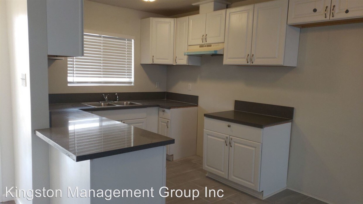
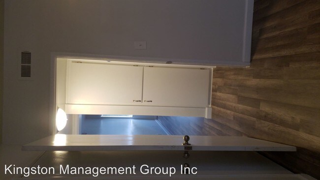
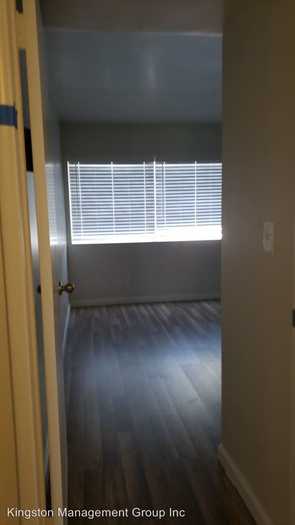
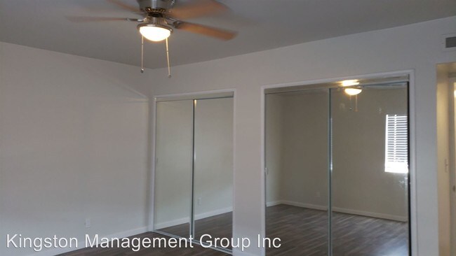
About This Property
(562) 746-8513 - Newly Renovated 2 Bedroom / 1 Bathroom Apartment! LA CITY SECTION 8 CITY VOUCHER ACCEPTED! - A well-maintained and up and coming neighborhood. The property is located on Crenshaw Blvd in between West Boulevard & Van Ness Avenue, just South of View Park-Windsor Hills Nearby schools include Little Angels Nursery School, Centinela Elementary School, View Park Middle School, and Crenshaw High School. The closest grocery stores are Ralphs, Food 4 Less, and Hearty Nutrition. A must see! No Pets. (RLNE5410416)
6321 Crenshaw Blvd is an apartment community located in Los Angeles County and the 90043 ZIP Code.
6321 Crenshaw Blvd,
Los Angeles,
CA
90043
Found in the Inglewood area of Los Angeles County, Park Mesa spans nearly three square miles between Downtown Los Angeles, which is 11 miles east, and Los Angeles International Airport, six miles west.
Park Mesa Heights hosts a variety of events and festivals. Inglewood's annual Dr. Martin Luther King Jr. Day Celebration brings residents out to commemorate, while the Slauson Indoor Swap Meet draws bargain hunters. With L.A. beaches lining the Pacific Ocean just eight miles away, Park Mesa Heights provides coastal breezes and easy access to sand and surf.
Learn more about living in Park Mesa HeightsBelow are rent ranges for similar nearby apartments
| Beds | Average Size | Lowest | Typical | Premium |
|---|---|---|---|---|
| Studio Studio Studio | 362-376 Sq Ft | $1,295 | $1,700 | $3,000 |
| 1 Bed 1 Bed 1 Bed | 539-542 Sq Ft | $1,050 | $2,179 | $2,875 |
| 2 Beds 2 Beds 2 Beds | 765-774 Sq Ft | $1,995 | $2,682 | $3,700 |
| 3 Beds 3 Beds 3 Beds | 1092-1094 Sq Ft | $2,295 | $3,152 | $4,900 |
| 4 Beds 4 Beds 4 Beds | 1964 Sq Ft | $3,295 | $4,516 | $7,950 |
Education
| Colleges & Universities | Distance | ||
|---|---|---|---|
| Colleges & Universities | Distance | ||
| Drive: | 11 min | 5.2 mi | |
| Drive: | 12 min | 5.4 mi | |
| Drive: | 10 min | 5.6 mi | |
| Drive: | 11 min | 7.0 mi |
6321 Crenshaw Blvd is within 11 minutes or 5.2 miles from Los Angeles Southwest College. It is also near West Los Angeles College and USC, University Park Campus.
Transportation options available in Los Angeles include Hyde Park Station, located 0.5 mile from 6321 Crenshaw Blvd. 6321 Crenshaw Blvd is near Los Angeles International, located 6.2 miles or 13 minutes away, and Bob Hope, located 18.4 miles or 32 minutes away.
| Transit / Subway | Distance | ||
|---|---|---|---|
| Transit / Subway | Distance | ||
| Walk: | 10 min | 0.5 mi | |
| Walk: | 14 min | 0.8 mi | |
| Drive: | 3 min | 1.6 mi | |
| Drive: | 3 min | 1.8 mi | |
| Drive: | 5 min | 2.2 mi |
| Commuter Rail | Distance | ||
|---|---|---|---|
| Commuter Rail | Distance | ||
|
|
Drive: | 16 min | 10.3 mi |
|
|
Drive: | 18 min | 10.5 mi |
|
|
Drive: | 23 min | 12.4 mi |
| Drive: | 20 min | 14.3 mi | |
|
|
Drive: | 23 min | 14.9 mi |
| Airports | Distance | ||
|---|---|---|---|
| Airports | Distance | ||
|
Los Angeles International
|
Drive: | 13 min | 6.2 mi |
|
Bob Hope
|
Drive: | 32 min | 18.4 mi |
Walkability Near 6321 Crenshaw Blvd Los Angeles, CA 90043
Getting Around
 What do Walkability, Transit, Drivability, and Bikeability mean?
Walkability measures the walking distance to day-to-day needs.
Transit measures access to public transportation.
Drivability measures congestion, parking availability, and access to major roads.
Bikeability measures the suitability for cycling.
How It Works
What do Walkability, Transit, Drivability, and Bikeability mean?
Walkability measures the walking distance to day-to-day needs.
Transit measures access to public transportation.
Drivability measures congestion, parking availability, and access to major roads.
Bikeability measures the suitability for cycling.
How It Works
Moderately Walkable
Walkability
60
/ 100
Good Public Transit
Transit
70
/ 100
Moderately Drivable
Drivability
70
/ 100
Fairly Bikeable
Bikeability
50
/ 100
Scores provided by
-
Soundscore™
-
/ 100
Traffic
-Airport
-Businesses
-Scores provided by
HowLoud What is a Sound Score Rating? A Sound Score Rating aggregates noise caused by vehicle traffic, airplane traffic and local sources. How It WorksTime and distance from 6321 Crenshaw Blvd.
| Shopping Centers | Distance | ||
|---|---|---|---|
| Shopping Centers | Distance | ||
| Walk: | 11 min | 0.6 mi | |
| Drive: | 3 min | 1.6 mi | |
| Drive: | 4 min | 2.0 mi |
6321 Crenshaw Blvd has 3 shopping centers within 2.0 miles, which is about a 4-minute drive. The miles and minutes will be for the farthest away property.
| Parks and Recreation | Distance | ||
|---|---|---|---|
| Parks and Recreation | Distance | ||
|
Natural History Museum of LA County
|
Drive: | 9 min | 4.8 mi |
|
Kenneth Hahn State Recreation Area
|
Drive: | 12 min | 4.8 mi |
|
Exposition Park Rose Garden
|
Drive: | 9 min | 4.9 mi |
|
California Science Center
|
Drive: | 10 min | 5.0 mi |
|
Augustus Hawkins Natural Park
|
Drive: | 9 min | 5.5 mi |
6321 Crenshaw Blvd has 5 parks within 5.5 miles, including Kenneth Hahn State Recreation Area, California Science Center, and Natural History Museum of LA County.
| Hospitals | Distance | ||
|---|---|---|---|
| Hospitals | Distance | ||
| Drive: | 7 min | 3.3 mi | |
| Drive: | 11 min | 6.4 mi | |
| Drive: | 12 min | 6.8 mi |
6321 Crenshaw Blvd has 3 hospitals within 6.8 miles, the nearest is Centinela Hospital Medical Center which is 3.3 miles away and a 7 minute drive.
| Military Bases | Distance | ||
|---|---|---|---|
| Military Bases | Distance | ||
| Drive: | 13 min | 7.1 mi | |
| Drive: | 31 min | 22.2 mi | |
| Drive: | 34 min | 24.5 mi |
6321 Crenshaw Blvd has 3 military bases within 24.5 miles, the nearest is Los Angeles Air Force Base which is 7.1 miles away and a 13 minute drive.
You May Also Like
Similar Rentals Nearby
-
-
-
-
-
-
-
-
-
-
2 Beds$3,469+Total Monthly PriceTotal Monthly Price NewPrices include base rent and required monthly fees of $15. Variable costs based on usage may apply.Base Rent:2 Beds$3,453+1 Month Free
Pets Allowed In Unit Washer & Dryer Maintenance on site Heat Controlled Access Elevator


What Are Walk Score®, Transit Score®, and Bike Score® Ratings?
Walk Score® measures the walkability of any address. Transit Score® measures access to public transit. Bike Score® measures the bikeability of any address.
What is a Sound Score Rating?
A Sound Score Rating aggregates noise caused by vehicle traffic, airplane traffic and local sources.

6321 Crenshaw Blvd
Los Angeles, CA 90043