
$2,000
/ Month
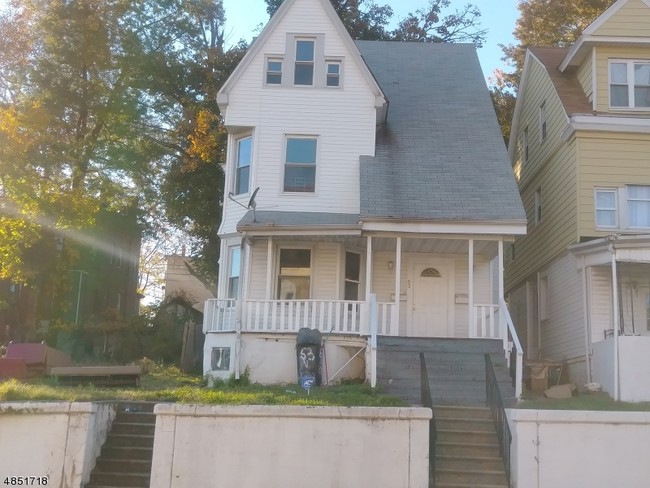
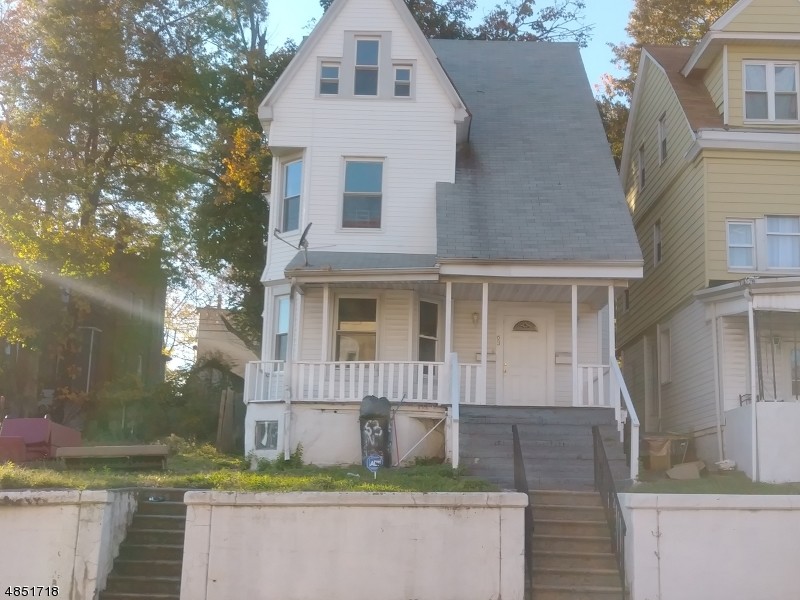
63 N Grove St
East Orange, NJ 07017
2 Weeks Ago
|
Edit
Favorites
63 N Grove St

Favorites
Check Back Soon for Upcoming Availability
| Beds | Baths | Average SF |
|---|---|---|
| 4 Bedrooms 4 Bedrooms 4 Br | 1.5 Baths 1.5 Baths 1.5 Ba | — |
About This Property
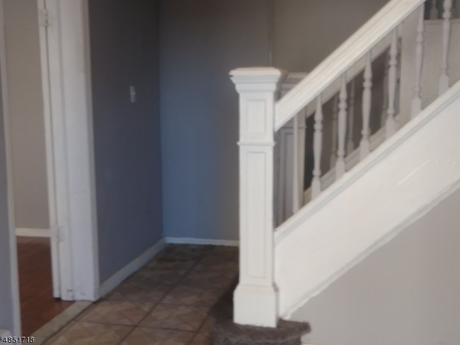
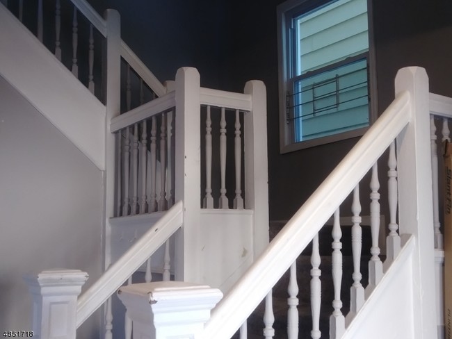
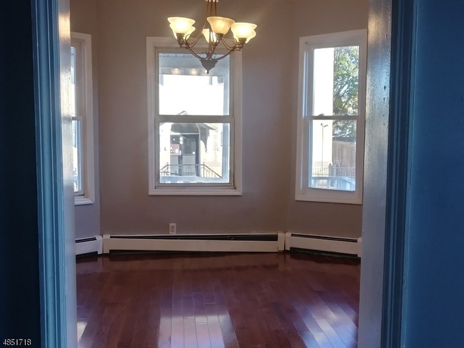
Large single family home near train station and public transportation. 4 spacious bedrooms, exercise room, home office,eat in kitchen, formal dining room and living room. Backyard is private.
63 N Grove St is an apartment community located in Essex County and the 07017 ZIP Code.
Location
Get Directions
East Orange, New Jersey sits just 12 miles from Manhattan, combining historic charm with contemporary city living. Tree-lined streets showcase the area's architectural heritage, from pre-war apartment buildings to classic single-family homes. Current rental rates show one-bedroom apartments average $1,407, while two-bedrooms typically rent for $1,897, with annual increases of 1-2% across all unit sizes.
The city features established neighborhoods like Greenwood, known for its architectural character, and the Central Avenue Commercial District. Elmwood Park provides recreational opportunities with its swimming pool, tennis courts, and walking track. The East Orange Campus High School stands on the historic grounds of the former Upsala College, while the Whitney E. Houston Academy of Creative & Performing Arts honors the legendary singer's local roots. Two NJ Transit train stations offer direct service to New York City, making the area particularly accessible for commuters.
Learn more about living in East Orange
Education
| Colleges & Universities | Distance | ||
|---|---|---|---|
| Colleges & Universities | Distance | ||
| Drive: | 4 min | 2.0 mi | |
| Drive: | 3 min | 2.2 mi | |
| Drive: | 3 min | 2.2 mi | |
| Drive: | 7 min | 3.2 mi |
63 N Grove St is within 4 minutes or 2.0 miles from N.J. Inst. of Technology. It is also near Rutgers, Newark Campus and Essex County College.
Transportation options available in East Orange include Orange Street, located 1.2 miles from 63 N Grove St. 63 N Grove St is near Newark Liberty International, located 7.5 miles or 13 minutes away, and LaGuardia, located 28.5 miles or 43 minutes away.
| Transit / Subway | Distance | ||
|---|---|---|---|
| Transit / Subway | Distance | ||
|
|
Drive: | 2 min | 1.2 mi |
|
|
Drive: | 2 min | 1.5 mi |
|
|
Drive: | 3 min | 1.6 mi |
|
|
Drive: | 5 min | 2.1 mi |
|
|
Drive: | 4 min | 2.3 mi |
| Commuter Rail | Distance | ||
|---|---|---|---|
| Commuter Rail | Distance | ||
|
|
Walk: | 9 min | 0.5 mi |
|
|
Walk: | 19 min | 1.0 mi |
|
|
Drive: | 3 min | 1.9 mi |
|
|
Drive: | 3 min | 2.0 mi |
|
|
Drive: | 4 min | 2.1 mi |
| Airports | Distance | ||
|---|---|---|---|
| Airports | Distance | ||
|
Newark Liberty International
|
Drive: | 13 min | 7.5 mi |
|
LaGuardia
|
Drive: | 43 min | 28.5 mi |
Time and distance from 63 N Grove St.
| Shopping Centers | Distance | ||
|---|---|---|---|
| Shopping Centers | Distance | ||
| Walk: | 8 min | 0.4 mi | |
| Walk: | 12 min | 0.6 mi | |
| Walk: | 20 min | 1.1 mi |
63 N Grove St has 3 shopping centers within 1.1 miles, which is about a 20-minute walk. The miles and minutes will be for the farthest away property.
| Parks and Recreation | Distance | ||
|---|---|---|---|
| Parks and Recreation | Distance | ||
|
Newark Museum and Dreyfuss Planetarium
|
Drive: | 4 min | 2.3 mi |
|
Branch Brook Park
|
Drive: | 5 min | 2.7 mi |
|
Edison National Historic Site
|
Drive: | 6 min | 3.0 mi |
|
Kearny Marsh
|
Drive: | 10 min | 5.0 mi |
|
Turtle Back Zoo
|
Drive: | 11 min | 5.5 mi |
63 N Grove St has 5 parks within 5.5 miles, including Newark Museum and Dreyfuss Planetarium, Branch Brook Park, and Edison National Historic Site.
| Hospitals | Distance | ||
|---|---|---|---|
| Hospitals | Distance | ||
| Walk: | 17 min | 0.9 mi | |
| Drive: | 2 min | 1.6 mi | |
| Drive: | 3 min | 2.1 mi |
63 N Grove St has 3 hospitals within 2.1 miles, the nearest is East Orange General Hospital which is 0.9 mile away and a 17 minute walk.
| Military Bases | Distance | ||
|---|---|---|---|
| Military Bases | Distance | ||
| Drive: | 18 min | 11.4 mi | |
| Drive: | 29 min | 14.1 mi | |
| Drive: | 34 min | 19.4 mi |
63 N Grove St has 3 military bases within 19.4 miles, the nearest is Military Ocean Terminal which is 11.4 miles away and a 18 minute drive.
You May Also Like
How do I access Social Services in New Jersey?
Statewide service is free, confidential, multilingual and always open. Three easy ways to reach Social Services in NJ: Dial 2-1-1; text your zip code to 898-211; or chat at https://www.nj211.org
Similar Rentals Nearby
-
-
-
1 / 22

-
-
-
1 / 50

-
-
-
-


What Are Walk Score®, Transit Score®, and Bike Score® Ratings?
Walk Score® measures the walkability of any address. Transit Score® measures access to public transit. Bike Score® measures the bikeability of any address.
What is a Sound Score Rating?
A Sound Score Rating aggregates noise caused by vehicle traffic, airplane traffic and local sources
63 N Grove St
East Orange, NJ 07017