


$900 - $1,000
Total Monthly Price
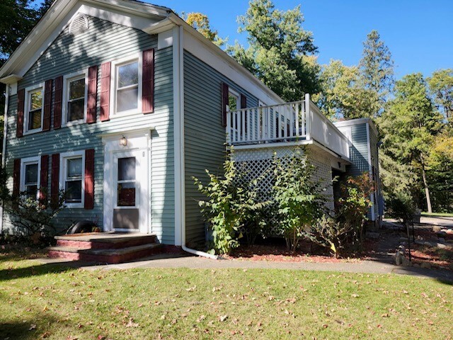
629 Platt St
Niles, MI 49120
2 Weeks Ago
|
Edit
Favorites
629 Platt St

Favorites
Check Back Soon for Upcoming Availability
| Beds | Baths | Average SF |
|---|---|---|
| 1 Bedroom 1 Bedroom 1 Br | 1 Bath 1 Bath 1 Ba | 805 SF |
| 2 Bedrooms 2 Bedrooms 2 Br | 1 Bath 1 Bath 1 Ba | 985 SF |
Fees and Policies
The fees listed below are community-provided and may exclude utilities or add-ons. All payments are made directly to the property and are non-refundable unless otherwise specified.
- Parking
-
Surface Lot--
Details
Utilities Included
-
Gas
-
Water
-
Heat
-
Trash Removal
-
Sewer
Property Information
-
4 units
About 629 Platt St Niles, MI 49120
Quiet rural feeling in the city of Niles. Close to hospital, St. joe river, entertainment, restaurants, and grocery shopping. 100% Smoke Free Property.
629 Platt St is an apartment community located in Berrien County and the 49120 ZIP Code. This area is served by the Niles Community Schools attendance zone.
Apartment Features
Air Conditioning
Hardwood Floors
Walk-In Closets
Microwave
Refrigerator
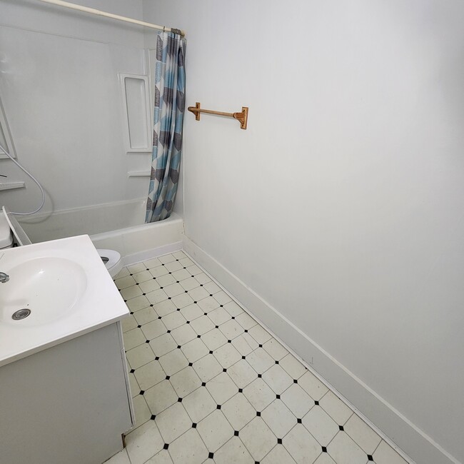
Tub/Shower
Freezer
Tile Floors
Indoor Features
- Air Conditioning
- Heating
- Ceiling Fans
- Smoke Free
- Cable Ready
- Tub/Shower
Kitchen Features & Appliances
- Pantry
- Kitchen
- Microwave
- Oven
- Range
- Refrigerator
- Freezer
Model Details
- Hardwood Floors
- Carpet
- Tile Floors
- Vinyl Flooring
- Views
- Walk-In Closets
- Linen Closet
629 Platt St,
Niles,
MI
49120
Niles is a small city in the far southwestern corner of Michigan, about ten miles north of South Bend, Indiana. Known as the “City of Four Flags,” Niles has a rich history as a settlement occupied by four different national powers dating back to the late 17th century. Today, the city retains a timeless character with numerous vintage structures all over the city, from the vintage storefronts downtown to the stone railroad bridge over 2nd Street to the iconic Chapin Mansion. Spanning both banks of the Saint Joseph River, much of the city’s waterfront is preserved with lush public parks, offering residents a beautiful scenic venue to enjoy the fresh air and sunshine.
Learn more about living in Niles
Amenities
- Air Conditioning
- Heating
- Ceiling Fans
- Smoke Free
- Cable Ready
- Tub/Shower
- Pantry
- Kitchen
- Microwave
- Oven
- Range
- Refrigerator
- Freezer
- Hardwood Floors
- Carpet
- Tile Floors
- Vinyl Flooring
- Views
- Walk-In Closets
- Linen Closet
- Laundry Facilities
- Porch
- Deck
- Yard
- Lawn
Expenses
Utilities Included
Gas, Water, Heat, Trash Removal, Sewer
Included
Education
| Colleges & Universities | Distance | ||
|---|---|---|---|
| Colleges & Universities | Distance | ||
| Drive: | 21 min | 10.3 mi | |
| Drive: | 21 min | 10.9 mi | |
| Drive: | 28 min | 14.8 mi | |
| Drive: | 24 min | 15.3 mi |
629 Platt St is within 21 minutes or 10.3 miles from St. Mary's College. It is also near University of Notre Dame and Andrews University.
Schools


Public Elementary, Middle & High School
Grades PK-12
100 Students
Nearby
Public Elementary School
Grades PK-5
15 Students
Attendance Zone
Public Elementary, Middle & High School
Grades K-12
23 Students
Attendance Zone
Public Middle School
Grades 6-8
554 Students
Attendance Zone
Public High School
Grades 9-12
834 Students
Attendance Zone
Private Elementary & Middle School
Grades K-8
62 Students
Nearby
School data provided by
 The GreatSchools Rating helps parents compare schools within a state based on a variety of school quality indicators and provides a helpful picture of how effectively each school serves all of its students. Ratings are on a scale of 1 (below average) to 10 (above average) and can include test scores, college readiness, academic progress, advanced courses, equity, discipline and attendance data. We also advise parents to visit schools, consider other information on school performance and programs, and consider family needs as part of the school selection process.
View GreatSchools Rating Methodology
Data provided by GreatSchools.org © 2026. All rights reserved.
View GreatSchools Rating Methodology
Data provided by GreatSchools.org © 2026. All rights reserved.
Walkability Near 629 Platt St Niles, MI 49120
Getting Around
 What do Walkability, Transit, Drivability, and Bikeability mean?
Walkability measures the walking distance to day-to-day needs.
Transit measures access to public transportation.
Drivability measures congestion, parking availability, and access to major roads.
Bikeability measures the suitability for cycling.
How It Works
What do Walkability, Transit, Drivability, and Bikeability mean?
Walkability measures the walking distance to day-to-day needs.
Transit measures access to public transportation.
Drivability measures congestion, parking availability, and access to major roads.
Bikeability measures the suitability for cycling.
How It Works
Somewhat Walkable
Walkability
30
/ 100
Very Drivable
Drivability
80
/ 100
Fairly Bikeable
Bikeability
40
/ 100
Scores provided by
-
Soundscore™
-
/ 100
Traffic
-Airport
-Businesses
-Scores provided by
HowLoud What is a Sound Score Rating? A Sound Score Rating aggregates noise caused by vehicle traffic, airplane traffic and local sources. How It WorksYou May Also Like
-
Irish Hills Apartments
4245 Irish Hills Dr
South Bend, IN 46614
$922 - $1,794
1-2 Br 14.0 mi
-
Autumn Lakes Apartments and Townhomes
1109 Hidden Lakes Dr
Mishawaka, IN 46544
$1,141 - $3,154
1-3 Br 15.3 mi
-
The Delta
304 E Jackson Blvd
Elkhart, IN 46516
$1,440 - $2,000 Total Monthly Price
1-2 Br 12 Month Lease 18.3 mi
Similar Rentals Nearby


What Are Walk Score®, Transit Score®, and Bike Score® Ratings?
Walk Score® measures the walkability of any address. Transit Score® measures access to public transit. Bike Score® measures the bikeability of any address.
What is a Sound Score Rating?
A Sound Score Rating aggregates noise caused by vehicle traffic, airplane traffic and local sources.
629 Platt St
Niles, MI 49120