$3,250
Total Monthly Price
621 Driscoll Rd
Fremont, CA 94539
Favorites
-
Bedrooms
2
-
Bathrooms
1
-
Square Feet
780 sq ft
-
Available
Available Jul 1
Highlights
- Playground
- Smoke Free
621 Driscoll Rd

Favorites
About This Home
12 Month Lease,
$3,250 deposit,
Available Jul 1
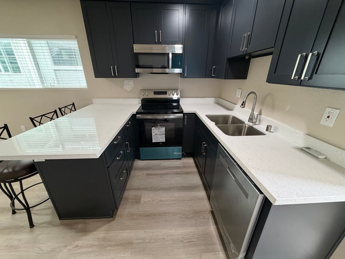
• Located in the highly desirable Mission San Jose neighborhood with access to some of Fremont's top-rated public schools • Walking distance to elementary (Gomes), middle (Hopkins), and high schools (Mission San Jose). • Multiple Silicon Valley employer shuttle/bus stops are in front of the house. • Approximately 8 minutes to Warm Springs/South Fremont BART and Fremont BART, making commuting throughout the Bay Area convenient. • Easy access to I-680, I-880, and CA-237, ideal for commuters heading to San Jose, Milpitas, Santa Clara, Palo Alto or Dublin, Pleasanton, San Roman. • Minutes from parks including Gomes Park and Lake Elizabeth Park, offering playgrounds, sports fields, and walking trails. • Surrounded by a wide selection of ethnic cuisine, grocery stores, shopping, and movie theaters. • Short drive to hiking destinations such as Mission Peak hike for outdoor enthusiasts. • No Smoking and Pets • Washer & dryer included
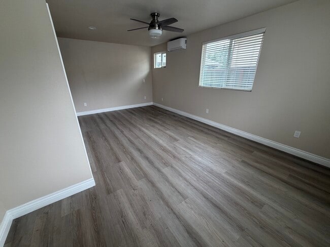
621 Driscoll Rd is a house located in Alameda County and the 94539 ZIP Code.
* Price shown is total price based on community-supplied monthly required fees. Excludes user-selected optional fees and variable or usage-based fees and required charges due at or prior to move-in or at move-out. Price, availability, fees, and any applicable rent special are subject to change without notice.
* Square footage definitions vary. Displayed square footage is approximate.
House Features
- Smoke Free
- Playground
- Walking/Biking Trails
- Media Center/Movie Theatre
Contact
- Contact
Location
Get Directions
Fremont, positioned in the San Francisco Bay Area, combines suburban living with innovation and technology. As home to the Tesla Factory, the city maintains a strong industrial presence while offering numerous parks and outdoor spaces. Lake Elizabeth in Central Park provides recreational opportunities, while Mission Peak's trails showcase panoramic Bay Area views. The rental market remains competitive, with average rents ranging from $2,204 for studios to $3,770 for three-bedroom homes, with year-over-year increases between 1.5% and 4.4%.
The city's five districts each offer distinct characteristics. Historic Niles preserves its early film industry heritage, while Mission San Jose features the restored Mission San José, an architectural landmark from 1797. The Warm Springs area has developed into a technology center, and Central Fremont includes shopping destinations like the Fremont Hub and Pacific Commons.
Learn more about living in Fremont
Education
| Colleges & Universities | Distance | ||
|---|---|---|---|
| Colleges & Universities | Distance | ||
| Drive: | 6 min | 2.7 mi | |
| Drive: | 11 min | 5.0 mi | |
| Drive: | 22 min | 11.4 mi | |
| Drive: | 20 min | 12.1 mi |
621 Driscoll Rd is within 6 minutes or 2.7 miles from Ohlone College, Fremont Campus. It is also near Ohlone College, Newark and Cal State East Bay.
Transportation options available in Fremont include Fremont, located 3.0 miles from 621 Driscoll Rd. 621 Driscoll Rd is near Norman Y Mineta San Jose International, located 16.1 miles or 24 minutes away, and Metro Oakland International, located 24.6 miles or 34 minutes away.
| Transit / Subway | Distance | ||
|---|---|---|---|
| Transit / Subway | Distance | ||
|
|
Drive: | 7 min | 3.0 mi |
|
|
Drive: | 7 min | 3.6 mi |
|
|
Drive: | 13 min | 6.5 mi |
|
|
Drive: | 18 min | 9.5 mi |
|
|
Drive: | 17 min | 10.9 mi |
| Commuter Rail | Distance | ||
|---|---|---|---|
| Commuter Rail | Distance | ||
| Drive: | 9 min | 4.2 mi | |
| Drive: | 10 min | 4.3 mi | |
| Drive: | 17 min | 12.5 mi | |
| Drive: | 21 min | 13.7 mi | |
| Drive: | 24 min | 16.5 mi |
| Airports | Distance | ||
|---|---|---|---|
| Airports | Distance | ||
|
Norman Y Mineta San Jose International
|
Drive: | 24 min | 16.1 mi |
|
Metro Oakland International
|
Drive: | 34 min | 24.6 mi |
Getting Around
 What do Walkability, Transit, Drivability, and Bikeability mean?
Walkability measures the walking distance to day-to-day needs.
Transit measures access to public transportation.
Drivability measures congestion, parking availability, and access to major roads.
Bikeability measures the suitability for cycling.
How It Works
What do Walkability, Transit, Drivability, and Bikeability mean?
Walkability measures the walking distance to day-to-day needs.
Transit measures access to public transportation.
Drivability measures congestion, parking availability, and access to major roads.
Bikeability measures the suitability for cycling.
How It Works
Fairly Walkable
Walkability
50
/ 100
Limited Public Transit
Transit
30
/ 100
Exceptionally Drivable
Drivability
90
/ 100
Fairly Bikeable
Bikeability
50
/ 100
Scores provided by
-
Soundscore™
-
/ 100
Traffic
-Airport
-Businesses
-Scores provided by
HowLoud What is a Sound Score Rating? A Sound Score Rating aggregates noise caused by vehicle traffic, airplane traffic and local sources. How It WorksTime and distance from 621 Driscoll Rd.
| Shopping Centers | Distance | ||
|---|---|---|---|
| Shopping Centers | Distance | ||
| Walk: | 9 min | 0.5 mi | |
| Drive: | 3 min | 1.2 mi | |
| Drive: | 3 min | 1.5 mi |
621 Driscoll Rd has 3 shopping centers within 1.5 miles, which is about a 3-minute drive. The miles and minutes will be for the farthest away property.
| Parks and Recreation | Distance | ||
|---|---|---|---|
| Parks and Recreation | Distance | ||
|
Central Park (Lake Elizabeth)
|
Drive: | 6 min | 2.5 mi |
|
Niles Canyon Railway
|
Drive: | 7 min | 3.6 mi |
|
Niles Community Park
|
Drive: | 9 min | 4.1 mi |
|
Quarry Lakes Regional Recreation Area
|
Drive: | 11 min | 5.2 mi |
|
Mission Peak Regional Preserve
|
Drive: | 19 min | 5.6 mi |
621 Driscoll Rd has 5 parks within 5.6 miles, including Central Park (Lake Elizabeth), Niles Canyon Railway, and Niles Community Park.
| Hospitals | Distance | ||
|---|---|---|---|
| Hospitals | Distance | ||
| Drive: | 5 min | 2.2 mi | |
| Drive: | 7 min | 3.1 mi | |
| Drive: | 21 min | 13.7 mi |
621 Driscoll Rd has 3 hospitals within 13.7 miles, the nearest is Kaiser Foundation Hospital - Fremont which is 2.2 miles away and a 5 minute drive.
| Military Bases | Distance | ||
|---|---|---|---|
| Military Bases | Distance | ||
| Drive: | 29 min | 18.9 mi | |
| Drive: | 46 min | 32.1 mi | |
| Drive: | 47 min | 32.3 mi |
621 Driscoll Rd has 3 military bases within 32.3 miles, the nearest is Ames Research Center which is 18.9 miles away and a 29 minute drive.
Amenities
- Smoke Free
- Playground
- Walking/Biking Trails
- Media Center/Movie Theatre
621 Driscoll Rd Photos

621 Driscoll Rd
Fremont, CA 94539