$2,445
/ Month
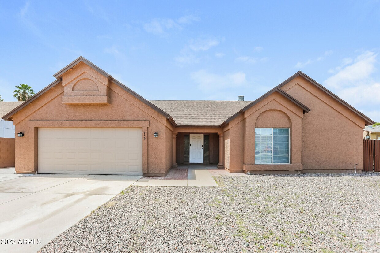
616 S Kenwood Ln
Chandler, AZ 85226
Favorites
616 S Kenwood Ln

Favorites
Check Back Soon for Upcoming Availability
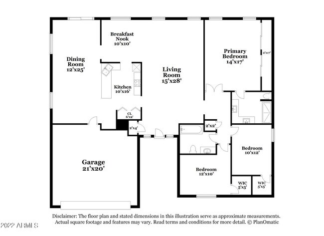
| Beds | Baths | Average SF |
|---|---|---|
| 3 Bedrooms 3 Bedrooms 3 Br | 2 Baths 2 Baths 2 Ba | 1,795 SF |
About This Property
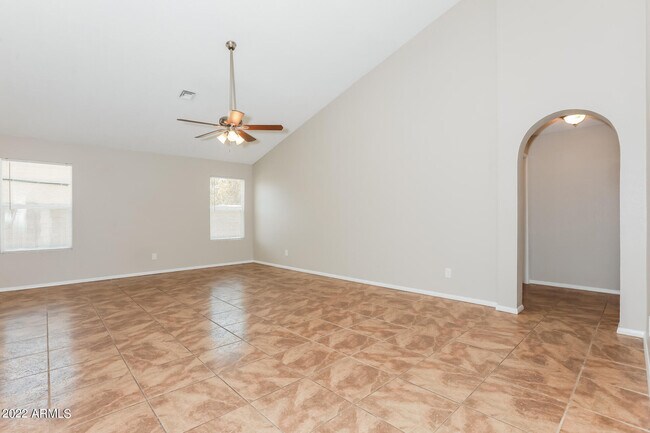
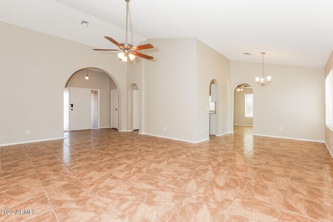
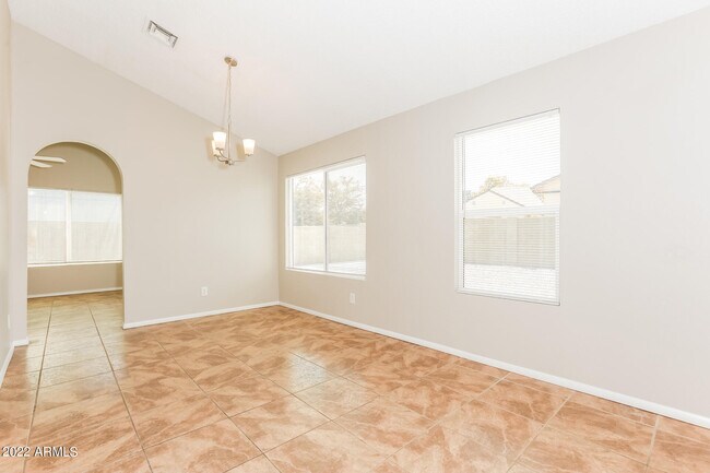
Looking for your dream home? Through our seamless leasing process,this beautifully designed home is move-in ready. Our spacious layout is perfect for comfortable living that you can enjoy with your pets too; we're proud to be pet friendly. Our homes are built using high-quality,eco-friendly materials with neutral paint colors,updated fixtures,and energy-efficient appliances. Enjoy the backyard and community to unwind after a long day,or simply greet neighbors,enjoy the fresh air,and gather for fun-filled activities. Ready to make your next move your best move? Apply now. The fixtures and finishes of this property may differ slightly from what is pictured.
616 S Kenwood Ln is a house located in Maricopa County and the 85226 ZIP Code. This area is served by the Kyrene Elementary School District attendance zone.
616 S Kenwood Ln,
Chandler,
AZ
85226
Situated about four miles west of Downtown Chandler, West Chandler is a scenic suburb brimming with recreation and retail. West Chandler residents enjoy access to an array of local parks, including Desert Breeze Park, Nozomi Park, and Hanger Park, as well as close proximity to the sprawling South Mountain Park.
Retail options in West Chandler provide a host of modern delights and everyday conveniences, with numerous shopping centers and plazas strewn throughout the area in addition to the upscale Chandler Fashion Center. West Chandler is also convenient to the popular Lone Butte Casino. Getting around from West Chandler is easy with access to the Santan Freeway, Maricopa Freeway, and the Price Freeway.
Learn more about living in West ChandlerBelow are rent ranges for similar nearby apartments
| Beds | Average Size | Lowest | Typical | Premium |
|---|---|---|---|---|
| Studio Studio Studio | 521 Sq Ft | $1,095 | $1,915 | $3,856 |
| 1 Bed 1 Bed 1 Bed | 759 Sq Ft | $1,112 | $2,058 | $14,881 |
| 2 Beds 2 Beds 2 Beds | 1094 Sq Ft | $1,211 | $2,376 | $8,370 |
| 3 Beds 3 Beds 3 Beds | 1407 Sq Ft | $1,799 | $3,352 | $24,689 |
| 4 Beds 4 Beds 4 Beds | 2423 Sq Ft | $2,250 | $3,764 | $7,500 |
Education
| Colleges & Universities | Distance | ||
|---|---|---|---|
| Colleges & Universities | Distance | ||
| Drive: | 15 min | 8.7 mi | |
| Drive: | 16 min | 9.6 mi | |
| Drive: | 18 min | 9.7 mi | |
| Drive: | 16 min | 9.8 mi |
616 S Kenwood Ln is within 16 minutes or 9.6 miles from Chandler-Gilbert C.C., Pecos. It is also near Mesa C.C., Southern and Dobson and Chandler-Gilbert CC. Sun Lakes.
Schools


Public Elementary & Middle School
Grades K-8
834 Students
Attendance Zone
Public Elementary & Middle School
Grades PK-8
549 Students
Attendance Zone
Public High School
Grades 9-12
2,598 Students
Attendance Zone
Private Elementary, Middle & High School
Grades K-12
235 Students
Nearby
School data provided by
 The GreatSchools Rating helps parents compare schools within a state based on a variety of school quality indicators and provides a helpful picture of how effectively each school serves all of its students. Ratings are on a scale of 1 (below average) to 10 (above average) and can include test scores, college readiness, academic progress, advanced courses, equity, discipline and attendance data. We also advise parents to visit schools, consider other information on school performance and programs, and consider family needs as part of the school selection process.
View GreatSchools Rating Methodology
Data provided by GreatSchools.org © 2026. All rights reserved.
View GreatSchools Rating Methodology
Data provided by GreatSchools.org © 2026. All rights reserved.
Transportation options available in Chandler include Price-101 Fwy/Apache Blvd, located 9.5 miles from 616 S Kenwood Ln. 616 S Kenwood Ln is near Phoenix Sky Harbor International, located 16.4 miles or 25 minutes away, and Phoenix-Mesa Gateway, located 17.0 miles or 26 minutes away.
| Transit / Subway | Distance | ||
|---|---|---|---|
| Transit / Subway | Distance | ||
|
|
Drive: | 14 min | 9.5 mi |
|
|
Drive: | 15 min | 10.0 mi |
|
|
Drive: | 16 min | 10.4 mi |
|
|
Drive: | 17 min | 10.9 mi |
|
|
Drive: | 18 min | 11.4 mi |
| Commuter Rail | Distance | ||
|---|---|---|---|
| Commuter Rail | Distance | ||
|
|
Drive: | 31 min | 22.1 mi |
| Airports | Distance | ||
|---|---|---|---|
| Airports | Distance | ||
|
Phoenix Sky Harbor International
|
Drive: | 25 min | 16.4 mi |
|
Phoenix-Mesa Gateway
|
Drive: | 26 min | 17.0 mi |
Walkability Near 616 S Kenwood Ln Chandler, AZ 85226
Getting Around
 What do Walkability, Transit, Drivability, and Bikeability mean?
Walkability measures the walking distance to day-to-day needs.
Transit measures access to public transportation.
Drivability measures congestion, parking availability, and access to major roads.
Bikeability measures the suitability for cycling.
How It Works
What do Walkability, Transit, Drivability, and Bikeability mean?
Walkability measures the walking distance to day-to-day needs.
Transit measures access to public transportation.
Drivability measures congestion, parking availability, and access to major roads.
Bikeability measures the suitability for cycling.
How It Works
Somewhat Walkable
Walkability
30
/ 100
Minimal Public Transit
Transit
10
/ 100
Exceptionally Drivable
Drivability
100
/ 100
Fairly Bikeable
Bikeability
50
/ 100
Scores provided by
-
Soundscore™
-
/ 100
Traffic
-Airport
-Businesses
-Scores provided by
HowLoud What is a Sound Score Rating? A Sound Score Rating aggregates noise caused by vehicle traffic, airplane traffic and local sources. How It WorksTime and distance from 616 S Kenwood Ln.
| Shopping Centers | Distance | ||
|---|---|---|---|
| Shopping Centers | Distance | ||
| Drive: | 4 min | 1.6 mi | |
| Drive: | 5 min | 1.6 mi | |
| Drive: | 5 min | 1.8 mi |
616 S Kenwood Ln has 3 shopping centers within 1.8 miles, which is about a 5-minute drive. The miles and minutes will be for the farthest away property.
| Parks and Recreation | Distance | ||
|---|---|---|---|
| Parks and Recreation | Distance | ||
|
Pecos Park
|
Drive: | 12 min | 6.1 mi |
|
South Mountain Park
|
Drive: | 18 min | 10.2 mi |
|
i.d.e.a. Museum
|
Drive: | 20 min | 12.5 mi |
|
ASU Center for Meteorite Studies
|
Drive: | 21 min | 12.6 mi |
|
City of Chandler Environmental Education Center
|
Drive: | 20 min | 13.1 mi |
616 S Kenwood Ln has 5 parks within 13.1 miles, including Pecos Park, South Mountain Park, and ASU Center for Meteorite Studies.
| Hospitals | Distance | ||
|---|---|---|---|
| Hospitals | Distance | ||
| Drive: | 7 min | 3.5 mi | |
| Drive: | 7 min | 3.9 mi | |
| Drive: | 12 min | 6.7 mi |
616 S Kenwood Ln has 3 hospitals within 6.7 miles, the nearest is Chandler Regional Medical Center which is 3.5 miles away and a 7 minute drive.
| Military Bases | Distance | ||
|---|---|---|---|
| Military Bases | Distance | ||
| Drive: | 24 min | 17.2 mi | |
| Drive: | 54 min | 41.4 mi | |
| Drive: | 99 min | 80.9 mi |
616 S Kenwood Ln has 3 military bases within 80.9 miles, the nearest is Phoenix Sky Harbor Airport Air Guard Station which is 17.2 miles away and a 24 minute drive.
You May Also Like
Similar Rentals Nearby
-
-
-
-
-
1 / 73
 3 Beds$2,572+Total Monthly PriceTotal Monthly Price NewPrices include base rent and required monthly fees of $56. Variable costs based on usage may apply.Base Rent:3 Beds$2,515+2 Months Free
Pets Allowed Fitness Center Pool Dishwasher Refrigerator Kitchen
-
-
-
-
3 Beds$2,740+Total Monthly Price12 Month LeaseTotal Monthly Price NewPrices include base rent and required monthly fees of $264. Variable costs based on usage may apply.Base Rent:3 Beds$2,475+Specials
Pets Allowed Fitness Center Dishwasher In Unit Washer & Dryer Stainless Steel Appliances Gated Yard
-


What Are Walk Score®, Transit Score®, and Bike Score® Ratings?
Walk Score® measures the walkability of any address. Transit Score® measures access to public transit. Bike Score® measures the bikeability of any address.
What is a Sound Score Rating?
A Sound Score Rating aggregates noise caused by vehicle traffic, airplane traffic and local sources.

616 S Kenwood Ln
Chandler, AZ 85226