

$1,300
/ Month
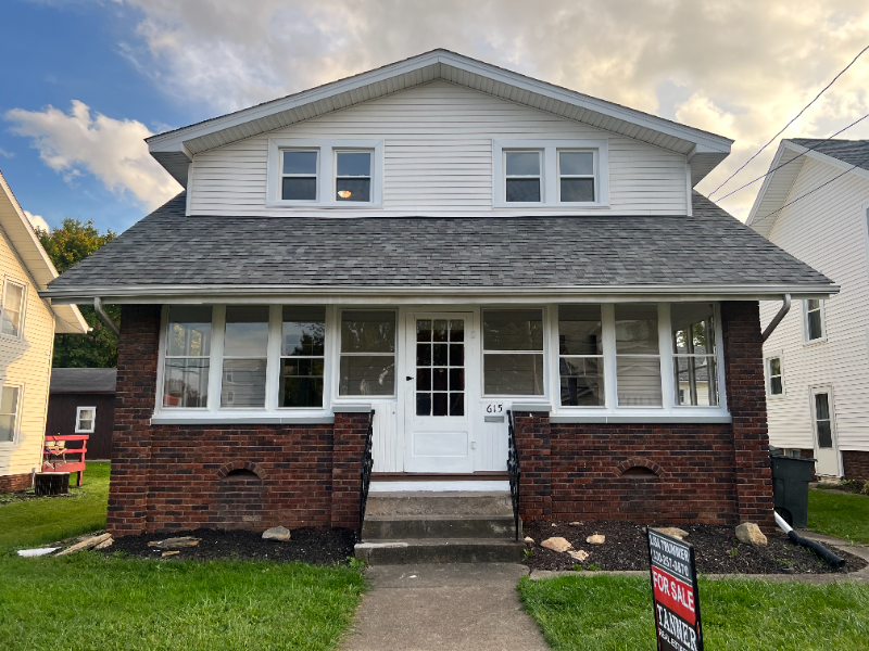
615 E State St
Alliance, OH 44601
Favorites
615 E State St

Favorites
Check Back Soon for Upcoming Availability
| Beds | Baths | Average SF |
|---|---|---|
| 3 Bedrooms 3 Bedrooms 3 Br | 1 Bath 1 Bath 1 Ba | 1,464 SF |
Fees and Policies
The fees listed below are community-provided and may exclude utilities or add-ons. All payments are made directly to the property and are non-refundable unless otherwise specified.
- Dogs Allowed
-
Fees not specified
- Cats Allowed
-
Fees not specified
About This Property
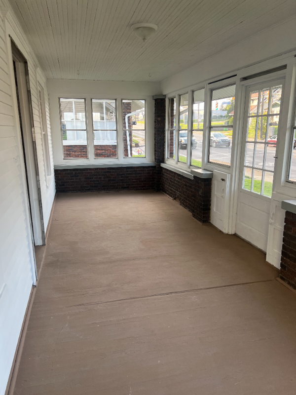
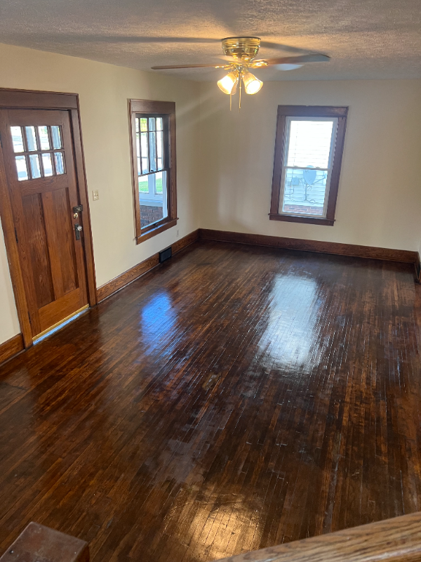
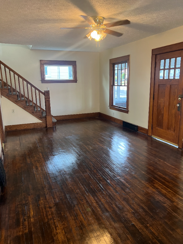
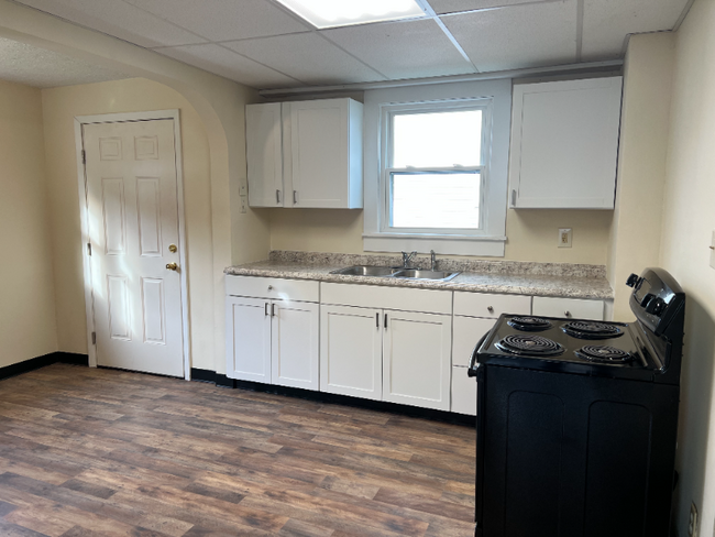
Property Id: 1354668 This 3-bed, 1-bath single-family property has recently undergone major renovations. The home also has an office on the first floor that could be used for a variety of different things including a potential living space. The house is nearby to lots in the area including Mount Union, Aultman Hospital, Memorial Park, multiple restaurants, stores, gas station, and more. Pets are welcome, including large dogs, small dogs, and cats. Don't miss out on this amazing opportunity. Available from Dec 18, 2023, for $1350. No smoking. Act fast and secure your spot now!
615 E State St is a house located in Stark County and the 44601 ZIP Code. This area is served by the Alliance City School District attendance zone.
House Features
Hardwood Floors
Microwave
Refrigerator
Freezer
- Microwave
- Oven
- Refrigerator
- Freezer
- Hardwood Floors
- Vinyl Flooring
615 E State St,
Alliance,
OH
44601
Alliance sits about 20 miles northeast of Canton in Stark County, shaped by its origins as a railroad and manufacturing hub. Founded in 1854 through the merger of three smaller communities, the city carries that layered history through its pre-war architecture, a walkable downtown, and the University of Mount Union, a private liberal arts college established in 1846 that anchors much of the city's day-to-day energy. Alliance is also Ohio's Carnation City, recognized for its ties to the scarlet carnation, the state flower, which the city celebrates each year with the Greater Alliance Carnation Festival. The downtown core along East State Street offers a compact mix of local dining and retail, while the historic district draws those with an interest in architecture and local heritage. Glamorgan Castle adds a distinct landmark presence to the landscape.
Learn more about living in Alliance
Amenities
- Microwave
- Oven
- Refrigerator
- Freezer
- Hardwood Floors
- Vinyl Flooring
Education
| Colleges & Universities | Distance | ||
|---|---|---|---|
| Colleges & Universities | Distance | ||
| Walk: | 17 min | 0.9 mi | |
| Drive: | 27 min | 15.8 mi | |
| Drive: | 29 min | 17.0 mi | |
| Drive: | 35 min | 22.4 mi |
615 E State St is within 17 minutes or 0.9 mile from Mount Union College. It is also near Walsh University and Malone University.
Schools


Public Elementary School
Grades PK-5
372 Students
Nearby
Public Elementary School
Grades K-5
408 Students
Nearby
Public Elementary School
Grades K-5
414 Students
Attendance Zone
Public Elementary School
Grades K-5
384 Students
Attendance Zone
Public Middle School
Grades 6-8
572 Students
Attendance Zone
Public High School
Grades 9-12
839 Students
Attendance Zone
Private Elementary School
Grades PK-5
53 Students
Nearby
Private Elementary School
Grades PK-5
119 Students
Nearby
Private Middle & High School
Grades 6-12
379 Students
Nearby
School data provided by
 The GreatSchools Rating helps parents compare schools within a state based on a variety of school quality indicators and provides a helpful picture of how effectively each school serves all of its students. Ratings are on a scale of 1 (below average) to 10 (above average) and can include test scores, college readiness, academic progress, advanced courses, equity, discipline and attendance data. We also advise parents to visit schools, consider other information on school performance and programs, and consider family needs as part of the school selection process.
View GreatSchools Rating Methodology
Data provided by GreatSchools.org © 2026. All rights reserved.
View GreatSchools Rating Methodology
Data provided by GreatSchools.org © 2026. All rights reserved.
Walkability Near 615 E State St Alliance, OH 44601
Getting Around
 What do Walkability, Transit, Drivability, and Bikeability mean?
Walkability measures the walking distance to day-to-day needs.
Transit measures access to public transportation.
Drivability measures congestion, parking availability, and access to major roads.
Bikeability measures the suitability for cycling.
How It Works
What do Walkability, Transit, Drivability, and Bikeability mean?
Walkability measures the walking distance to day-to-day needs.
Transit measures access to public transportation.
Drivability measures congestion, parking availability, and access to major roads.
Bikeability measures the suitability for cycling.
How It Works
Fairly Walkable
Walkability
50
/ 100
Limited Public Transit
Transit
30
/ 100
Exceptionally Drivable
Drivability
100
/ 100
Fairly Bikeable
Bikeability
40
/ 100
Scores provided by
-
Soundscore™
-
/ 100
Traffic
-Airport
-Businesses
-Scores provided by
HowLoud What is a Sound Score Rating? A Sound Score Rating aggregates noise caused by vehicle traffic, airplane traffic and local sources. How It WorksYou May Also Like
Similar Rentals Nearby


615 E State St
Alliance, OH 44601