$2,899 / Month
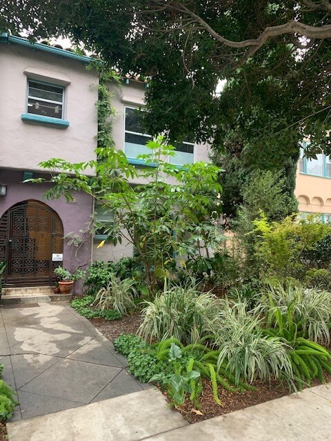
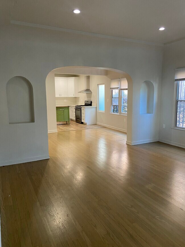
6128 Saturn St Unit 6128
Los Angeles, CA 90035
2 Weeks Ago
Favorites
6128 Saturn St Unit 6128

Favorites
Check Back Soon for Upcoming Availability
| Beds | Baths | Average SF |
|---|---|---|
| 2 Bedrooms 2 Bedrooms 2 Br | 1 Bath 1 Bath 1 Ba | 1,100 SF |
Fees and Policies
The fees below are based on community-supplied data and may exclude additional fees and utilities.
- Cats Allowed
-
Fees not specified
-
Weight limit--
-
Pet Limit--
- Parking
-
Street--
Details
Utilities Included
-
Water
Property Information
-
4 units
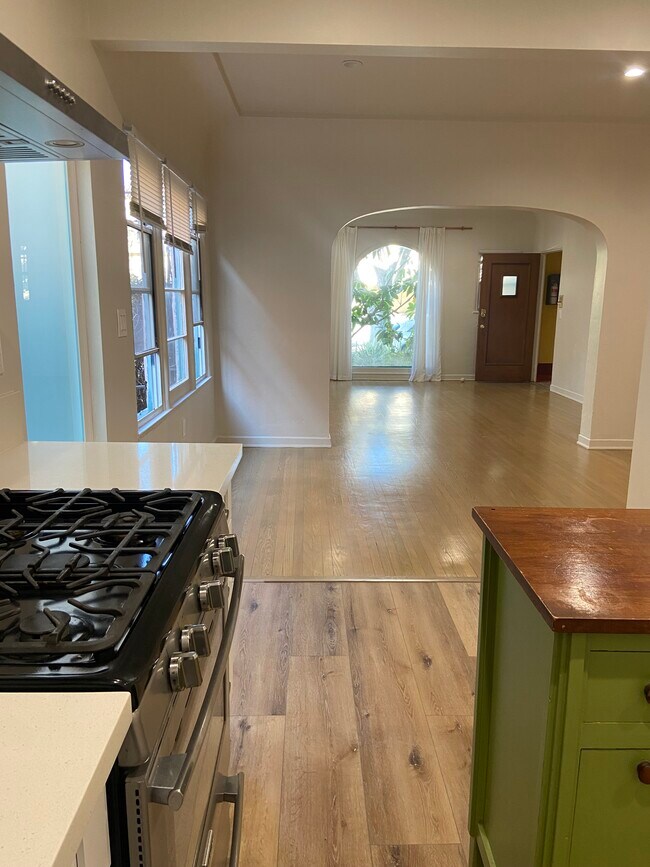
About This Property
6128 Saturn St is an apartment community located in Los Angeles County and the 90035 ZIP Code.
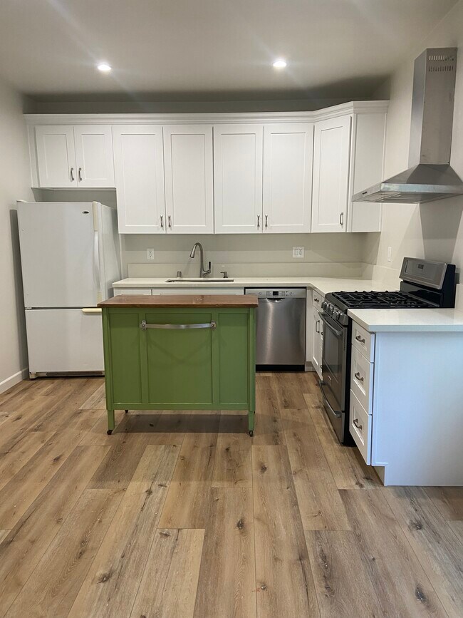
Apartment Features
- Washer/Dryer
- Air Conditioning
- Dishwasher
Location
Get Directions
Pico-Robertson is a popular Los Angeles neighborhood situated directly south of Beverly Hills and east of Century City. Despite its location in the heart of glittery West Los Angeles near the Miracle Mile, Beverlywood, Carthay, and Cheviot Hills, Pico-Robertson is much more low-key. You won't find trendy hotspots and wild nightlife in Pico-Robertson, but you will find a strong sense of community and a quiet setting.
Pico-Robertson offers a unique collection of delis, bakeries, and more. It is named for the intersection of Pico Boulevard and Robertson Boulevard, and that's where you'll find the majority of the neighborhood's shops, restaurants, and cafes.
Learn more about living in Pico-RobertsonBelow are rent ranges for similar nearby apartments
| Beds | Average Size | Lowest | Typical | Premium |
|---|---|---|---|---|
| Studio Studio Studio | 658 Sq Ft | $1,950 | $2,484 | $3,095 |
| 1 Bed 1 Bed 1 Bed | 896-899 Sq Ft | $990 | $2,574 | $4,000 |
| 2 Beds 2 Beds 2 Beds | 1121-1123 Sq Ft | $2,350 | $3,608 | $7,000 |
| 3 Beds 3 Beds 3 Beds | 1866 Sq Ft | $3,535 | $5,099 | $8,650 |
| 4 Beds 4 Beds 4 Beds | 2959 Sq Ft | $3,920 | $9,778 | $15,800 |
Amenities
- Washer/Dryer
- Air Conditioning
- Dishwasher
Expenses
Utilities Included
Water
Included
Education
| Colleges & Universities | Distance | ||
|---|---|---|---|
| Colleges & Universities | Distance | ||
| Drive: | 11 min | 4.4 mi | |
| Drive: | 11 min | 5.6 mi | |
| Drive: | 12 min | 6.0 mi | |
| Drive: | 13 min | 7.6 mi |
6128 Saturn St Unit 6128 is within 11 minutes or 4.4 miles from West Los Angeles College. It is also near UCLA and Musicians Institute.
Transportation options available in Los Angeles include La Cienega/Jefferson, located 2.0 miles from 6128 Saturn St Unit 6128. 6128 Saturn St Unit 6128 is near Los Angeles International, located 9.1 miles or 18 minutes away, and Bob Hope, located 13.9 miles or 27 minutes away.
| Transit / Subway | Distance | ||
|---|---|---|---|
| Transit / Subway | Distance | ||
|
|
Drive: | 4 min | 2.0 mi |
|
|
Drive: | 5 min | 2.1 mi |
|
|
Drive: | 5 min | 2.8 mi |
|
|
Drive: | 7 min | 3.6 mi |
|
|
Drive: | 8 min | 3.6 mi |
| Commuter Rail | Distance | ||
|---|---|---|---|
| Commuter Rail | Distance | ||
|
|
Drive: | 17 min | 10.6 mi |
|
|
Drive: | 19 min | 10.7 mi |
|
|
Drive: | 20 min | 11.5 mi |
|
|
Drive: | 23 min | 11.8 mi |
|
|
Drive: | 25 min | 12.8 mi |
| Airports | Distance | ||
|---|---|---|---|
| Airports | Distance | ||
|
Los Angeles International
|
Drive: | 18 min | 9.1 mi |
|
Bob Hope
|
Drive: | 27 min | 13.9 mi |
Time and distance from 6128 Saturn St Unit 6128.
| Shopping Centers | Distance | ||
|---|---|---|---|
| Shopping Centers | Distance | ||
| Walk: | 5 min | 0.3 mi | |
| Walk: | 11 min | 0.6 mi | |
| Walk: | 12 min | 0.6 mi |
6128 Saturn St Unit 6128 has 3 shopping centers within 0.6 mile, which is about a 12-minute walk. The miles and minutes will be for the farthest away property.
| Parks and Recreation | Distance | ||
|---|---|---|---|
| Parks and Recreation | Distance | ||
|
Zimmer Children's Museum
|
Drive: | 3 min | 1.6 mi |
|
La Brea Tar Pits
|
Drive: | 4 min | 1.8 mi |
|
Kenneth Hahn State Recreation Area
|
Drive: | 11 min | 4.1 mi |
|
Virginia Robinson Gardens
|
Drive: | 10 min | 4.2 mi |
|
Mathias Botanical Garden
|
Drive: | 12 min | 5.4 mi |
6128 Saturn St Unit 6128 has 5 parks within 5.4 miles, including Zimmer Children's Museum, La Brea Tar Pits, and Virginia Robinson Gardens.
| Hospitals | Distance | ||
|---|---|---|---|
| Hospitals | Distance | ||
| Walk: | 19 min | 1.0 mi | |
| Drive: | 2 min | 1.1 mi | |
| Drive: | 3 min | 1.3 mi |
6128 Saturn St Unit 6128 has 3 hospitals within 1.3 miles, the nearest is Kaiser Foundation Hospital - West LA which is 1.0 miles away and a 19 minute walk.
| Military Bases | Distance | ||
|---|---|---|---|
| Military Bases | Distance | ||
| Drive: | 18 min | 10.7 mi |
6128 Saturn St Unit 6128 is 10.7 miles and a 18 minute drive from Los Angeles Air Force Base.
You May Also Like
Similar Rentals Nearby


 - Violet on Virgil")


 - AVA Burbank")
What Are Walk Score®, Transit Score®, and Bike Score® Ratings?
Walk Score® measures the walkability of any address. Transit Score® measures access to public transit. Bike Score® measures the bikeability of any address.
What is a Sound Score Rating?
A Sound Score Rating aggregates noise caused by vehicle traffic, airplane traffic and local sources

6128 Saturn St
Los Angeles, CA 90035