
Seaview Apartments
520-550 Seaview Ave,
Staten Island, NY 10305
Call for Rent
2 Beds
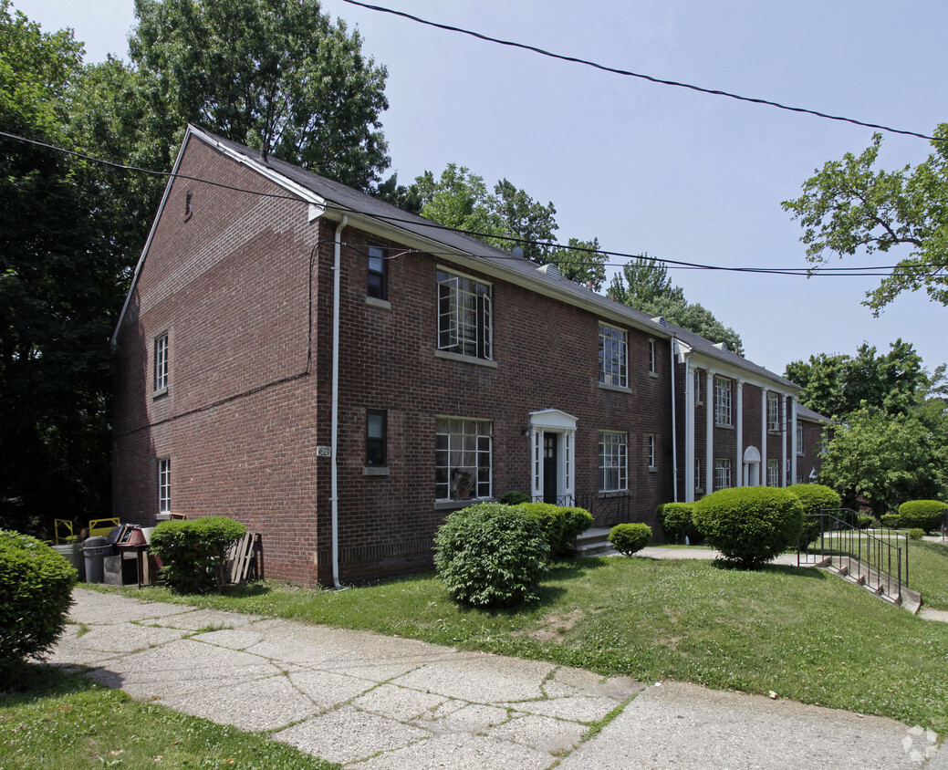
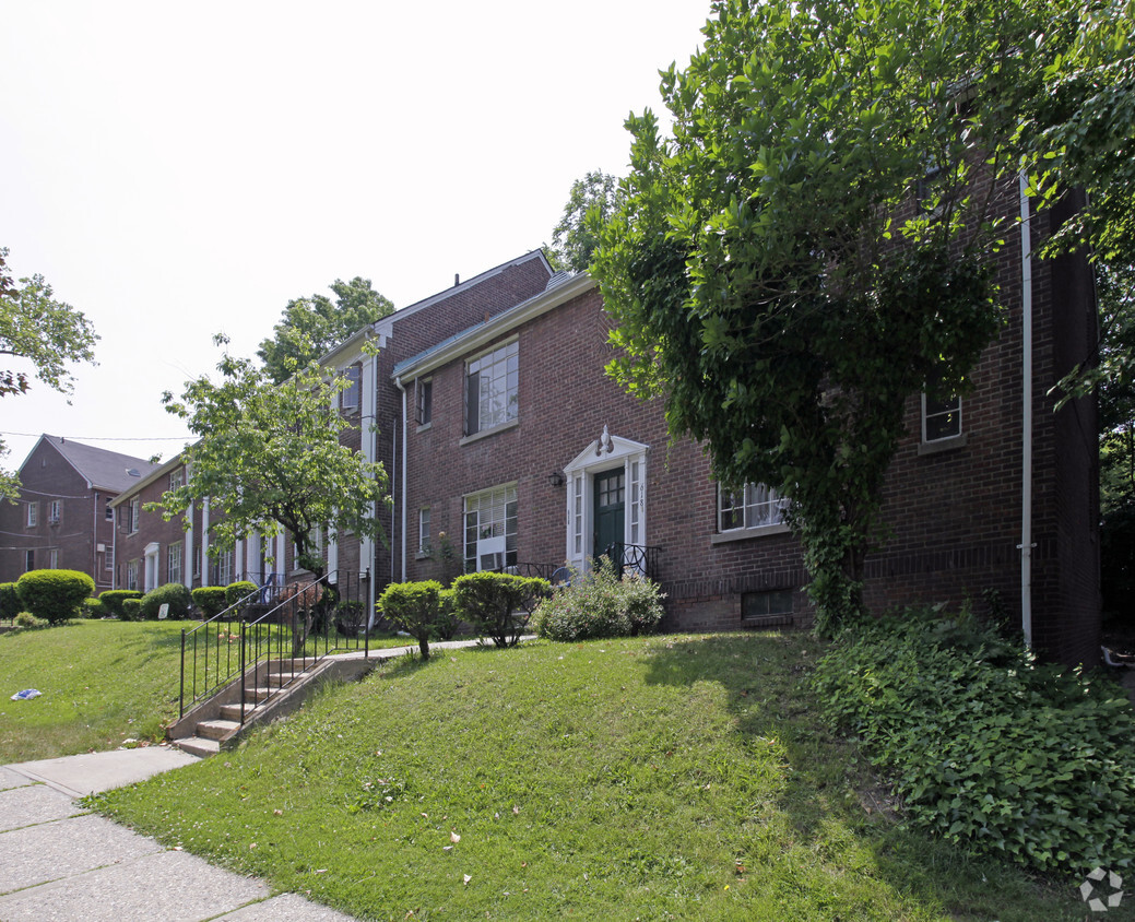
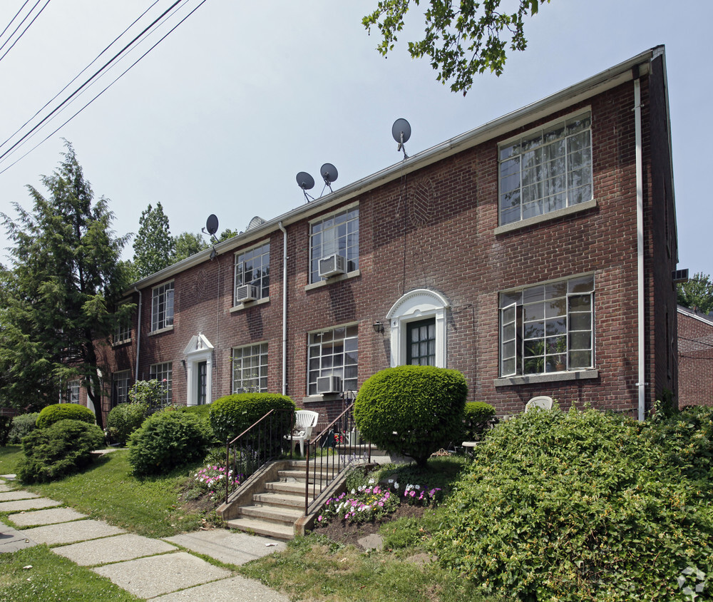

At 608 Castleton Ave, you've discovered your new place. Based in the 10301 area of Staten Island on Castleton Ave, local residents have easy access to a mixture of nearby points of interest. The leasing team will be ready to help you find the perfect new home. Come for a visit to check out the apartment floorplan options. Stop by 608 Castleton Ave today.
608 Castleton Ave is an apartment community located in Richmond County and the 10301 ZIP Code. This area is served by the New York City Geographic District #31 attendance zone.
High Speed Internet Access
Refrigerator
Disposal
Smoke Free
The West Brighton neighborhood is located along the Staten Island North Shore. The Staten Island Zoo is a notable landmark and attraction within the community – it houses 320 different species from around the world! The oldest operating cricket club can be found at nearby Walker Park. Founded in 1827, the park hosts regular cricket tournaments to this day.
West Brighton’s peaceful neighborhood boasts a large selection of restaurants along Forest Avenue. In the mid-1800s, the area was known as “Factoryville” because of the booming textile industry during that time.
The neighborhood is nestled between Clove Lakes Park and the Silver Lake Golf Course. In addition to the park’s trails, scenic lake, and natural beauty, visitors enjoy brunch on the Stone House at Clove Lakes’ garden patio! Residents in the area are served by the Staten Island Railway and bus services.
Learn more about living in West Brighton| Colleges & Universities | Distance | ||
|---|---|---|---|
| Colleges & Universities | Distance | ||
| Drive: | 9 min | 2.5 mi | |
| Drive: | 13 min | 4.9 mi | |
| Drive: | 18 min | 8.4 mi | |
| Drive: | 21 min | 10.2 mi |


Transportation options available in Staten Island include 8Th Street Light Rail Station, located 4.5 miles from 608 Castleton Ave. 608 Castleton Ave is near Newark Liberty International, located 12.8 miles or 23 minutes away, and LaGuardia, located 23.3 miles or 42 minutes away.
| Transit / Subway | Distance | ||
|---|---|---|---|
| Transit / Subway | Distance | ||
| Drive: | 11 min | 4.5 mi | |
|
|
Drive: | 13 min | 5.8 mi |
|
|
Drive: | 14 min | 6.6 mi |
|
|
Drive: | 15 min | 6.9 mi |
|
|
Drive: | 17 min | 8.0 mi |
| Commuter Rail | Distance | ||
|---|---|---|---|
| Commuter Rail | Distance | ||
|
|
Drive: | 5 min | 1.8 mi |
|
|
Drive: | 6 min | 1.9 mi |
|
|
Drive: | 6 min | 2.2 mi |
|
|
Drive: | 7 min | 2.3 mi |
|
|
Drive: | 9 min | 3.4 mi |
| Airports | Distance | ||
|---|---|---|---|
| Airports | Distance | ||
|
Newark Liberty International
|
Drive: | 23 min | 12.8 mi |
|
LaGuardia
|
Drive: | 42 min | 23.3 mi |
Time and distance from 608 Castleton Ave.
| Shopping Centers | Distance | ||
|---|---|---|---|
| Shopping Centers | Distance | ||
| Drive: | 5 min | 1.9 mi | |
| Drive: | 5 min | 1.9 mi | |
| Drive: | 8 min | 2.6 mi |
| Parks and Recreation | Distance | ||
|---|---|---|---|
| Parks and Recreation | Distance | ||
|
Staten Island Children's Museum
|
Walk: | 15 min | 0.8 mi |
|
Snug Harbor Cultural Center & Botanical Garden
|
Walk: | 15 min | 0.8 mi |
|
Staten Island Zoo
|
Drive: | 4 min | 1.3 mi |
|
Silver Lake Park
|
Drive: | 4 min | 1.4 mi |
|
Mahoney Playground
|
Drive: | 4 min | 1.6 mi |
| Hospitals | Distance | ||
|---|---|---|---|
| Hospitals | Distance | ||
| Walk: | 5 min | 0.3 mi | |
| Drive: | 13 min | 5.1 mi | |
| Drive: | 15 min | 5.6 mi |
| Military Bases | Distance | ||
|---|---|---|---|
| Military Bases | Distance | ||
| Drive: | 7 min | 2.0 mi | |
| Drive: | 17 min | 7.7 mi |
What Are Walk Score®, Transit Score®, and Bike Score® Ratings?
Walk Score® measures the walkability of any address. Transit Score® measures access to public transit. Bike Score® measures the bikeability of any address.
What is a Sound Score Rating?
A Sound Score Rating aggregates noise caused by vehicle traffic, airplane traffic and local sources

608 Castleton Ave
Staten Island, NY 10301


