

$3,250
/ Month
6063 Brogan Way
El Dorado Hills, CA 95762
Today
Favorites
916-365-2299
-
Bedrooms
5
-
Bathrooms
3
-
Square Feet
2,500 sq ft
-
Available
Available Nov 1
6063 Brogan Way

Favorites
About This Home
$5,000 deposit,
Available Nov 1
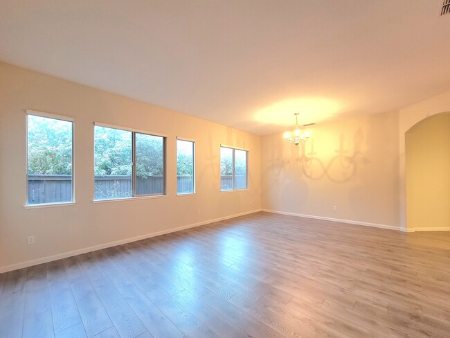
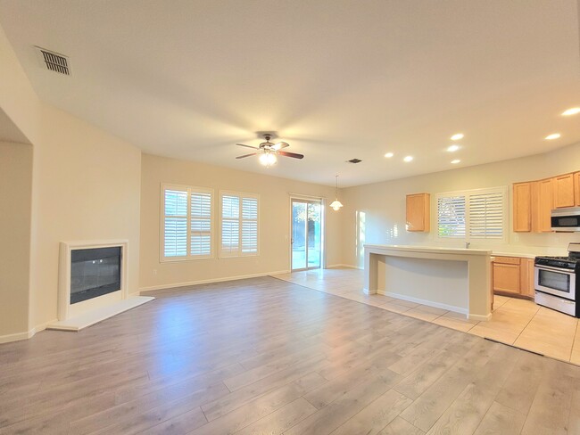
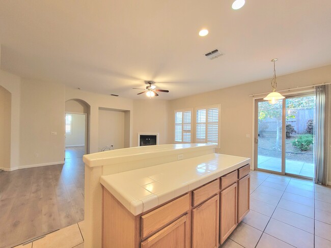
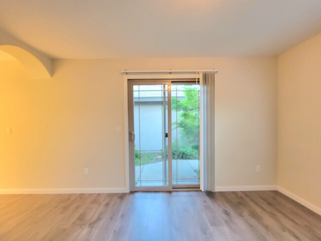
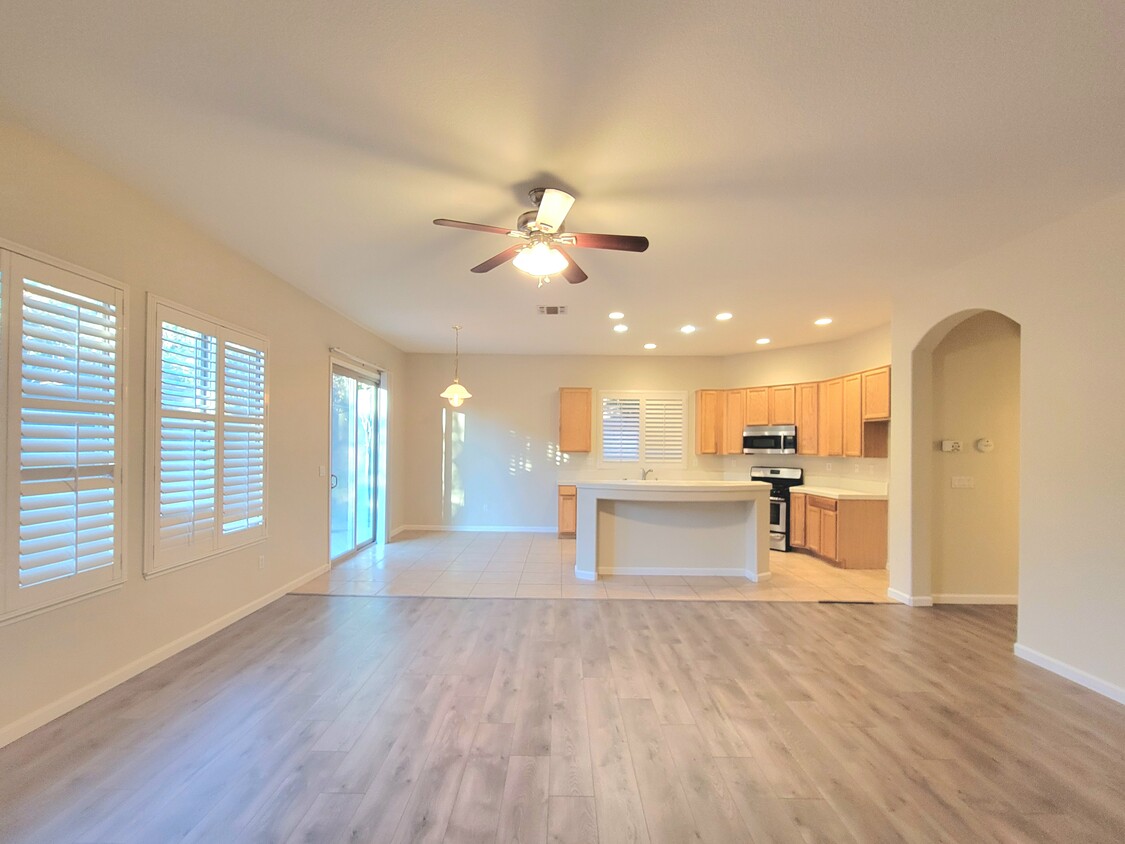
Located in the Prestigious Serrano Community with miles of walking trails! Gated privacy with 24 hours security patrol and quiet location. This semi-custom beauty was built in 2004 by JTS Homes. One Jr. Suite/office at the front with private entrance. A large living room and dining room combo. Separate family room with fireplace. Spacious open kitchen has large center island. Private back yard with concrete patio, easy to care for backyard landscaping. No pets and No smoking. Good credit. Renter insurance is required.
6063 Brogan Way is a house located in El Dorado County and the 95762 ZIP Code. This area is served by the Buckeye Union Elementary attendance zone.
* Price shown is base rent. Excludes user-selected optional fees and variable or usage-based fees and required charges due at or prior to move-in or at move-out. Price, availability, fees, and any applicable rent special are subject to change without notice.
* Square footage definitions vary. Displayed square footage is approximate.
Contact
- Listed by Wing Lam (Realtor)
- Phone Number
- Contact
Location
Get Directions
El Dorado Hills covers 48 square miles in the Sierra Nevada foothills, combining residential areas with natural landscapes. The El Dorado Hills Town Center serves as the community hub, featuring the Steven Young Amphitheatre where residents gather for summer concerts. The area provides access to Folsom Lake and the South Fork of the American River for outdoor recreation. Students attend schools in the El Dorado Union High School District and Buckeye Union School District. Housing includes apartments with one-bedroom units averaging $2,158, while established neighborhoods like Lake Forest Village, Highland Hills, and Bridlewood offer single-family homes.
The area's history connects to the California Gold Rush, with historic Pony Express routes now serving as modern roadways. Developer Allan Lindsey established El Dorado Hills in the 1960s, creating residential villages interwoven with preserved open spaces that protect the native oak trees and rolling terrain.
Learn more about living in El Dorado Hills
Education
| Colleges & Universities | Distance | ||
|---|---|---|---|
| Colleges & Universities | Distance | ||
| Drive: | 15 min | 7.8 mi | |
| Drive: | 23 min | 15.3 mi | |
| Drive: | 34 min | 18.8 mi | |
| Drive: | 35 min | 21.5 mi |
6063 Brogan Way is within 15 minutes or 7.8 miles from Folsom Lake College, Folsom. It is also near Folsom Lake College, El Dorado and Sierra College, Rocklin Campus.
Schools


Public Elementary School
Grades K-3
518 Students
Nearby
Public Elementary School
Grades K-5
496 Students
Attendance Zone
Public Middle & High School
Grades 8-12
2,516 Students
Attendance Zone
Public Middle School
Grades 6-8
817 Students
Attendance Zone
Private Elementary School
Grades PK-1
Nearby
Private Elementary & Middle School
Grades K-8
217 Students
Nearby
Private Elementary, Middle & High School
Grades 1-12
Nearby
School data provided by
 The GreatSchools Rating helps parents compare schools within a state based on a variety of school quality indicators and provides a helpful picture of how effectively each school serves all of its students. Ratings are on a scale of 1 (below average) to 10 (above average) and can include test scores, college readiness, academic progress, advanced courses, equity, discipline and attendance data. We also advise parents to visit schools, consider other information on school performance and programs, and consider family needs as part of the school selection process.
View GreatSchools Rating Methodology
Data provided by GreatSchools.org © 2025. All rights reserved.
View GreatSchools Rating Methodology
Data provided by GreatSchools.org © 2025. All rights reserved.
Transportation options available in El Dorado Hills include Glenn, located 10.7 miles from 6063 Brogan Way. 6063 Brogan Way is near Sacramento International, located 41.2 miles or 53 minutes away.
| Transit / Subway | Distance | ||
|---|---|---|---|
| Transit / Subway | Distance | ||
|
|
Drive: | 17 min | 10.7 mi |
|
|
Drive: | 17 min | 11.4 mi |
|
|
Drive: | 18 min | 11.6 mi |
|
|
Drive: | 17 min | 11.9 mi |
| Commuter Rail | Distance | ||
|---|---|---|---|
| Commuter Rail | Distance | ||
|
|
Drive: | 37 min | 20.3 mi |
|
|
Drive: | 36 min | 21.2 mi |
| Drive: | 45 min | 28.6 mi | |
|
|
Drive: | 45 min | 28.6 mi |
| Drive: | 39 min | 30.9 mi |
| Airports | Distance | ||
|---|---|---|---|
| Airports | Distance | ||
|
Sacramento International
|
Drive: | 53 min | 41.2 mi |
Time and distance from 6063 Brogan Way.
| Shopping Centers | Distance | ||
|---|---|---|---|
| Shopping Centers | Distance | ||
| Drive: | 4 min | 1.7 mi | |
| Drive: | 6 min | 3.1 mi | |
| Drive: | 7 min | 3.1 mi |
6063 Brogan Way has 3 shopping centers within 3.1 miles, which is about a 7-minute drive. The miles and minutes will be for the farthest away property.
| Parks and Recreation | Distance | ||
|---|---|---|---|
| Parks and Recreation | Distance | ||
|
Folsom Lake State Recreation Area
|
Drive: | 19 min | 7.9 mi |
|
Folsom Powerhouse State Historic Park
|
Drive: | 19 min | 10.3 mi |
|
Folsom City Zoo Sanctuary
|
Drive: | 19 min | 10.3 mi |
6063 Brogan Way has 3 parks within 10.3 miles, including Folsom Lake State Recreation Area, Folsom City Zoo Sanctuary, and Folsom Powerhouse State Historic Park.
| Hospitals | Distance | ||
|---|---|---|---|
| Hospitals | Distance | ||
| Drive: | 15 min | 8.8 mi |
6063 Brogan Way is 8.8 miles and a 15 minute drive from Mercy Hospital of Folsom.
| Military Bases | Distance | ||
|---|---|---|---|
| Military Bases | Distance | ||
| Drive: | 48 min | 27.2 mi |
6063 Brogan Way is 27.2 miles and a 48 minute drive from McClellan Air Force Base.
You May Also Like
Similar Rentals Nearby


What Are Walk Score®, Transit Score®, and Bike Score® Ratings?
Walk Score® measures the walkability of any address. Transit Score® measures access to public transit. Bike Score® measures the bikeability of any address.
What is a Sound Score Rating?
A Sound Score Rating aggregates noise caused by vehicle traffic, airplane traffic and local sources
6063 Brogan Way
El Dorado Hills, CA 95762