

$2,950 / Month
601 N Oak St
Falls Church, VA 22046
2 Weeks Ago
Favorites
601 N Oak St

Favorites
Check Back Soon for Upcoming Availability
| Beds | Baths | Average SF |
|---|---|---|
| 3 Bedrooms 3 Bedrooms 3 Br | 1 Bath 1 Bath 1 Ba | — |
About This Property
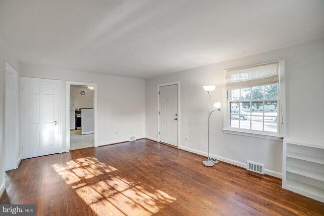
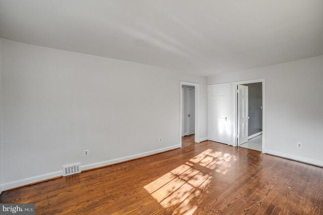
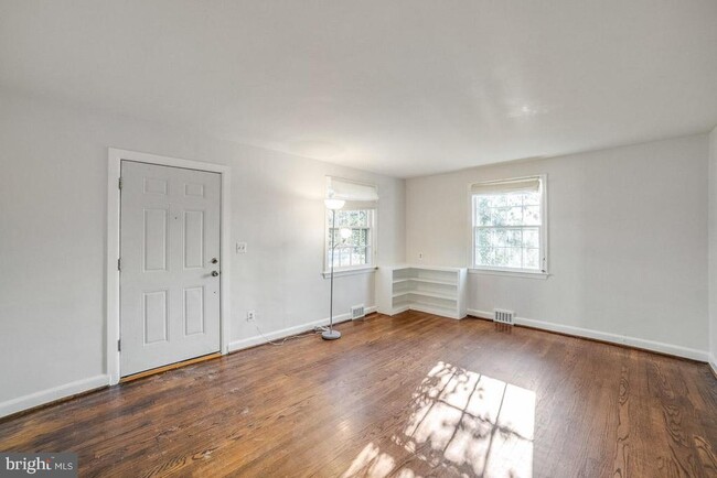
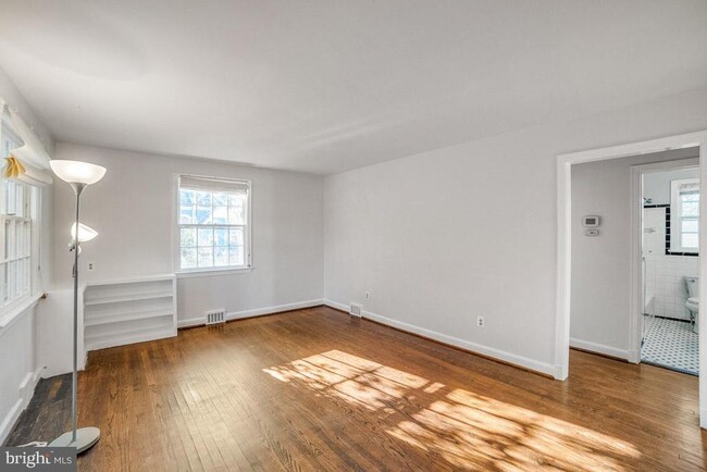
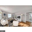
Cute Cape! Great Location! Falls Church City and FCC Schools! 8 blocks to West Falls Church Metro! Bus even closer! Single family with 2 BR on main level /1 Bath plus full upstairs with 2 additional rooms. Gas Furnace! 2 levels + unfin. basement with laundry. Central AC, hardwood floors, gas heat and gas cooking, New Gas range. New dishwasher, new sink, new counter ,new disposal. Whole upstairs finished and lots of storage. Large unfinished basement/outside entrance! New Washer/Dryer. Near bike trail, shopping and entertainment at Founder Row & Rte 495/66. Avail. July 1, 2024. No Smoking. NO Pets. 12 month lease term beginning July 1, 2024 . Additional follow on lease renewal possible. Use application and Credit feature in MLS. Adults on lease, must fill out RentSpree: to apply. Lots of room for the flower or vegetable gardener. Unfinished basement is great for projects, laundry and many other purposes. New concrete and railings for safety. Blocks to new fabulous Bike Trail and Falls Church Farmer's market. MT Daniel Elementary at end of street and playground! Ready to move in. Love your life! Leave the Car At Home! So close to Everything. Only 2 incomes will be used to review qualifications for rental. 3X rent to qualify. Tenants responsible for household maintenance, utilities and Yard and shrub upkeep, not included in rent.
601 N Oak St is a house located in Falls Church County and the 22046 ZIP Code. This area is served by the Falls Church City Public Schools attendance zone.
House Features
- Dishwasher
- Basement
Location
Get Directions
Spanning roughly two square miles, Falls Church is a quaint city with unique charm and an incredibly tight-knit community. With top-notch school systems, safe neighborhoods, and proximity to the nation’s capital, Falls Church is a highly sought-after area with immense desirability.
Known as “the little city,” Falls Church is regarded as the number one healthiest community in the country. It’s healthy, active residents push the community to thrive through their persistence for educational growth, community involvement, and the continual betterment of their city.
Public transportation, historic homes, shopping centers, community parks, local restaurants, and lively theaters line this city’s walkable streets. Delve into casual cuisine at Clare & Don’s Beach Shack, grab a craft beer at the Mad Fox Brewing Company, explore the Cherry Hill Farmhouse, or catch a live performance at the State Theatre. Just a quick commute to Washington D.C.
Learn more about living in Falls Church
Amenities
- Dishwasher
- Basement
Education
| Colleges & Universities | Distance | ||
|---|---|---|---|
| Colleges & Universities | Distance | ||
| Drive: | 8 min | 3.4 mi | |
| Drive: | 11 min | 5.0 mi | |
| Drive: | 13 min | 5.8 mi | |
| Drive: | 14 min | 6.7 mi |
601 N Oak St is within 8 minutes or 3.4 miles from Marymount University. It is also near George Mason Univ., Arlington and NOVA, Alexandira Campus.
Schools


Public Elementary School
Grades PK-6
872 Students
Nearby
Public Elementary School
Grades 3-5
526 Students
Attendance Zone
Public Elementary School
Grades K-2
461 Students
Attendance Zone
Public Middle School
Grades 6-8
581 Students
Attendance Zone
Public High School
Grades 9-12
865 Students
Attendance Zone
Private Elementary School
Grades PK-K
104 Students
Nearby
Private Elementary & Middle School
Grades K-8
419 Students
Nearby
Private High School
Grades 9-12
1,193 Students
Nearby
School data provided by
 The GreatSchools Rating helps parents compare schools within a state based on a variety of school quality indicators and provides a helpful picture of how effectively each school serves all of its students. Ratings are on a scale of 1 (below average) to 10 (above average) and can include test scores, college readiness, academic progress, advanced courses, equity, discipline and attendance data. We also advise parents to visit schools, consider other information on school performance and programs, and consider family needs as part of the school selection process.
View GreatSchools Rating Methodology
Data provided by GreatSchools.org © 2025. All rights reserved.
View GreatSchools Rating Methodology
Data provided by GreatSchools.org © 2025. All rights reserved.
Transportation options available in Falls Church include East Falls Church, Orange/Silver Line Center Platform, located 3.6 miles from 601 N Oak St. 601 N Oak St is near Ronald Reagan Washington Ntl, located 11.6 miles or 21 minutes away, and Washington Dulles International, located 18.5 miles or 33 minutes away.
| Transit / Subway | Distance | ||
|---|---|---|---|
| Transit / Subway | Distance | ||
| Drive: | 6 min | 3.6 mi | |
| Drive: | 8 min | 3.8 mi | |
| Drive: | 9 min | 4.0 mi | |
| Drive: | 12 min | 6.9 mi | |
| Drive: | 14 min | 8.2 mi |
| Commuter Rail | Distance | ||
|---|---|---|---|
| Commuter Rail | Distance | ||
|
|
Drive: | 19 min | 8.5 mi |
|
|
Drive: | 18 min | 10.2 mi |
|
|
Drive: | 19 min | 10.3 mi |
|
|
Drive: | 19 min | 10.3 mi |
|
|
Drive: | 21 min | 11.9 mi |
| Airports | Distance | ||
|---|---|---|---|
| Airports | Distance | ||
|
Ronald Reagan Washington Ntl
|
Drive: | 21 min | 11.6 mi |
|
Washington Dulles International
|
Drive: | 33 min | 18.5 mi |
Time and distance from 601 N Oak St.
| Shopping Centers | Distance | ||
|---|---|---|---|
| Shopping Centers | Distance | ||
| Walk: | 9 min | 0.5 mi | |
| Walk: | 13 min | 0.7 mi | |
| Walk: | 15 min | 0.8 mi |
601 N Oak St has 3 shopping centers within 0.8 mile, which is about a 15-minute walk. The miles and minutes will be for the farthest away property.
| Parks and Recreation | Distance | ||
|---|---|---|---|
| Parks and Recreation | Distance | ||
|
W&OD Trail
|
Walk: | 17 min | 0.9 mi |
|
Benjamin Banneker Park
|
Drive: | 4 min | 1.7 mi |
|
Parkhurst Park
|
Drive: | 7 min | 2.5 mi |
|
Rock Spring Park
|
Drive: | 6 min | 2.7 mi |
|
Upton Hill Regional Park
|
Drive: | 7 min | 3.0 mi |
601 N Oak St has 5 parks within 3.0 miles, including W&OD Trail, Benjamin Banneker Park, and Parkhurst Park.
| Hospitals | Distance | ||
|---|---|---|---|
| Hospitals | Distance | ||
| Drive: | 6 min | 2.4 mi | |
| Drive: | 8 min | 3.4 mi | |
| Drive: | 9 min | 3.5 mi |
601 N Oak St has 3 hospitals within 3.5 miles, the nearest is Dominion Hospital which is 2.4 miles away and a 6 minute drive.
| Military Bases | Distance | ||
|---|---|---|---|
| Military Bases | Distance | ||
| Drive: | 16 min | 7.3 mi |
601 N Oak St is 7.3 miles and a 16 minute drive from Fort Myer.
You May Also Like
Similar Rentals Nearby


What Are Walk Score®, Transit Score®, and Bike Score® Ratings?
Walk Score® measures the walkability of any address. Transit Score® measures access to public transit. Bike Score® measures the bikeability of any address.
What is a Sound Score Rating?
A Sound Score Rating aggregates noise caused by vehicle traffic, airplane traffic and local sources
601 N Oak St
Falls Church, VA 22046