
Hue39
3909 San Fernando Rd,
Glendale, CA 91204
$2,525 - $3,495
1-2 Beds


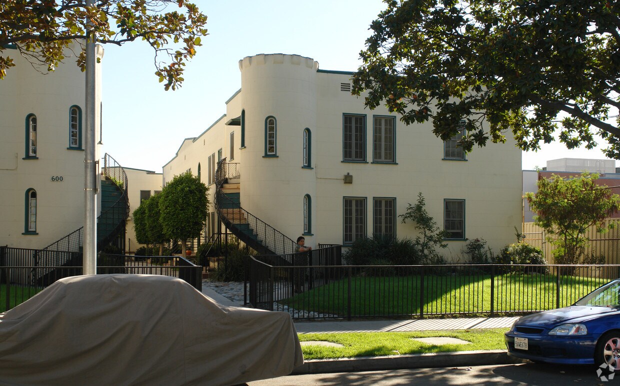
Discover your new home at 600 E Garfield Ave. You'll find this community in the Mariposa area of Glendale. Let the professional leasing staff show you everything this community has to offer. Drop by the leasing office to see available floor plans and find your new home at 600 E Garfield Ave.
600 E Garfield Ave is an apartment community located in Los Angeles County and the 91205 ZIP Code. This area is served by the Los Angeles Unified attendance zone.
Laundry Facilities
Recycling
Property Manager on Site
Storage Space
Air Conditioning
Dishwasher
Hardwood Floors
Granite Countertops
Mariposa is a small neighborhood in the San Fernando Valley. Complemented by neighborhood parks and views of the Verdugo Mountains, Mariposa features Mediterranean-style houses and townhomes and mid-century apartments. Although most rentals are priced in the mid-range to upscale, there are a few more affordable options available as well. Mariposa boasts an excellent location, bordering Downtown Glendale to the south, giving residents easy access to plenty of amenities like the Glendale Galleria and Americana at Brand, two massive centers for high-end retail, restaurants, and more. The neighborhood is also convenient to several Los Angeles local favorites including Griffith Park and Dodger Stadium, which are both under five miles away. Scenic backdrops, great location, and abundant amenities paired with excellent schools shape Mariposa as a family-friendly neighborhood, but any renter can enjoy living here.
Learn more about living in MariposaCompare neighborhood and city base rent averages by bedroom.
| Mariposa | Glendale, CA | |
|---|---|---|
| Studio | $1,310 | $2,020 |
| 1 Bedroom | $1,470 | $2,074 |
| 2 Bedrooms | $1,849 | $2,625 |
| 3 Bedrooms | $3,106 | $3,443 |
| Colleges & Universities | Distance | ||
|---|---|---|---|
| Colleges & Universities | Distance | ||
| Drive: | 7 min | 2.9 mi | |
| Drive: | 9 min | 3.5 mi | |
| Drive: | 10 min | 5.2 mi | |
| Drive: | 16 min | 8.1 mi |


Transportation options available in Glendale include Vermont/Sunset Station, located 4.4 miles from 600 E Garfield Ave. 600 E Garfield Ave is near Bob Hope, located 11.1 miles or 18 minutes away, and Los Angeles International, located 21.5 miles or 36 minutes away.
| Transit / Subway | Distance | ||
|---|---|---|---|
| Transit / Subway | Distance | ||
|
|
Drive: | 9 min | 4.4 mi |
|
|
Drive: | 11 min | 4.7 mi |
|
|
Drive: | 10 min | 5.0 mi |
|
|
Drive: | 11 min | 5.0 mi |
|
|
Drive: | 11 min | 5.6 mi |
| Commuter Rail | Distance | ||
|---|---|---|---|
| Commuter Rail | Distance | ||
|
|
Drive: | 4 min | 1.3 mi |
|
|
Drive: | 11 min | 5.7 mi |
|
|
Drive: | 16 min | 7.1 mi |
|
|
Drive: | 14 min | 7.4 mi |
| Drive: | 18 min | 11.5 mi |
| Airports | Distance | ||
|---|---|---|---|
| Airports | Distance | ||
|
Bob Hope
|
Drive: | 18 min | 11.1 mi |
|
Los Angeles International
|
Drive: | 36 min | 21.5 mi |
Time and distance from 600 E Garfield Ave.
| Shopping Centers | Distance | ||
|---|---|---|---|
| Shopping Centers | Distance | ||
| Walk: | 7 min | 0.4 mi | |
| Walk: | 9 min | 0.5 mi | |
| Walk: | 9 min | 0.5 mi |
| Parks and Recreation | Distance | ||
|---|---|---|---|
| Parks and Recreation | Distance | ||
|
Marsh Park
|
Drive: | 9 min | 3.2 mi |
|
Elyria Canyon Park
|
Drive: | 9 min | 3.8 mi |
|
Bird Sanctuary
|
Drive: | 10 min | 4.0 mi |
|
Los Angeles Zoo
|
Drive: | 14 min | 4.5 mi |
|
Griffith Park
|
Drive: | 23 min | 7.4 mi |
| Hospitals | Distance | ||
|---|---|---|---|
| Hospitals | Distance | ||
| Drive: | 3 min | 1.1 mi | |
| Drive: | 6 min | 2.2 mi | |
| Drive: | 9 min | 4.4 mi |
| Military Bases | Distance | ||
|---|---|---|---|
| Military Bases | Distance | ||
| Drive: | 33 min | 23.0 mi |
What Are Walk Score®, Transit Score®, and Bike Score® Ratings?
Walk Score® measures the walkability of any address. Transit Score® measures access to public transit. Bike Score® measures the bikeability of any address.
What is a Sound Score Rating?
A Sound Score Rating aggregates noise caused by vehicle traffic, airplane traffic and local sources
600 E Garfield Ave
Glendale, CA 91205


