
The Vitagraph
1277 E 14th St,
Brooklyn, NY 11230
$3,424 - $4,304
2-3 Beds

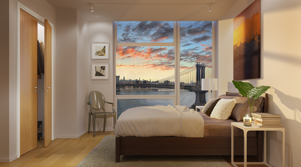
In Brooklyn’s historic waterfront neighborhood comes 60 Water– a remarkable, modern residence deserving of its landmark setting. Designed by LEESER Architecture, 60 Water offers residents a full-service luxury experience within 17 stories of all-glass, light-filled spaces complete with oak floors, solar shades, central AC, floor-to-ceiling windows, and expansive private terraces. Experience DUMBO living at its finest, from a landscaped roof deck designed by James Corner Field Operations of High Line fame, to the absolute best views of the Brooklyn Bridge, East River, and Manhattan skyline. Diplomats welcome with requirements
60 Water Street is an apartment community located in Kings County and the 11201 ZIP Code. This area is served by the New York City Geographic District #13 attendance zone.
Unique Features
Fitness Center
Elevator
Roof Terrace
24 Hour Access
Washer/Dryer
Air Conditioning
Dishwasher
Hardwood Floors
Sandwiched between the Brooklyn Bridge and the Manhattan Bridge, this tiny waterfront neighborhood began as an industrial area in the 19th century. Local lore says that when artists moved into the neglected Victorian factories in the late '70s, they dubbed the area Down Under Manhattan Bridge Overpass, or DUMBO, as counter-branding to thwart potential developers. Today, the renovated factories have transformed into apartments and lofts, many retaining original timber beams and red brick walls. In addition to the historic digs and cobblestone streets, residents list short commutes to Manhattan as a major draw, with 10-minute subway rides to the Lower East Side and 20-minute rides to Midtown.
Encircled by parks and bike paths, DUMBO offers grassy lawns and sweeping views of the East River. The area remains home to many art galleries, as well as St. Ann's Warehouse, a performing arts venue.
Learn more about living in DUMBOCompare neighborhood and city base rent averages by bedroom.
| DUMBO | Brooklyn, NY | |
|---|---|---|
| Studio | $3,930 | $2,680 |
| 1 Bedroom | $4,942 | $3,031 |
| 2 Bedrooms | $6,928 | $3,947 |
| 3 Bedrooms | $8,824 | $4,907 |
| Colleges & Universities | Distance | ||
|---|---|---|---|
| Colleges & Universities | Distance | ||
| Walk: | 12 min | 0.6 mi | |
| Drive: | 3 min | 1.1 mi | |
| Drive: | 3 min | 1.2 mi | |
| Drive: | 4 min | 1.4 mi |


Transportation options available in Brooklyn include York Street, located 0.4 mile from 60 Water Street. 60 Water Street is near LaGuardia, located 10.2 miles or 19 minutes away, and Newark Liberty International, located 14.5 miles or 25 minutes away.
| Transit / Subway | Distance | ||
|---|---|---|---|
| Transit / Subway | Distance | ||
|
|
Walk: | 7 min | 0.4 mi |
|
|
Walk: | 7 min | 0.4 mi |
|
|
Walk: | 11 min | 0.6 mi |
| Walk: | 15 min | 0.8 mi | |
|
|
Drive: | 3 min | 1.1 mi |
| Commuter Rail | Distance | ||
|---|---|---|---|
| Commuter Rail | Distance | ||
|
|
Drive: | 7 min | 2.4 mi |
|
|
Drive: | 11 min | 3.5 mi |
|
|
Drive: | 11 min | 3.6 mi |
|
|
Drive: | 12 min | 4.2 mi |
|
|
Drive: | 17 min | 6.2 mi |
| Airports | Distance | ||
|---|---|---|---|
| Airports | Distance | ||
|
LaGuardia
|
Drive: | 19 min | 10.2 mi |
|
Newark Liberty International
|
Drive: | 25 min | 14.5 mi |
Scores provided by
Traffic
-Airport
-Businesses
-Scores provided by
HowLoud What is a Sound Score Rating? A Sound Score Rating aggregates noise caused by vehicle traffic, airplane traffic and local sources. How It WorksTime and distance from 60 Water Street.
| Shopping Centers | Distance | ||
|---|---|---|---|
| Shopping Centers | Distance | ||
| Walk: | 16 min | 0.8 mi | |
| Drive: | 6 min | 2.3 mi |
| Parks and Recreation | Distance | ||
|---|---|---|---|
| Parks and Recreation | Distance | ||
|
Brooklyn Bridge Park
|
Walk: | 8 min | 0.4 mi |
|
Cadman Plaza Park
|
Walk: | 9 min | 0.5 mi |
|
Commodore Barry Park
|
Drive: | 4 min | 1.4 mi |
|
Cobble Hill Park
|
Drive: | 4 min | 1.6 mi |
|
City Hall Park
|
Drive: | 5 min | 2.0 mi |
| Hospitals | Distance | ||
|---|---|---|---|
| Hospitals | Distance | ||
| Drive: | 5 min | 1.8 mi | |
| Drive: | 8 min | 3.2 mi | |
| Drive: | 10 min | 4.0 mi |
| Military Bases | Distance | ||
|---|---|---|---|
| Military Bases | Distance | ||
| Drive: | 11 min | 4.3 mi | |
| Drive: | 23 min | 11.9 mi | |
| Drive: | 22 min | 12.3 mi |
What Are Walk Score®, Transit Score®, and Bike Score® Ratings?
Walk Score® measures the walkability of any address. Transit Score® measures access to public transit. Bike Score® measures the bikeability of any address.
What is a Sound Score Rating?
A Sound Score Rating aggregates noise caused by vehicle traffic, airplane traffic and local sources.
60 Water St
Brooklyn, NY 11201


