
$1,200
/ Month
6 Main St
Unionville, NY 10988
2 Weeks Ago
|
Edit
Favorites
6 Main St

Favorites
Check Back Soon for Upcoming Availability
| Beds | Baths | Average SF |
|---|---|---|
| 1 Bedroom 1 Bedroom 1 Br | 1 Bath 1 Bath 1 Ba | 800 SF |
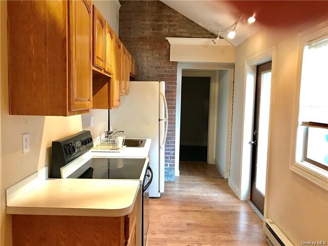
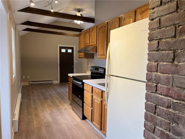
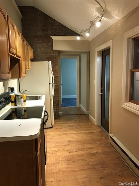
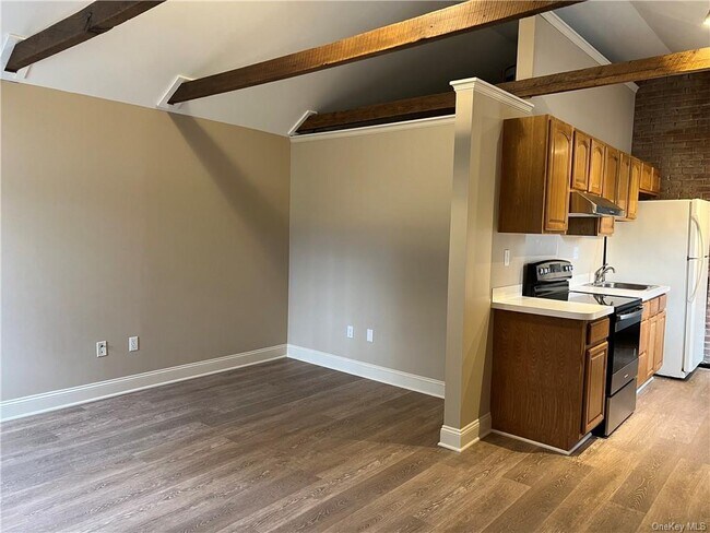
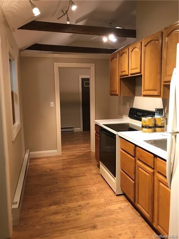
About This Property
Cozy and Charming! Exposed brick and beams in this very clean first floor apartment with large livingroom. Based on information submitted to the MLS GRID as of [see last changed date above]. All data is obtained from various sources and may not have been verified by broker or MLS GRID. Supplied Open House Information is subject to change without notice. All information should be independently reviewed and verified for accuracy. Properties may or may not be listed by the office/agent presenting the information. Some IDX listings have been excluded from this website. Prices displayed on all Sold listings are the Last Known Listing Price and may not be the actual selling price.
6 Main St is an apartment community located in Orange County and the 10988 ZIP Code.
6 Main St,
Unionville,
NY
10988
Education
| Colleges & Universities | Distance | ||
|---|---|---|---|
| Colleges & Universities | Distance | ||
| Drive: | 55 min | 35.5 mi | |
| Drive: | 59 min | 37.2 mi | |
| Drive: | 67 min | 48.9 mi | |
| Drive: | 71 min | 51.0 mi |
6 Main St is within 55 minutes or 35.5 miles from Passaic County C.C., Wanaque. It is also near Ramapo College of New Jersey and SUNY Rockland.
Walkability Near 6 Main St Unionville, NY 10988
Getting Around
 What do Walkability, Transit, Drivability, and Bikeability mean?
Walkability measures the walking distance to day-to-day needs.
Transit measures access to public transportation.
Drivability measures congestion, parking availability, and access to major roads.
Bikeability measures the suitability for cycling.
How It Works
What do Walkability, Transit, Drivability, and Bikeability mean?
Walkability measures the walking distance to day-to-day needs.
Transit measures access to public transportation.
Drivability measures congestion, parking availability, and access to major roads.
Bikeability measures the suitability for cycling.
How It Works
Somewhat Walkable
Walkability
20
/ 100
Exceptionally Drivable
Drivability
100
/ 100
Somewhat Bikeable
Bikeability
20
/ 100
Scores provided by
-
Soundscore™
-
/ 100
Traffic
-Airport
-Businesses
-Scores provided by
HowLoud What is a Sound Score Rating? A Sound Score Rating aggregates noise caused by vehicle traffic, airplane traffic and local sources. How It WorksYou May Also Like
Similar Rentals Nearby
-
-
-
-
-
-
-
2 Beds$2,200Total Monthly Price12 Month LeaseTotal Monthly Price NewPrices include all required monthly fees.Specials
-
2 Beds$2,150Total Monthly Price12 Month LeaseTotal Monthly Price NewPrices include all required monthly fees.Specials
-
-


What Are Walk Score®, Transit Score®, and Bike Score® Ratings?
Walk Score® measures the walkability of any address. Transit Score® measures access to public transit. Bike Score® measures the bikeability of any address.
What is a Sound Score Rating?
A Sound Score Rating aggregates noise caused by vehicle traffic, airplane traffic and local sources.
6 Main St
Unionville, NY 10988