

$1,650
/ Month
6 Laramie Ln
Little Rock, AR 72211
Favorites
501-416-5163
-
Bedrooms
3
-
Bathrooms
2
-
Square Feet
--
-
Available
Available Now
6 Laramie Ln

Favorites
About This Home
$1,650 deposit,
Available Now
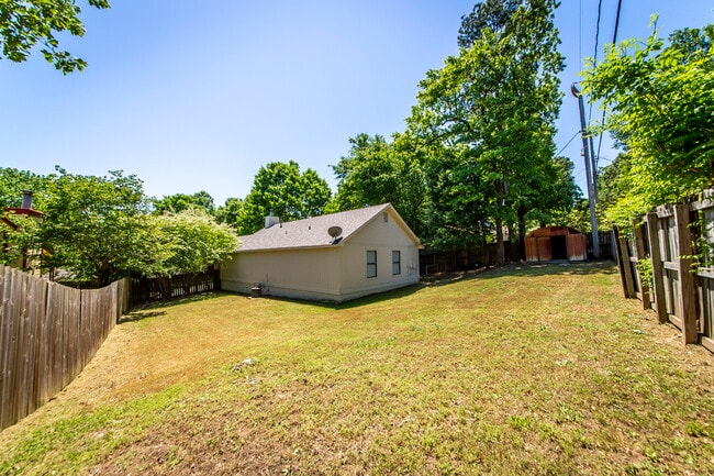
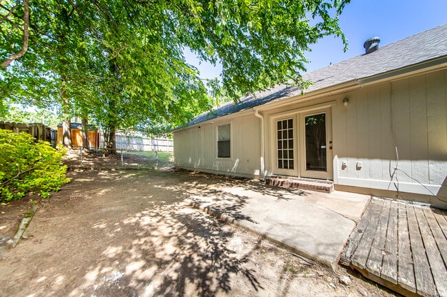
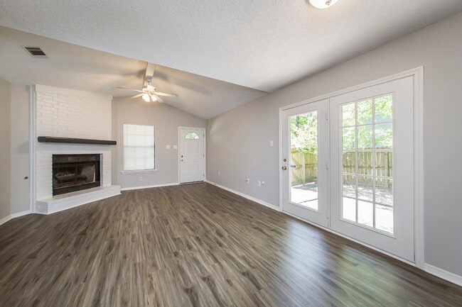
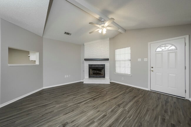
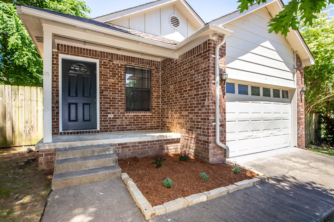
This 3 bedroom 2 bathroom home is conveniently located in the Point West neighborhood of WLR. Many updates include modern flooring and countertops, new paint, new stove and dishwasher. Washer/Dryer hookups. Pets allowed with preapproval and additional pet fee is required. One year lease.
6 Laramie Ln is a house located in Pulaski County and the 72211 ZIP Code. This area is served by the Little Rock School District attendance zone.
* Price shown is base rent. Excludes user-selected optional fees and variable or usage-based fees and required charges due at or prior to move-in or at move-out. Price, availability, fees, and any applicable rent special are subject to change without notice.
* Square footage definitions vary. Displayed square footage is approximate.
Fees and Policies
The fees listed below are community-provided and may exclude utilities or add-ons. All payments are made directly to the property and are non-refundable unless otherwise specified. Use the Cost Calculator to determine costs based on your needs.
-
One-Time Basics
-
Due at Move-In
-
Security Deposit - RefundableCharged per unit.$1,650
-
-
Due at Move-In
Property Fee Disclaimer: Based on community-supplied data and independent market research. Subject to change without notice. May exclude fees for mandatory or optional services and usage-based utilities.
Contact
- Listed by Sarah Eddleman
- Phone Number
- Contact
Location
Get Directions
West Little Rock is comprised of a vast swath of land stretching from Interstate 430 out towards Williams Junction and over Lake Maumelle. There’s an incredible variety of neighborhoods, communities, and landscapes in what’s considered West Little Rock, including waterfront communities on the lake, pastoral reprieves of the Arkansas countryside, and the more suburban communities nearing the city center. There’s a little something for everyone in West Little Rock, but most renters will be enticed by the apartment communities and affordable renters just west of the Interstate that mix the serenity of living outside the city while still being close enough to enjoy its amenities.
Learn more about living in West Little Rock
Education
| Colleges & Universities | Distance | ||
|---|---|---|---|
| Colleges & Universities | Distance | ||
| Drive: | 12 min | 6.4 mi | |
| Drive: | 13 min | 6.6 mi | |
| Drive: | 14 min | 8.6 mi | |
| Drive: | 24 min | 15.2 mi |
6 Laramie Ln is within 12 minutes or 6.4 miles from UA Little Rock. It is also near Univ. of Ark. Medical Scis. and Philander Smith College.
Schools


Public Elementary School
Grades K-5
314 Students
Attendance Zone
Public Elementary School
Grades PK-5
402 Students
Nearby
Public Middle School
Grades 6-8
833 Students
Attendance Zone
Public Middle School
Grades 6-8
1,352 Students
Nearby
Public High School
Grades 9-12
338 Students
Attendance Zone
Private Elementary School
Grades PK-5
24 Students
Nearby
Private Elementary, Middle & High School
Grades PK-12
52 Students
Nearby
School data provided by
 The GreatSchools Rating helps parents compare schools within a state based on a variety of school quality indicators and provides a helpful picture of how effectively each school serves all of its students. Ratings are on a scale of 1 (below average) to 10 (above average) and can include test scores, college readiness, academic progress, advanced courses, equity, discipline and attendance data. We also advise parents to visit schools, consider other information on school performance and programs, and consider family needs as part of the school selection process.
View GreatSchools Rating Methodology
Data provided by GreatSchools.org © 2026. All rights reserved.
View GreatSchools Rating Methodology
Data provided by GreatSchools.org © 2026. All rights reserved.
Transportation options available in Little Rock include 2Nd St & Center St, located 9.4 miles from 6 Laramie Ln. 6 Laramie Ln is near Bill and Hillary Clinton Ntl/Adams Field, located 13.2 miles or 21 minutes away.
| Transit / Subway | Distance | ||
|---|---|---|---|
| Transit / Subway | Distance | ||
| Drive: | 15 min | 9.4 mi | |
| Drive: | 15 min | 9.4 mi | |
| Drive: | 15 min | 9.7 mi | |
| Drive: | 16 min | 9.8 mi | |
| Drive: | 16 min | 10.1 mi |
| Commuter Rail | Distance | ||
|---|---|---|---|
| Commuter Rail | Distance | ||
|
|
Drive: | 15 min | 8.5 mi |
|
|
Drive: | 50 min | 41.8 mi |
| Airports | Distance | ||
|---|---|---|---|
| Airports | Distance | ||
|
Bill and Hillary Clinton Ntl/Adams Field
|
Drive: | 21 min | 13.2 mi |
Getting Around
 What do Walkability, Transit, Drivability, and Bikeability mean?
Walkability measures the walking distance to day-to-day needs.
Transit measures access to public transportation.
Drivability measures congestion, parking availability, and access to major roads.
Bikeability measures the suitability for cycling.
How It Works
What do Walkability, Transit, Drivability, and Bikeability mean?
Walkability measures the walking distance to day-to-day needs.
Transit measures access to public transportation.
Drivability measures congestion, parking availability, and access to major roads.
Bikeability measures the suitability for cycling.
How It Works
Fairly Walkable
Walkability
40
/ 100
Minimal Public Transit
Transit
0
/ 100
Exceptionally Drivable
Drivability
90
/ 100
Somewhat Bikeable
Bikeability
30
/ 100
Scores provided by
-
Soundscore™
-
/ 100
Traffic
-Airport
-Businesses
-Scores provided by
HowLoud What is a Sound Score Rating? A Sound Score Rating aggregates noise caused by vehicle traffic, airplane traffic and local sources. How It WorksTime and distance from 6 Laramie Ln.
| Shopping Centers | Distance | ||
|---|---|---|---|
| Shopping Centers | Distance | ||
| Walk: | 15 min | 0.8 mi | |
| Walk: | 15 min | 0.8 mi | |
| Walk: | 18 min | 0.9 mi |
6 Laramie Ln has 3 shopping centers within 0.9 mile, which is about a 18-minute walk. The miles and minutes will be for the farthest away property.
| Parks and Recreation | Distance | ||
|---|---|---|---|
| Parks and Recreation | Distance | ||
|
Little Rock Zoo
|
Drive: | 11 min | 5.8 mi |
|
Central High School National Historic Site
|
Drive: | 13 min | 7.6 mi |
|
Museum of Discovery
|
Drive: | 16 min | 9.9 mi |
|
Pinnacle Mountain State Park
|
Drive: | 25 min | 11.0 mi |
|
Burns Park
|
Drive: | 20 min | 12.4 mi |
6 Laramie Ln has 5 parks within 12.4 miles, including Little Rock Zoo, Central High School National Historic Site, and Museum of Discovery.
| Hospitals | Distance | ||
|---|---|---|---|
| Hospitals | Distance | ||
| Drive: | 5 min | 1.8 mi | |
| Drive: | 11 min | 6.2 mi | |
| Drive: | 12 min | 6.4 mi |
6 Laramie Ln has 3 hospitals within 6.4 miles, the nearest is Arkansas Heart Hospital which is 1.8 miles away and a 5 minute drive.
| Military Bases | Distance | ||
|---|---|---|---|
| Military Bases | Distance | ||
| Drive: | 36 min | 19.5 mi | |
| Drive: | 41 min | 27.1 mi | |
| Drive: | 43 min | 27.5 mi |
6 Laramie Ln has 3 military bases within 27.5 miles, the nearest is Camp Joseph T. Robinson Hill which is 19.5 miles away and a 36 minute drive.
You May Also Like
Similar Rentals Nearby


What Are Walk Score®, Transit Score®, and Bike Score® Ratings?
Walk Score® measures the walkability of any address. Transit Score® measures access to public transit. Bike Score® measures the bikeability of any address.
What is a Sound Score Rating?
A Sound Score Rating aggregates noise caused by vehicle traffic, airplane traffic and local sources.
6 Laramie Ln
Little Rock, AR 72211