
$2,550
Total Monthly Price
12 Month Lease
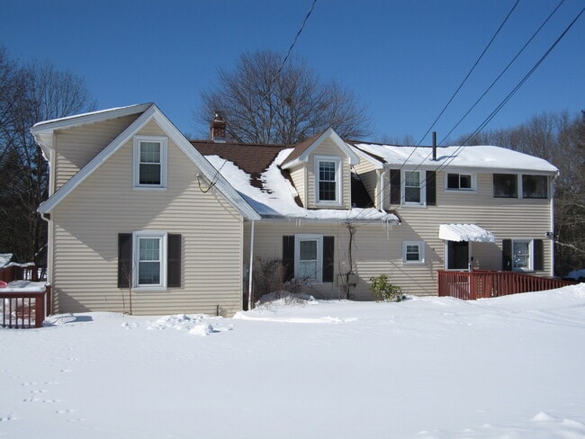
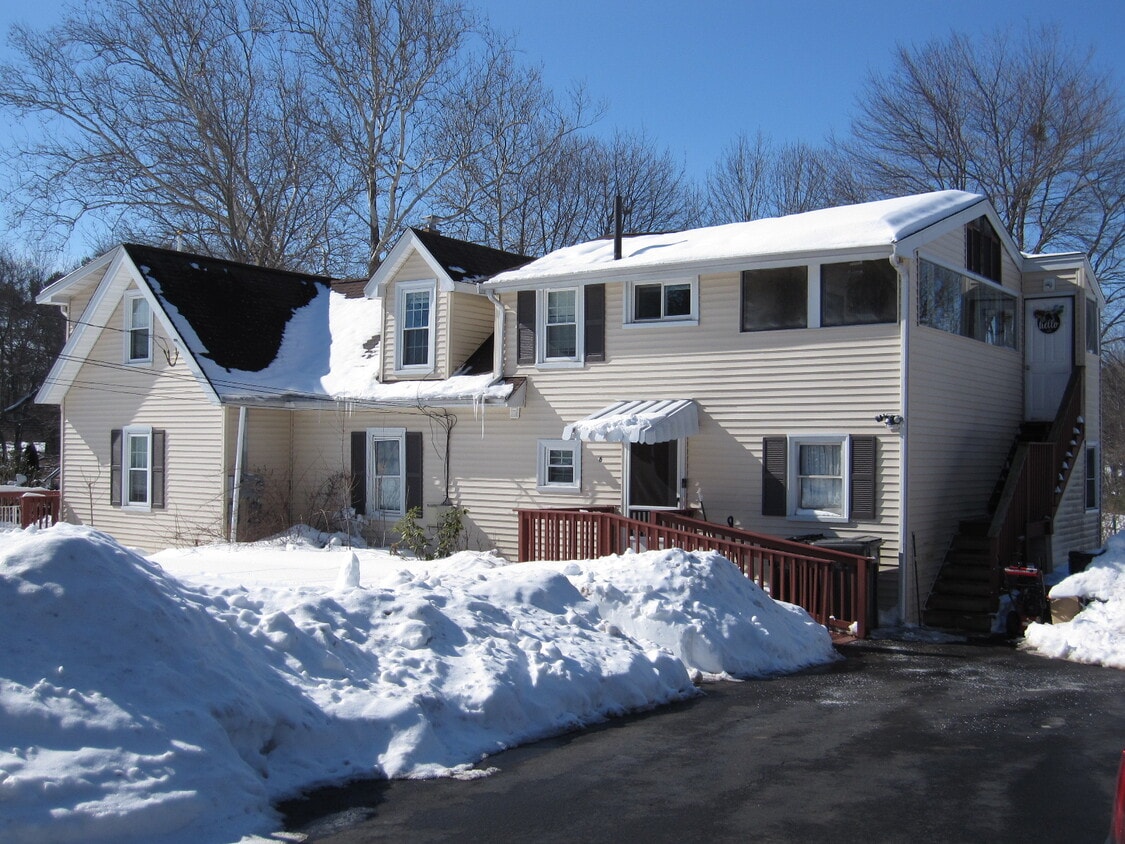
6 Cart Path Unit 2
Framingham, MA 01701
Today
|
Edit
Favorites
-
Bedrooms
2
-
Bathrooms
1
-
Square Feet
865 sq ft
-
Available
Available Now
Highlight
- Pets Allowed
6 Cart Path Unit 2

Favorites
About This Home
12 Month Lease
,
Available Now
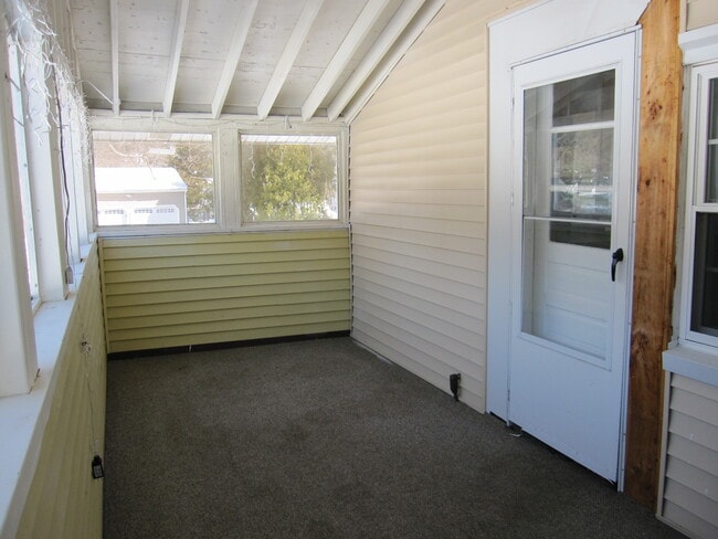
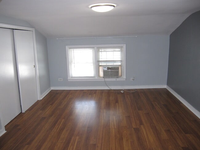
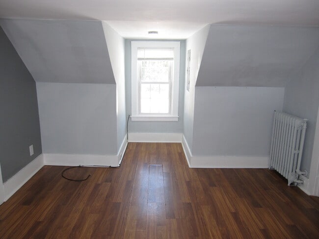
This is an updated north side two-bedroom apartment with easy access to everything. A sun filled unit and located on a cu-de-sac this apartment offering a very private setting. There is a large eat-in kitchen with updated birch cabinets. The living room is large and has a reading nook plus to large bedrooms. There is engineered flooring throughout, an enclosed three-season porch, and vinyl replacement windows. Close to parks, shopping, and highway. THE RENT INCLUDES HEAT, HOT WATER, WATER, SEWER, AND LANDSCAPING.
6 Cart Path is an apartment community located in Middlesex County and the 01701 ZIP Code. This area is served by the Framingham attendance zone.
* Price shown is total price based on community-supplied monthly required fees. Excludes user-selected optional fees and variable or usage-based fees and required charges due at or prior to move-in or at move-out. Price, availability, fees, and any applicable rent special are subject to change without notice.
* Square footage definitions vary. Displayed square footage is approximate.
Apartment Features
Washer/Dryer Hookup
Refrigerator
Heating
Range
- Washer/Dryer Hookup
- Heating
- Eat-in Kitchen
- Kitchen
- Range
- Refrigerator
- Instant Hot Water
- Large Bedrooms
- Porch
Fees and Policies
The fees listed below are community-provided and may exclude utilities or add-ons. All payments are made directly to the property and are non-refundable unless otherwise specified.
- One-Time Move-In Fees
-
Broker Fee$0
- Dogs Allowed
-
Fees not specified
- Cats Allowed
-
Fees not specified
- Parking
-
Surface Lot--
Details
Utilities Included
-
Water
-
Heat
-
Trash Removal
-
Sewer
Property Information
-
2 units
Contact
- Contact
Location
Get Directions
Just west of Boston and East of Worcester sits Metro West, a region that houses a group of towns and cities with significant historical backgrounds. A total of 19 municipalities make up the core of this community, but other municipalities are considered to be a part of the Interstate 495/Metro West Corridor.
Learn more about living in Metro West
Education
| Colleges & Universities | Distance | ||
|---|---|---|---|
| Colleges & Universities | Distance | ||
| Drive: | 7 min | 3.5 mi | |
| Drive: | 18 min | 8.1 mi | |
| Drive: | 22 min | 9.7 mi | |
| Drive: | 22 min | 9.8 mi |
6 Cart Path Unit 2 is within 7 minutes or 3.5 miles from Framingham State College. It is also near Wellesley College and Babson College.
Schools


Public Elementary School
Grades K-5
322 Students
Attendance Zone
Public Elementary School
Grades K-5
500 Students
Attendance Zone
Public Elementary School
Grades PK-5
509 Students
Nearby
Public Middle School
Grades 6-8
550 Students
Attendance Zone
Public Middle School
Grades 6-8
726 Students
Attendance Zone
Public High School
Grades 9-12
2,271 Students
Attendance Zone
Private Elementary School
Grades PK-5
27 Students
Nearby
Private Elementary & Middle School
Grades PK-8
247 Students
Nearby
Private Middle & High School
Grades 6-11
14 Students
Nearby
Private High School
Grades 9-12
227 Students
Nearby
School data provided by
 The GreatSchools Rating helps parents compare schools within a state based on a variety of school quality indicators and provides a helpful picture of how effectively each school serves all of its students. Ratings are on a scale of 1 (below average) to 10 (above average) and can include test scores, college readiness, academic progress, advanced courses, equity, discipline and attendance data. We also advise parents to visit schools, consider other information on school performance and programs, and consider family needs as part of the school selection process.
View GreatSchools Rating Methodology
Data provided by GreatSchools.org © 2026. All rights reserved.
View GreatSchools Rating Methodology
Data provided by GreatSchools.org © 2026. All rights reserved.
Transportation options available in Framingham include Riverside Station, located 11.2 miles from 6 Cart Path Unit 2. 6 Cart Path Unit 2 is near General Edward Lawrence Logan International, located 24.3 miles or 37 minutes away, and Worcester Regional, located 27.4 miles or 47 minutes away.
| Transit / Subway | Distance | ||
|---|---|---|---|
| Transit / Subway | Distance | ||
|
|
Drive: | 19 min | 11.2 mi |
|
|
Drive: | 20 min | 11.5 mi |
|
|
Drive: | 23 min | 12.1 mi |
|
|
Drive: | 21 min | 12.2 mi |
| Commuter Rail | Distance | ||
|---|---|---|---|
| Commuter Rail | Distance | ||
|
|
Drive: | 10 min | 4.4 mi |
|
|
Drive: | 10 min | 4.5 mi |
|
|
Drive: | 12 min | 5.1 mi |
|
|
Drive: | 11 min | 5.3 mi |
|
|
Drive: | 19 min | 8.0 mi |
| Airports | Distance | ||
|---|---|---|---|
| Airports | Distance | ||
|
General Edward Lawrence Logan International
|
Drive: | 37 min | 24.3 mi |
|
Worcester Regional
|
Drive: | 47 min | 27.4 mi |
Time and distance from 6 Cart Path Unit 2.
| Shopping Centers | Distance | ||
|---|---|---|---|
| Shopping Centers | Distance | ||
| Walk: | 11 min | 0.6 mi | |
| Walk: | 20 min | 1.0 mi | |
| Drive: | 5 min | 2.2 mi |
6 Cart Path Unit 2 has 3 shopping centers within 2.2 miles, which is about a 5-minute drive. The miles and minutes will be for the farthest away property.
| Parks and Recreation | Distance | ||
|---|---|---|---|
| Parks and Recreation | Distance | ||
|
Garden in the Woods
|
Drive: | 7 min | 2.7 mi |
|
Nobscot Scout Reservation
|
Drive: | 6 min | 2.9 mi |
|
Hop Brook Natural Area
|
Drive: | 8 min | 3.0 mi |
|
Lyons-Cutler Reservation
|
Drive: | 9 min | 4.3 mi |
|
Cochituate State Park
|
Drive: | 18 min | 10.7 mi |
6 Cart Path Unit 2 has 5 parks within 10.7 miles, including Garden in the Woods, Cochituate State Park, and Nobscot Scout Reservation.
| Hospitals | Distance | ||
|---|---|---|---|
| Hospitals | Distance | ||
| Drive: | 9 min | 4.5 mi | |
| Drive: | 20 min | 9.0 mi | |
| Drive: | 19 min | 11.2 mi |
6 Cart Path Unit 2 has 3 hospitals within 11.2 miles, the nearest is MetroWest Medical Center which is 4.5 miles away and a 9 minute drive.
| Military Bases | Distance | ||
|---|---|---|---|
| Military Bases | Distance | ||
| Drive: | 11 min | 4.9 mi | |
| Drive: | 29 min | 14.7 mi |
6 Cart Path Unit 2 is 4.9 miles from US Military Reservation, and is convenient to other military bases, including Hanscom Air Force Base.
Amenities
- Washer/Dryer Hookup
- Heating
- Eat-in Kitchen
- Kitchen
- Range
- Refrigerator
- Instant Hot Water
- Large Bedrooms
- Porch
6 Cart Path Unit 2 Photos
What Are Walk Score®, Transit Score®, and Bike Score® Ratings?
Walk Score® measures the walkability of any address. Transit Score® measures access to public transit. Bike Score® measures the bikeability of any address.
What is a Sound Score Rating?
A Sound Score Rating aggregates noise caused by vehicle traffic, airplane traffic and local sources
6 Cart Path
Framingham, MA 01701