-
-
-
-
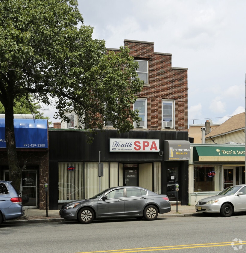
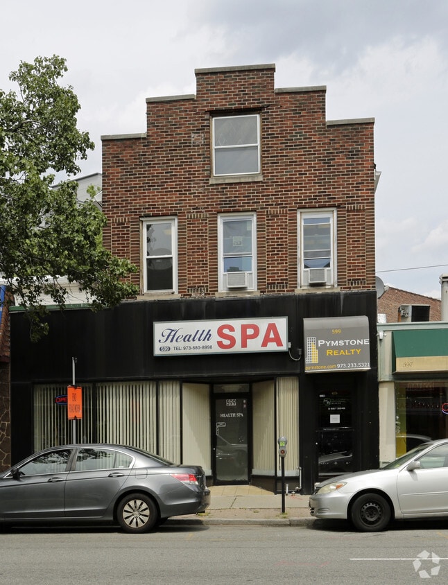
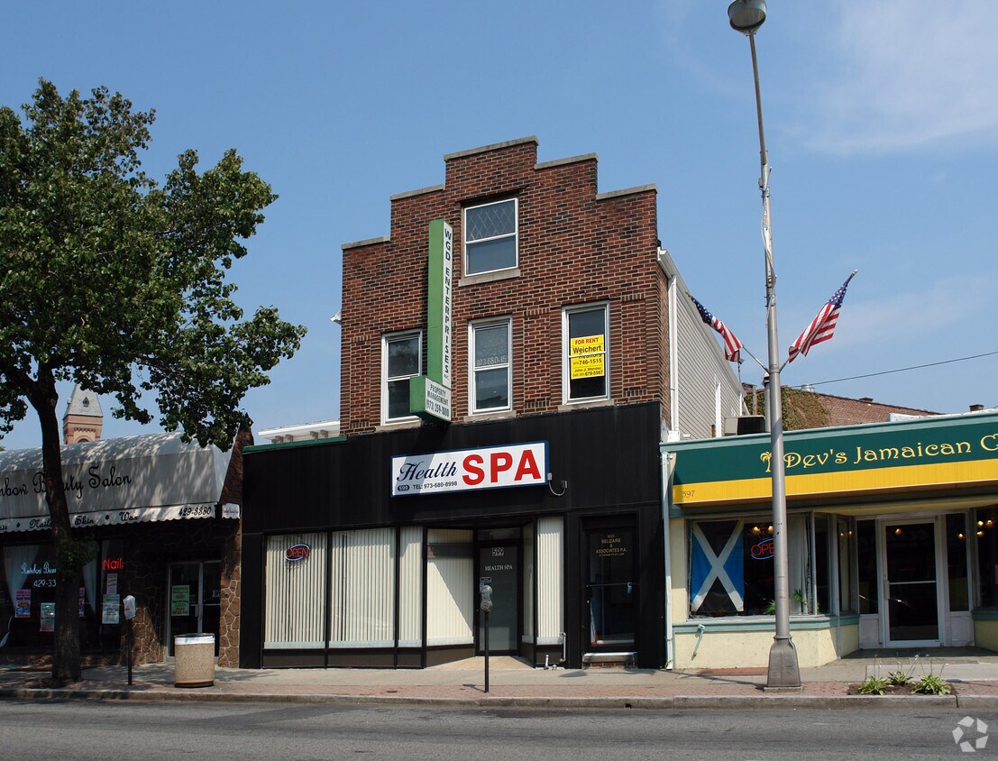
Primary Photo
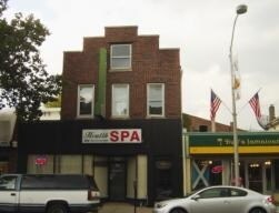
599 Bloomfield Ave
599 Bloomfield Ave,
Bloomfield,
NJ
07003
2 Weeks Ago
Favorites
599 Bloomfield Ave
Favorites
Check Back Soon for Upcoming Availability
Fees and Policies
Details
Property Information
-
Built in 1929
-
4 units/2 stories
About 599 Bloomfield Ave Bloomfield, NJ 07003
Come enjoy Bloomfield living at 599 Bloomfield Ave. You'll find this community in the 07003 area of Bloomfield. The professional leasing staff is ready to show you our community. Drop by the leasing office to learn more about our community and find your new place at 599 Bloomfield Ave.
599 Bloomfield Ave is an apartment community located in Essex County and the 07003 ZIP Code. This area is served by the Bloomfield Board Of Education attendance zone.
Apartment Features
- Vinyl Flooring
- Office
Location
Get Directions
Stretched along the Garden State Parkway, the Township of Bloomfield sits in Essex County adjacent to the Township of Montclair. Bloomfield is regarded as an up-and-coming area, boasting convenient access to New York City via major roadways, highways, buses, trains, commuter rail, and light rail. Bloomfield is also close to two major airports, Newark Liberty International and LaGuardia.
In addition to its central locale, Bloomfield offers residents access to a wide range of amenities and services. Quaint shops, cafes, and restaurants line the downtown area on Broad Street in Bloomfield. Large local parks such as Brookdale and Watsessing provide plenty of options for outdoor recreation as well as the behemoth neighbors of South Mountain Reservation and Eagle Rock Reservation. Bloomfield’s appeal is as diverse as its population and offerings, with the township experiencing record growth in residential, retail, and entertainment venues.
Learn more about living in Bloomfield
Amenities
- Vinyl Flooring
- Office
Education
| Colleges & Universities | Distance | ||
|---|---|---|---|
| Colleges & Universities | Distance | ||
| Walk: | 6 min | 0.3 mi | |
| Drive: | 7 min | 4.0 mi | |
| Drive: | 8 min | 4.2 mi | |
| Drive: | 8 min | 4.5 mi |
599 Bloomfield Ave is within 6 minutes or 0.3 mile from Bloomfield College. It is also near Rutgers, Newark Campus and N.J. Inst. of Technology.
Schools

Public Elementary School
Grades PK-2
154 Students
Nearby
Public Elementary School
Grades PK-6
493 Students
Attendance Zone
Public Middle School
Grades 7-8
965 Students
Attendance Zone
Public High School
Grades 9-12
2,029 Students
Attendance Zone
Private Elementary, Middle & High School
Grades K-12
57 Students
Nearby
Private Elementary School
Grades PK-5
Nearby
School data provided by
 The GreatSchools Rating helps parents compare schools within a state based on a variety of school quality indicators and provides a helpful picture of how effectively each school serves all of its students. Ratings are on a scale of 1 (below average) to 10 (above average) and can include test scores, college readiness, academic progress, advanced courses, equity, discipline and attendance data. We also advise parents to visit schools, consider other information on school performance and programs, and consider family needs as part of the school selection process.
View GreatSchools Rating Methodology
Data provided by GreatSchools.org © 2025. All rights reserved.
View GreatSchools Rating Methodology
Data provided by GreatSchools.org © 2025. All rights reserved.
Transportation options available in Bloomfield include Grove Street, located 1.3 miles from 599 Bloomfield Ave. 599 Bloomfield Ave is near Newark Liberty International, located 9.8 miles or 16 minutes away, and LaGuardia, located 25.7 miles or 44 minutes away.
| Transit / Subway | Distance | ||
|---|---|---|---|
| Transit / Subway | Distance | ||
|
|
Drive: | 2 min | 1.3 mi |
|
|
Drive: | 4 min | 1.7 mi |
|
|
Drive: | 4 min | 1.8 mi |
|
|
Drive: | 4 min | 1.9 mi |
|
|
Drive: | 3 min | 2.2 mi |
| Commuter Rail | Distance | ||
|---|---|---|---|
| Commuter Rail | Distance | ||
|
|
Walk: | 6 min | 0.3 mi |
|
|
Walk: | 11 min | 0.6 mi |
|
|
Drive: | 2 min | 1.2 mi |
|
|
Drive: | 2 min | 1.2 mi |
|
|
Drive: | 4 min | 2.0 mi |
| Airports | Distance | ||
|---|---|---|---|
| Airports | Distance | ||
|
Newark Liberty International
|
Drive: | 16 min | 9.8 mi |
|
LaGuardia
|
Drive: | 44 min | 25.7 mi |
Time and distance from 599 Bloomfield Ave.
| Shopping Centers | Distance | ||
|---|---|---|---|
| Shopping Centers | Distance | ||
| Drive: | 3 min | 1.3 mi | |
| Drive: | 2 min | 1.3 mi | |
| Drive: | 3 min | 1.6 mi |
599 Bloomfield Ave has 3 shopping centers within 1.6 miles, which is about a 3-minute drive. The miles and minutes will be for the farthest away property.
| Parks and Recreation | Distance | ||
|---|---|---|---|
| Parks and Recreation | Distance | ||
|
Van Vleck House & Gardens
|
Drive: | 4 min | 2.6 mi |
|
Branch Brook Park
|
Drive: | 6 min | 2.9 mi |
|
Edison National Historic Site
|
Drive: | 8 min | 3.4 mi |
|
Newark Museum and Dreyfuss Planetarium
|
Drive: | 7 min | 4.1 mi |
|
Presby Memorial Iris Gardens
|
Drive: | 8 min | 4.7 mi |
599 Bloomfield Ave has 5 parks within 4.7 miles, including Branch Brook Park, Van Vleck House & Gardens, and Edison National Historic Site.
| Hospitals | Distance | ||
|---|---|---|---|
| Hospitals | Distance | ||
| Drive: | 5 min | 3.2 mi | |
| Drive: | 7 min | 4.0 mi | |
| Drive: | 7 min | 4.4 mi |
599 Bloomfield Ave has 3 hospitals within 4.4 miles, the nearest is East Orange General Hospital which is 3.2 miles away and a 5 minute drive.
| Military Bases | Distance | ||
|---|---|---|---|
| Military Bases | Distance | ||
| Drive: | 21 min | 13.7 mi | |
| Drive: | 31 min | 15.7 mi | |
| Drive: | 37 min | 21.7 mi |
599 Bloomfield Ave has 3 military bases within 21.7 miles, the nearest is Military Ocean Terminal which is 13.7 miles away and a 21 minute drive.
You May Also Like
How do I access Social Services in New Jersey?
Statewide service is free, confidential, multilingual and always open. Three easy ways to reach Social Services in NJ: Dial 2-1-1; text your zip code to 898-211; or chat at https://www.nj211.org
Similar Rentals Nearby


What Are Walk Score®, Transit Score®, and Bike Score® Ratings?
Walk Score® measures the walkability of any address. Transit Score® measures access to public transit. Bike Score® measures the bikeability of any address.
What is a Sound Score Rating?
A Sound Score Rating aggregates noise caused by vehicle traffic, airplane traffic and local sources
Responded To This Review