

$2,500
Total Monthly Price
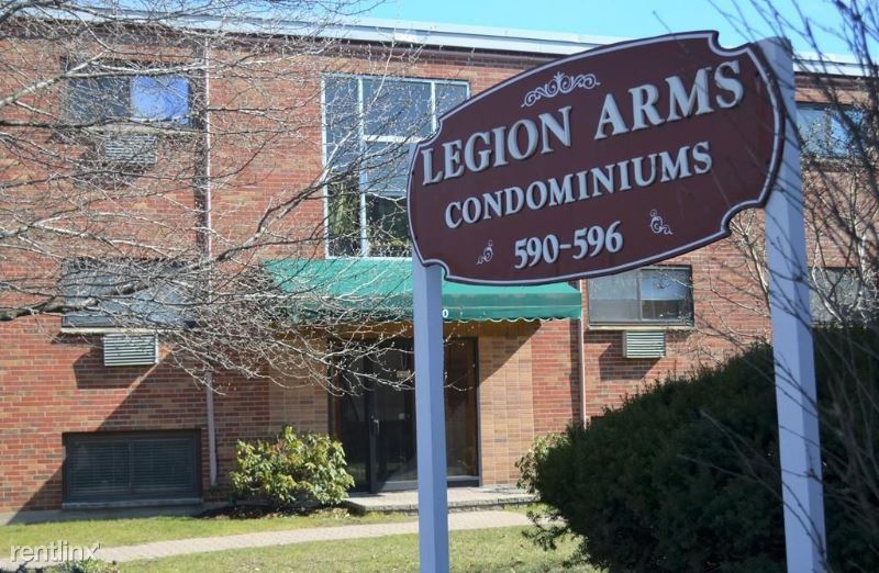
590 American Legion Hwy
Boston, MA 02131
Favorites
590 American Legion Hwy

Favorites
Check Back Soon for Upcoming Availability
| Beds | Baths | Average SF |
|---|---|---|
| 2 Bedrooms 2 Bedrooms 2 Br | 1 Bath 1 Bath 1 Ba | 720 SF |
Fees and Policies
The fees listed below are community-provided and may exclude utilities or add-ons. All payments are made directly to the property and are non-refundable unless otherwise specified.
Details
Utilities Included
-
Water
About This Property
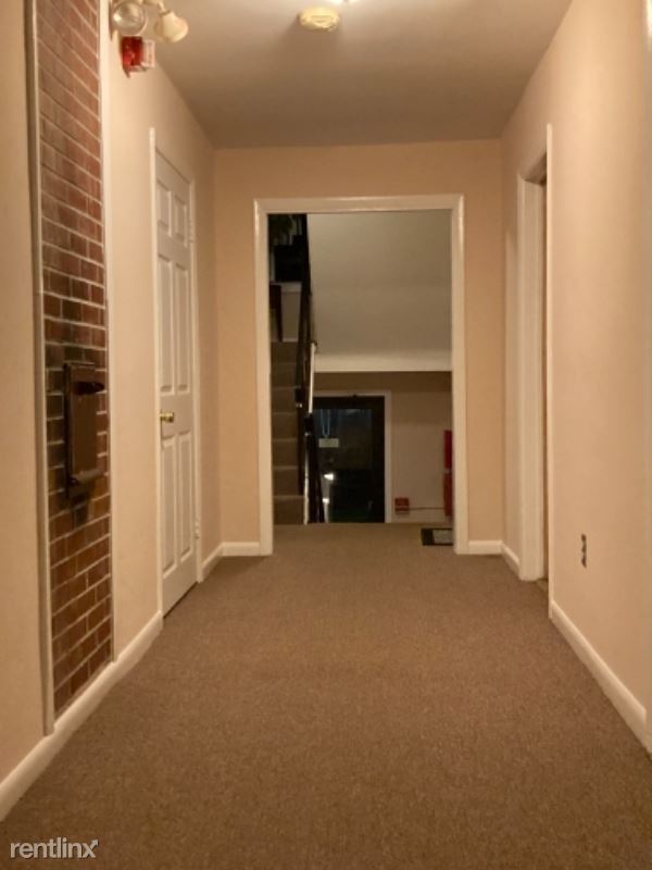
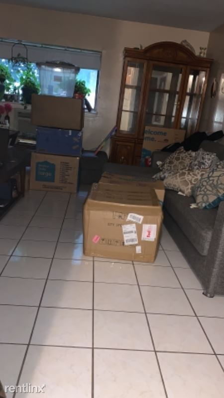
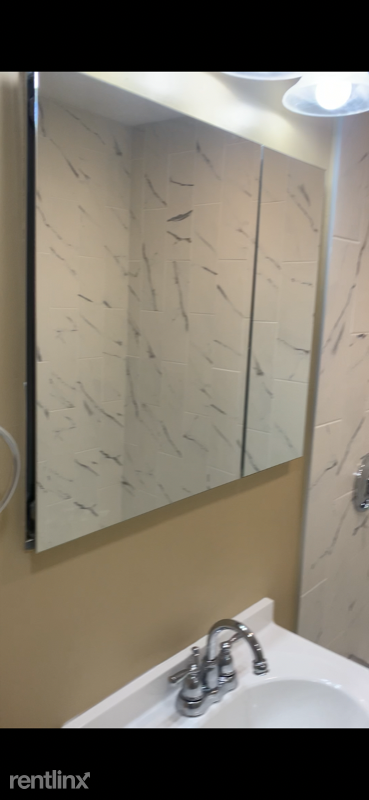
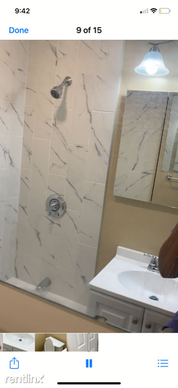
(857) 244-9324 - Beautiful Brick condominium - Property Id: 706541 This beautiful apartment is located on 590 American Legion Highway, Apt 6 in Roslindale. This place has two bedrooms and one recently renewed bathroom, the kitchen floor was upgraded, and there is a fresh coat of paint too. In the main area of this home, there is a window with a great view of the Haley Pilot School! Downstairs there is a drying/washing machine for your clothes. The neighbors are extremely kind, so don't be nervous to interact! Nearby the wonderful building is the Forest Hills Station. It is about 3 minutes away, driving distance, and 5 -7 minutes, walking distance. Close places to the apartment building are markets, barbershops, fast-food places and more! For more information about when the house is available call +1 (857) 244 - 9324 | More Photos coming soon. Apply at TurboTenant: http://rental.turbotenant.com/p/590-american-legion-hwy-roslindale-ma/706541 Property Id 706541 No Pets Allowed (RLNE6887703) Other Amenities: Other (Cooling System: Wall). Appliances: Refrigerator, Range, Oven. Lease lengths: 12 Months. Utilities: Water Included. Pet policies: No Dogs Allowed, No Pets Allowed.
590 American Legion Hwy is a condo located in Suffolk County and the 02131 ZIP Code. This area is served by the Boston Public Schools attendance zone.
Unique Features
- No Dogs Allowed, No Pets Allowed, Oven, Amenities - Cooling System: Wall, Amenities - Fenced Yard, A
590 American Legion Hwy,
Boston,
MA
02131
Lower Washington-Mount Hope is a walkable neighborhood about eight miles south of Boston via Interstate 93 or public transit. Despite this area’s dense population, Lower Washington-Mount Hope has many wooded areas, and large parks like Bussey Brook Meadow and Franklin Park surround the neighborhood. Along with residential neighborhoods, a few shops and eateries can be found in town along American Legion Highway. Many residents travel to the western corner of town to get to the shopping plaza off Corinth Street for all the necessities. The western part of the neighborhood is also where most of the rentals in this area are located. Apartments, condos, and townhomes ranging from moderately priced to luxury can be found here.
Learn more about living in Lower Washington-Mount HopeBelow are rent ranges for similar nearby apartments
Amenities
- No Dogs Allowed, No Pets Allowed, Oven, Amenities - Cooling System: Wall, Amenities - Fenced Yard, A
Expenses
Utilities Included
Water
Included
Education
| Colleges & Universities | Distance | ||
|---|---|---|---|
| Colleges & Universities | Distance | ||
| Drive: | 9 min | 4.2 mi | |
| Drive: | 12 min | 4.3 mi | |
| Drive: | 9 min | 4.6 mi | |
| Drive: | 10 min | 4.8 mi |
590 American Legion Hwy is within 12 minutes or 4.3 miles from Curry College. It is also near Wentworth Inst. of Technology and MCPHS University, Boston.
Schools


Public Elementary, Middle & High School
Grades K-12
2,230 Students
Nearby
Public Elementary & Middle School
Grades PK-8
352 Students
Nearby
Public High School
Grades 9-12
282 Students
Nearby
Private Elementary & Middle School
Grades PK-8
264 Students
Nearby
Private High School
Grades 9-12
Nearby
School data provided by
 The GreatSchools Rating helps parents compare schools within a state based on a variety of school quality indicators and provides a helpful picture of how effectively each school serves all of its students. Ratings are on a scale of 1 (below average) to 10 (above average) and can include test scores, college readiness, academic progress, advanced courses, equity, discipline and attendance data. We also advise parents to visit schools, consider other information on school performance and programs, and consider family needs as part of the school selection process.
View GreatSchools Rating Methodology
Data provided by GreatSchools.org © 2026. All rights reserved.
View GreatSchools Rating Methodology
Data provided by GreatSchools.org © 2026. All rights reserved.
Transportation options available in Boston include Forest Hills Station, located 1.3 miles from 590 American Legion Hwy. 590 American Legion Hwy is near General Edward Lawrence Logan International, located 9.1 miles or 19 minutes away.
| Transit / Subway | Distance | ||
|---|---|---|---|
| Transit / Subway | Distance | ||
|
|
Drive: | 4 min | 1.3 mi |
|
|
Drive: | 5 min | 2.1 mi |
|
|
Drive: | 5 min | 2.2 mi |
|
|
Drive: | 7 min | 2.7 mi |
|
|
Drive: | 7 min | 2.8 mi |
| Commuter Rail | Distance | ||
|---|---|---|---|
| Commuter Rail | Distance | ||
|
|
Drive: | 4 min | 1.3 mi |
| Drive: | 4 min | 1.7 mi | |
|
|
Drive: | 3 min | 1.7 mi |
| Drive: | 5 min | 1.9 mi | |
|
|
Drive: | 6 min | 2.1 mi |
| Airports | Distance | ||
|---|---|---|---|
| Airports | Distance | ||
|
General Edward Lawrence Logan International
|
Drive: | 19 min | 9.1 mi |
Walkability Near 590 American Legion Hwy Boston, MA 02131
Getting Around
 What do Walkability, Transit, Drivability, and Bikeability mean?
Walkability measures the walking distance to day-to-day needs.
Transit measures access to public transportation.
Drivability measures congestion, parking availability, and access to major roads.
Bikeability measures the suitability for cycling.
How It Works
What do Walkability, Transit, Drivability, and Bikeability mean?
Walkability measures the walking distance to day-to-day needs.
Transit measures access to public transportation.
Drivability measures congestion, parking availability, and access to major roads.
Bikeability measures the suitability for cycling.
How It Works
Moderately Walkable
Walkability
70
/ 100
Good Public Transit
Transit
60
/ 100
Exceptionally Drivable
Drivability
90
/ 100
Moderately Bikeable
Bikeability
70
/ 100
Scores provided by
-
Soundscore™
-
/ 100
Traffic
-Airport
-Businesses
-Scores provided by
HowLoud What is a Sound Score Rating? A Sound Score Rating aggregates noise caused by vehicle traffic, airplane traffic and local sources. How It WorksTime and distance from 590 American Legion Hwy.
| Shopping Centers | Distance | ||
|---|---|---|---|
| Shopping Centers | Distance | ||
| Walk: | 3 min | 0.2 mi | |
| Drive: | 4 min | 1.3 mi | |
| Drive: | 5 min | 1.9 mi |
590 American Legion Hwy has 3 shopping centers within 1.9 miles, which is about a 5-minute drive. The miles and minutes will be for the farthest away property.
| Parks and Recreation | Distance | ||
|---|---|---|---|
| Parks and Recreation | Distance | ||
|
Mass Audubon's Boston Nature Center and Wildlife Sanctuary
|
Walk: | 10 min | 0.6 mi |
|
Franklin Park Zoo
|
Drive: | 5 min | 1.9 mi |
|
Lower Neponset River Trail
|
Drive: | 5 min | 2.0 mi |
|
Arnold Arboretum of Harvard University
|
Drive: | 7 min | 3.3 mi |
|
Stony Brook Reservation
|
Drive: | 9 min | 3.7 mi |
590 American Legion Hwy has 5 parks within 3.7 miles, including Mass Audubon's Boston Nature Center and Wildlife Sanctuary, Franklin Park Zoo, and Lower Neponset River Trail.
| Hospitals | Distance | ||
|---|---|---|---|
| Hospitals | Distance | ||
| Drive: | 7 min | 2.6 mi | |
| Drive: | 6 min | 2.9 mi | |
| Drive: | 6 min | 2.9 mi |
590 American Legion Hwy has 3 hospitals within 2.9 miles, the nearest is Arbour Hospital which is 2.6 miles away and a 7 minute drive.
| Military Bases | Distance | ||
|---|---|---|---|
| Military Bases | Distance | ||
| Drive: | 31 min | 17.3 mi | |
| Drive: | 38 min | 21.7 mi | |
| Drive: | 44 min | 23.9 mi |
590 American Legion Hwy has 3 military bases within 23.9 miles, the nearest is US Military Reservation which is 17.3 miles away and a 31 minute drive.
You May Also Like
Similar Rentals Nearby


What Are Walk Score®, Transit Score®, and Bike Score® Ratings?
Walk Score® measures the walkability of any address. Transit Score® measures access to public transit. Bike Score® measures the bikeability of any address.
What is a Sound Score Rating?
A Sound Score Rating aggregates noise caused by vehicle traffic, airplane traffic and local sources.
590 American Legion Hwy
Boston, MA 02131