
$3,500
Total Monthly Price
59 Poverty Rd
Southbury, CT 06488
1 Day Ago
|
Edit
Favorites
857-526-1525
-
Bedrooms
4
-
Bathrooms
2
-
Square Feet
1,946 sq ft
-
Available
Not Available
Highlights
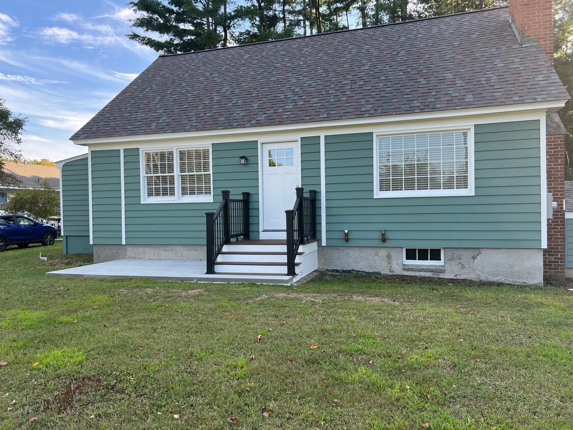
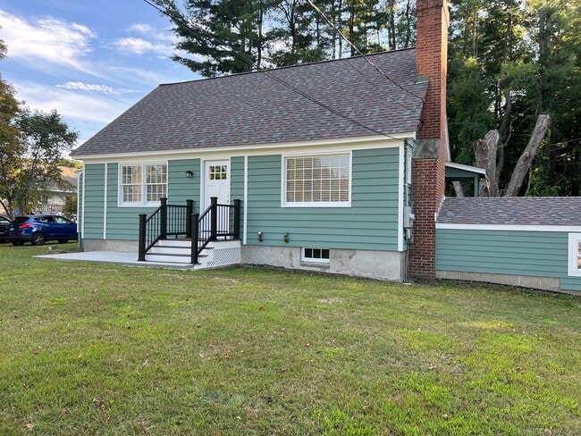
- Cape Cod Architecture
- 1 Fireplace
- Property is near shops
- Hot Water Circulator
- Hot Water Heating System
- Private Driveway
59 Poverty Rd

Favorites
About This Home
Not Available
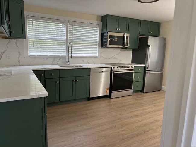
Call for Availability - Completely renovated 4 bedroom 2 full bath cape cod home conveniently located right off Main ST. This home has a brand new stainless steel kitchen with granite countertops, new flooring,2 brand new bathrooms, fresh paint throughout Easy access to route 84 and close to shopping, restaurants and entertainment. The rent includes all utilities, heat, hot water, water and electricity. Credit, background check and references required. MLS# 24115436
59 Poverty Rd is a house located in New Haven County and the 06488 ZIP Code. This area is served by the Regional School District 15 attendance zone.
* Price shown is total price based on community-supplied monthly required fees. Excludes user-selected optional fees and variable or usage-based fees and required charges due at or prior to move-in or at move-out. Price, availability, fees, and any applicable rent special are subject to change without notice.
* Square footage definitions vary. Displayed square footage is approximate.
Home Details
Year Built
Built in 1957
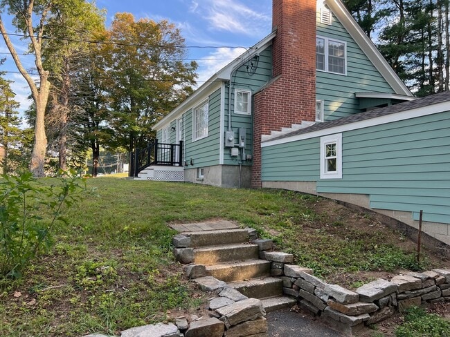
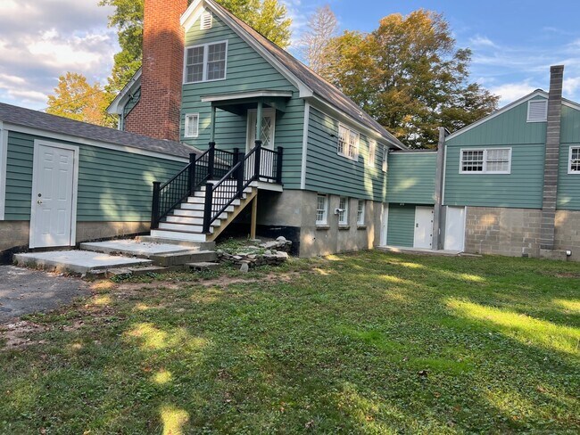
Basement
Basement Fills Entire Space Under The House
Bedrooms and Bathrooms
2 Full Bathrooms
4 Bedrooms
Home Design
Cape Cod Architecture
Interior Spaces
1 Fireplace
1,946 Sq Ft Home
Kitchen
Electric Range
Microwave
Dishwasher
Range Hood
Listing and Financial Details
Assessor Parcel Number 1329619
Location
Property is near shops
Lot Details
0.85 Acre Lot
Level Lot
Property is zoned R-30
Parking
Private Driveway
1 Car Garage
Utilities
Hot Water Circulator
Hot Water Heating System
Private Company Owned Well
Electric Water Heater
Fuel Tank Located in Basement
Heating System Uses Oil
Community Details
Pet Policy
Pets Allowed with Restrictions
Contact
- Listed by Rosemary Jacob | Borla & Associates Real Estate
- Phone Number
- Contact
-
Source
 Smart MLS
The data relating to real estate for sale on this website appears in part through the SMARTMLS Internet Data Exchange program, a voluntary cooperative exchange of property listing data between licensed real estate brokerage firms, and is provided by SMARTMLS through a licensing agreement. Listing information is from various brokers who participate in the SMARTMLS IDX program and not all listings may be visible on the site. The property information being provided on or through the website is for the personal, non-commercial use of consumers and such information may not be used for any purpose other than to identify prospective properties consumers may be interested in purchasing. Some properties which appear for sale on the website may no longer be available because they are for instance, under contract, sold or are no longer being offered for sale. Property information displayed is deemed reliable but is not guaranteed. Copyright 2026 SmartMLS, Inc.
Location
Get Directions
Seymour/Naugatuck/Ansonia is a large area encompassing a collection of neighborhoods east of the Naugatuck River. The northern section of the area is comprised mostly of forests hiding a few residential areas, but the eastern and southern portions of the community are less secluded. Highway 8 runs through the eastern section of town connecting residents to other parts of New England including New Haven, located 10 miles southeast. The highway also features commercial developments as several shopping centers are located along or just off the road. Renters will find that rental options are centered along this road as well. Apartments in a range of styles and prices are situated in proximity to the main thoroughfare.
Learn more about living in Seymour/Naugatuck/Ansonia
Education
| Colleges & Universities | Distance | ||
|---|---|---|---|
| Colleges & Universities | Distance | ||
| Drive: | 13 min | 9.2 mi | |
| Drive: | 16 min | 12.0 mi | |
| Drive: | 23 min | 16.2 mi | |
| Drive: | 27 min | 19.7 mi |
59 Poverty Rd is within 13 minutes or 9.2 miles from Post University. It is also near UCONN, Tri Campus, Waterbury and Western Connecticut, Midtown.
Schools


Public Elementary School
Grades PK-5
415 Students
Nearby
Public Elementary School
Grades PK-5
351 Students
Attendance Zone
Public Middle School
Grades 6-8
384 Students
Attendance Zone
Public High School
Grades 9-12
1,039 Students
Attendance Zone
Private Elementary & Middle School
Grades PK-8
280 Students
Nearby
Private High School
Grades 9-12
179 Students
Nearby
School data provided by
 The GreatSchools Rating helps parents compare schools within a state based on a variety of school quality indicators and provides a helpful picture of how effectively each school serves all of its students. Ratings are on a scale of 1 (below average) to 10 (above average) and can include test scores, college readiness, academic progress, advanced courses, equity, discipline and attendance data. We also advise parents to visit schools, consider other information on school performance and programs, and consider family needs as part of the school selection process.
View GreatSchools Rating Methodology
Data provided by GreatSchools.org © 2026. All rights reserved.
View GreatSchools Rating Methodology
Data provided by GreatSchools.org © 2026. All rights reserved.
You May Also Like
Similar Rentals Nearby
-
-

-

-

-
 4 Beds, 1 Bath, 1,150 sq ft$1,900Total Monthly PriceTotal Monthly Price NewPrices include all required monthly fees.390 Willow St
 -
 4 Beds, 3 Baths, 2,360 sq ft$29,500Total Monthly PriceTotal Monthly Price NewPrices include all required monthly fees.126 River Rd
 -
 4 Beds, 4 Baths, 5,224 sq ft$10,000Total Monthly PriceTotal Monthly Price NewPrices include all required monthly fees.14 Magellan Ln
 -
 5 Beds, 3 Baths, 2,400 sq ft$4,500Total Monthly PriceTotal Monthly Price NewPrices include all required monthly fees.5160 Madison Ave
 -
 4 Beds, 4 Baths, 4,599 sq ft$4,000Total Monthly PriceTotal Monthly Price NewPrices include all required monthly fees.17 Curtis Dr
 -
 4 Beds, 2 Baths, 1,610 sq ft$2,700Total Monthly PriceTotal Monthly Price NewPrices include all required monthly fees.56 Dorman St
What Are Walk Score®, Transit Score®, and Bike Score® Ratings?
Walk Score® measures the walkability of any address. Transit Score® measures access to public transit. Bike Score® measures the bikeability of any address.
What is a Sound Score Rating?
A Sound Score Rating aggregates noise caused by vehicle traffic, airplane traffic and local sources

59 Poverty Rd
Southbury, CT 06488