
Vanguard
1001 Marshall Ave,
Cincinnati, OH 45219
Studio - 5 Beds $683 - $1,479
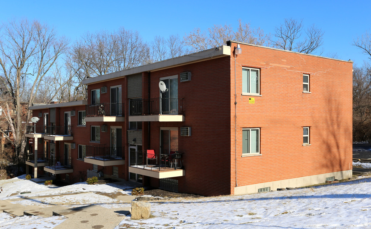

At 5890 Shadymist Ln, you've discovered your new place. This community can be found at 5890 Shadymist Ln. in Cincinnati. Make a visit to view the available floorplans. The professional leasing staff is waiting to show you all that this community has to offer. Drop by to find out the current floorplan availability.
5890 Shadymist Ln is an apartment community located in Hamilton County and the 45239 ZIP Code. This area is served by the Cincinnati Public Schools attendance zone.
Air Conditioning
Refrigerator
Tub/Shower
Heating
Mount Airy is a classic suburban neighborhood with peaceful streets lined with single-family homes. Interstate 74 and Highway 22 makes the seven mile drive into Downtown Cincinnati and beyond accessible, but Mount Airy has a lot to offer from within. Its southern border encompasses Mount Airy Forest, which provides residents with outdoor fun. There are also a few fast food restaurants within the neighborhood, but residents can easily travel to the surrounding areas or into downtown for a diverse selection of restaurants. Renters will find that they have a few affordable options of apartments in longstanding brick buildings to choose from.
Learn more about living in Mount Airy| Colleges & Universities | Distance | ||
|---|---|---|---|
| Colleges & Universities | Distance | ||
| Drive: | 15 min | 5.5 mi | |
| Drive: | 16 min | 7.2 mi | |
| Drive: | 18 min | 7.6 mi | |
| Drive: | 21 min | 9.2 mi |


Transportation options available in Cincinnati include Brewery District Station, Elm & Henry, located 7.9 miles from 5890 Shadymist Ln. 5890 Shadymist Ln is near Cincinnati/Northern Kentucky International, located 21.9 miles or 41 minutes away.
| Transit / Subway | Distance | ||
|---|---|---|---|
| Transit / Subway | Distance | ||
| Drive: | 17 min | 7.9 mi | |
| Drive: | 17 min | 8.0 mi | |
| Drive: | 17 min | 8.1 mi | |
| Drive: | 18 min | 8.1 mi | |
| Drive: | 18 min | 8.2 mi |
| Commuter Rail | Distance | ||
|---|---|---|---|
| Commuter Rail | Distance | ||
|
|
Drive: | 16 min | 7.9 mi |
| Airports | Distance | ||
|---|---|---|---|
| Airports | Distance | ||
|
Cincinnati/Northern Kentucky International
|
Drive: | 41 min | 21.9 mi |
Time and distance from 5890 Shadymist Ln.
| Shopping Centers | Distance | ||
|---|---|---|---|
| Shopping Centers | Distance | ||
| Walk: | 9 min | 0.5 mi | |
| Walk: | 10 min | 0.5 mi | |
| Drive: | 4 min | 1.6 mi |
| Parks and Recreation | Distance | ||
|---|---|---|---|
| Parks and Recreation | Distance | ||
|
LaBoiteaux Woods
|
Drive: | 7 min | 2.6 mi |
|
Mt. Airy Forest
|
Drive: | 8 min | 2.8 mi |
|
Farbach-Werner Nature Preserve
|
Drive: | 7 min | 2.9 mi |
|
Buttercup Valley
|
Drive: | 9 min | 3.6 mi |
|
Caldwell Preserve
|
Drive: | 12 min | 5.3 mi |
| Hospitals | Distance | ||
|---|---|---|---|
| Hospitals | Distance | ||
| Drive: | 9 min | 3.5 mi | |
| Drive: | 15 min | 6.5 mi | |
| Drive: | 15 min | 6.5 mi |
| Military Bases | Distance | ||
|---|---|---|---|
| Military Bases | Distance | ||
| Drive: | 70 min | 54.1 mi | |
| Drive: | 76 min | 59.2 mi | |
| Drive: | 79 min | 62.5 mi |
What Are Walk Score®, Transit Score®, and Bike Score® Ratings?
Walk Score® measures the walkability of any address. Transit Score® measures access to public transit. Bike Score® measures the bikeability of any address.
What is a Sound Score Rating?
A Sound Score Rating aggregates noise caused by vehicle traffic, airplane traffic and local sources

5890 Shadymist Ln
Cincinnati, OH 45239


