
$3,950 / Month
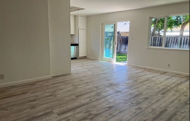
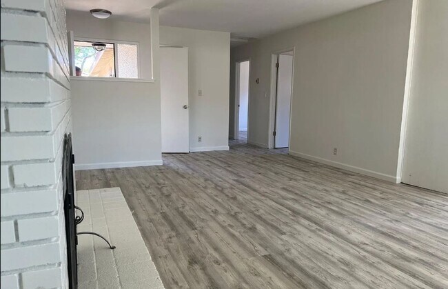
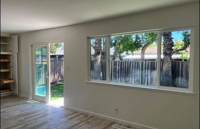
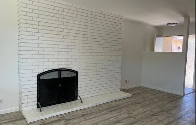
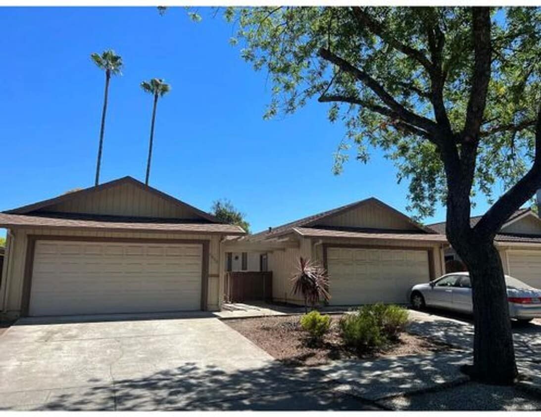
5852-5852 El Dori Dr Unit 5850
San Jose, CA 95123
Today
Favorites
650-610-2100
-
Bedrooms
3
-
Bathrooms
2
-
Square Feet
1,200 sq ft
-
Available
Available Aug 1
5852-5852 El Dori Dr Unit 5850

Favorites
Contact
- Listed by Purpose Property Management Inc. | Purpose Property Management Inc.
- Phone Number
- Contact
Location
Get Directions
Blossom Valley is a neighborhood in San Jose situated along Highway 85 between the Sierra Azul Preserve and the Diablo Range. The neighborhood is densely populated with several apartments and a few spacious homes for rent. An abundance of shopping and dining options at large retail centers like Westfield Oakridge are located in town as well. More retailers and eateries are scattered throughout the neighborhood, and a few community parks like Comanche Lookout Park dot the area. Parks, golf courses, and trails surround Blossom Valley, and outdoor enthusiasts have easy access to the massive state parks on either side of town.
Learn more about living in Blossom Valley/S San Jose
Education
| Colleges & Universities | Distance | ||
|---|---|---|---|
| Colleges & Universities | Distance | ||
| Drive: | 13 min | 7.9 mi | |
| Drive: | 14 min | 8.6 mi | |
| Drive: | 18 min | 9.7 mi | |
| Drive: | 18 min | 10.7 mi |
5852-5852 El Dori Dr Unit 5850 is within 13 minutes or 7.9 miles from San Jose State University. It is also near San Jose City College and Evergreen Valley College.
Transportation options available in San Jose include Ohlone/Chynoweth Station, located 1.6 miles from 5852-5852 El Dori Dr Unit 5850. 5852-5852 El Dori Dr Unit 5850 is near Norman Y Mineta San Jose International, located 10.1 miles or 16 minutes away.
| Transit / Subway | Distance | ||
|---|---|---|---|
| Transit / Subway | Distance | ||
|
|
Drive: | 4 min | 1.6 mi |
|
|
Drive: | 3 min | 1.6 mi |
| Drive: | 4 min | 2.3 mi | |
|
|
Drive: | 4 min | 2.3 mi |
| Drive: | 9 min | 5.6 mi |
| Commuter Rail | Distance | ||
|---|---|---|---|
| Commuter Rail | Distance | ||
| Drive: | 7 min | 4.2 mi | |
| Drive: | 8 min | 4.8 mi | |
| Drive: | 10 min | 5.8 mi | |
| Drive: | 10 min | 5.9 mi | |
| Drive: | 11 min | 7.2 mi |
| Airports | Distance | ||
|---|---|---|---|
| Airports | Distance | ||
|
Norman Y Mineta San Jose International
|
Drive: | 16 min | 10.1 mi |
Time and distance from 5852-5852 El Dori Dr Unit 5850.
| Shopping Centers | Distance | ||
|---|---|---|---|
| Shopping Centers | Distance | ||
| Walk: | 6 min | 0.3 mi | |
| Walk: | 8 min | 0.4 mi | |
| Walk: | 9 min | 0.5 mi |
5852-5852 El Dori Dr Unit 5850 has 3 shopping centers within 0.5 mile, which is about a 9-minute walk. The miles and minutes will be for the farthest away property.
| Parks and Recreation | Distance | ||
|---|---|---|---|
| Parks and Recreation | Distance | ||
|
Almaden Lake Park
|
Walk: | 21 min | 1.1 mi |
|
Almaden Quicksilver County Park
|
Drive: | 9 min | 3.7 mi |
|
Hellyer County Park
|
Drive: | 12 min | 5.6 mi |
|
Edith Morley Park
|
Drive: | 12 min | 7.1 mi |
|
Santa Teresa County Park
|
Drive: | 17 min | 7.7 mi |
5852-5852 El Dori Dr Unit 5850 has 5 parks within 7.7 miles, including Almaden Lake Park, Almaden Quicksilver County Park, and Hellyer County Park.
| Hospitals | Distance | ||
|---|---|---|---|
| Hospitals | Distance | ||
| Drive: | 7 min | 3.9 mi | |
| Drive: | 9 min | 6.1 mi | |
| Drive: | 10 min | 6.2 mi |
5852-5852 El Dori Dr Unit 5850 has 3 hospitals within 6.2 miles, the nearest is Kaiser Foundation Hospital - San Jose which is 3.9 miles away and a 7 minute drive.
| Military Bases | Distance | ||
|---|---|---|---|
| Military Bases | Distance | ||
| Drive: | 26 min | 19.2 mi |
5852-5852 El Dori Dr Unit 5850 is 19.2 miles and a 26 minute drive from Ames Research Center.
You May Also Like
Similar Rentals Nearby


What Are Walk Score®, Transit Score®, and Bike Score® Ratings?
Walk Score® measures the walkability of any address. Transit Score® measures access to public transit. Bike Score® measures the bikeability of any address.
What is a Sound Score Rating?
A Sound Score Rating aggregates noise caused by vehicle traffic, airplane traffic and local sources
5852-5852 El Dori Dr
San Jose, CA 95123