
$4,100
/ Month
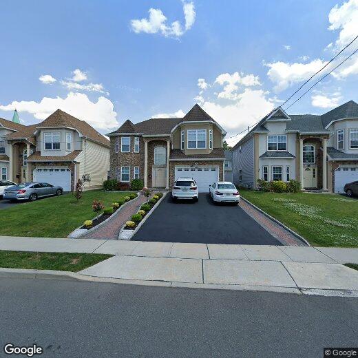
58 S Whittier St
Carteret, NJ 07008
2 Weeks Ago
|
Edit
Favorites
58 S Whittier St

Favorites
Check Back Soon for Upcoming Availability
| Beds | Baths | Average SF |
|---|---|---|
| 4 Bedrooms 4 Bedrooms 4 Br | 2.5 Baths 2.5 Baths 2.5 Ba | 2,403 SF |
Fees and Policies
The fees below are based on community-supplied data and may exclude additional fees and utilities.
- Parking
-
Garage--
-
Other--
Details
Utilities Included
-
Electricity
Lease Options
-
12 meses
About This Property
Hermosa casa colonial en Carteret con cuatro dormitorios y dos baños y medio. El hotel se encuentra en una ubicación céntrica, cerca de Carteret High School, centros comerciales, restaurantes, cancha de baloncesto, campo de fútbol, autopistas principales y autobús de NYC. ¡Ven y echa un vistazo hoy mismo!
58 S Whittier St is a house located in Middlesex County and the 07008 ZIP Code. This area is served by the Carteret Public attendance zone.
House Features
Lavadora/Secadora
Aire acondicionado
Lavavajillas
Suelos de madera maciza
- Lavadora/Secadora
- Aire acondicionado
- Lavavajillas
- Encimeras de granito
- Cocina
- Horno
- Fogón
- Nevera
- Suelos de madera maciza
- Alfombra
- Suelos de baldosas
- Comedor
- Sala familiar
- Ático
Location
Get Directions
Located directly across the Arthur Kill from Staten Island, Carteret was once part of the Woodbridge Township. It became the borough of Roosevelt in 1906 and was renamed Carteret in 1922. This popular community is bordered by the Rahway River to the north, Arthur Kill to the east, and the Ernest L. Oros Wildlife Preserve to the west. Due to its central location, the borough bills itself as the "Center of it All."
Residents enjoy a fantastic location and beautiful parks. Carteret Waterfront Park has a fishing pier and access to two hiking trails: Danielle's Garden Trail and the Waterfront Fitness Trail. Shopping in Carteret is plentiful -- the brick-paved sidewalks and outdoor cafes along Washington Avenue provide historic charm and locally-owned businesses, while the shops and restaurants along Roosevelt Avenue have a more modern feel. With just 22 miles to Manhattan, 10 miles to Newark, and 70 miles to Philadelphia, residents can easily commute to nearby cities.
Learn more about living in Carteret
Amenities
- Lavadora/Secadora
- Aire acondicionado
- Lavavajillas
- Encimeras de granito
- Cocina
- Horno
- Fogón
- Nevera
- Suelos de madera maciza
- Alfombra
- Suelos de baldosas
- Comedor
- Sala familiar
- Ático
Expenses
Utilities Included
Electricity
Included
Education
| Colleges & Universities | Distance | ||
|---|---|---|---|
| Colleges & Universities | Distance | ||
| Drive: | 14 min | 7.4 mi | |
| Drive: | 18 min | 9.0 mi | |
| Drive: | 19 min | 10.2 mi | |
| Drive: | 23 min | 13.2 mi |
58 S Whittier St is within 14 minutes or 7.4 miles from Union County Coll., Elizabeth. It is also near Kean University and Coll. of Staten Island, CUNY.
Schools


Public Elementary School
Grades 5-6
553 Students
Nearby
Public Elementary School
Grades PK-4
578 Students
Nearby
Public High School
Grades 9-12
1,089 Students
Attendance Zone
Private Elementary, Middle & High School
40 Students
Nearby
Private Elementary School
Grades PK-5
Nearby
School data provided by
 The GreatSchools Rating helps parents compare schools within a state based on a variety of school quality indicators and provides a helpful picture of how effectively each school serves all of its students. Ratings are on a scale of 1 (below average) to 10 (above average) and can include test scores, college readiness, academic progress, advanced courses, equity, discipline and attendance data. We also advise parents to visit schools, consider other information on school performance and programs, and consider family needs as part of the school selection process.
View GreatSchools Rating Methodology
Data provided by GreatSchools.org © 2026. All rights reserved.
View GreatSchools Rating Methodology
Data provided by GreatSchools.org © 2026. All rights reserved.
Transportation options available in Carteret include 8Th Street Light Rail Station, located 11.8 miles from 58 S Whittier St. 58 S Whittier St is near Newark Liberty International, located 13.4 miles or 22 minutes away, and LaGuardia, located 30.8 miles or 51 minutes away.
| Transit / Subway | Distance | ||
|---|---|---|---|
| Transit / Subway | Distance | ||
| Drive: | 20 min | 11.8 mi | |
|
|
Drive: | 22 min | 13.1 mi |
|
|
Drive: | 21 min | 14.7 mi |
|
|
Drive: | 20 min | 14.7 mi |
| Commuter Rail | Distance | ||
|---|---|---|---|
| Commuter Rail | Distance | ||
|
|
Drive: | 8 min | 3.5 mi |
|
|
Drive: | 9 min | 4.3 mi |
|
|
Drive: | 10 min | 5.3 mi |
|
|
Drive: | 20 min | 10.0 mi |
|
|
Drive: | 22 min | 11.4 mi |
| Airports | Distance | ||
|---|---|---|---|
| Airports | Distance | ||
|
Newark Liberty International
|
Drive: | 22 min | 13.4 mi |
|
LaGuardia
|
Drive: | 51 min | 30.8 mi |
Time and distance from 58 S Whittier St.
| Shopping Centers | Distance | ||
|---|---|---|---|
| Shopping Centers | Distance | ||
| Walk: | 17 min | 0.9 mi | |
| Drive: | 3 min | 1.2 mi | |
| Drive: | 6 min | 2.2 mi |
58 S Whittier St has 3 shopping centers within 2.2 miles, which is about a 6-minute drive. The miles and minutes will be for the farthest away property.
| Parks and Recreation | Distance | ||
|---|---|---|---|
| Parks and Recreation | Distance | ||
|
Liberty State Park
|
Drive: | 5 min | 2.0 mi |
|
Hawk Rise Sanctuary
|
Drive: | 12 min | 5.3 mi |
|
Clay Pit Ponds State Park Preserve
|
Drive: | 21 min | 9.5 mi |
|
William T. Davis Wildlife Refuge
|
Drive: | 18 min | 10.4 mi |
|
Freshkills Park
|
Drive: | 24 min | 13.3 mi |
58 S Whittier St has 5 parks within 13.3 miles, including Liberty State Park, Hawk Rise Sanctuary, and Clay Pit Ponds State Park Preserve.
| Hospitals | Distance | ||
|---|---|---|---|
| Hospitals | Distance | ||
| Drive: | 12 min | 5.3 mi | |
| Drive: | 14 min | 6.5 mi | |
| Drive: | 17 min | 9.5 mi |
58 S Whittier St has 3 hospitals within 9.5 miles, the nearest is Robert Wood Johnson University Hospital at Rahway which is 5.3 miles away and a 12 minute drive.
| Military Bases | Distance | ||
|---|---|---|---|
| Military Bases | Distance | ||
| Drive: | 19 min | 8.3 mi | |
| Drive: | 22 min | 9.1 mi | |
| Drive: | 27 min | 14.8 mi |
58 S Whittier St has 3 military bases within 14.8 miles, the nearest is Ash Brook Reservation which is 8.3 miles away and a 19 minute drive.
You May Also Like
How do I access Social Services in New Jersey?
Statewide service is free, confidential, multilingual and always open. Three easy ways to reach Social Services in NJ: Dial 2-1-1; text your zip code to 898-211; or chat at https://www.nj211.org
Similar Rentals Nearby


What Are Walk Score®, Transit Score®, and Bike Score® Ratings?
Walk Score® measures the walkability of any address. Transit Score® measures access to public transit. Bike Score® measures the bikeability of any address.
What is a Sound Score Rating?
A Sound Score Rating aggregates noise caused by vehicle traffic, airplane traffic and local sources

58 S Whittier St
Carteret, NJ 07008