
Westlake Apartments
331 Park Plaza Dr,
Daly City, CA 94015
$1,970 - $5,048
Studio - 3 Beds
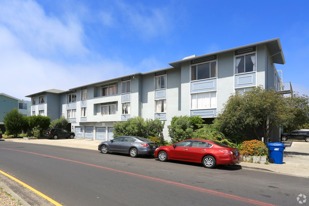
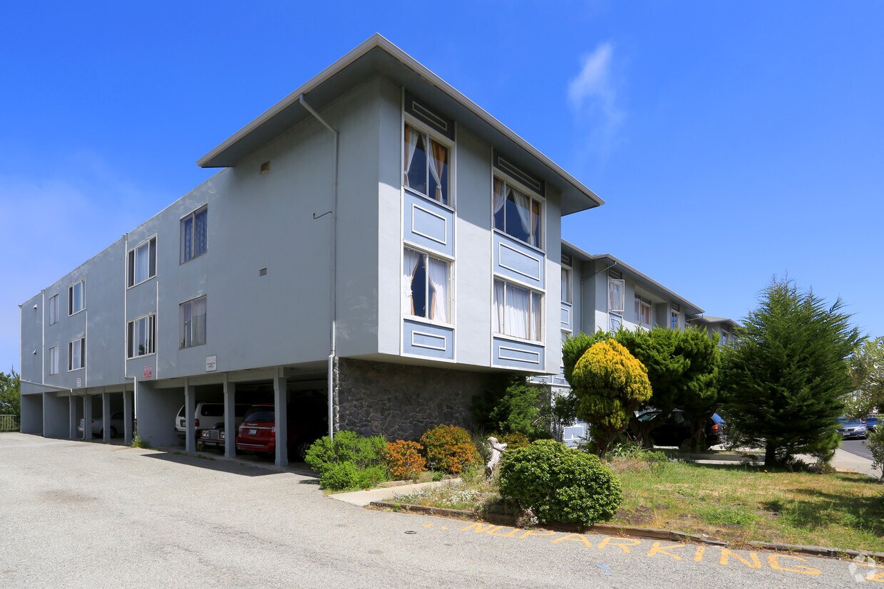
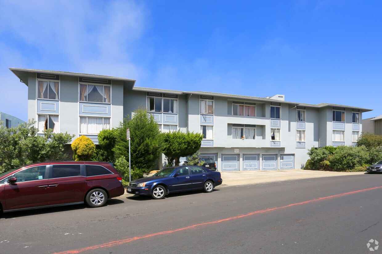

Discover your new home at 578 Clarinada Ave in Daly City. The location in Daly City's 94015 area is an ideal place to live. The leasing team is ready for you to come by for a tour. Schedule a time to check out the apartment floorplan options. Experience a new standard at 578 Clarinada Ave.
578 Clarinada Ave is an apartment community located in San Mateo County and the 94015 ZIP Code. This area is served by the Jefferson Elementary School District attendance zone.
Refrigerator
Heating
Oven
Range
Saint Francis is a suburban neighborhood known for its large single-family houses, but there is a variety of mid-rise and luxury apartments available for rent as well. Since Saint Frances is about 10 miles south of San Francisco, the neighborhood is a popular area for commuters. Residents have access to Highway 35 and 1 and Interstate 280 so traveling into the city is easy. The neighborhood is family friendly with excellent schools and access to plenty of green space and amenities. Along with its own stores and restaurants, Saint Frances is about two miles away from several large shopping centers like Serra Center and Serramonte Center, a large mall. Golf courses like Lake Merced Golf Club are just a short drive away while waterfront parks like Mussel Rock Park offer picturesque views of the Pacific Ocean, low-key beaches, and hiking trails.
Learn more about living in St FrancisCompare neighborhood and city base rent averages by bedroom.
| St Francis | Daly City, CA | |
|---|---|---|
| Studio | $1,689 | $2,189 |
| 1 Bedroom | $2,280 | $2,444 |
| 2 Bedrooms | $3,015 | $3,225 |
| 3 Bedrooms | $6,503 | $4,032 |
| Colleges & Universities | Distance | ||
|---|---|---|---|
| Colleges & Universities | Distance | ||
| Drive: | 9 min | 4.3 mi | |
| Drive: | 9 min | 4.9 mi | |
| Drive: | 9 min | 5.4 mi | |
| Drive: | 15 min | 7.5 mi |


Transportation options available in Daly City include Colma Station, located 2.0 miles from 578 Clarinada Ave. 578 Clarinada Ave is near San Francisco International, located 8.4 miles or 15 minutes away, and Metro Oakland International, located 29.9 miles or 42 minutes away.
| Transit / Subway | Distance | ||
|---|---|---|---|
| Transit / Subway | Distance | ||
|
|
Drive: | 5 min | 2.0 mi |
|
|
Drive: | 6 min | 2.8 mi |
|
|
Drive: | 7 min | 3.3 mi |
|
|
Drive: | 6 min | 4.0 mi |
| Drive: | 7 min | 4.4 mi |
| Commuter Rail | Distance | ||
|---|---|---|---|
| Commuter Rail | Distance | ||
| Drive: | 11 min | 5.5 mi | |
| Drive: | 10 min | 5.9 mi | |
| Drive: | 15 min | 9.4 mi | |
| Drive: | 14 min | 9.5 mi | |
| Drive: | 15 min | 11.3 mi |
| Airports | Distance | ||
|---|---|---|---|
| Airports | Distance | ||
|
San Francisco International
|
Drive: | 15 min | 8.4 mi |
|
Metro Oakland International
|
Drive: | 42 min | 29.9 mi |
Scores provided by
Traffic
-Airport
-Businesses
-Scores provided by
HowLoud What is a Sound Score Rating? A Sound Score Rating aggregates noise caused by vehicle traffic, airplane traffic and local sources. How It WorksTime and distance from 578 Clarinada Ave.
| Shopping Centers | Distance | ||
|---|---|---|---|
| Shopping Centers | Distance | ||
| Walk: | 8 min | 0.4 mi | |
| Walk: | 15 min | 0.8 mi | |
| Walk: | 15 min | 0.8 mi |
| Parks and Recreation | Distance | ||
|---|---|---|---|
| Parks and Recreation | Distance | ||
|
San Francisco Zoo
|
Drive: | 10 min | 5.5 mi |
|
Charles F. Hagar Planetarium
|
Drive: | 11 min | 5.6 mi |
|
San Francisco State Univ. Observatory
|
Drive: | 11 min | 5.6 mi |
|
San Bruno Mountain State Park
|
Drive: | 15 min | 6.0 mi |
|
Pacifica State Beach
|
Drive: | 8 min | 6.1 mi |
| Hospitals | Distance | ||
|---|---|---|---|
| Hospitals | Distance | ||
| Walk: | 19 min | 1.0 mi | |
| Drive: | 6 min | 2.9 mi | |
| Drive: | 10 min | 7.0 mi |
| Military Bases | Distance | ||
|---|---|---|---|
| Military Bases | Distance | ||
| Drive: | 22 min | 9.6 mi | |
| Drive: | 21 min | 9.8 mi | |
| Drive: | 39 min | 24.5 mi |
Pets Allowed Fitness Center In Unit Washer & Dryer Walk-In Closets Stainless Steel Appliances Hardwood Floors EV Charging
What Are Walk Score®, Transit Score®, and Bike Score® Ratings?
Walk Score® measures the walkability of any address. Transit Score® measures access to public transit. Bike Score® measures the bikeability of any address.
What is a Sound Score Rating?
A Sound Score Rating aggregates noise caused by vehicle traffic, airplane traffic and local sources.

578 Clarinada Ave
Daly City, CA 94015


