$1,700
/ Month
571 39th St Unit 3R
Brooklyn, NY 11232
2 Weeks Ago
|
Edit
Favorites
571 39th St Unit 3R

Favorites
Check Back Soon for Upcoming Availability
| Beds | Baths | Average SF |
|---|---|---|
| 1 Bedroom 1 Bedroom 1 Br | 1 Bath 1 Bath 1 Ba | 700 SF |
Fees and Policies
Details
Lease Options
-
12 Months
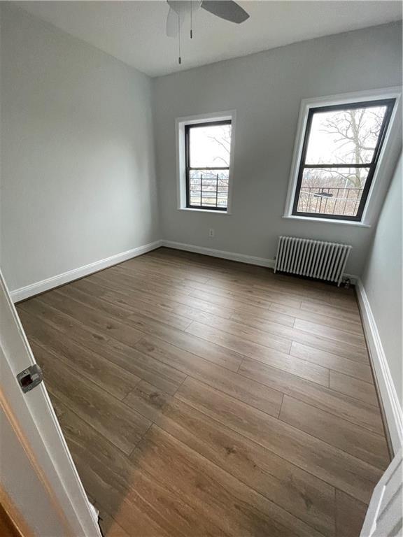
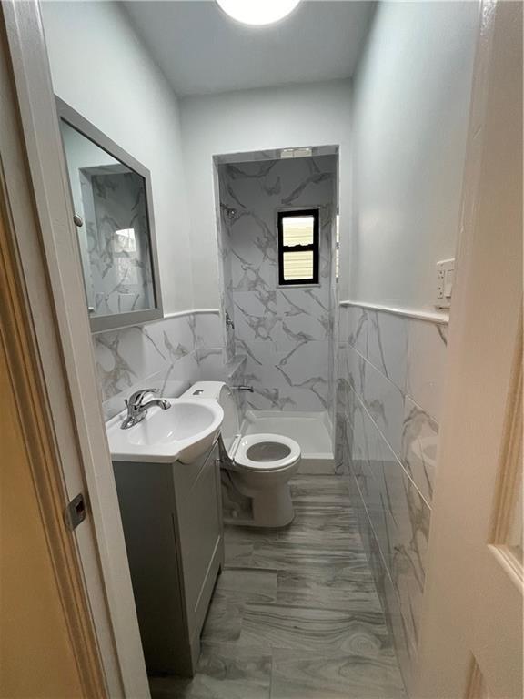
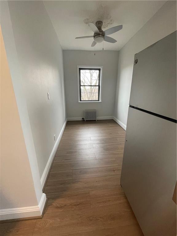
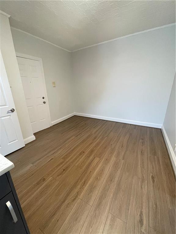
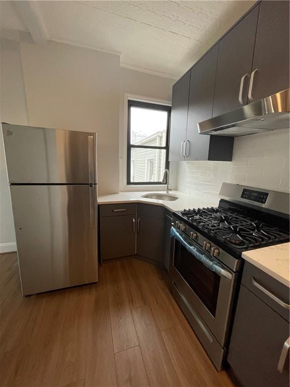
About This Property
Enjoy this recently renovated one bedroom apartment located in third floor of the building. The apartment has beautiful marble tops in the kitchen with new appliances, stove and refrigerator. On the other hand, the bathroom is beautifully tiled. It is located near the B70 and B35 bus stations, the 36th St subway station, restaurants, supermarkets and convenience stores. The rent includes heat and hot water; therefore, the tenant is responsible for electricity and cooking gas. The apartment will be great for a single person and no pets are allowed. If interested, please have the following information ready before inquiry: 1. Full name of the tenant 2. Income 3. credit score 4. occupation Thanks
571 39th St is an apartment community located in Kings County and the 11232 ZIP Code.
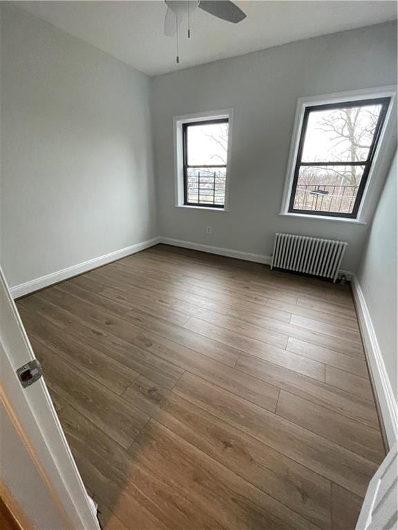
Features
- Hardwood Floors
571 39th St,
Brooklyn,
NY
11232
Greenwood is a quaint neighborhood on the banks of the Hudson River and Upper Bay in Brooklyn, New York. This urban area is situated near Downtown Brooklyn with close proximity to major roads and subway stations that take you around town and to neighboring New York City boroughs.
Though a bustling urban neighborhood, Greenwood boasts walkable streets, good schools, and a safe community that’s favored by its residents. Greenwood is nestled near the Green Wood Cemetery, a sprawling area across nearly 500 acres that’s home to numerous notable figures.
Learn more about living in GreenwoodBelow are rent ranges for similar nearby apartments
Amenities
- Hardwood Floors
Education
| Colleges & Universities | Distance | ||
|---|---|---|---|
| Colleges & Universities | Distance | ||
| Drive: | 8 min | 3.5 mi | |
| Drive: | 8 min | 3.5 mi | |
| Drive: | 10 min | 3.7 mi | |
| Drive: | 9 min | 3.8 mi |
571 39th St Unit 3R is within 10 minutes or 3.7 miles from Brooklyn College. It is also near Medgar Evers College, CUNY and ASA College Brooklyn.
Transportation options available in Brooklyn include 36 Street (D,M,N,R Line), located 0.4 mile from 571 39th St Unit 3R. 571 39th St Unit 3R is near LaGuardia, located 14.1 miles or 26 minutes away, and Newark Liberty International, located 17.6 miles or 30 minutes away.
| Transit / Subway | Distance | ||
|---|---|---|---|
| Transit / Subway | Distance | ||
|
|
Walk: | 8 min | 0.4 mi |
|
|
Walk: | 10 min | 0.5 mi |
|
|
Walk: | 10 min | 0.5 mi |
|
|
Walk: | 18 min | 1.0 mi |
|
|
Drive: | 2 min | 1.2 mi |
| Commuter Rail | Distance | ||
|---|---|---|---|
| Commuter Rail | Distance | ||
|
|
Drive: | 10 min | 3.5 mi |
|
|
Drive: | 13 min | 5.0 mi |
|
|
Drive: | 16 min | 8.5 mi |
|
|
Drive: | 19 min | 9.1 mi |
|
|
Drive: | 21 min | 9.7 mi |
| Airports | Distance | ||
|---|---|---|---|
| Airports | Distance | ||
|
LaGuardia
|
Drive: | 26 min | 14.1 mi |
|
Newark Liberty International
|
Drive: | 30 min | 17.6 mi |
Walkability Near 571 39th St Brooklyn, NY 11232
Getting Around
 What do Walkability, Transit, Drivability, and Bikeability mean?
Walkability measures the walking distance to day-to-day needs.
Transit measures access to public transportation.
Drivability measures congestion, parking availability, and access to major roads.
Bikeability measures the suitability for cycling.
How It Works
What do Walkability, Transit, Drivability, and Bikeability mean?
Walkability measures the walking distance to day-to-day needs.
Transit measures access to public transportation.
Drivability measures congestion, parking availability, and access to major roads.
Bikeability measures the suitability for cycling.
How It Works
Exceptionally Walkable
Walkability
90
/ 100
Exceptional Public Transit
Transit
100
/ 100
Moderately Drivable
Drivability
70
/ 100
Moderately Bikeable
Bikeability
70
/ 100
Scores provided by
-
Soundscore™
-
/ 100
Traffic
-Airport
-Businesses
-Scores provided by
HowLoud What is a Sound Score Rating? A Sound Score Rating aggregates noise caused by vehicle traffic, airplane traffic and local sources. How It WorksTime and distance from 571 39th St Unit 3R.
| Shopping Centers | Distance | ||
|---|---|---|---|
| Shopping Centers | Distance | ||
| Drive: | 4 min | 1.6 mi | |
| Drive: | 5 min | 2.3 mi | |
| Drive: | 6 min | 2.3 mi |
571 39th St Unit 3R has 3 shopping centers within 2.3 miles, which is about a 6-minute drive. The miles and minutes will be for the farthest away property.
| Parks and Recreation | Distance | ||
|---|---|---|---|
| Parks and Recreation | Distance | ||
|
Sunset Park
|
Walk: | 5 min | 0.3 mi |
|
Red Hook Park
|
Drive: | 5 min | 2.5 mi |
|
Prospect Park
|
Drive: | 9 min | 2.8 mi |
|
Owl's Head Park
|
Drive: | 6 min | 2.8 mi |
|
Waterfront Museum & Showboat Barge
|
Drive: | 7 min | 3.3 mi |
571 39th St Unit 3R has 5 parks within 3.3 miles, including Sunset Park, Owl's Head Park, and Red Hook Park.
| Hospitals | Distance | ||
|---|---|---|---|
| Hospitals | Distance | ||
| Walk: | 20 min | 1.0 mi | |
| Drive: | 7 min | 2.3 mi | |
| Drive: | 10 min | 3.4 mi |
571 39th St Unit 3R has 3 hospitals within 3.4 miles, the nearest is Maimonides Medical Center which is 1.0 miles away and a 20 minute walk.
| Military Bases | Distance | ||
|---|---|---|---|
| Military Bases | Distance | ||
| Drive: | 9 min | 4.4 mi | |
| Drive: | 12 min | 6.2 mi | |
| Drive: | 17 min | 8.7 mi |
571 39th St Unit 3R has 3 military bases within 8.7 miles, the nearest is Fort Hamilton which is 4.4 miles away and a 9 minute drive.
You May Also Like
Similar Rentals Nearby


What Are Walk Score®, Transit Score®, and Bike Score® Ratings?
Walk Score® measures the walkability of any address. Transit Score® measures access to public transit. Bike Score® measures the bikeability of any address.
What is a Sound Score Rating?
A Sound Score Rating aggregates noise caused by vehicle traffic, airplane traffic and local sources.
571 39th St
Brooklyn, NY 11232