
$6,200
/ Month
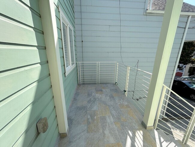
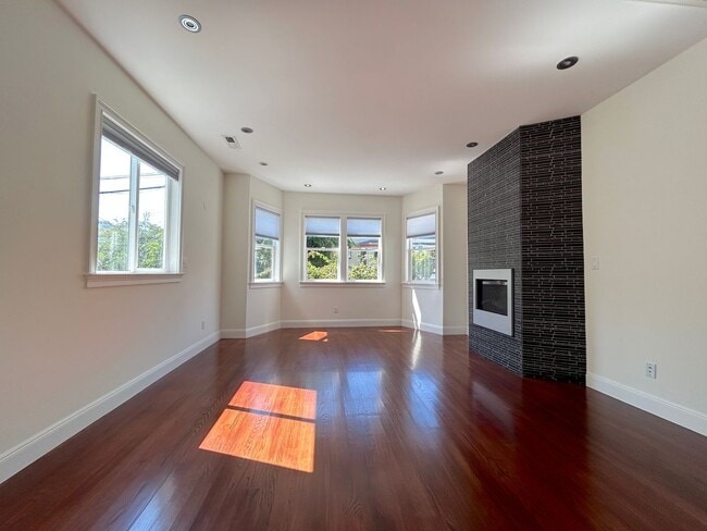
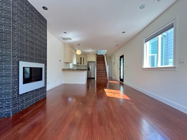
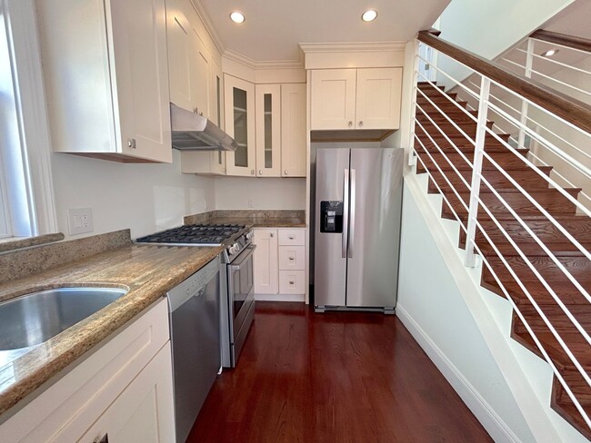
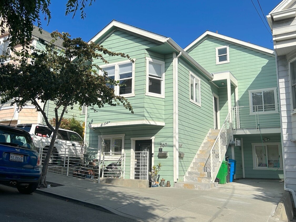
569 Moultrie St Unit 569 Moultrie St.
San Francisco, CA 94110
2 Weeks Ago
Favorites
569 Moultrie St Unit 569 Moultrie St.

Favorites
Check Back Soon for Upcoming Availability
| Beds | Baths | Average SF |
|---|---|---|
| 3 Bedrooms 3 Bedrooms 3 Br | 3 Baths 3 Baths 3 Ba | — |
About This Property
You'll adore this great property in San Francisco, CA. Rent at this 569 Moultrie St location in San Francisco and enjoy easy access to highways and a variety of attractions. Stop searching and get moving. Let us assist you! Contact us now to discuss the next steps!
569 Moultrie St is an apartment community located in San Francisco County and the 94110 ZIP Code.
Location
Get Directions
Life in the Bernal Heights neighborhood of San Francisco centers around the area's many parks, which provide space for community events, recreation, and more. This residential neighborhood keeps mostly to itself, with neighbors enjoying their spectacular views and access to a weekly farmer's market and flea market. Modern apartments give way to incredible homes in the classic San Francisco style.
The Fiesta on the Hill closes down streets every fall, and local filmmakers get to show off their latest work at the Bernal Heights Outdoor Cinema, which sets up for a couple of months a year. The more daring in the neighborhood participate in the yearly San Francisco Illegal Soap Box Derby, taking advantage of the steep hills to enjoy a true adventure as they race for the prize.
Learn more about living in Bernal HeightsBelow are rent ranges for similar nearby apartments
Education
| Colleges & Universities | Distance | ||
|---|---|---|---|
| Colleges & Universities | Distance | ||
| Drive: | 6 min | 2.9 mi | |
| Drive: | 7 min | 3.0 mi | |
| Drive: | 7 min | 3.4 mi | |
| Drive: | 13 min | 4.8 mi |
569 Moultrie St Unit 569 Moultrie St. is within 6 minutes or 2.9 miles from City College of San Francisco. It is also near California College of the Arts and UC San Francisco, Mission Bay.
Transportation options available in San Francisco include San Jose Ave & Randall St, located 0.6 mile from 569 Moultrie St Unit 569 Moultrie St.. 569 Moultrie St Unit 569 Moultrie St. is near San Francisco International, located 10.7 miles or 18 minutes away, and Metro Oakland International, located 22.4 miles or 34 minutes away.
| Transit / Subway | Distance | ||
|---|---|---|---|
| Transit / Subway | Distance | ||
|
|
Walk: | 12 min | 0.6 mi |
| Walk: | 12 min | 0.6 mi | |
|
|
Walk: | 13 min | 0.7 mi |
|
|
Walk: | 16 min | 0.9 mi |
|
|
Walk: | 18 min | 0.9 mi |
| Commuter Rail | Distance | ||
|---|---|---|---|
| Commuter Rail | Distance | ||
| Drive: | 6 min | 2.8 mi | |
| Drive: | 8 min | 3.4 mi | |
| Drive: | 8 min | 3.4 mi | |
| Drive: | 7 min | 4.0 mi | |
| Drive: | 8 min | 4.1 mi |
| Airports | Distance | ||
|---|---|---|---|
| Airports | Distance | ||
|
San Francisco International
|
Drive: | 18 min | 10.7 mi |
|
Metro Oakland International
|
Drive: | 34 min | 22.4 mi |
Time and distance from 569 Moultrie St Unit 569 Moultrie St..
| Shopping Centers | Distance | ||
|---|---|---|---|
| Shopping Centers | Distance | ||
| Walk: | 18 min | 1.0 mi | |
| Drive: | 7 min | 1.8 mi | |
| Drive: | 6 min | 2.2 mi |
569 Moultrie St Unit 569 Moultrie St. has 3 shopping centers within 2.2 miles, which is about a 6-minute walk. The miles and minutes will be for the farthest away property.
| Parks and Recreation | Distance | ||
|---|---|---|---|
| Parks and Recreation | Distance | ||
|
Heron's Head Park
|
Drive: | 8 min | 3.0 mi |
|
Candlestick Point State Recreation Area
|
Drive: | 9 min | 3.2 mi |
|
Buena Vista Park
|
Drive: | 10 min | 3.4 mi |
|
Randall Museum
|
Drive: | 11 min | 3.7 mi |
|
Children's Creativity Museum
|
Drive: | 9 min | 4.3 mi |
569 Moultrie St Unit 569 Moultrie St. has 5 parks within 4.3 miles, including Heron's Head Park, Randall Museum, and Candlestick Point State Recreation Area.
| Hospitals | Distance | ||
|---|---|---|---|
| Hospitals | Distance | ||
| Drive: | 3 min | 1.2 mi | |
| Drive: | 4 min | 1.3 mi | |
| Drive: | 5 min | 1.8 mi |
569 Moultrie St Unit 569 Moultrie St. has 3 hospitals within 1.8 miles, the nearest is California Pacific Medical Center - Mission Bernal which is 1.2 miles away and a 3 minute drive.
| Military Bases | Distance | ||
|---|---|---|---|
| Military Bases | Distance | ||
| Drive: | 21 min | 7.9 mi | |
| Drive: | 31 min | 16.9 mi |
569 Moultrie St Unit 569 Moultrie St. is 7.9 miles from East Fort Miley, and is convenient to other military bases, including Alameda/US Naval Air Station San Francisco.
You May Also Like
Similar Rentals Nearby


What Are Walk Score®, Transit Score®, and Bike Score® Ratings?
Walk Score® measures the walkability of any address. Transit Score® measures access to public transit. Bike Score® measures the bikeability of any address.
What is a Sound Score Rating?
A Sound Score Rating aggregates noise caused by vehicle traffic, airplane traffic and local sources
569 Moultrie St
San Francisco, CA 94110