$4,000
/ Month
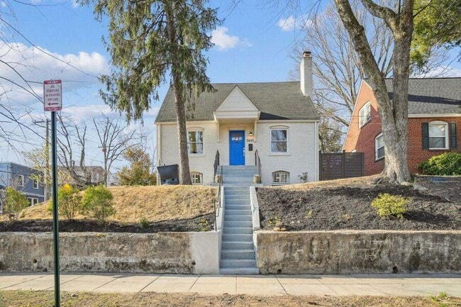
5643 Clay Pl NE
Washington, DC 20019
3 Days Ago
|
Edit
Favorites
202-968-1777
-
Bedrooms
4
-
Bathrooms
3
-
Square Feet
1,800 sq ft
-
Available
Available Now
5643 Clay Pl NE

Favorites
About This Home
Available Now
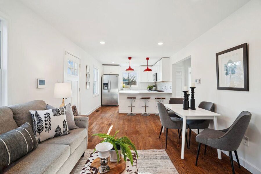
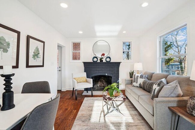
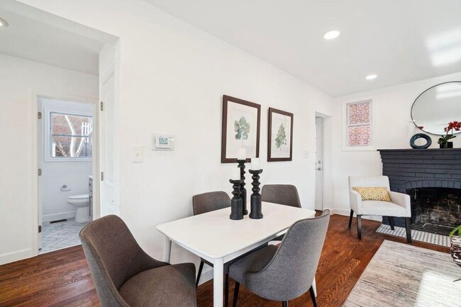
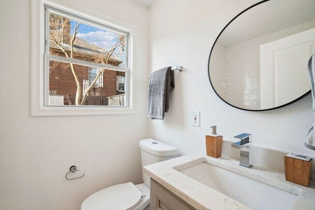
• Spacious 4 BR / 3 BA with 1800 sq ft • Open layout with hardwood floors & large windows for natural light • Sleek kitchen with white counters & stainless steel appliances • Generous closets • Washer/dryer in-unit Location: - Tucked in DC’s far northeast, near the Maryland border - Local shops & dining along Nannie Helen Burroughs Ave and Dix Street NE - Quiet, residential streets with a laid-back vibe - Served by nearby bus lines for commuting Details: • Rent: $4,000 • Water included • Resident pays electricity and gas • Security deposit = 1 month’s rent • Small dogs are welcome! • Street parking > Schedule a tour for the latest availability. > leasing@nest- > More homes: www.nest- > FAQs: nest-/prospective-renters Nest DC happily accepts applicants whose rent is paid either in part or in full via rental housing assistance provided by the District or the federal government. Gas Stove Oven Small Dogs Ok Washer/Dryer Water
5643 Clay Pl NE is a house located in District of Columbia County and the 20019 ZIP Code. This area is served by the District Of Columbia Public Schools attendance zone.
* Price shown is base rent. Excludes user-selected optional fees and variable or usage-based fees and required charges due at or prior to move-in or at move-out. Price, availability, fees, and any applicable rent special are subject to change without notice.
* Square footage definitions vary. Displayed square footage is approximate.
House Features
- Dishwasher
- Microwave
- Refrigerator
Fees and Policies
The fees below are based on community-supplied data and may exclude additional fees and utilities.
- Dogs Allowed
-
Fees not specified
-
Weight limit--
-
Pet Limit--
Contact
- Listed by Nest DC
- Phone Number
- Contact
Location
Get Directions
Amenities
- Dishwasher
- Microwave
- Refrigerator
Grant Park is a hilly, wooded neighborhood located on the north side of Capitol View and directly east of Lincoln Heights. The narrow streets are lined with square, brick houses and a variety of apartment communities. At the east end of the neighborhood, the Watts Branch Playground includes a spray ground, picnic areas, and the Marvin Gaye Recreation Center. Grant Park is an affordable, mostly residential neighborhood located about seven miles southeast of Downtown DC. Residents have easy access to the Tenleytown Metro Station for car-free commutes into the city.
Learn more about living in Grant Park
Education
| Colleges & Universities | Distance | ||
|---|---|---|---|
| Colleges & Universities | Distance | ||
| Drive: | 11 min | 4.9 mi | |
| Drive: | 11 min | 5.3 mi | |
| Drive: | 11 min | 5.9 mi | |
| Drive: | 12 min | 6.2 mi |
5643 Clay Pl NE is within 11 minutes or 4.9 miles from Gallaudet University. It is also near Univ. of Md. Univ. Coll. and Georgetown Law.
Schools


Public Elementary School
Grades PK-5
189 Students
Attendance Zone
Public Middle School
Grades 6-8
351 Students
Attendance Zone
Public High School
Grades 9-12
543 Students
Attendance Zone
Private Elementary School
Grades PK-6
50 Students
Nearby
Private Elementary, Middle & High School
Grades PK-12
Nearby
Private High School
Grades 9-12
Nearby
School data provided by
 The GreatSchools Rating helps parents compare schools within a state based on a variety of school quality indicators and provides a helpful picture of how effectively each school serves all of its students. Ratings are on a scale of 1 (below average) to 10 (above average) and can include test scores, college readiness, academic progress, advanced courses, equity, discipline and attendance data. We also advise parents to visit schools, consider other information on school performance and programs, and consider family needs as part of the school selection process.
View GreatSchools Rating Methodology
Data provided by GreatSchools.org © 2025. All rights reserved.
View GreatSchools Rating Methodology
Data provided by GreatSchools.org © 2025. All rights reserved.
Transportation options available in Washington include Capitol Heights, Blue/Silver Line Center Platform, located 0.7 mile from 5643 Clay Pl NE. 5643 Clay Pl NE is near Ronald Reagan Washington Ntl, located 11.4 miles or 21 minutes away, and Baltimore/Washington International Thurgood Marshall, located 28.1 miles or 43 minutes away.
| Transit / Subway | Distance | ||
|---|---|---|---|
| Transit / Subway | Distance | ||
|
Capitol Heights, Blue/Silver Line Center Platform
|
Walk: | 14 min | 0.7 mi |
|
|
Drive: | 3 min | 1.3 mi |
|
|
Drive: | 4 min | 1.7 mi |
|
|
Drive: | 5 min | 1.8 mi |
|
|
Drive: | 5 min | 1.9 mi |
| Commuter Rail | Distance | ||
|---|---|---|---|
| Commuter Rail | Distance | ||
|
|
Drive: | 10 min | 5.2 mi |
|
|
Drive: | 11 min | 5.3 mi |
|
|
Drive: | 13 min | 5.9 mi |
| Drive: | 13 min | 7.3 mi | |
|
|
Drive: | 13 min | 7.3 mi |
| Airports | Distance | ||
|---|---|---|---|
| Airports | Distance | ||
|
Ronald Reagan Washington Ntl
|
Drive: | 21 min | 11.4 mi |
|
Baltimore/Washington International Thurgood Marshall
|
Drive: | 43 min | 28.1 mi |
Time and distance from 5643 Clay Pl NE.
| Shopping Centers | Distance | ||
|---|---|---|---|
| Shopping Centers | Distance | ||
| Walk: | 12 min | 0.6 mi | |
| Drive: | 4 min | 1.2 mi | |
| Drive: | 4 min | 1.5 mi |
5643 Clay Pl NE has 3 shopping centers within 1.5 miles, which is about a 4-minute walk. The miles and minutes will be for the farthest away property.
| Parks and Recreation | Distance | ||
|---|---|---|---|
| Parks and Recreation | Distance | ||
|
Fort Dupont Park
|
Drive: | 7 min | 2.6 mi |
|
Kingman and Heritage Island Park
|
Drive: | 6 min | 3.2 mi |
|
Bladensburg Waterfront Park
|
Drive: | 8 min | 4.0 mi |
|
Walker Mill Regional Park
|
Drive: | 9 min | 4.4 mi |
|
National Arboretum
|
Drive: | 12 min | 5.5 mi |
5643 Clay Pl NE has 5 parks within 5.5 miles, including Fort Dupont Park, Kingman and Heritage Island Park, and Walker Mill Regional Park.
| Hospitals | Distance | ||
|---|---|---|---|
| Hospitals | Distance | ||
| Drive: | 8 min | 3.3 mi | |
| Drive: | 16 min | 6.0 mi | |
| Drive: | 15 min | 6.2 mi |
5643 Clay Pl NE has 3 hospitals within 6.2 miles, the nearest is University of Maryland Prince George's Hospital Center which is 3.3 miles away and a 8 minute drive.
| Military Bases | Distance | ||
|---|---|---|---|
| Military Bases | Distance | ||
| Drive: | 12 min | 5.5 mi | |
| Drive: | 15 min | 7.2 mi |
5643 Clay Pl NE is 5.5 miles from Washington Navy Yard, and is convenient to other military bases, including Anacostia Naval Station.
You May Also Like
Similar Rentals Nearby


What Are Walk Score®, Transit Score®, and Bike Score® Ratings?
Walk Score® measures the walkability of any address. Transit Score® measures access to public transit. Bike Score® measures the bikeability of any address.
What is a Sound Score Rating?
A Sound Score Rating aggregates noise caused by vehicle traffic, airplane traffic and local sources

5643 Clay Pl NE
Washington, DC 20019