$900
/ Month
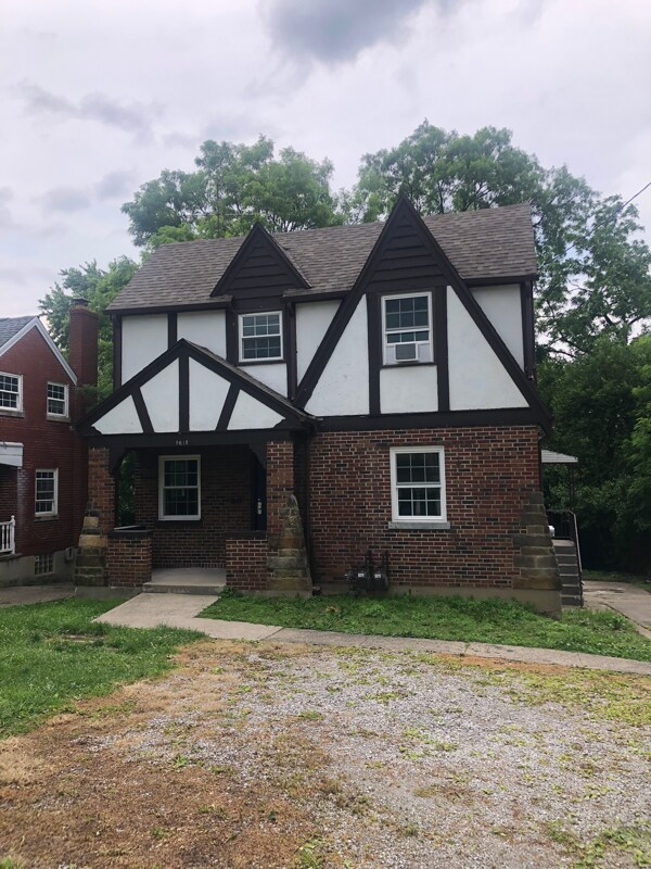
5612 Colerain Ave Unit 1
Cincinnati, OH 45239
2 Weeks Ago
Favorites
5612 Colerain Ave Unit 1

Favorites
Check Back Soon for Upcoming Availability
| Beds | Baths | Average SF |
|---|---|---|
| 1 Bedroom 1 Bedroom 1 Br | 1 Bath 1 Bath 1 Ba | 770 SF |
Fees and Policies
The fees below are based on community-supplied data and may exclude additional fees and utilities.
- Dogs Allowed
-
Fees not specified
- Cats Allowed
-
Fees not specified
About This Property
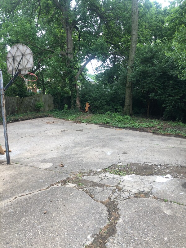
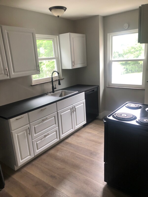
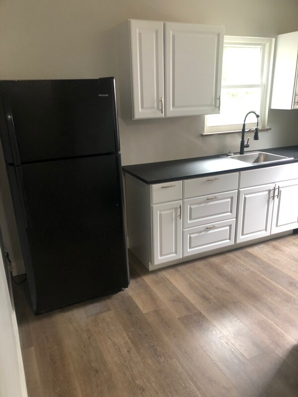
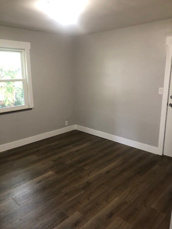
Property Id: 913401 Newly renovated house from top to bottom. This beautiful 1 bed 1 bath apartment is going for $900. It has off street parking, a back patio that you can use at your leisure and great management in place. Comes with a stove, refrigerator and a hookup for a washer and dryer in the basement. Pet friendly (small dogs and small cats). Pet deposit of $200 per pet and must be approved by management. Utilities paid by the tenant. Renters insurance is required. Management can recommend an insurance agent if needed.
5612 Colerain Ave is an apartment community located in Hamilton County and the 45239 ZIP Code.
Features
Dishwasher
Refrigerator
Oven
Vinyl Flooring
- Cable Ready
- Dishwasher
- Oven
- Refrigerator
- Vinyl Flooring
- Lawn
Location
Get Directions
Mount Airy is a classic suburban neighborhood with peaceful streets lined with single-family homes. Interstate 74 and Highway 22 makes the seven mile drive into Downtown Cincinnati and beyond accessible, but Mount Airy has a lot to offer from within. Its southern border encompasses Mount Airy Forest, which provides residents with outdoor fun. There are also a few fast food restaurants within the neighborhood, but residents can easily travel to the surrounding areas or into downtown for a diverse selection of restaurants. Renters will find that they have a few affordable options of apartments in longstanding brick buildings to choose from.
Learn more about living in Mount AiryBelow are rent ranges for similar nearby apartments
Amenities
- Cable Ready
- Dishwasher
- Oven
- Refrigerator
- Vinyl Flooring
- Lawn
Education
| Colleges & Universities | Distance | ||
|---|---|---|---|
| Colleges & Universities | Distance | ||
| Drive: | 13 min | 4.7 mi | |
| Drive: | 13 min | 6.4 mi | |
| Drive: | 15 min | 6.8 mi | |
| Drive: | 19 min | 8.4 mi |
5612 Colerain Ave Unit 1 is within 13 minutes or 4.7 miles from Cincinnati State. It is also near University of Cincinnati and Univ. of Cincinnati, Medical.
Transportation options available in Cincinnati include Brewery District Station, Elm & Henry, located 7.1 miles from 5612 Colerain Ave Unit 1. 5612 Colerain Ave Unit 1 is near Cincinnati/Northern Kentucky International, located 21.1 miles or 38 minutes away.
| Transit / Subway | Distance | ||
|---|---|---|---|
| Transit / Subway | Distance | ||
| Drive: | 14 min | 7.1 mi | |
| Drive: | 15 min | 7.2 mi | |
| Drive: | 15 min | 7.2 mi | |
| Drive: | 15 min | 7.3 mi | |
| Drive: | 15 min | 7.4 mi |
| Commuter Rail | Distance | ||
|---|---|---|---|
| Commuter Rail | Distance | ||
|
|
Drive: | 14 min | 7.0 mi |
| Airports | Distance | ||
|---|---|---|---|
| Airports | Distance | ||
|
Cincinnati/Northern Kentucky International
|
Drive: | 38 min | 21.1 mi |
Time and distance from 5612 Colerain Ave Unit 1.
| Shopping Centers | Distance | ||
|---|---|---|---|
| Shopping Centers | Distance | ||
| Walk: | 14 min | 0.8 mi | |
| Walk: | 15 min | 0.8 mi | |
| Drive: | 3 min | 1.6 mi |
5612 Colerain Ave Unit 1 has 3 shopping centers within 1.6 miles, which is about a 3-minute walk. The miles and minutes will be for the farthest away property.
| Parks and Recreation | Distance | ||
|---|---|---|---|
| Parks and Recreation | Distance | ||
|
Mt. Airy Forest
|
Drive: | 5 min | 2.0 mi |
|
LaBoiteaux Woods
|
Drive: | 6 min | 2.6 mi |
|
Buttercup Valley
|
Drive: | 7 min | 2.8 mi |
|
Farbach-Werner Nature Preserve
|
Drive: | 7 min | 3.1 mi |
|
Caldwell Preserve
|
Drive: | 12 min | 5.5 mi |
5612 Colerain Ave Unit 1 has 5 parks within 5.5 miles, including Mt. Airy Forest, LaBoiteaux Woods, and Buttercup Valley.
| Hospitals | Distance | ||
|---|---|---|---|
| Hospitals | Distance | ||
| Drive: | 8 min | 3.0 mi | |
| Drive: | 12 min | 5.6 mi | |
| Drive: | 15 min | 6.9 mi |
5612 Colerain Ave Unit 1 has 3 hospitals within 6.9 miles, the nearest is Mercy Health - West Hospital which is 3.0 miles away and a 8 minute drive.
| Military Bases | Distance | ||
|---|---|---|---|
| Military Bases | Distance | ||
| Drive: | 70 min | 54.4 mi | |
| Drive: | 76 min | 59.4 mi | |
| Drive: | 79 min | 62.7 mi |
5612 Colerain Ave Unit 1 has 3 military bases within 62.7 miles, the nearest is Gentile Air Force Station which is 54.4 miles away and a 70 minute drive.
You May Also Like
Similar Rentals Nearby


What Are Walk Score®, Transit Score®, and Bike Score® Ratings?
Walk Score® measures the walkability of any address. Transit Score® measures access to public transit. Bike Score® measures the bikeability of any address.
What is a Sound Score Rating?
A Sound Score Rating aggregates noise caused by vehicle traffic, airplane traffic and local sources

5612 Colerain Ave
Cincinnati, OH 45239