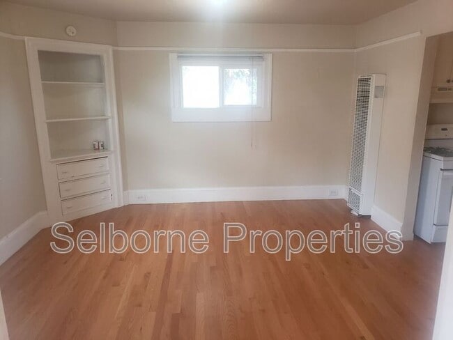
546 Merrimac St
Oakland, CA 94612
-
Bedrooms
1
-
Bathrooms
1
-
Square Feet
600 sq ft
-
Available
Available Sep 15

About This Home
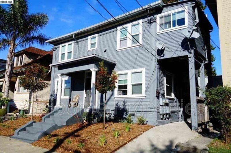
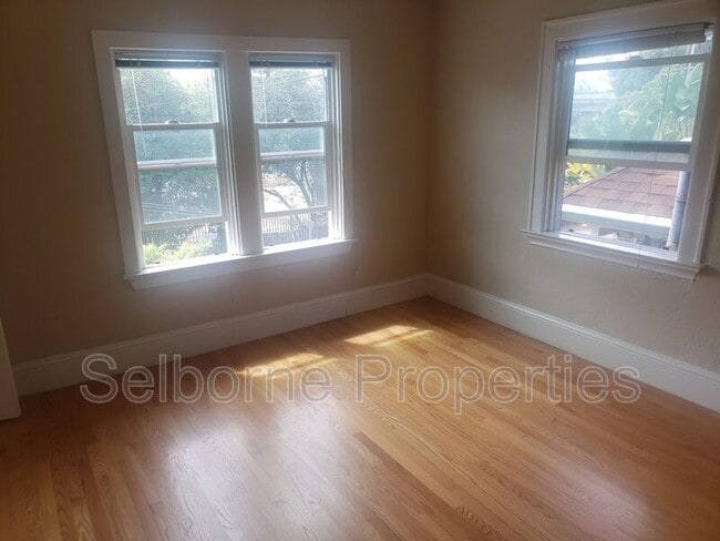
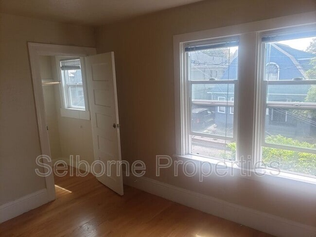
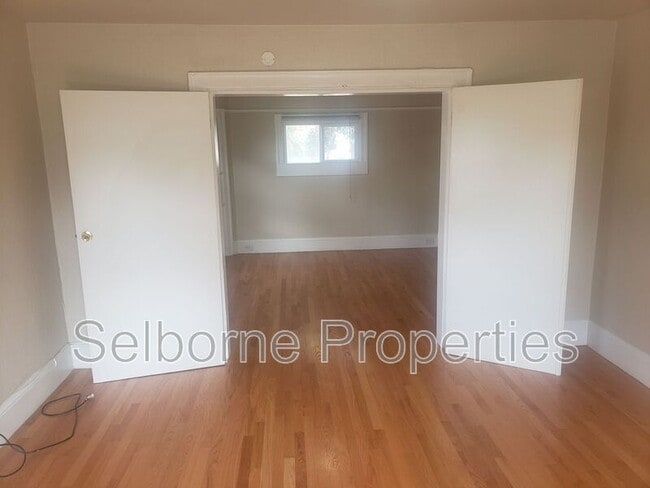
Schedule a tour today - Great downtown 1 bed / bath apartment. 1 bed / 1 bath. Close to MacArthur BART and downtown Oakland. Great living/dining room, hardwood floors, and more! Easy access to BART, Rockridge, Temescal Farmer's Market, Downtown Oakland, Berkeley, and 580. 1 Beds 1 Bath Spacious living room/dining room Hardwood floors Closets plus storage Renter's Insurance Required Non-Smoking Unit No on site laundry, laundromat nearby Please do not disturb current residents. EMAIL ONLY. We are unable to return phone calls. DRE# 01940533 Equal Housing Opportunity Federal law prohibits housing discrimination on the basis of race, color, national origin, religion, sex, familial status, or disability.
546 Merrimac St is a house located in Alameda County and the 94612 ZIP Code. This area is served by the Oakland Unified School District attendance zone.
Contact
- Phone Number
- Contact
Pill Hill is a small neighborhood located about a mile north of Downtown Oakland. Various medical facilities are located in the neighborhood, hence the name. Along with pharmacies and doctor’s offices, Pill Hill is home to the Alta Bates Summit Medical Center. Pill Hill has apartments and condos available for rent. The iconic Telegraph Avenue runs through Pill Hill so residents have access to cafes, coffee shops, and grocery stores within walking distance, but many residents take advantage of the neighborhood’s central location by traveling into neighboring communities for more shopping, dining, and entertainment options. Explore eateries on Piedmont Avenue, or head to Adams Point to access Lake Merritt. Pill Hill is nestled between Interstate 580 and 980 so it’s a great choice for anyone who wants to be able to travel across the Bay Area with ease into other major cities like Berkeley and San Francisco.
Learn more about living in Pill Hill| Colleges & Universities | Distance | ||
|---|---|---|---|
| Colleges & Universities | Distance | ||
| Walk: | 8 min | 0.5 mi | |
| Drive: | 4 min | 1.2 mi | |
| Drive: | 6 min | 2.6 mi | |
| Drive: | 8 min | 3.1 mi |


 The GreatSchools Rating helps parents compare schools within a state based on a variety of school quality indicators and provides a helpful picture of how effectively each school serves all of its students. Ratings are on a scale of 1 (below average) to 10 (above average) and can include test scores, college readiness, academic progress, advanced courses, equity, discipline and attendance data. We also advise parents to visit schools, consider other information on school performance and programs, and consider family needs as part of the school selection process.
View GreatSchools Rating Methodology
Data provided by GreatSchools.org © 2026. All rights reserved.
Transportation options available in Oakland include 19Th Street Oakland, located 0.7 mile from 546 Merrimac St. 546 Merrimac St is near Metro Oakland International, located 10.3 miles or 17 minutes away, and San Francisco International, located 22.4 miles or 34 minutes away.
| Transit / Subway | Distance | ||
|---|---|---|---|
| Transit / Subway | Distance | ||
|
|
Walk: | 14 min | 0.7 mi |
|
|
Walk: | 19 min | 1.0 mi |
|
|
Drive: | 5 min | 1.8 mi |
| Drive: | 5 min | 1.8 mi | |
|
|
Drive: | 6 min | 3.5 mi |
| Commuter Rail | Distance | ||
|---|---|---|---|
| Commuter Rail | Distance | ||
|
|
Drive: | 5 min | 1.9 mi |
|
|
Drive: | 6 min | 3.4 mi |
|
|
Drive: | 9 min | 5.5 mi |
| Drive: | 14 min | 7.4 mi | |
|
|
Drive: | 14 min | 7.4 mi |
| Airports | Distance | ||
|---|---|---|---|
| Airports | Distance | ||
|
Metro Oakland International
|
Drive: | 17 min | 10.3 mi |
|
San Francisco International
|
Drive: | 34 min | 22.4 mi |
Scores provided by
 What do Walkability, Transit, Drivability, and Bikeability mean?
Walkability measures the walking distance to day-to-day needs.
Transit measures access to public transportation.
Drivability measures congestion, parking availability, and access to major roads.
Bikeability measures the suitability for cycling.
How It Works
What do Walkability, Transit, Drivability, and Bikeability mean?
Walkability measures the walking distance to day-to-day needs.
Transit measures access to public transportation.
Drivability measures congestion, parking availability, and access to major roads.
Bikeability measures the suitability for cycling.
How It Works
Traffic
BusyAirport
CalmBusinesses
BusyScores provided by
HowLoud What is a Sound Score Rating? A Sound Score Rating aggregates noise caused by vehicle traffic, airplane traffic and local sources. How It WorksTime and distance from 546 Merrimac St.
| Shopping Centers | Distance | ||
|---|---|---|---|
| Shopping Centers | Distance | ||
| Walk: | 8 min | 0.4 mi | |
| Walk: | 8 min | 0.5 mi | |
| Walk: | 11 min | 0.6 mi |
| Parks and Recreation | Distance | ||
|---|---|---|---|
| Parks and Recreation | Distance | ||
|
Lakeside Park Garden Center
|
Walk: | 19 min | 1.0 mi |
|
Lakeside Park
|
Drive: | 3 min | 1.2 mi |
|
Rotary Nature Center
|
Drive: | 4 min | 1.3 mi |
|
Juan Bautista de Anza National Historic Trail
|
Drive: | 4 min | 1.5 mi |
|
Morcom Rose Garden
|
Drive: | 5 min | 2.0 mi |
| Hospitals | Distance | ||
|---|---|---|---|
| Hospitals | Distance | ||
| Walk: | 11 min | 0.6 mi | |
| Drive: | 2 min | 1.2 mi | |
| Drive: | 3 min | 1.7 mi |
| Military Bases | Distance | ||
|---|---|---|---|
| Military Bases | Distance | ||
| Drive: | 12 min | 4.3 mi | |
| Drive: | 12 min | 4.6 mi | |
| Drive: | 13 min | 4.8 mi |
You May Also Like
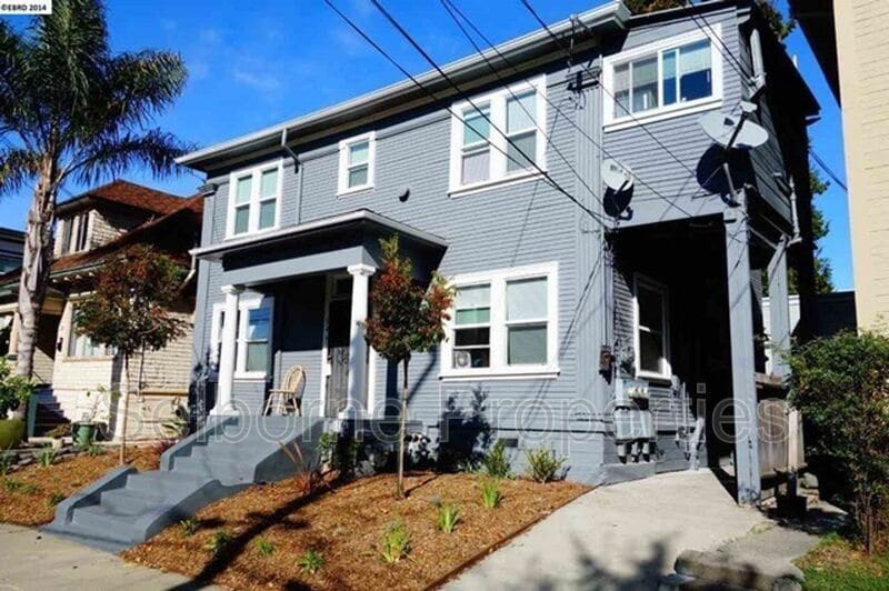
546 Merrimac St
Oakland, CA 94612